Plaza de Castilla
The Plaza de Castilla is a roundabout in the north of Madrid, Spain.Photo: Zaqarbal, CC BY-SA 3.0.
Photo: Zaqarbal, CC BY-SA 3.0.
Notable Places in the Area
Plaza de Castilla
Metro station

Photo: Draceane, CC BY-SA 4.0.
Plaza de Castilla is a station on Line 1, Line 9 and Line 10 of the Madrid Metro.
Caja Madrid Obelisk
Work of art
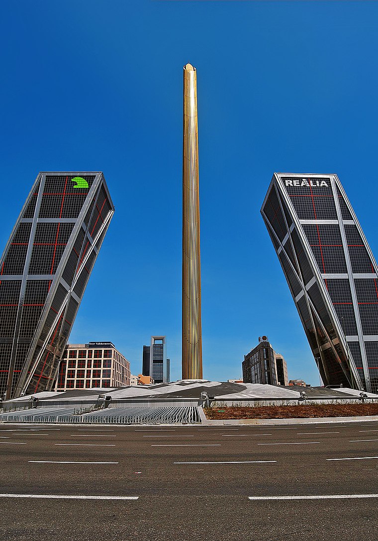
Photo: Guimir, Public domain.
The Caja Madrid Obelisk is an obelisk designed by Santiago Calatrava located in the Plaza de Castilla in Madrid, Spain.
Gate of Europe
Office building

Photo: Quique Huertas, Public domain.
The Gate of Europe towers, also known as KIO Towers, are twin office buildings near the Plaza de Castilla in Madrid, Spain. Gate of Europe is situated 120 metres northwest of Plaza de Castilla.
Localities in the Area
Almenara
Quarter
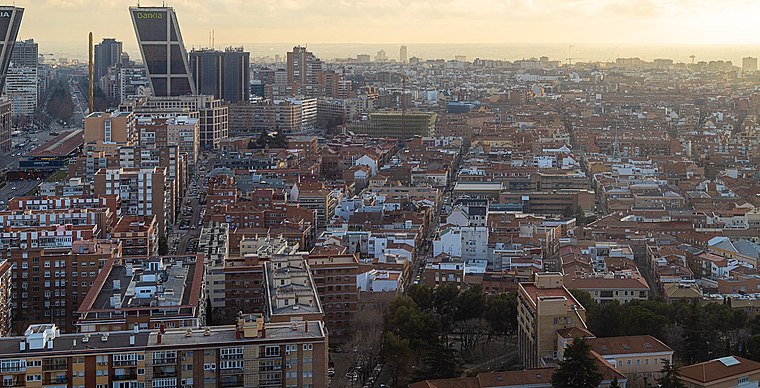
Photo: vpogarcia, CC BY-SA 2.0.
Almenara, also popularly known by the name of La Ventilla, is an administrative neighborhood of Madrid located in the district of Tetuán.
Castillejos
Quarter
 Castillejos is an administrative neighborhood of Madrid located in the district of Tetuán.

Plaza de Castilla
- Type: Square
- Description: square in Madrid, Spain
- Category: locality
- Location: Chamartín, Madrid, Madrid, Community of Madrid, Central Spain, Spain, Iberia, Europe
- View on OpenStreetMap
Latitude
40.46601° or 40° 27' 58" northLongitude
-3.68938° or 3° 41' 22" westElevation
735 metres (2,411 feet)Open Location Code
8CGRF886+C6OpenStreetMap ID
way 597993113OpenStreetMap Feature
place=squareGeoNames ID
6452856Wikidata ID
Q786291Plaza de Castilla Satellite Map
© OpenStreetMap, Mapbox and Maxar
Also Known As
- Basque: Gaztela plaza (Madril)
- Basque: Gaztela plaza
- Dutch: plaza de Castilla
- Egyptian Arabic: ميدان كاستيا
- English: plaza de Castilla
- Esperanto: Placo Kastilio
- French: Place de Castille
- French: plaza de Castilla
- Galician: Plaza de Castilla
- Galician: Praza de Castilla
- German: Plaza de Castilla
- Hebrew: פלאסה דה קסטייה
- Italian: plaza de Castilla
- Russian: площадь Кастилии
- Spanish: Castilla (plaza de)
- Spanish: Castilla, plaza de
- Spanish: Castilla plaza de
- Spanish: Plaza Castilla
- Spanish: Plaza de Castilla
- Spanish: plaza de Castilla
- Spanish: plaza de Castilla (Madrid)
- Spanish: plaza de Castilla, Madrid
Other Places Named Plaza de Castilla
In the Area
Localities
- Costa FlemingNeighborhood
- Nueva EspañaQuarter
- ValdeacederasQuarter
- ChamartinSuburb
- CastillaQuarter
- BerrugueteQuarter
Other Places
- Plaza de CastillaRailway stop
- Plaza de CastillaRailway stop
- Plaza CastillaBus stop
- Plaza de CastillaTaxicab stand
- CaixabankBank
- Intercambiador de Plaza de Castilla (Isla 1, Dársena 1)Bus stop
Popular Destinations in Madrid
Escape to a Random Place
Discover the squares Plaza San Diego in Cartagena, Colombia and Plaça de Catalunya in Eixample, Spain.
About Mapcarta. Thanks to Mapbox for providing amazing maps. Data © OpenStreetMap contributors and available under the Open Database License. Text is available under the CC BY-SA 4.0 license, excluding photos, directions and the map. Description text is based on the Wikipdia page Plaza de Castilla. Photo: Zaqarbal, CC BY-SA 3.0.