File:Australia location map.svg
Jump to navigation
Jump to search

Size of this PNG preview of this SVG file: 667 × 599 pixels. Other resolutions: 267 × 240 pixels | 534 × 480 pixels | 855 × 768 pixels | 1,140 × 1,024 pixels | 2,280 × 2,048 pixels | 2,055 × 1,846 pixels.
Original file (SVG file, nominally 2,055 × 1,846 pixels, file size: 185 KB)
Captions
Captions
Add a one-line explanation of what this file represents
Summary[edit]
| Description |
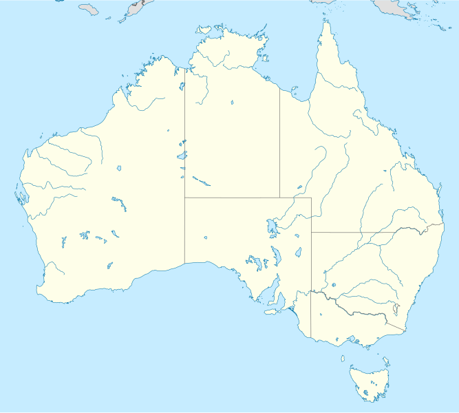
Deutsch: Positionskarte von Australien
Quadratische Plattkarte, N-S-Streckung 110 %. Geographische Begrenzung der Karte:
English: Location map of Australia
Equirectangular projection, N/S stretching 110 %. Geographic limits of the map:
|
||
| Date | |||
| Source |
own work, using
|
||
| Author | NordNordWest | ||
| Permission (Reusing this file) |
I, the copyright holder of this work, hereby publish it under the following licenses:
This file is licensed under the Creative Commons Attribution-Share Alike 3.0 Unported license.
You may select the license of your choice. |
||
| Other versions |
Derivative works of this file: |


|
This map has been made or improved in the German Kartenwerkstatt (Map Lab). You can propose maps to improve as well.
|
File history
Click on a date/time to view the file as it appeared at that time.
| Date/Time | Thumbnail | Dimensions | User | Comment | |
|---|---|---|---|---|---|
| current | 01:54, 12 March 2019 | | 2,055 × 1,846 (185 KB) | AndreyKva (talk | contribs) | Optimized. |
| 18:21, 18 September 2008 |  | 2,055 × 1,846 (408 KB) | NordNordWest (talk | contribs) | {{Information |Description= {{de|Positionskarte von Australien}} Quadratische Plattkarte, N-S-Streckung 110 %. Geographische Begrenzung der Karte: * N: 9.0° S * S: 44.5° S * W: 111.5° O * O: 155.0° O {{en|Location map of [[:en:Austr |
You cannot overwrite this file.
File usage on Commons
The following 55 pages use this file:
- User:Goran tek-en/discussions/2022
- User:NordNordWest/Gallery/Location maps
- User:SpinnerLaserz/Flags/Flags of Australia/Australia
- User talk:Summerdrought
- File:Ashmore and Cartier Islands in Australia.svg
- File:Australia relief map.jpg
- File:Australian Antarctic Territory in Australia.svg
- File:Australian Antarctic Territory in Australia (+grid).svg
- File:Australian Antarctic Territory in Australia (+grid) (-mini map).svg
- File:Australian Antarctic Territory in Australia (-mini map).svg
- File:Australian Antarctic Territory in Australia (hatched).svg
- File:Australian Antarctic Territory in Australia (hatched) (+grid).svg
- File:Australian Antarctic Territory in Australia (hatched) (+grid) (-mini map).svg
- File:Australian Antarctic Territory in Australia (hatched) (-mini map).svg
- File:Australian Capital Territory in Australia.svg
- File:Australian Capital Territory in Australia (special marker).svg
- File:Australian Capital Territory in Australia (zoom).svg
- File:Autralian colonies before 1825 deutsch.svg
- File:Christmas Island in Australia.svg
- File:Christmas Island in Australia (-mini map).svg
- File:Cocos (Keeling) Islands in Australia.svg
- File:Cocos (Keeling) Islands in Australia (-mini map).svg
- File:Coral Sea Islands in Australia.svg
- File:Coral Sea Islands in Australia (special marker).svg
- File:Coral Sea Islands in Australia (special marker blue).svg
- File:Gascoyne in Western Australia.svg
- File:Goldfields–Esperance in Western Australia.svg
- File:Great Southern in Western Australia.svg
- File:Heard Island and McDonald Islands in Australia.svg
- File:Heard Island and McDonald Islands in Australia (+grid).svg
- File:Heard Island and McDonald Islands in Australia (+grid) (-mini map).svg
- File:Heard Island and McDonald Islands in Australia (-mini map).svg
- File:Jervis Bay Territory in Australia (close zoom).svg
- File:Jervis Bay Territory in Australia (special marker).svg
- File:Jervis Bay Territory in Australia (zoom).svg
- File:Kimberley in Western Australia.svg
- File:Leichhardt Reise 3 Karte deutsch.svg
- File:Leichhardt Reise 3 Karte deutsch2.svg
- File:Mid West in Western Australia.svg
- File:New South Wales in Australia.svg
- File:Norfolk Island in Australia.svg
- File:Norfolk Island in Australia (-mini map).svg
- File:Northern Territory in Australia.svg
- File:Peel in Western Australia.svg
- File:Perth metropolitan region in Western Australia.svg
- File:Pilbara in Western Australia.svg
- File:Queensland in Australia.svg
- File:Regions of Western Australia (plain).svg
- File:South Australia in Australia.svg
- File:South West in Western Australia.svg
- File:Tasmania in Australia.svg
- File:The Outback Locator map.png
- File:Victoria in Australia.svg
- File:Western Australia in Australia.svg
- File:Wheatbelt in Western Australia.svg
.svg)
_(-mini_map).svg)
.svg)
.svg)
_(%2Bgrid).svg)
_(%2Bgrid)_(-mini_map).svg)
_(-mini_map).svg)
.svg)
.svg)
.svg)
_Islands_in_Australia.svg)
_Islands_in_Australia_(-mini_map).svg)
.svg)
.svg)
.svg)
_(-mini_map).svg)
.svg)
.svg)
.svg)
.svg)
.svg)
.svg)
File usage on other wikis
The following other wikis use this file:
- Usage on ab.wikipedia.org
- Usage on af.wikipedia.org
- Barberton (dubbelsinnig)
- Broken Hill
- Townsville
- Adelaide
- Wallabies
- Groot Koraalrif
- Daintree Nasionale Park
- Rugbywêreldbeker 2003
- Rugbywêreldbeker 1987
- Rockingham
- Kwinana
- Aberdeen (dubbelsinnig)
- Sydney-opera
- Royal National Park
- Hartley
- Redcliffe
- Normanton, Queensland
- Sjabloon:Liggingkaart Australië
- Fitzroy North
- Australiese nasionale krieketspan
- Darwin Internasionale Lughawe
- Mountain View
- Uluru
- Krieketwêreldbeker 1992
- Krieketwêreldbeker 2015
- Barraba
- Hardingrivier
- Aberdeen, Australië
- Rugbywêreldbeker 2027
- T20I-wêreldbeker 2022
- Barberton, Australië
- Sydney-lughawe
- Perth-lughawe
- Brisbane-lughawe
- Melbourne-lughawe
- Adelaide-lughawe
- Usage on als.wikipedia.org
- Usage on am.wikipedia.org
- Usage on an.wikipedia.org
View more global usage of this file.