Nuussuaq
Nuussuaq is a district of Nuuk, the capital of Greenland, It is located in the northern part of the city, west and southwest of Nuuk Airport, approximately 4 km outside the city center. Aerial view of Nuussuaq from the east…Photo: Algkalv, CC BY-SA 3.0.
Notable Places in the Area
Nuuk Airport
Aerodrome

Photo: Algkalv, CC BY-SA 3.0.
Nuuk Airport is an airport serving Nuuk, the capital of Greenland.
Nuuk Art Museum
Museum
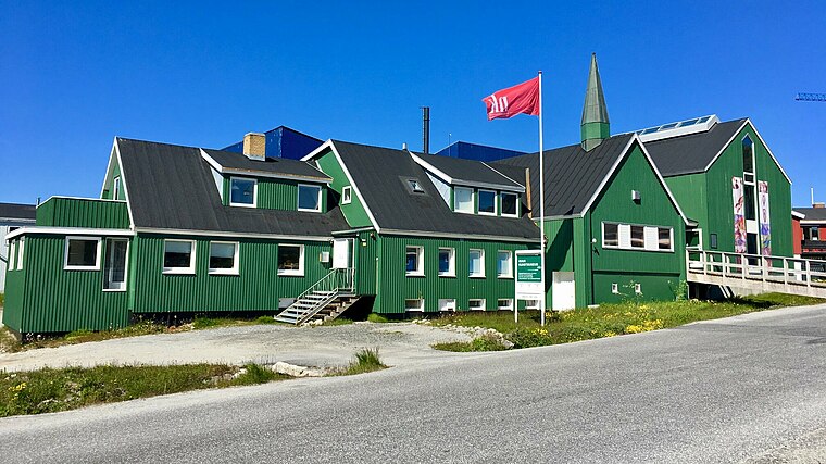
Photo: C.rosing.nuuk, CC BY-SA 4.0.
64°10′40″N 51°43′45″W / 64.177860°N 51.729216°W Nuuk Art Museum is a local museum in Greenland, located in Nuuk, the capital.
Nuuk Stadium
Pitch

Photo: henrikkarll, CC BY-SA 2.0.
Nuuk Stadium is a multi-purpose venue in Nuuk, Greenland.
Localities in the Area
Nuuk
 Nuuk, also known by its Danish name of Godthåb, is the capital and administrative centre of Greenland, with a population of around 15,000.
Quassussuup Tungaa
Suburb

Photo: Algkalv, CC BY-SA 3.0.
Quassussuup Tungaa is a district of Nuuk, the capital of Greenland.
Qernertunnguit
Neighborhood

Photo: Algkalv, CC BY-SA 3.0.
Qernertunnguit is a neighborhood of Nuuk, the capital of Greenland.
Nuussuaq
- Type: Suburb
- Description: district of Nuuk, the capital of Greenland
- Categories: neighborhood and locality
- Location: Sermersooq, Greenland, North America
- View on OpenStreetMap
Latitude
64.18182° or 64° 10' 55" northLongitude
-51.70837° or 51° 42' 30" westOpen Location Code
98PC57JR+PMOpenStreetMap ID
node 2583735795OpenStreetMap Feature
place=suburbWikidata ID
Q2337568Nuussuaq Satellite Map
© OpenStreetMap, Mapbox and Maxar
Also Known As
Other Places Named Nuussuaq
In the Area
Nuussuaq is situated close to the neighborhoods Inussussuaq and Qaurunnguaq.
Localities
- ImeqarfikNeighborhood
- TuujukNeighborhood
- Nuuk CentrumSuburb
- Old NuukNeighborhood
- TaqissorfikNeighborhood
- NukappiakulukNeighborhood
Landmarks
- Nuussuaq HallenSports venue
- IllorputCommunity center
- MalikSports venue
- National theater of GreenlandTheater building
- NukissiorfiitGovernment office
- Nuuk FitnessHealth club
Popular Destinations in Greenland
Escape to a Random Place
About Mapcarta. Thanks to Mapbox for providing amazing maps. Data © OpenStreetMap contributors and available under the Open Database License. Text is available under the CC BY-SA 4.0 license, excluding photos, directions and the map. Description text is based on the Wikipdia page Nuussuaq. Photo: Algkalv, CC BY-SA 3.0.