Michigan is a state in the USA that is situated in the upper Midwestern region of the country. Michigan is the 11th largest state by area covering an area of 250,493 km2 and this state has 10th rank in the country based on population with 10,077,331 inhabitants. The largest city in Michigan by population is Detroit. Michigan has approx. 1773 municipalities that include 1240 townships, 276 cities, and 257 villages. If you want to learn more about the cities and towns of Michigan through a map of Michigan with Cities & Towns then you are on the right page. Below, we are adding some printable maps related to the cities in MI state. So, scroll down the page and have a look at our collection of maps.
Michigan (MI) Cities & Towns Maps Collection:
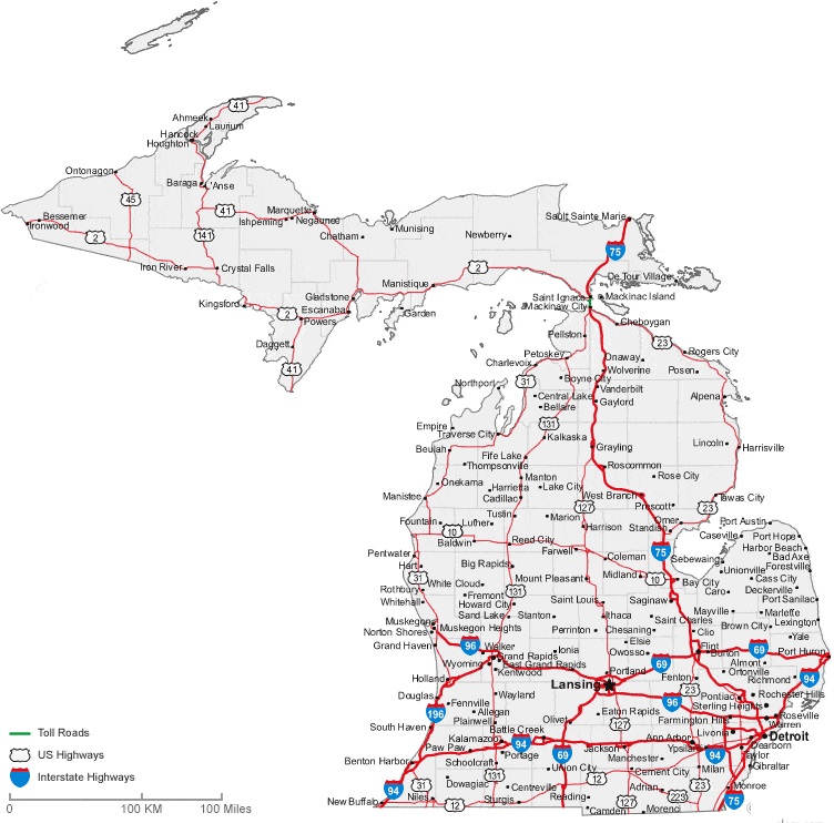
1. Map of Michigan with Cities:
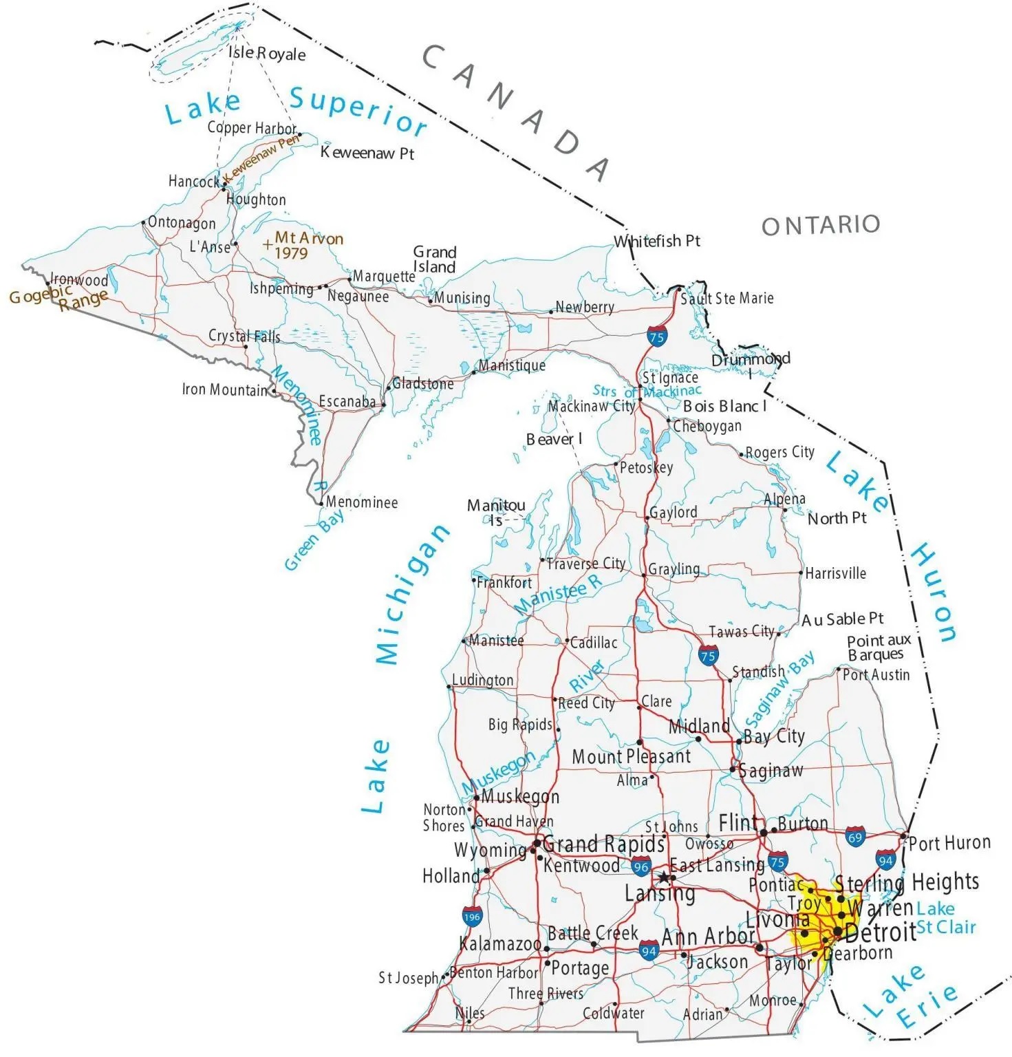
2. Map of Michigan with Towns:
3. Cities & Towns Map of Michigan:
4. County Map of Michigan:

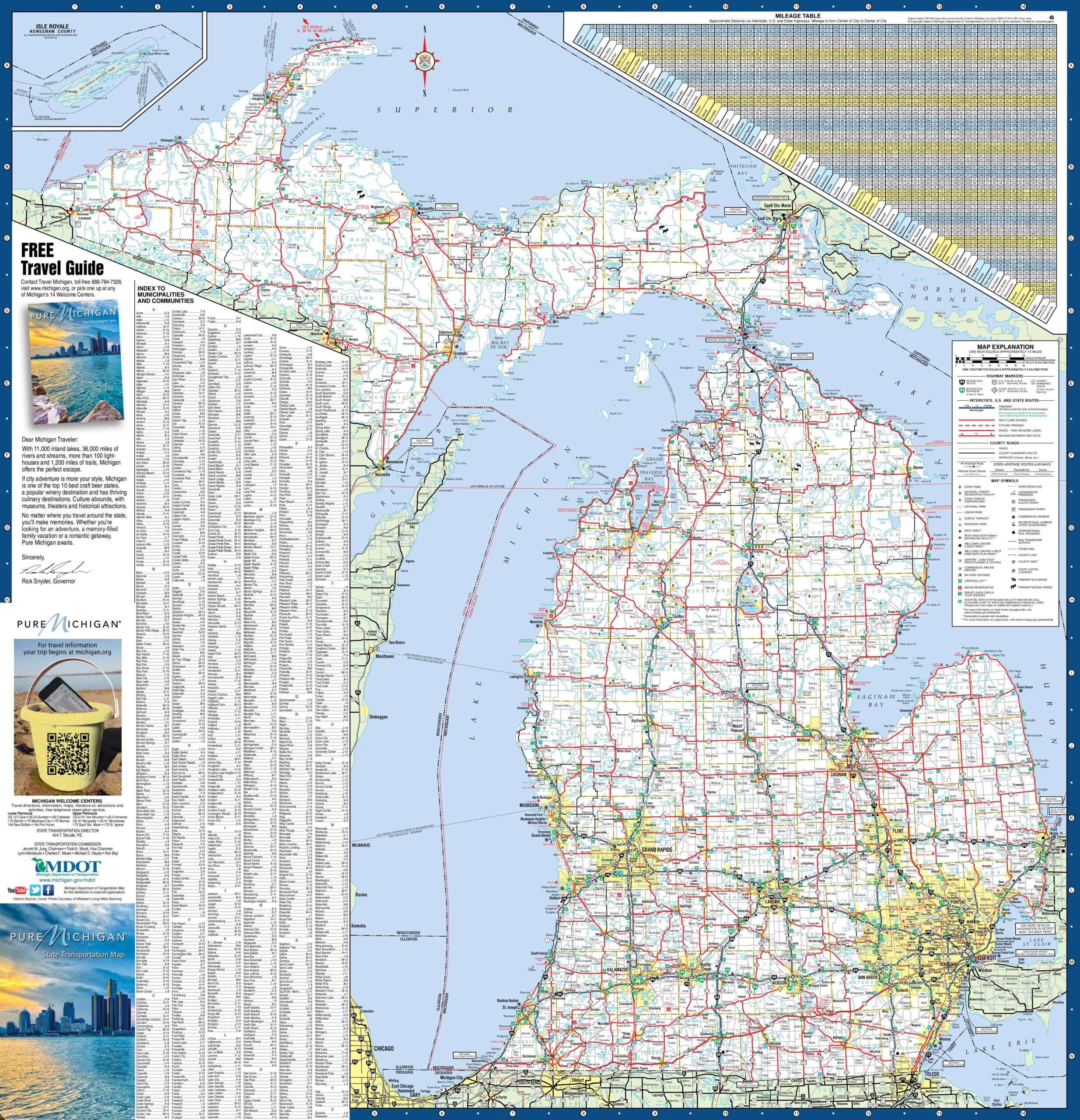
5. Map of Michigan:

Above, we have added five types of different maps related to the cities and towns of Michigan. Below, we’re also giving some information about each map, so read the information and get any map on your device for free.
The first map is related to the cities of Michigan state. So, you can easily locate any city in Michigan with the help of this map. Now, on the next map, you will get to know about the city of Michigan. And the third map is the main and detailed map of Michigan with Cities and Towns. You will easily navigate anywhere inside any city of MI, USA on this map because roads and highways are also visible. You can also check some other Roads and Highway Maps of Michigan State if you are looking for a detailed city road and highway network map.
The fourth map is related to the main County map of Michigan. In this map, you can easily locate any county in this state. The county seat major cities are also mentioned on this map. The last map is related to the complete state map of Michigan with towns, cities, roads, and highways. This map is similar to the previous map, but this map shows some other places and landmarks. For example, you will see rail networks, airports, beaches, malls, rivers, lakes, etc. So, these were some best printable Town and City maps of Michigan. You can easily print any map because all maps are HD quality and available in PDF and JPG format. And you can download any map for free by clicking on the buttons under the preview image.