
Alabama State Map With Cities Pictures, Images and Stock Photos
Browse 540+ alabama state map with cities stock photos and images available, or start a new search to explore more stock photos and images.
Most popular
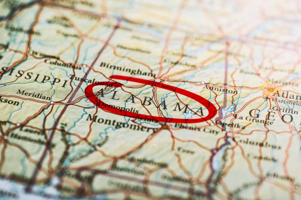
Alabama circled with red marker on map. Close up shot.
alabama administrative and political vector map with flag


Mississippi, MS, political map, with capital Jackson, important cities, rivers and lakes. State in the Southeastern region of the United States, nicknamed The Magnolia State and The Hospitality State.
Detailed map of Alabama with surroundings, provinces and capital
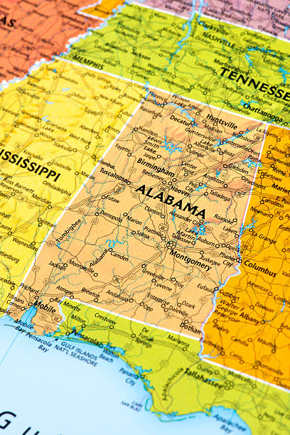
road map of the US American State of Alabama.

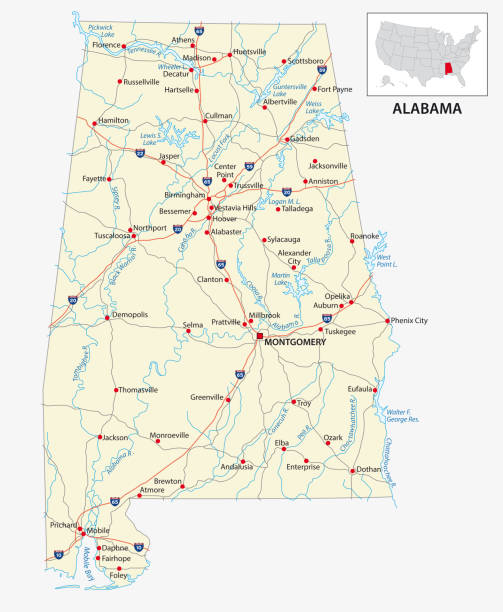
Highway map of the state of Albama with Interstates and US Routes. It also has lines for state and county routes (but not labeled/named) and many cities on it as well (mostly the county seats and State Capitol).
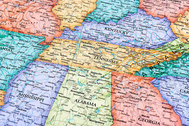
Map of Tennessee and Kentucky States in USA. Detail from the World Map.
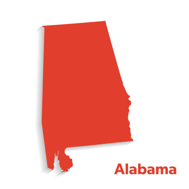
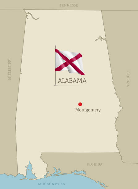
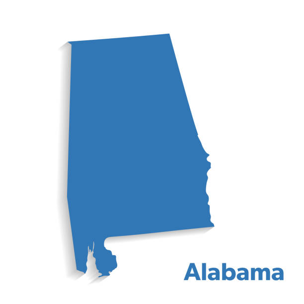
Map of Alabama State.

Detailed outline map of Alabama with capital

A map pin with a red flag pinpoints the city on a select area from a high quality map. The red flag creates highlighted copy space for text.

Isolated U.S.A State With Capital City. The map is on a transparent background (there is no white shape behind it)

A map pin with a red flag pinpoints the city on a select area from a high quality map. The red flag creates highlighted copy space for text.

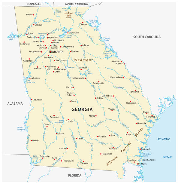
Georgia, GA, gray political map with capital Atlanta and largest cities. State in the southeastern region of the United States of America. Peach State. Empire State of the South. Illustration. Vector

A map pin with a red flag pinpoints the city on a select area from a high quality map. The red flag creates highlighted copy space for text.
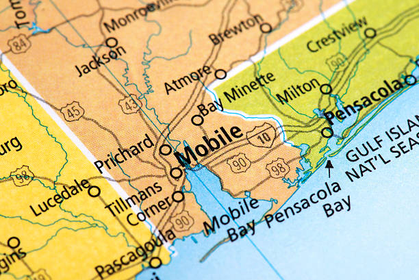
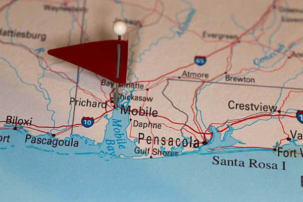
Map of Mobile City in Alabama State, USA. Detail from the World Map.
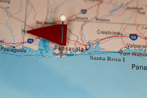
A map pin with a red flag pinpoints the city on a select area from a high quality map. The red flag creates highlighted copy space for text.

Empty Blue Map of the United States
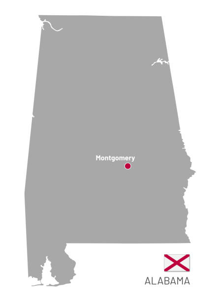
Gray map of Federal State of Alabama, USA. Administrative map of Alabama federal state with Montgomery capital and flag vector illustration isolated on white background
Detailed map of Alabama with surroundings, provinces and capital
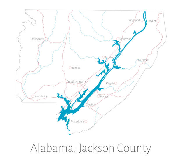
Detailed map of Jackson county in Alabama, USA
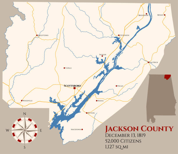
Large and detailed map of Jackson county in Alabama, USA.
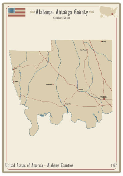
Map on an old playing card of Autauga county in Alabama, USA.
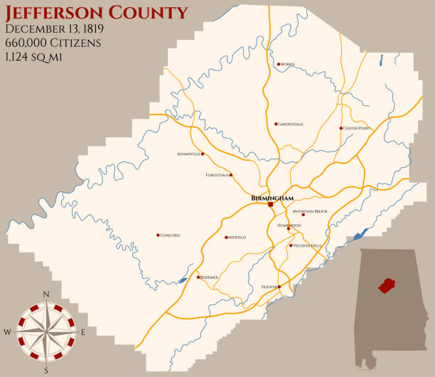
Large and detailed map of Jefferson county in Alabama, USA.
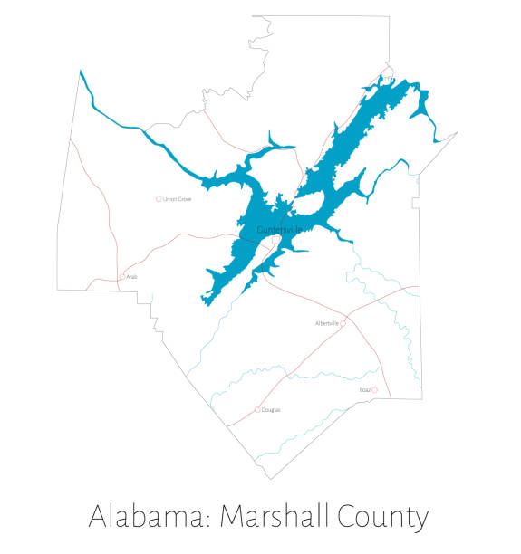
Detailed map of Marshall county in Alabama, USA
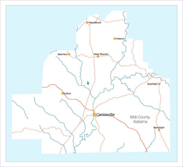
Detailed and large map of Bibb County in Alabama, USA
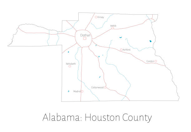
Detailed map of Houston county in Alabama, USA
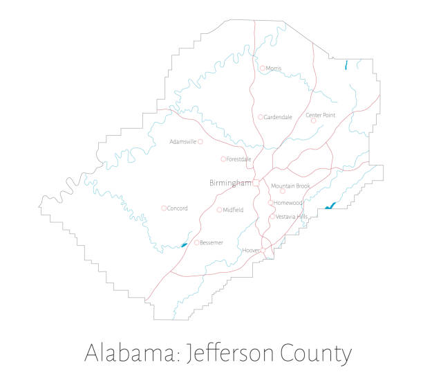
Detailed map of Jefferson county in Alabama, USA
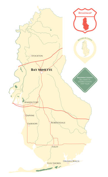
Large and detailed map of Baldwin county in Alabama, USA
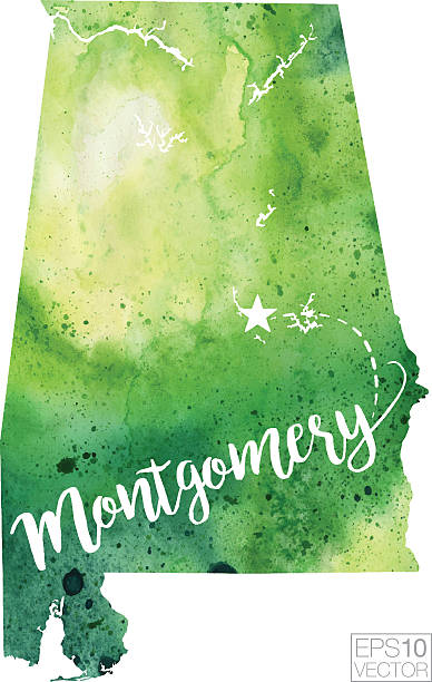
A highly detailed vector map of Montgomery, Alabama with a multicoloured green hand painted watercolour texture. Map is isolated on a white background. "Montgomery" stylized text is added overtop with a star to indicate the location of the capital city.
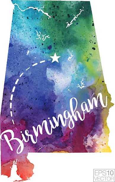
A highly detailed vector map of the US State of Alabama featuring the city of Birmingham with a multicoloured hand painted watercolour texture. Map is isolated on a white background. "Birmingham" stylized text is added overtop with a star to indicate the location of the city.
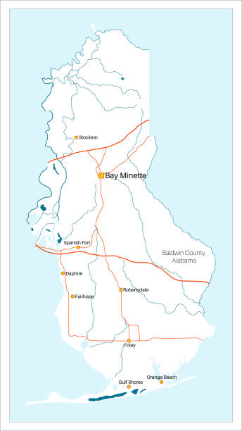
Detailed and large map of Baldwin County in Alabama, USA
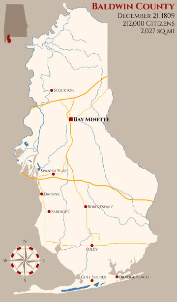
Large and detailed map of Baldwin county in Alabama, USA
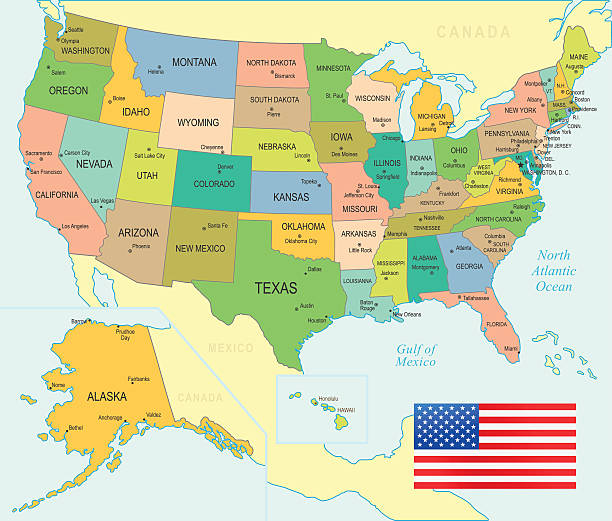
Colored Map of the United States
A map pin with a red flag pinpoints the city on a select area from a high quality map. The red flag creates highlighted copy space for text.
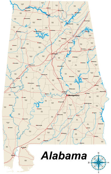
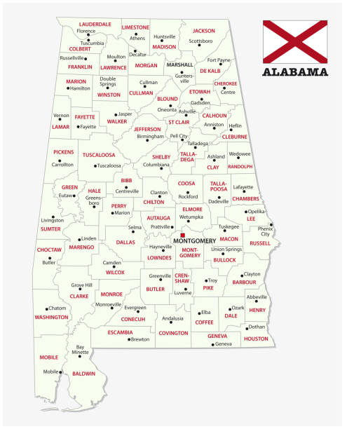
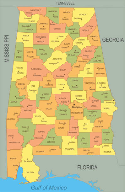
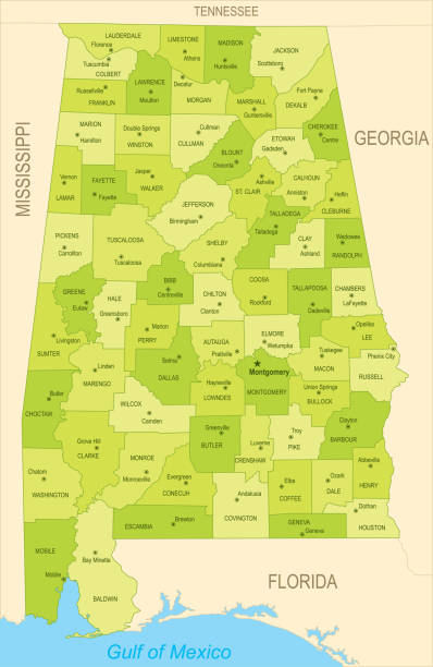
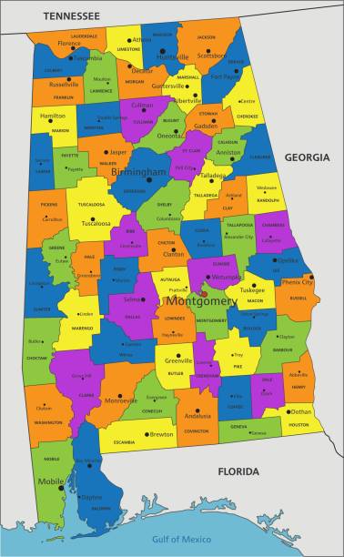
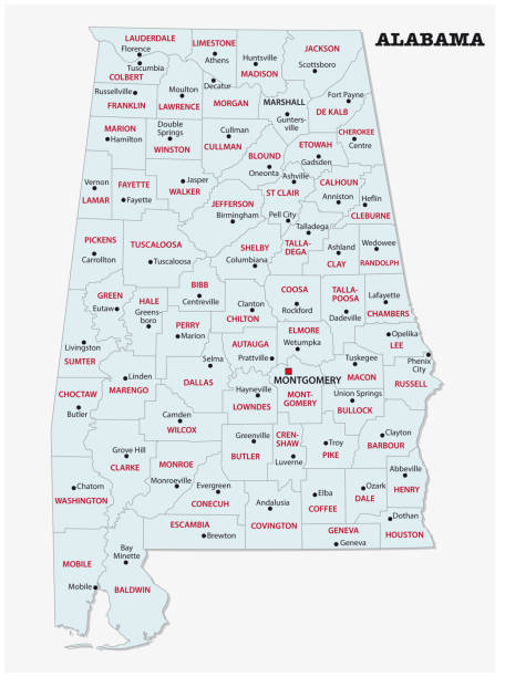
A large and detailed map of the State of Alabama with all counties and county seats.
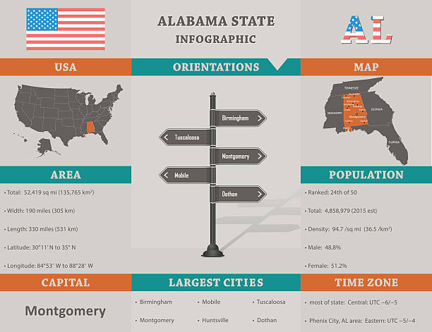
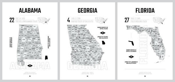
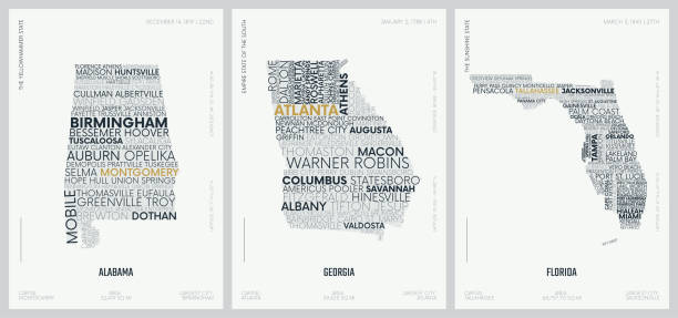
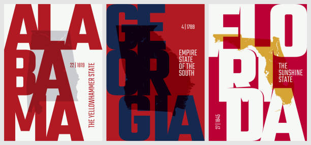
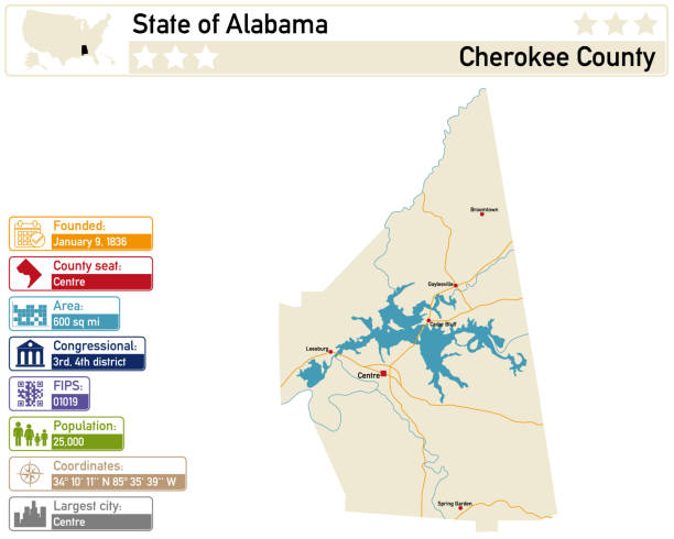
USA - Alabama state infographic template with area, population and orientations information included
US, AL State highly detailed map with the flag. Editable map of USA Federal State with territory borders, political or geographical design vector illustration
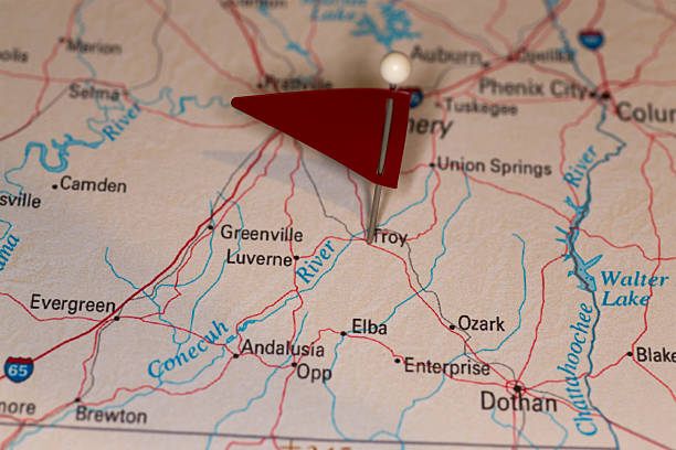
A map pin with a red flag pinpoints the city on a select area from a high quality map. The red flag creates highlighted copy space for text.
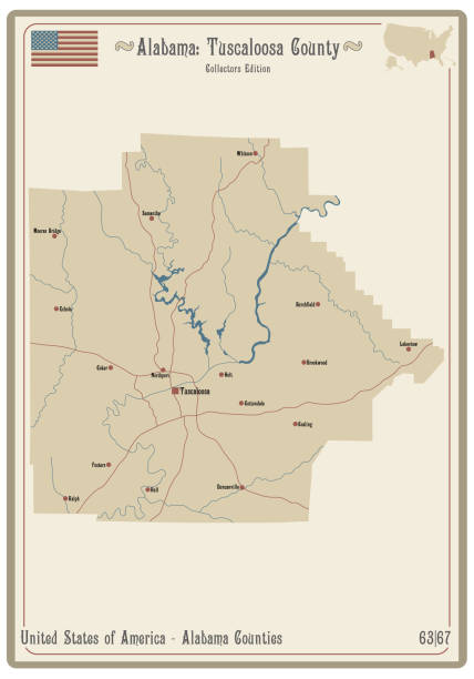
Map on an old playing card of Tuscaloosa county in Alabama, USA.
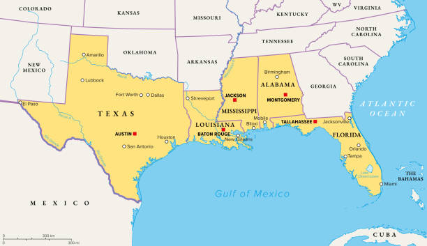
Gulf States of the United States, also called Gulf South or South Coast, political map. Coastline along Southern United States at Gulf of Mexico. Texas, Louisiana, Mississippi, Alabama and Florida.
Isolated U.S.A State With Capital City. The map is on a transparent background (there is no white shape behind it)
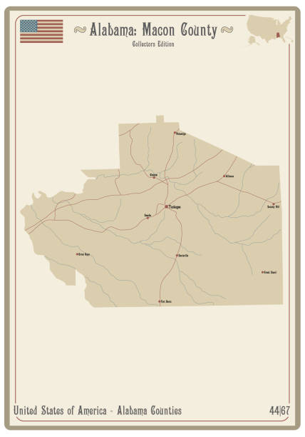
Map on an old playing card of Macon county in Alabama, USA.
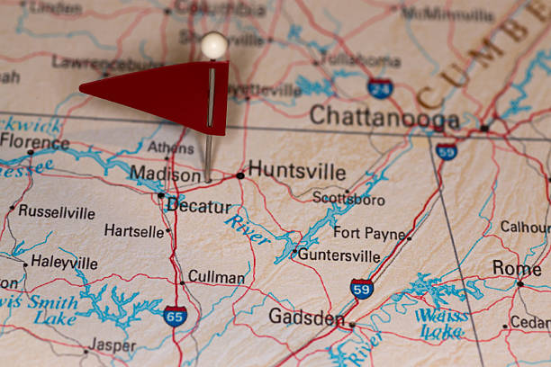
A map pin with a red flag pinpoints the city on a select area from a high quality map. The red flag creates highlighted copy space for text.
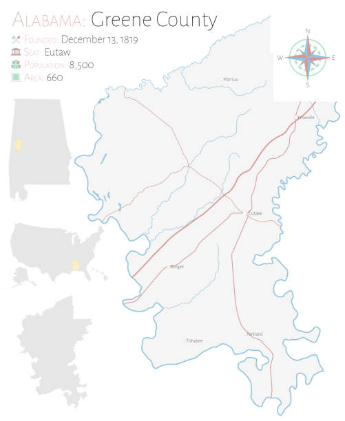
Large and detailed map of Greene county in Alabama, USA.
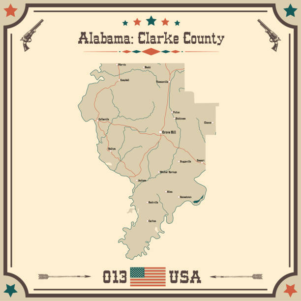
Large and accurate map of Clarke county, Alabama, USA with vintage colors.
alabama administrative and political vector map
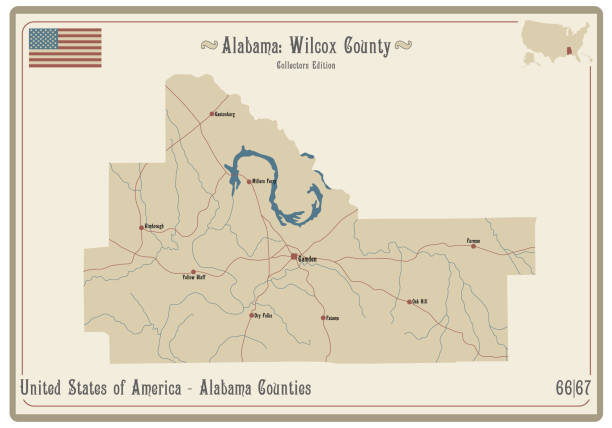
Map on an old playing card of Wilcox county in Alabama, USA.
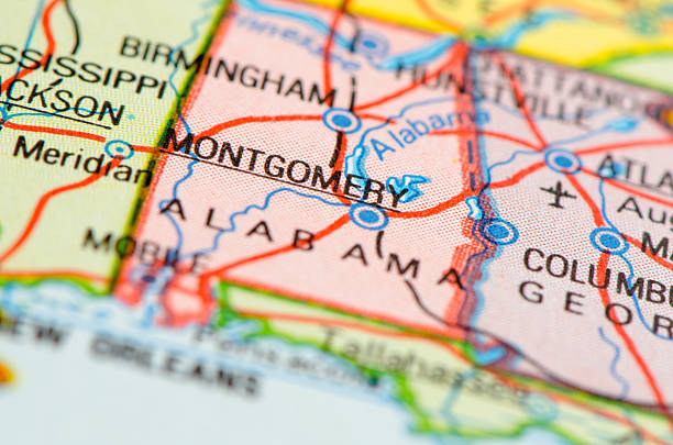
Montgomery map 1982.
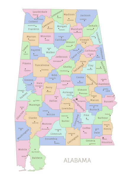
Alabama state administrative map with names of departments. US American Federal State highly detailed map with territory borders vector illustration on white background
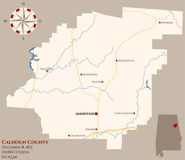
Large and detailed map of Calhoun county in Alabama, USA.