
Map Alabama Cities Pictures, Images and Stock Photos
Browse 730+ map alabama cities stock photos and images available, or start a new search to explore more stock photos and images.
Most popular
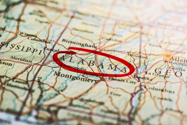
Alabama circled with red marker on map. Close up shot.


Mississippi, MS, political map, with capital Jackson, important cities, rivers and lakes. State in the Southeastern region of the United States, nicknamed The Magnolia State and The Hospitality State.
Detailed map of Alabama with surroundings, provinces and capital
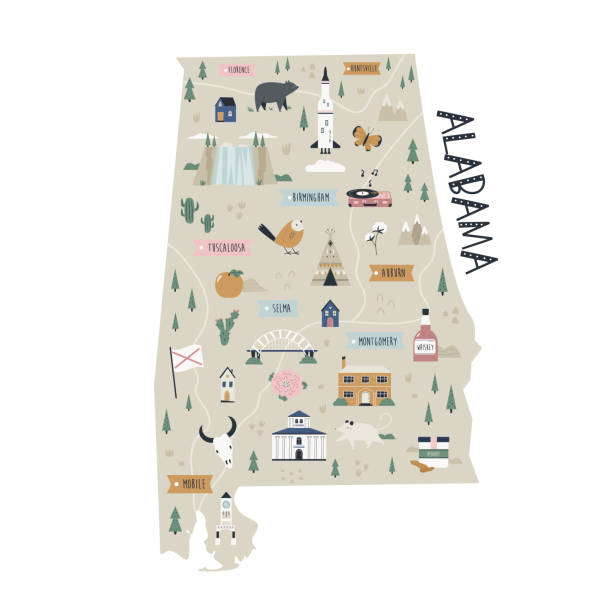
Illustrated map of Alabama state with landmarks and symbols.
http://s017.radikal.ru/i404/1110/87/2c00b7bbd3ec.jpgHighly detailed map of the North America with countries, cities and other labels.
road map of the US American State of Alabama.
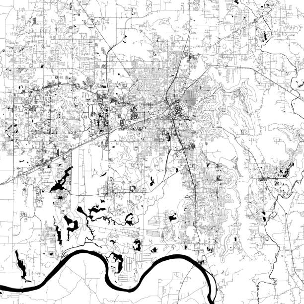
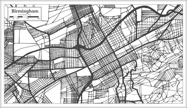
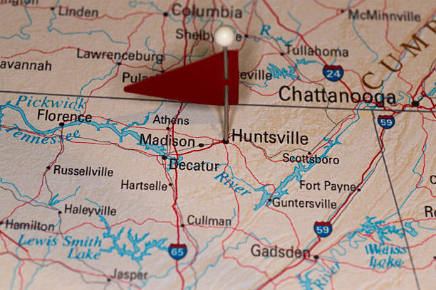
Topographic / Road map of Huntsville, AL. Map data is open data via openstreetmap contributors. All maps are layered and easy to edit. Roads are editable stroke.
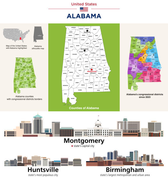
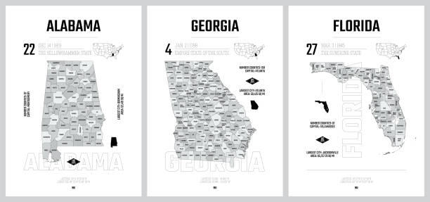
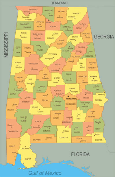
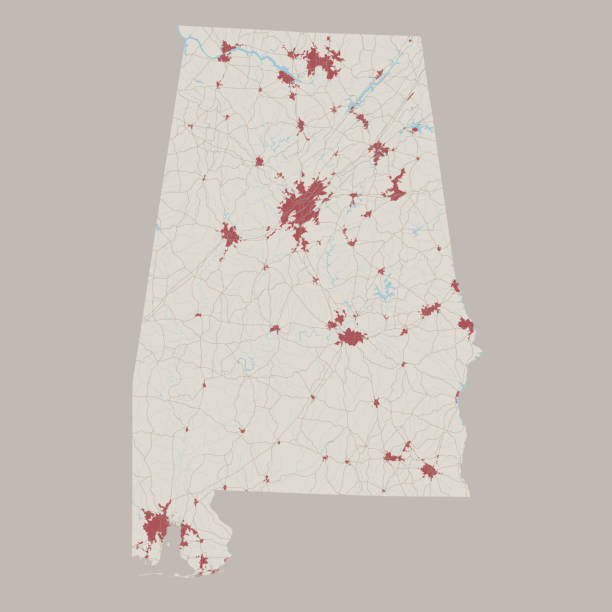
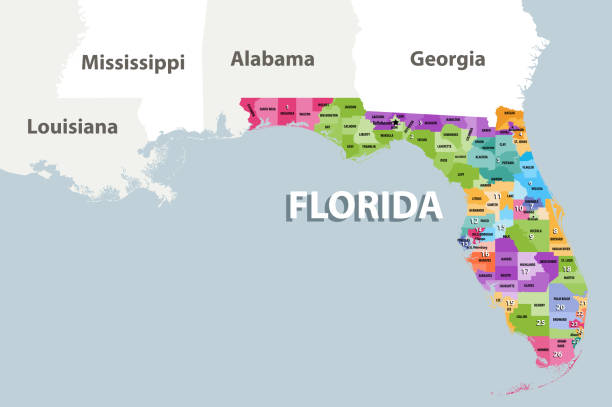
Alabama's counties map and congressional districts since 2023 map. Montgomery skyline (state's capital city), and state's largest cities: Huntsville and Birmingham. Vector set. I drew all elements in a vector graphics editor and design program. Elements and layers are well organized, separable, detachable and easy to use and edit. Map data is in the public domain, available from the United States Census Bureau via census.gov
Map of Alabama State.

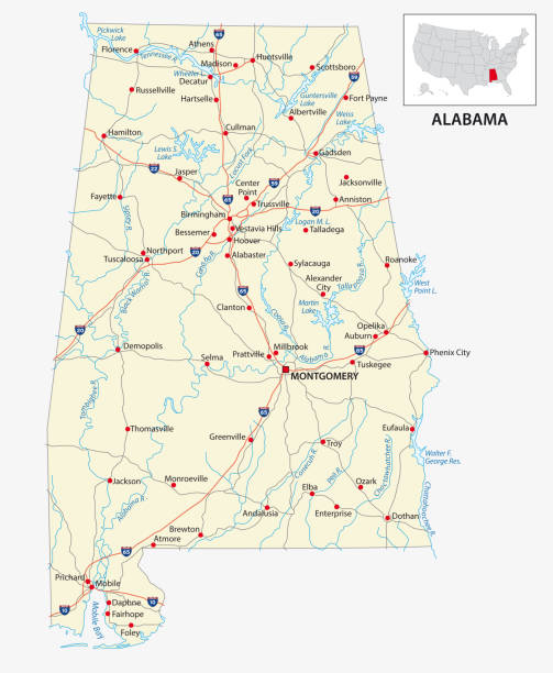
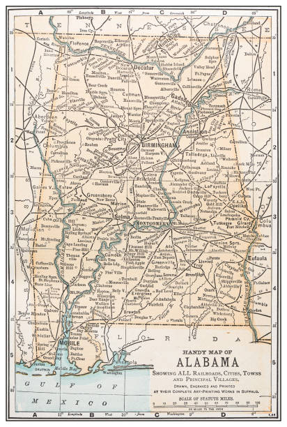
Highway map of the state of Albama with Interstates and US Routes. It also has lines for state and county routes (but not labeled/named) and many cities on it as well (mostly the county seats and State Capitol).
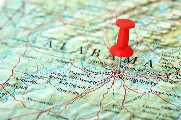
"Montgomery Map. Source: ""Reference Atlas of the World"""

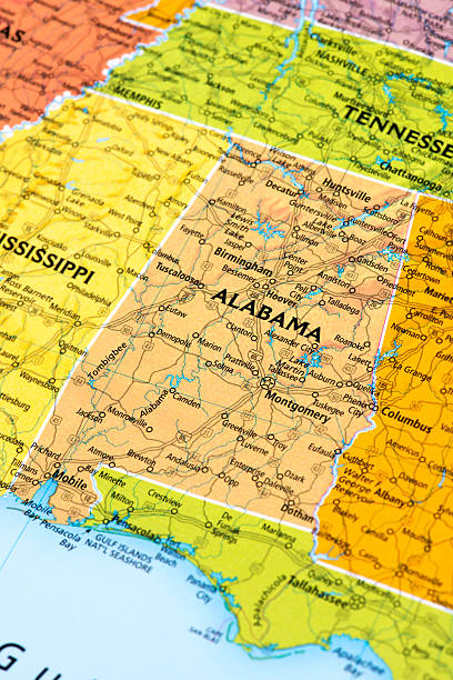
Map of Alabama, USA.
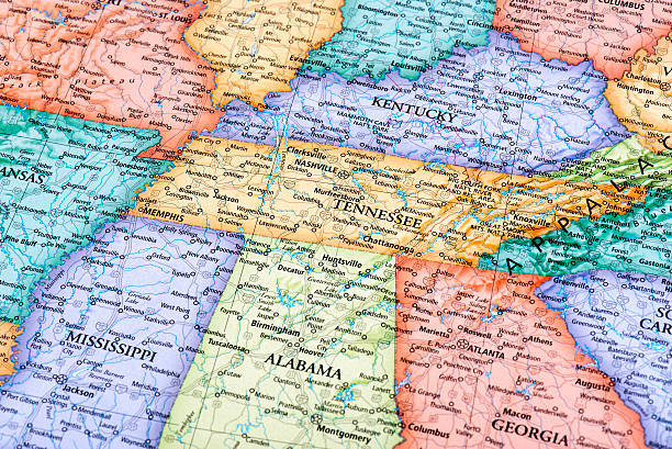
Map of Tennessee and Kentucky States in USA. Detail from the World Map.


Detailed outline map of Alabama with capital
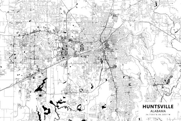
Poster Style Topographic / Road map of Huntsville, AL. Map data is open data via openstreetmap contributors. All maps are layered and easy to edit. Roads are editable stroke.
Vector Illustration of a Road Map of Alabama State, USA. All source data is in the public domain. U.S. Geological Survey, US Topo Used Layers: USGS The National Map: National Hydrography Dataset (NHD) USGS The National Map: National Transportation Dataset (NTD)
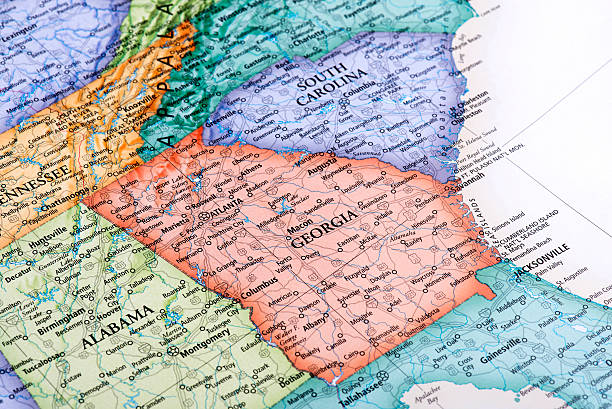
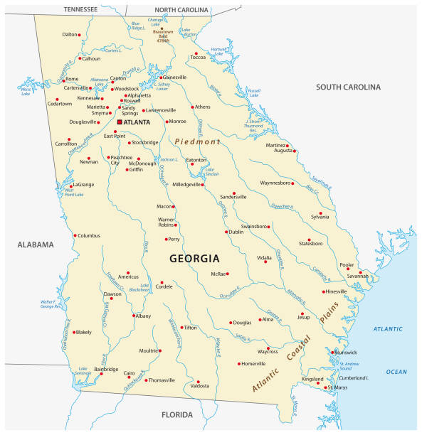
Map of Georgia State in USA. Detail from the World Map.
Birmingham Alabama USA City Map in Retro Style. Outline Map. Vector Illustration.

Birmingham AL City Vector Road Map Blue Text. All source data is in the public domain. U.S. Census Bureau Census Tiger. Used Layers: areawater, linearwater, roads.


A map pin with a red flag pinpoints the city on a select area from a high quality map. The red flag creates highlighted copy space for text.

A map pin with a red flag pinpoints the city on a select area from a high quality map. The red flag creates highlighted copy space for text.

Vector illustration of alabama
A map pin with a red flag pinpoints the city on a select area from a high quality map. The red flag creates highlighted copy space for text.
Every state is a seperate object that has a complete boundary that you can edit it. The map and scales are accurately prepared by a map expert.
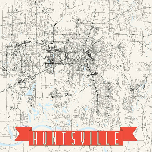
Topographic / Road map of Huntsville, AL. Map data is open data via openstreetmap contributors. All maps are layered and easy to edit. Roads are editable stroke.

A map pin with a red flag pinpoints the city on a select area from a high quality map. The red flag creates highlighted copy space for text.

Isolated U.S.A State With Capital City. The map is on a transparent background (there is no white shape behind it)
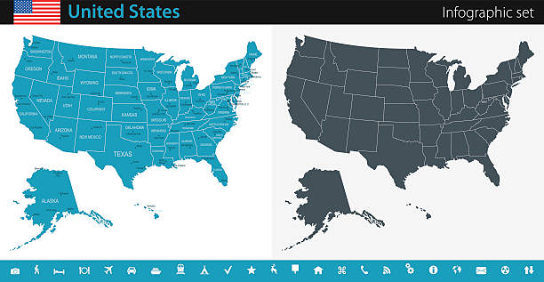
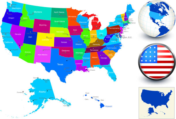
Vector maps of the United States with variable specification and icons
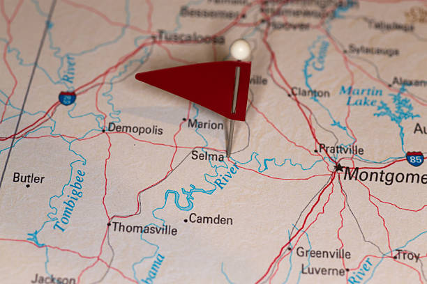
A map pin with a red flag pinpoints the city on a select area from a high quality map. The red flag creates highlighted copy space for text.
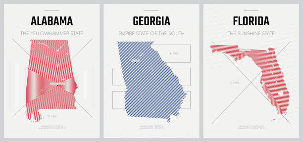
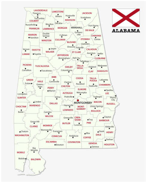
alabama administrative and political vector map with flag

A map pin with a red flag pinpoints the city on a select area from a high quality map. The red flag creates highlighted copy space for text.
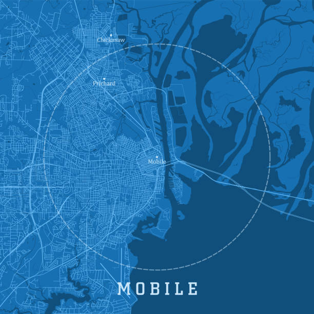
Mobile AL City Vector Road Map Blue Text. All source data is in the public domain. U.S. Census Bureau Census Tiger. Used Layers: areawater, linearwater, roads.

Photo of pinned Birmingham on a map of USA. May be used as illustration for traveling theme.

Birmingham silhouette skyline. Great Britain - Birmingham vector city, british linear architecture, buildings. Birmingham line travel illustration, landmarks. Great Britain flat icon, british outline design banner
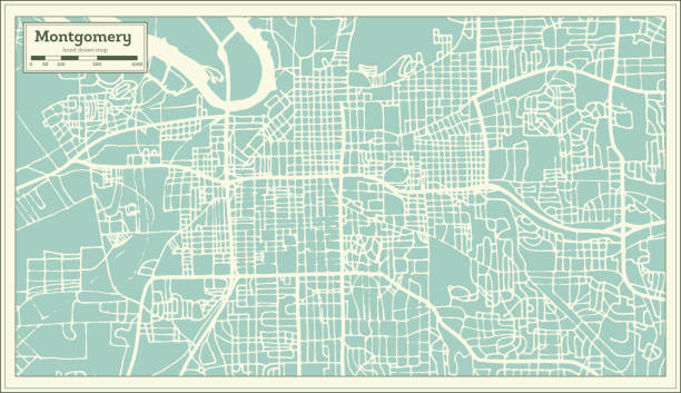
Montgomery Alabama USA City Map in Retro Style. Outline Map. Vector Illustration.

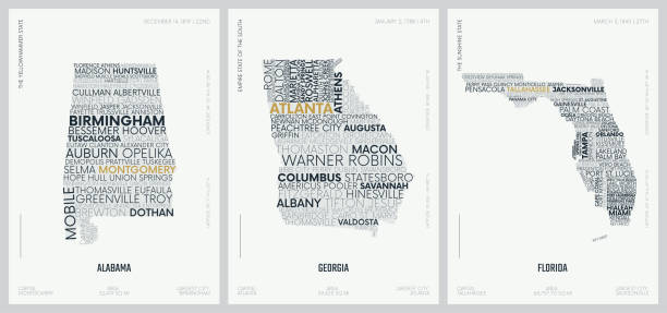
Georgia, GA, gray political map with capital Atlanta and largest cities. State in the southeastern region of the United States of America. Peach State. Empire State of the South. Illustration. Vector

Birmingham Alabama USA City Map in Retro Style. Outline Map. Vector Illustration.

A map pin with a red flag pinpoints the city on a select area from a high quality map. The red flag creates highlighted copy space for text.
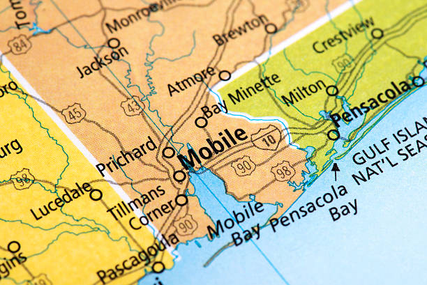
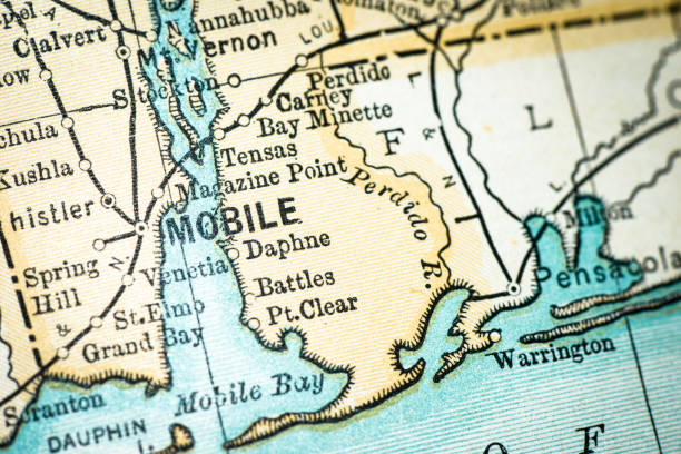
Map of Mobile City in Alabama State, USA. Detail from the World Map.
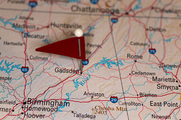
A map pin with a red flag pinpoints the city on a select area from a high quality map. The red flag creates highlighted copy space for text.

A map pin with a red flag pinpoints the city on a select area from a high quality map. The red flag creates highlighted copy space for text.
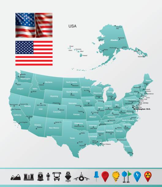
High detailed map оf United States with navigation and travel icons.
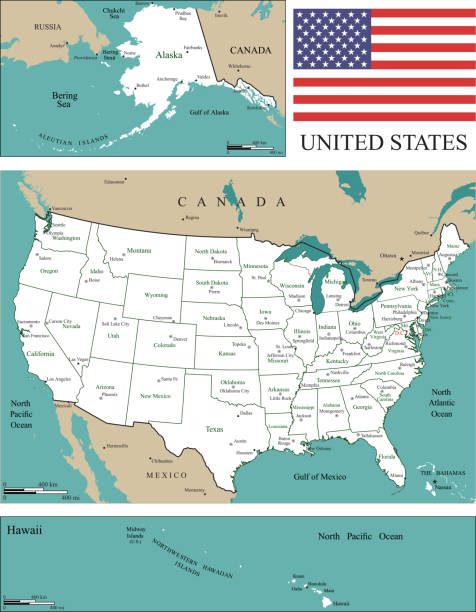
World Geography Map of United States


Empty Blue Map of the United States
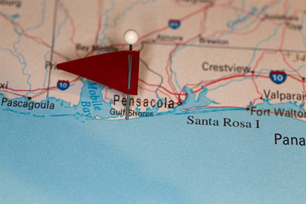
A map pin with a red flag pinpoints the city on a select area from a high quality map. The red flag creates highlighted copy space for text.

http://s017.radikal.ru/i404/1110/87/2c00b7bbd3ec.jpg