Top trails (56)
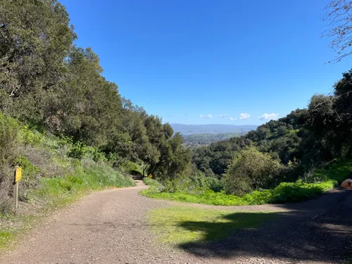
- Saratoga Gap and Ridge LoopThe trail is a true gem. One of the most appealing aspects of this trail is the balance it strikes between shade and sun. While certain stretches provide a cool, dappled respite from the sun's rays, others open up to the brilliant sunshine, bathing hikers in its warm embrace. This dynamic setting ensures the journey remains engaging and diverse. For those contemplating a weekend hike, this trail is an excellent choice. Its length is ideal - not too taxing, yet long enough to feel...
- Goat Rock Overlook, Emily Smith Observation Point and Saratoga Gap TrailModerate•4.7(2478)#2 - Goat Rock Overlook, Emily Smith Observation Point and Saratoga Gap TrailLength: 4.0 mi•Est. 2h 3mThis loop has some awesome overlooks of the Santa Cruz Mountains and even passes a waterfall overlook. The forest is scattered with large boulders that are fun to scramble on. There are several trail junctions, so downloading the map ahead of time is recommended. The parking area is just off Skyline Boulevard.
- Alma and Redwood Springs LoopModerate•4.7(4806)#3 - Alma and Redwood Springs LoopLength: 5.3 mi•Est. 2h 38mThe Alma (the Spanish word for soul) Trail is located west of Bear Creek Road and is accessible using the new pedestrian crossing. This trail traverses into densely wooded fir and redwood forests, through bay and oak woodlands, eventually linking to the Madrone Knoll Trail. Be prepared: These trails climb from the parking area located at 1,000 feet in elevation to Madrone Knoll, the highest point, at 2,400 feet.
- Los Gatos Creek to Jones LoopModerate•4.5(2465)#4 - Los Gatos Creek to Jones LoopLength: 3.9 mi•Est. 1h 40mA great West Valley paved path/trail for biking, mountain biking, jogging, and birding. A good starting point from Campbell Park the paved trail extends through Vasona Park, Downtown Los Gatos, and on to Lexington Reservoir and more challenging dirt road mountain bike climbs. Los Gatos Creek and ponds along the way offer good birding opportunities. The paved path makes a 2 mile loop from Campbell park to a pedestrian bridge at San Thomas Expressway. The east side of the loop has a 1 mile...
- Castle Rock, Saratoga Gap and Ridge Trail LoopHard•4.5(1602)#5 - Castle Rock, Saratoga Gap and Ridge Trail LoopLength: 10.9 miCastle Rock, Saratoga Gap and Ridge Trail is an awe inducing trek with views of the Santa Cruz Mountains. Located in Castle Rock State Park, just off highway 35, this route has it all! It provides amazing views of Rock Falls, crosses the San Lorenzo River, passes by the notorious climbing spot at Goat Rock and is conveniently located close to San Jose. Starting off on the Castle Rock Trail, you will quickly meet up with the east end of the Ridge Trail and round out with Saratoga Gap Trail....
- Lexington Reservoir TrailModerate•4.4(2295)#6 - Lexington Reservoir TrailLength: 4.8 mi•Est. 2h 37mThis loop trail explores the west side of the Lexington Reservoir and is a great option for the entire family. This trail is multi-use, and can be steep in sections. Take the Limekiln trail to the junction of Priest Rock Trail. Return via the Priest Rock trail. Walk along the shore line to return. The loop can be done in either direction.
- Los Gatos Creek Trail to Saint Josephs HillModerate•4.5(1177)#7 - Los Gatos Creek Trail to Saint Josephs HillLength: 6.1 mi•Est. 2h 47m
- Jones, Manzanita, Range, Novitiate Trail LoopModerate•4.5(1708)#8 - Jones, Manzanita, Range, Novitiate Trail LoopLength: 3.7 mi•Est. 1h 52m
- Manzanita Trail via Jones TrailModerate•4.5(908)#9 - Manzanita Trail via Jones TrailLength: 3.2 mi•Est. 1h 37m
Helpful reviews of trails in Los Gatos
Activity type
Attractions
Suitability
Points of Interest
Frequently asked trail questions about Los Gatos
What are the different types of hiking trails in Los Gatos?
There are plenty of things to do on Los Gatos's hiking trails. On AllTrails.com, you'll find 49 hiking trails, 40 running trails, 26 walking trails, and more.
What is the longest trail in Los Gatos?
According to AllTrails.com, the longest trail in Los Gatos is Skyline-to-the-Sea Trail: Castle Rock Route. This trail is estimated to be 27.1 mi long.
Which trail has the most elevation gain in Los Gatos?
Los Gatos: With an ascent of 4,924 ft, Castle Rock, Big Basin, and Portola Redwoods State Park Loop has the most elevation gain of all of the trails in the area. The next highest ascent trail is Priest Rock, Limekiln and Kennedy Trail Loop with 3,530 ft of elevation gain.
What is the most popular and difficult trail in Los Gatos?
The most popular and difficult trail in Los Gatos is Castle Rock, Saratoga Gap and Ridge Trail Loop with a 4.5-star rating from 1,602 reviews.
Are there camping trails available in Los Gatos?
According to AllTrails.com, there are 3 camping trails in Los Gatos and the most popular is Limekiln to Kennedy to Priest Rock Loop with an average 4.4 star rating from 69 community reviews.
Are there running trails available in Los Gatos?
According to AllTrails.com, there are 40 running trails in Los Gatos and the most popular is Saratoga Gap and Ridge Loop with an average 4.7 star rating from 4,778 community reviews.
Are there biking trails available in Los Gatos?
According to AllTrails.com, there are 28 biking trails in Los Gatos and the most popular is Lexington Reservoir Trail with an average 4.4 star rating from 2,295 community reviews.

