Share now
Brief History – Early History – Mughal Era – Sikh Era – British Rule – Independence Movement and KP – Post Partition – Governmental Structure – Administrative Divisions
Brief History Khyber Pakhtunkhwa Province
The province was called the North-West Frontier Province during British Rule (or the British Raj: 1858-1947) as this area formed the north-western borders of the Raj. After Partition Pakistan continued to use this name till 2010 when the name was changed to Khyber Pakhtunkhwa[1] under the 18th Amendment to the Constitution of Pakistan. The name Khyber Pakhtunkhwa means “Khyber side of the land of the Pakhtuns”[2] while only the word Pakhtunkhwa means “Land of the Pakhtuns”; according to some scholars, Pukhtunkhwa means “Pakhtun culture and society.”
[1] The name is commonly shortened to the acronym KP or KPK. This volume uses KP
[2] US department of State 2011; Background Notes: South Asia, May, 2011
Early History Khyber Pakhtunkhwa
The province is home to the Gandhara Civilization, which lasted from 1000 BC to the 11th century AD. It consisted of multiple dynasties which ruled over the same area and which were loosely linked by their adoption of Buddhism as a religion. This civilization has been historically significant since the Achaemenid Empire[1] and more specifically, during the reign of Cyrus the Great (558-28 BC).
The Imperial Gazetteer Provincial Series: NWFP shows that Darius Hystaspes (550–486 BC, the third king of the Persian Achaemenid Empire), sent Scylax, a Greek seaman of Karyanda, to explore the course of the River Indus. Darius successfully subdued the tribes dwelling west of the Indus and north of Kabul, which led to the assimilation of Gandhara (modern district of Peshawar) in a Persian satrapy (province or governorship), and the formation of a special satrapy—that of the Indians (Assakenoi)—with the tribes farther north on the Indus.
In the year 327 BC, Alexander the Great crossed the Indian Caucasus (Hindu Kush) Mountain and advanced towards the plains of Punjab. Ombhi, the King of Taxila, and other chiefs joined him. Alexander dispatched parts of his forces through the valley of the Kabul River, while he himself advanced into Bajaur and Swat with his light troops. He crossed the Gouraios (Panjkora River) successfully, and entered the territory of the Assakenoi which is located in modern-day KP. After capturing the area, he then made Embolima (thought to be the region of Amb in KP) his base. The ancient region of Peukelaotis (modern Hashtnagar, 27 km northwest of Peshawar) submitted to the Greek invasion, and Alexander made Nacanor, a Macedonian, his satrap (governor) of the country west of the Indus, which included modern KP. Alexander himself is believed to have crossed River Indus either at Ohind or, as some historians believe, further down the river near Attock.
After Alexander’s death in 323 BC, Raja Porus obtained possession of the Lower Indus Valley, but was murdered by Eudamos (the Greek Governor) in 317 BC. After Eudamos left India, the Greek power collapsed and Chandragupta Maurya (founder of the Mauryan Empire) made himself the master of this area. His grandson Asoka made Buddhism the dominant religion in Gandhara and in Pakhli (part of Hazara).
After Asoka’s death, the Mauryan Empire fell to pieces, and the Greek prince and one of the kings of the Bactrian Dynasty, Demetrius, again captured parts of Northern India (190 BC). The Bactrian Dynasty, however, was attacked from the west by the Parthians and from the north by the Sakas (a Central Asian tribe). The last vestiges of Greek dominion were extinguished by the Yueh-Chi (Chinese name for a central Asiatic Tribe that ruled in Bactria[2] and India).
One section of nomadic tribe (the Yueh-Chi), called the Kushans, under their chief Kadphises I, seized vast territories extending south to the Kabul Valley. His son Kadphises II conquered Northwestern India, which he governed through his generals. During the rule of his last successor, Vasushka, the dominions[3] of the Kushan Empire shrank to the Indus Valley and modern Afghanistan. Their dynasty was supplanted by Ki-to-lo, the chief of the section of the Yueh-Chi tribe that had remained in Bactria. They, in turn, were subdued by the Ephthalites, who established a vast empire, from Chinese Turkistan to Persia including the Kabul Valley. The Ephthalites are popularly known as the White Huns.
Muslim rule was first brought to the region by a former Turkish slave-soldier/ governor of Ghazni (mamluk) named Sebuktigin, who gained control of Peshawar in 988 AD. Sabüktagin or Sebuktigin, was the founder of the Slave dynasty or the Ghaznavid dynasty. He invaded the Indian Frontier in 986 AD; by 988 AD he had defeated Jaipal with the help of his allies at Laghman (Afghanistan), and soon after, he had conquered the country up to the Indus, placing his governor at Peshawar. His son, Maḥmud Ghaznavi, raided Northern India several times between 1001 and 1027, and brought a large area of present-day KP province into the boundaries of the Ghaznavid dynasty. In 1179, Muhammad of Ghor conquered Peshawar, and then seized Lahore from Khusro Malik 2 years later.
After Muhammad of Ghor was assassinated in 1206 AD, his general, Taj-ud Din Yalduz, established himself at Ghazni, until he was driven into Hindustan by the Khwarizmis (1215 AD). The latter were, in turn, overwhelmed by the Mongols in 1221 AD. In 1224 AD, Jalal-ud Din Khwarizimi appointed Saif-ud Din Hasan (the Karlugh) the ruler of Ghazni. Saif-ud Din added Kurram and Bannu to Ghazni, and declared independence in 1236 AD. In 1239, Mongols drove him out of Ghazni and Kurram, but Saif-ud Din managed to hold on to Bannu (Banian). After his death in 1249, his son Nasir-ud Din Muhammad became the feudatory of the Mongols, thus retaining Bannu.
In 1398, Timur (Tamerlane the Great) set out from Samarkand to invade India, and on his way to Punjab, conquered Kator (now Chitral). After subduing Kator, he made inroads into Punjab and returned via Bannu in March 1399. His expedition established a Mongol over-lordship in the province (KP), and he established a Karlugh regent in Hazara. The descendants of Timur held the province as a dependency of Kandahar, but after the fall of the Timurid Dynasty, their hold on the province relaxed.
According to the Provincial Gazetteer NWFP:
Meanwhile the Afghans began rising to power; implacably hostile to the Mongols, they now appear as a political factor. At the close of the fourteenth century they were firmly established in their present seats south of Kohat, and in 1451 Bahlol Lodi’s accession to the throne of Delhi gave them a dominant position in Northern India. Somewhat later Babar’s [first Mughal Emperor] uncle, Mirza Ulugh Beg of Kabul, expelled the Khashi (Khakhai) Afghans from his kingdom, and compelled them to move eastwards into Peshawar, Swat, and Bajaur. After Babar had seized Kabul, he made his first raid into India in 1505, marching down the Khyber, through Kohat, Bannu, Isa Khel, and the Derajat,[4] and returned by the Sakhi Sarwar pass. Around 1518, he invaded Bajaur and Swat, but before he could capture them, he was recalled by an attack on Badakhshan in present-day Afghanistan. (pg. 16)
The remains of both pre-Islamic and Islamic eras can be found in various places in the province.
[1]Achaemenid Empire is also known as the First Persian Empire, and was founded by Cyrus the Great in 550 BC. The Empire lasted till 28 BC.
[2]Bactria was located between the Hindu Kush Mountain Range and the Amu Darya River (Central Asia region).
[3] According to the Provincial Gazetteer of NWFP, the dates of their rule are unknown and are a matter of dispute, but it is known that they reigned in the early Christian Era.
[4] Derajat is the plain area between River Indus and Suleiman Range which consists of Dera Ismail Khan, Dera Ghazi Khan, and Dera Fateh Khan
Mughal Era Khyber Pakhtunkhwa
In 1526, Babar’s victory at Panipat gave him control over the area belonging to the NWFP (now KP). At his death in 1530, Mirza Kamran, Babar’s second son, became a feudatory of Kabul. With his aid, the Ghwaria Khel Afghans overthrew the Dilazaks who were loyal to Humayun (second Mughal Emperor), and thus, obtained control over Peshawar; however, in 1550, Khan Kaju, the chief of a confederation of the Khashi Afghan tribes, defeated the Ghwaria Khel at Shaikh Tapur. Humayun, after overthrowing Kamran, entered Peshawar in 1552, which he garrisoned strongly. Nevertheless, the Mughal hold on these territories remained weak, and often precarious.
On Humayun’s death in 1556, Mirza Muhammad Hakim, Akbar’s brother (Humayun’s successor to Delhi) was ruling Kabul. When Mirza Hakim died in 1585, Akbar’s Rajput General, Kunwar Man Singh, occupied Peshawar and Kabul, and became the governor of the province of Kabul. In 1586, however, the Mohmands and other tribes revolted, led by Jalala, the son of Pir Roshan (their leader), and invaded Peshawar. Man Singh was defeated and subsequently joined Akbar’s forces. Meanwhile, the Yousafzais also joined the Roshanias, and in 1587, Zain Khan Kokaltash was dispatched into Swat and Bajaur to suppress them. The expedition was defeated and Birbal, one of Akbar’s Nauratans (special advisers), was killed. In 1592, Zain Khan defeated the Afghans, and in 1593 conquered Tirah, Swat, and Bajaur. In 1620, a large Mughal force was defeated while it was attempting to enter the country through Sampagha Pass (Tirah Valley). Raja Jagat Singh held Kohat and Kurram, and thus maintained communications with Kabul. By 1667, the Yousafzai, and Mandaur Afghans were strong enough to cross the Indus, but were defeated near Attock. In 1673, the Afridis defeated a Mughal army, and in 1674 they again defeated a Mughal onslaught and drove it to Bajaur. Aurangzeb (Shahjahan’s successor) adopted a conciliatory policy towards the Afghans, giving some of them fiefdoms to maintain peace.
In 1738, Nadir Shah, the Shah of Persia and the founder of the Afsharid Dynasty, defeated Nazir Shah, the Mughal Governor of Kabul, but allowed him, as his feudatory, to retain that province, which included Peshawar and Ghazni.
Nadir Shah’s successor, Ahmad Shah Durrani, established a reasonably settled government in the Peshawar Valley, but with the advent of Timur Shah Durrani, anarchy returned to the valley. Once Timur Shah died (in 1793), his sons competed for the throne with varying results; this dissension gave ample opportunity to the local chieftains throughout the province to establish completely independent States. Peshawar was ultimately conquered by the Barakzai family (c1826), and Dera Ismail Khan by the Sadozais (c1794).
Sikh Era Khyber Pakhtunkhwa
The Sikh invasions of the region began[1] in 1818, and from that date to the annexation by the British, the Sikhs, under Ranjit Singh, steadily made themselves masters of the region that included Punjab and present-day FATA as well as KP. In 1818, the Nawab of Dera Ismail Khan surrendered to a Sikh army, and 5 years later the Sikhs captured the Marwat Plain of Bannu. In 1836, all authority was taken from the Nawabs of Dera Ismail Khan and a Sikh Kardar (wazir, or revenue collector) was appointed in their place. The First Anglo-Sikh War (1845-46) ended with partial control of the Sikh Kingdom being handed over to the British. The British, under the leadership of Herbert Edwardes, built the fort of Bannu, and brought the Bannuchis under the direct control of the Lahore Darbar.
Hazara-i-Karlugh, Gandhgarh, and the Gakkar territories had been governed from Attock under the Afghans, while Kashmir collected the revenue from the upper regions of Pakhli,[2] Damtaur,[3] and Darband.[4] In 1813, the Sikhs conquered the fort of Attock, at which time Lower Hazara became a tributary to them. Upper Hazara began paying tribute in 1819, when the Sikhs conquered Kashmir. The territory referred to as Hazara was united when it was bestowed as a jagir[5] to Hari Singh Nalwa, Commander-in-Chief of the Sikh army, by Maharaja Ranjit Singh[6] in 1822.
The Sikhs forayed into Peshawar for the first time in 1818, but did not occupy the territory. In 1823, following the battle of Nowshera on the banks of the Kabul River, Hari Singh Nalwa and his men pursued the retreating Afghans first to Peshawar, and then to the mouth of the Khyber Pass. The Sikhs entered the city of Peshawar for a second time, once again avowing to hold Peshawar as a tributary to the Sikh Court of Lahore. After plundering the city, they burnt its fortress, the Bala Hissar. In 1834, General Hari Singh Nalwa took possession of Peshawar Fort and, at the same time, Kohat and Teri were temporarily occupied by the Sikh Garrison. After the death of Ranjit Singh, the turbulent and exposed tracts in the region like Hashtnagar and Miranzai, were made over in jagir to the local chieftains, who enjoyed almost complete independence, and a vigorous administration was attempted only in the more easily controlled areas[7] by the Sikhs. Of the Sikh governors, the best remembered for his bravery while establishing control of the region is Hari Singh Nalwa (1834-1837), while Ranjit Singh’s Italian General Avitabile (1838-1842) is remembered for his cruelty and barbaric executions. The most significant contributions of Sikh rule to this region were the city of Haripur, the first planned city in this entire region, and the forts of Sumergarh (Bala Hissar, Peshawar) and Fatehgarh (Fort of Jamrud) at the mouth of the Khyber Pass
British Rule Khyber Pakhtunkhwa
The Punjab province was annexed by the British in 1849. In 1850, the districts of Peshawar, Kohat and Hazara were formed into a regular Division under a Commissioner, and British Rule was fully established. The internal administration of NWFP did not differ in any way from that of Punjab, but in order to maintain peace along the borders, a special force—the Punjab Frontier Force—was raised; according to Gazetteer of the North-West Frontier Province 1908 (p. 19) it consisted, at first, of 5 regiments of Cavalry, the Corps of Guides, 5 regiments of Infantry, 3 Light Field Batteries, 2 Garrison Batteries, 2 Companies of Sappers and Miners, and the Sind Camel Corps. In 1886, this regiment was removed from the control of the Punjab Government and amalgamated with the regular British army. During the War of Independence of 1857 (or Mutiny of 1857 as termed by British historians) the Hindustani army stationed at Peshawar joined the mutiny, but after being subdued by the British, tried to escape across the Indus, only to perish after fearful privations at the hands of hill-men at the Hazara border. This resulted in the Pathans from both Peshawar and across the border in joining the newly raised Levies Force.[8]
Under British Rule, from 1857 to 1881, the history of the area consists of expeditions being sent to subjugate various tribes. In 1859-60, the Kabul Wazirs of Thal and Bannu as well as Mahsud country were subjugated, but the Mahsud tribe did not submit and were put under a blockade. By the treaty of Gandamak (1879) Amir Yakub Khan renounced his claim to authority over Khyber and Mohmand passes. Between 1888 and 1897, a number of expeditions were sent by the British, and the Hazara border (controlled by the Isazai clan, cis-Indus[9] Swatis, Alatis, and Parari Syeds) was secured. In 1894, Wana was secured, and in 1895, Chitral was occupied. Under the Gandamak Treaty, the borders of the Afghan influence were fixed to the western ends of the Khyber Pass and the Kurram Valley, but borders on the north and south of these routes were not fixed. In 1893 the Amir of Kabul, Amir Yakub Khan, consented to fixing precise boundaries.[10] A mission under Sir Mortimer Durand was sent, and an agreement between the Government of India and the Amir of Kabul was signed. Through this agreement, the limits of Afghanistan and British India were fixed. This demarcation line is known as the Durand Line.
In 1897, the Afridis and Orakzais planned a simultaneous uprising in the Kurram and Khyber valleys. This is known as the Pathan Uprising. Initially, this rebellion was successful, and the Khyber Pass at Jamrud was retaken by the tribes; in December 1897, they were defeated, however, and by the end of the year, the British had gained control of the region. In 1908, the Zaka Khel Afridi tribe of the Peshawar border (Khyber Pass region) was also subdued. Thus, the districts of Hazara, Peshawar, Kohat, Bannu, Dera Ismail Khan, Khyber Agency, Kurram Agency, Tochi, Wana, Swat, Dir, and Chitral were separated from Punjab and a new province—NWFP—was created in 1901 with its headquarters at Peshawar.
Independence Movement and Khyber Pakhtunkhwa
The Pathans or the Pashtuns never fully submitted to British Authority. The idea of a separate Muslim State was first presented by Sardar Gul Muhammad Khan in 1924 at Dera Ismail Khan in his statement to the Frontier Inquiry Committee (the Bray Commission). In 1930, when the ideology of Pakistan was presented by Allama Muhammad Iqbal in an annual session of Muslim League at Allahabad, the frontier Muslims wholeheartedly supported the idea. The massacres of Muslims at gatherings supporting the “Pakistan” idea held at Qissa Khwani Bazaar and Kalan Bazaar (Peshawar), as well as Takkar Hathi Khel, and Spin Tangi, where 300 Pathans were martyred, intensified the support for an independent Muslim State.
Sardar Abdur Rab Nishtar, a Kakar Pashtun, joined the All India Muslim League in 1932 and became a confidante of Quaid-e-Azam Muhammad Ali Jinnah. He represented the All India Muslim League in the Simla Conference of 1945. After Independence, he was made Governor of Punjab in 1949. He was the first Pakistani to be made a Governor; before his appointment to the position, British Governors had continued ruling. He effectively ran the governorship for 2 years, paving the way for the restoration of an elected government in 1951.
Post Partition Khyber Pakhtunkhwa
Following independence, the NWFP voted to join Pakistan in a referendum in 1947 by a very small majority (50.1%). In addition, Afghanistan’s loya jirga of 1949 declared the Durand Line invalid, which led to border tensions with Pakistan. Afghanistan’s governments have periodically refused to recognize Pakistan’s inheritance of British treaties regarding the region,[11] leading to a counter-claim by Pakistan that discussions of the original treaties, if they must be discussed, can only be held with the original signer, the Kingdom of Afghanistan, which is now defunct—essentially denying modern Afghanistan the same inheritance rights that it denies Pakistan.
At the time of Partition, some Princely States acceded to Pakistan, including Swat, Dir, and Chitral, and remained as Princely States till 1969. The Princely States of Dir, Swat and Chitral were merged in 1969, and Kohistan and Malakand in 1972. The area of Swat State is now divided into Swat, Buner, Shangla & Chitral and made into districts. Dir was merged into Khyber Pakhtunkhwa (then NWFP), and in 1996 it was divided into 2 districts: Upper and Lower Dir. These were termed Provincially Administered Tribal Areas, or PATAs. PATAs are administered by the Chief Minister of KP but in name only; in most cases, all Pakistani Laws apply in these areas.
History of Former Federally Administered Tribal Areas
Federally Administered Tribal Areas (FATA) was a semi-autonomous tribal region in north-western Pakistan that existed from 1947 until being merged with neighbouring province Khyber Pakhtunkhwa in 2018. It consisted of seven tribal agencies (now Districts in KP) and 6 Frontier Regions[12] which were directly governed by Pakistan’s federal government through a special set of laws called the Frontier Crimes Regulations. FATA bordered Pakistan’s provinces of Khyber Pakhtunkhwa, Balochistan, and Punjab to the east, south, and south-east respectively, and Afghanistan to the west and north. The territory is almost exclusively inhabited by the Pashtuns, who also live in the neighbouring provinces of KP and Northern Balochistan, and straddle across the border into Afghanistan.
On 24 May 2018, the National Assembly of Pakistan voted in favour of an amendment to the Constitution of Pakistan for the FATA-KP merger which was approved by the Senate also. Since the change was to affect the province of KP, it was presented for approval in the KP assembly on 27 May 2018, and passed with majority vote. On 28 May 2018, the President of Pakistan signed the FATA Interim Governance Regulation, a set of interim rules for FATA until it merged with Khyber Pakhtunkhwa within a timeframe of two years.
The 25th Amendment received assent from President Mamnoon Husain the then President of Pakistan on 31 May 2018, after which FATA was officially merged with KP.
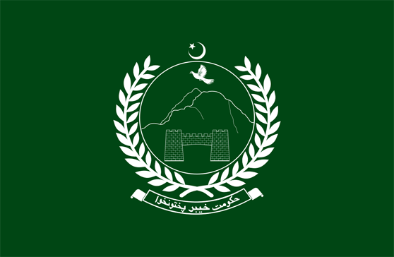
Figure 1.3 KP State emblem of Khyber Pakhtunkhwa
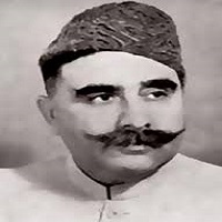
Figure 1.4 Sardar Abdur Rab Nishtar (A leader of All India Muslim League)
[1] Imperial Gazetteer of India v. 19, p.153 and 154
[2] Pakhli was an ancient district of Punjab province during Mughal Rule. It is now part of Hazara
[3] Now a Union Council in Abbottabad
[4] Now a Union Council in Mansehra
[5] Feudal land grant
[6]Nalwa, V. (2009), Hari Singh Nalwa – Champion of Khalsaji, New Delhi: Manohar, p. 102
[7] Imperial Gazetteer of India, v. 19 p. 153
[8] Imperial Gazetteer of India v.19, p.155
[9] Cis-Indus means near side of Indus
[10] The Expeditions undertaken by the British are discussed in more details in individual chapters in this volume.
[11] http://www.carnegieendowment.org/files/cp72_grare_final.pdf
[12] These FRs were made part of the neighboring District
Governmental Structure; Khyber Pakhtunkhwa Province
At the Federal level, KP has 51 elected members in the National Assembly of Pakistan, and 9 women members.
The KP Provincial Assembly consists of 145 elected members, out of which 26 seats are reserved for women and 04 seats are meant for representatives of the minority groups. The Chief Minister is the Chief Executive of the Province and is an elected member of the Provincial Assembly. S/he forms a Cabinet of Ministers to oversee various departments. These ministers are chosen from the elected representatives of the Assembly on the democratic level, and a secretary on the bureaucratic level.
The Federal government appoints a Governor as Head of the Provincial Government. The Governor, in performance of the vested functions, acts in accordance with the advice of the Cabinet or the Chief Minister.
The Government of KP adopted the Khyber Pakhtunkhwa Local Government Act 2013, according to which a village, tehsil, town, district, and city district shall be governed by the local governments. The City District Government Peshawar shall govern Peshawar and the District Governments shall govern all districts. The District Governments shall consist of a District Council and District Administration. The District Government shall be looked after by the Zila Nazim. The District Council shall consist of general seats, seats reserved for women, peasants and workers, youth, and non-Muslims. The District Councils shall consist of Tehsil Councils which shall also consist of general seats, and seats reserved for women, peasants and workers, as well as youth, and non-Muslims.
The local government affairs in KP are managed by the Local Government Elections and Rural Development Department (LGE & RDD) and the Local Council Board (LCB). The Secretary of the Local Government & Rural Development Department (LGRD), by virtue of the position, also acts as chairman of the LCB.
Government Structure of Former FATA
The Constitution (Twenty-fifth Amendment) Act, 2018, reduced the Senate from 104 to 96 members, and the National Assembly from 342 to 336 members. The Khyber Pakhtunkhwa Assembly will have 145 seats (115 general, 26 reserved for women, and 4 reserved for minorities); FATA will have 21 seats within the KP Assembly (16 general, 4 reserved for women, and 1 reserved for non-Muslims).
Administrative Divisions; Khyber Pakhtunkhwa Province
The total area of the province is 101,741 km2 (1998 Census); this is divided into 32 districts as follows:
| Abbottabad | 02 Tehsils | 46 Union Councils |
| Bannu | 01 Tehsil | 40 Union Councils |
| Battagram | 02 Tehsils | 20 Union Councils |
| Buner | 06 Tehsils | 27 Union Councils |
| Charsadda | 02 Tehsils | 46 Union Councils |
| Chitral | 02 Tehsils | 24 Union Councils |
| Dera Ismail Khan | 03 Tehsils | 48 Union Councils |
| Hangu | 01 Tehsils | 17 Union Councils |
| Haripur | 02 Tehsil | 44 Union Councils |
| Karak | 03 Tehsils | 21 Union Councils |
| Kohat | 01 Tehsils | 21 Union Councils |
| Kohistan | 04 Tehsils | 38 Union Councils |
| Lakki Marwat | 01 Tehsils | 32 Union Councils |
| Lower Dir | 02 Tehsils | 13 Union Councils |
| Malakand | 02 Tehsils | 28 Union Councils |
| Mansehra | 03 Tehsils | 58 Union Councils |
| Mardan | 02 Tehsils | 74 Union Councils |
| Nowshera | 02 Tehsils | 47 Union Councils |
| Peshawar | 04 Towns | 92 Union Councils |
| Shangla | 02 Tehsils | 28 Union Councils |
| Swabi | 02 Tehsils | 55 Union Councils |
| Swat | 02 Tehsils | 65 Union Councils |
| Tank | 01 Tehsils | 16 Union Councils |
| Torghar | 03 Tehsils | 11 Union Councils |
| Upper Dir | 02 Tehsils | 28 Union Councils |
| Bajaur | 07 Tehsils | 120 Village Councils |
| Khyber | 05 Tehsils | 147 Village Councils |
| Kurram | 05 Tehsils | 81 Village Councils |
| Mohmand | 07 Tehsils | 113 Village Councils |
| North Waziristan | 09 Tehsila | 81 Village Councils |
| South Waziristan | 08 Tehsils | 97 Village Councils |
| Orakzai | 04 Tehsils | 46 Village Councils |
Table 1.2 KP Administrative Divisions
Historic/ Heritage Sites; Khyber Pakhtunkhwa Province
KP has been the historic gateway to South Asia and was once the cradle of the Gandhara Civilization. The classical Gandhara territory was the Peshawar Valley, and included the hilly areas of Swat, and Dir, extending in the east to the Indus River and Taxila. The Khyber Pass has always been the route between Peshawar and Afghanistan. The province has many archeological remains, some of which are listed on the UNESCO List of World Heritage Sites. There are 87 protected heritage sites and monuments in the province. The following table shows the number of sites that are protected under KP Laws in each district[1]
| District | No. of Sites | District | No. of Sites |
| Abbottabad | 21 | Bannu | 04 |
| Buner | 01 | Dera Ismail Khan | 05 |
| Kohat | 01 | Mardan | 16 |
| Nowshera | 01 | Peshawar | 13 |
| Swat | 20 | Gilgit | 01 |
Table 1.12 KP Number of Historical Sites
The following sites are the heritage sites listed on UNESCO’s List of World Heritage Sites:
- Buddhist Ruins of Takht-e-Bahai
- City remains at Sehr-i-Bahlol
Figure 1.23 Takht-e-Bahai main cluster of ruins.
Figure 1.24 Brass Shop in Historical Qissa Khwani Bazaar, Peshawar
Recreational Areas/ Tourist Attractions; Khyber Pakhtunkhwa Province
KP has the potential of becoming one of the biggest tourist attractions in the world due to its scenic beauty, geographical location, climate, and natural resources. The northern part of the province is exceptionally rich in picturesque and alluring landscapes, exotic valleys, and dense pine forests. The natural lakes and dense forests of the province are a safe haven for eco-tourism. Major tourist attractions of the province are:
- The Galliyats, the most important of which is Nathiagali
- Swat
- Shangla
- Shogran
- Kaghan Valley
- Naran Valley
- Mahabat Khan’s Mosque, Peshawar
- Bala Hisar Fort
- Akra Mounds, Bannu
- Takht-e-Bahai, Mardan
- Shahbaz Garhi, and Chanako Dheri (Buddhist Monasteries)
- Jamal Garhi (archeological site), Mardan
- Uch and the Noor Mahal relics, Timergara, Lower Dir District: Noor Mahal is a mini-museum, located in the mosque of the town. About 200 years ago, Maulana Muhammad Nasim Siddiqui, a scholar, brought many relics and rare books from Delhi; some of these relics include the hair of the Prophet Muhammad (SAW) and items belonging to Hazrat Ali, Hazrat Imam Hussain, as well as the Ghilaf of Khana Kaaba (in Mecca). All are housed in Noor Mahal
- Hund, Mardan: This town was of importance as part of the silk route between China and India. Alexander the Great is said to have crossed River Indus at this point in 327 BC. It remained the capital of India during the Hindu Shahi Period, for about 300 years. A fort was built here by Mughal Emperor Akbar
- Andan Dheri, near Uch, Timergara, Lower Dir. This is a Buddhist Stupa made of stone masonry
- Tarbela Dam. This is the world’s largest earth-filled dam and is located in Haripur
- Malam Jabba: This is the most promising hill resort in Swat Valley. It contains a modern Four Star hotel, golf course, ski runs, and chair lifts
- Shandur Pass
- Thandiani: Located 2,700 m above sea level, on a small plateau surrounded by pine forests
- Khyber Steam Safari.
There are a large number of important historical forts that need protection by the government in the region of Ex Fata. Some of the important forts are in Bajaur, Jamrud, Wana, Miranshah, Razmak (NWA), and FR Bannu.
Some historic shrines include shrines of Ghazi Baba, Sakhi Baba, Sheikh Baba, and Mir Ali Baba (all situated in Bajaur district). The tomb of Sakhi Arab Khan (Governor of this area under the Mughals) at Naway Dhand in the outskirts of Khaor (Bajaur) is also historically important.
Jamrud Fort at the mouth of the Khyber Pass was built by Ranjit Singh’s General, Hari Singh Nalwa, in 1836-37.
Landi Kotal plateau on top of Khyber Pass, located 1,072 m above sea level, has a large showroom for arms and ammunitions manufactured in the Tribal Arms Factory located beyond the hills.
Figure 1.25 KP Kumrat Valley: Upper Dir
Figure 1.26 KP Shogran, Kaghan Valley
Figure 1.27 Khattak Dance, KP
Figure 1.28 KP Polo Match, Shandur
Figure 1.29 KP Khyber Train Safari
[1] Guidelines for Sensitive and Critical Areas, Government of Pakistan 1997.
Khyber Pakhtunkhwa Districts
- Peshawar District Profile
- Abbottabad District Profile
- Bannu District Profile
- Battagram District Profile
- Buner District Profile
- Charsadda District Profile
- Chitral District Profile
- Dera Ismail Khan District Profile
- Lower Dir District Profile
- Upper Dir District Profile
- Hangu District Profile
- Haripur District Profile
- Karak District Profile
- Kohat District Profile
- Kohistan District Profile
- Lakki Marwat District Profile
- Malakand District Profile
- Mansehra District Profile
- Mardan District Profile
- Nowshera District Profile
- Shangla District Profile
- Swabi District Profile
- Swat District Profile
- Tank District Profile
- Torghar District Profile
- Bajaur Tribal Distyrict Ptofile
- Khyber Tribal District Profile
- Kurram Tribal District
- Mohmand Tribal District Profile
- North Waziristan Tribal District Profile
- Orakzai Tribal District Profile
- South Waziristan Tribal District Profile
Also visit: Sindh, Punjab, Baluchistan