


Towns & Villages Search
Towns & Villages Search
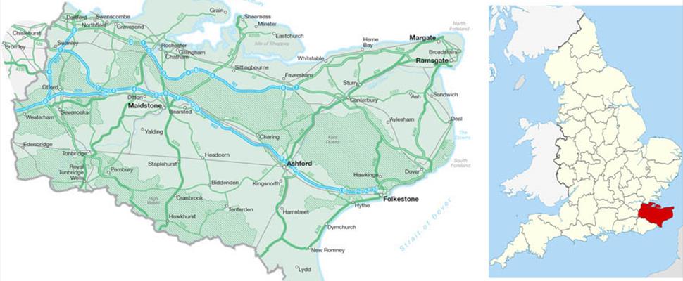
Kent is the most south-easterly county in the United Kingdom and therefore enjoys much of Britain's warmest and driest weather. Spanning 1,442 square miles, Kent shares its borders with East Sussex, Surrey, Greater London and Essex as well as being the shortest gateway from England to France.
The town of Dover is just 25 miles from the French city of Calais in mainland Europe, home to the iconic white cliffs and is part of Kent's Heritage Coastline. On the north east coast, you'll find Margate, Broadstairs and Ramsgate which are renowned for an abundance of blue flag beaches. Kent's county town is Maidstone, just a twenty minute drive from London's M25 motorway and Kent's event capital.
The west of Kent is dominated by the High Weald Area of Outstanding Natural Beauty while the Kent Downs AONB in the north and east of the county stretches from Sevenoaks, across to Rochester and down to Folkestone. Kent is full of quaint villages, coastal towns, breath-taking walks and trails to enjoy. Use our interactive map below to explore the towns and villages scattered around this beautiful county, known as the Garden of England.
Map of Kent's towns and villages
Zoom in and out of the map using the plus and minus icons in the bottom corner while selecting the map's markers will bring up more information about one of the featured towns or villages. Alternatively, click or tap the icon at the top left corner of the map to show a full list.
For directions, click on the icon of a red arrow in a white square that appears whenever a map marker or list item is selected.

© Visit South East England 2024. All Rights Reserved