Ingria
Last updatedYou can help expand this article with text translated from the corresponding article in Russian. (January 2021)Click [show] for important translation instructions.
|
| Ingria Izhora | |
|---|---|
| Historical region | |
 | |
 Flag  Coat of arms | |
| Demonym | |
| Area | |
| • Coordinates | 59°38′N29°18′E / 59.633°N 29.300°E |
| Today part of | |
Ingria (Russian : Ингрия, Ингерманландия, Ижорская земля; Finnish : Inkeri, Inkerinmaa; Swedish : Ingermanland; Estonian : Ingeri, Ingerimaa) is a historical region in what is now northwestern European Russia. It lies along the southeastern shore of the Gulf of Finland, bordered by Lake Ladoga on the Karelian Isthmus in the north and by the River Narva on the border with Estonia in the west. The earliest known indigenous European peoples of the region are the now mostly Eastern Orthodox Izhorians and Votians, as well as the Ingrian Finns who descend from the Lutheran Finnish immigrants who settled in the area in the 17th century, when Finland proper and Ingria were both parts of the Swedish Empire.
Contents
- History
- Swedish Ingria
- Russian Ingria
- Estonian Ingria
- Soviet Ingria
- After the dissolution of the Soviet Union
- See also
- References
- Further reading
Ingria as a whole never formed a separate state; however, North Ingria was an independent state for just under two years in 1919–1920. The Ingrians, understood as the inhabitants of Ingria regardless of ethnicity, can hardly be said to have been a nation, although the Soviet Union recognized their "nationality"; as an ethnic group, the Ingrians proper, Izhorians, are close to extinction together with their language. This notwithstanding, many people still recognize their Ingrian heritage. [2]
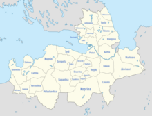
Historic Ingria covers approximately the same area as the Gatchinsky, Kingiseppsky, Kirovsky, Lomonosovsky, Tosnensky, Volosovsky and Vsevolozhsky districts of modern Leningrad Oblast as well as the city of Saint Petersburg.
The names of the region are: Finnish : Inkeri or Inkerinmaa; Russian: Ингрия, Ingriya, Ижора, Izhora, or Ингерманландия, Ingermanlandiya; Swedish : Ingermanland; Estonian : Ingeri or Ingerimaa.
History
In the Viking era (late Iron Age), from the 750s onwards, Ladoga served as a bridgehead on the Varangian trade route to Eastern Europe. A Varangian aristocracy developed that would ultimately rule over Novgorod and Kievan Rus'. In the 860s, the warring Finnic and Slavic tribes rebelled under Vadim the Bold, but later asked the Varangians under Rurik to return and to put an end to the recurring conflicts between them. [3]
The Swedes referred to the ancient Novgorodian land of Vod people as "Ingermanland", Latinized to "Ingria". Folk etymology traces its name to Ingegerd Olofsdotter, the daughter of the Swedish king Olof Skötkonung (995–1022). Upon her marriage to Yaroslav I the Wise, Grand Prince of Novgorod and Kiev, in 1019, she received the lands around Ladoga as a marriage gift. They were administered by Swedish jarls, such as Ragnvald Ulfsson, under the sovereignty of the Novgorod Republic.
In the 12th century, Western Ingria was absorbed by the Novgorod Republic. There followed centuries of frequent wars, chiefly between Novgorod and Sweden, and occasionally involving Denmark and Teutonic Knights as well. The Teutonic Knights established a stronghold in the town of Narva, followed by the Russian castle Ivangorod on the opposite side of the Narva River in 1492.
With the consolidation of the Kievan Rus and the expansion of the Republic of Novgorod north, the indigenous Ingrians became Eastern Orthodox. Ingria became a province of Sweden in the Treaty of Stolbovo in 1617 that ended the Ingrian War, fought between Sweden and Russia. After the Swedish conquest of the area in 1617 the Ingrian Finns, descendants of 17th-century Lutheran emigrants from present-day Finland, became the majority in Ingria. In 1710, following a Russian conquest, Ingria was designated as the Province of St. Petersburg.
In the Treaty of Nystad in 1721, Sweden formally ceded Ingria to Russia.
In 1927 the Soviet authorities designated the area as Leningrad Province. Deportations of the Ingrian Finns started in late 1920s, and Russification was nearly complete by the 1940s.
In the modern era, Ingria forms the northwestern anchor of Russia—its "window" on the Baltic Sea—with Saint Petersburg as its centre.
Swedish Ingria
Although Sweden and Novgorod had fought for the Ingrian lands more or less since the Great Schism of 1054, the first actual attempt to establish Swedish dominion in Ingria appears to date from the early 14th century, when Sweden first founded the settlement of Viborg in Karelia [4] and then the fortress Landskrona (built in 1299 or 1300) at the confluence of the Ohta and Neva rivers. However, Novgorod re-conquered Landskrona in 1301 and destroyed it. Ingria eventually became a Swedish dominion in the 1580s, but the Treaty of Teusina (1595) returned it to Russia in 1595. Russia in its turn ceded Ingria to Sweden in the Treaty of Stolbova (1617) after the Ingrian War of 1610–1617. Sweden's interest in the territory was mainly strategic: the area served as a buffer zone against Russian attacks on the Karelian Isthmus and on present-day Finland, then the eastern half of the Swedish realm; and Russian Baltic trade had to pass through Swedish territory. The townships of Ivangorod, Jama (now Kingisepp), Caporie (now Koporye) and Nöteborg (now Shlisselburg) became the centres of the four Ingrian counties (slottslän), and consisted of citadels, in the vicinity of which were small boroughs called hakelverk – before the wars of the 1650s mainly inhabited by Russian townspeople. The degree to which Ingria became the destination for Swedish deportees has often been exaggerated.[ by whom? ]
Ingria remained sparsely populated. In 1664 the total population amounted to 15,000.