Massachusetts is located in the New England region of the USA. Explore more about this state through its maps. Here on this page, we are adding some printable maps of Massachusetts state. These maps will surely help you to know more about Massachusetts. And you can also use these HD maps for any document work, school, and college work. So, please scroll down the page and check our collection of maps without any more delay. Let’s start with the county map of Massachusetts state.
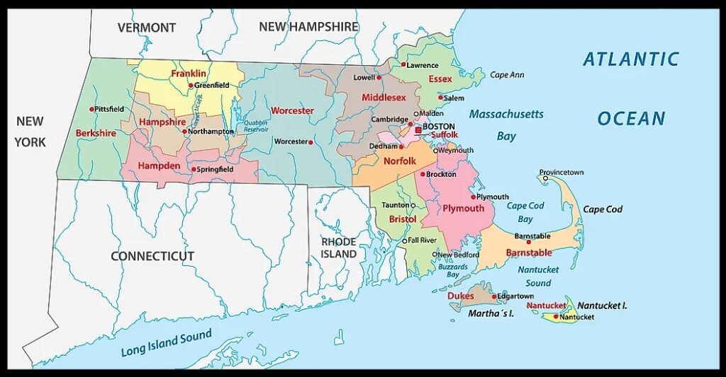
1. Massachusetts County Map:
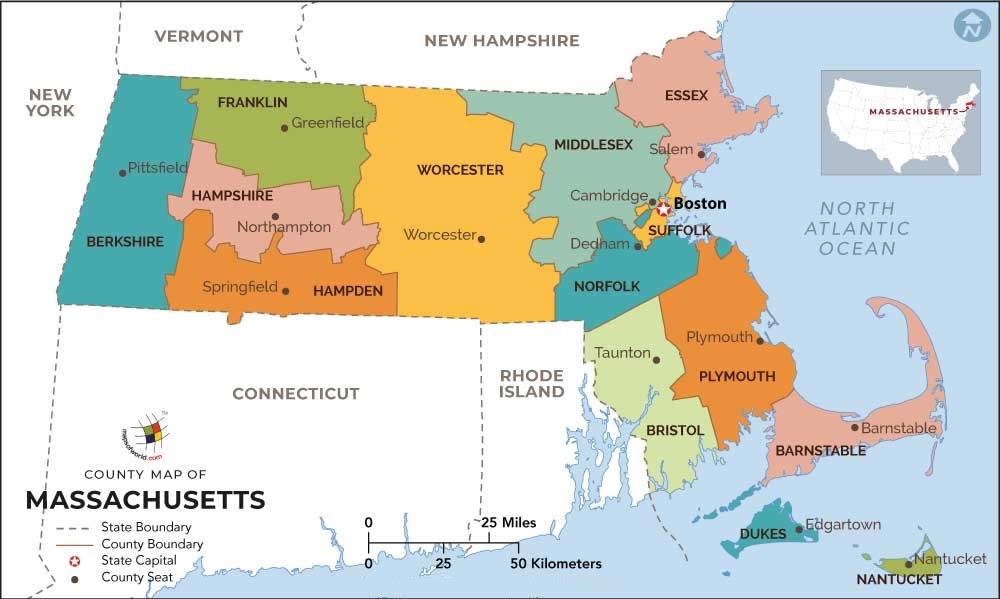
2. Map of Massachusetts with Counties:
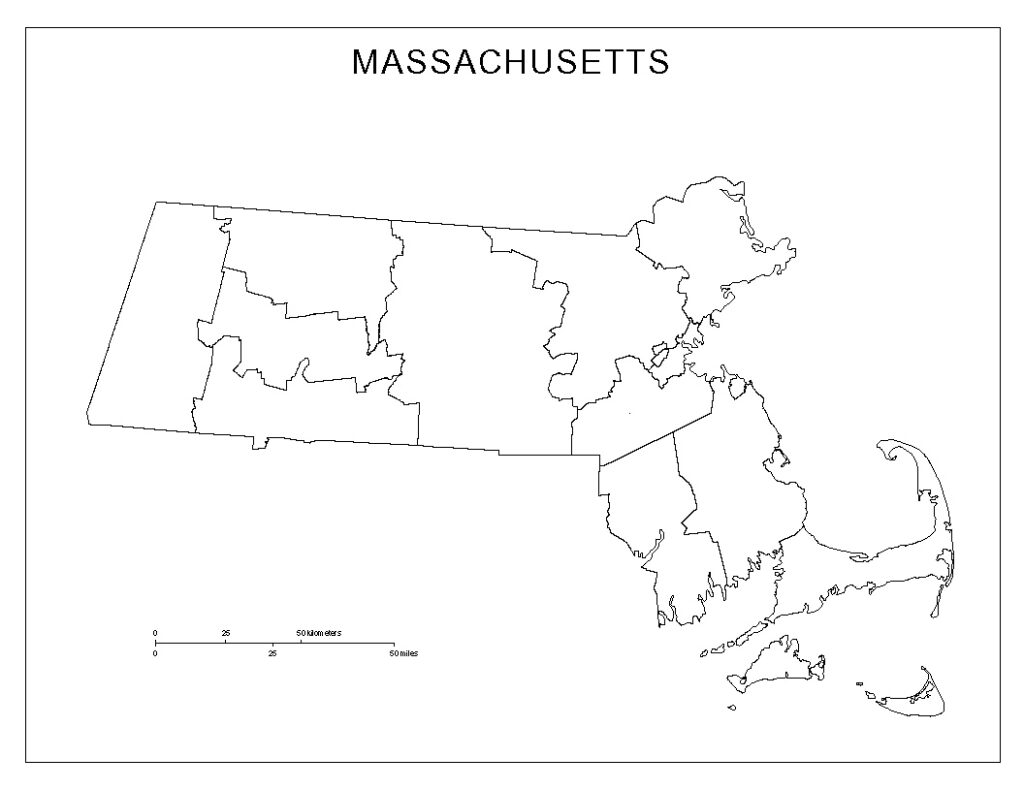
3. County Map of Massachusetts:
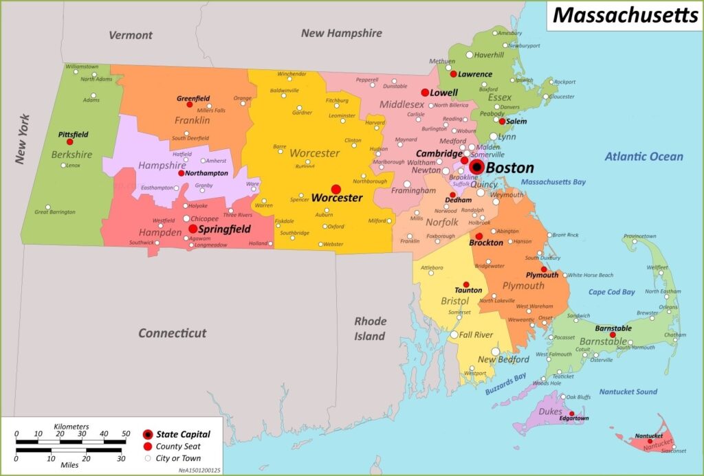
4. Massachusetts County Map with Towns:
5. Map of MA:
6. Massachusetts Map with Cities:
We have added above this collection of printable maps of Massachusetts County. We have added six different maps that contain helpful information about the counties. Below, we are adding some brief information about each map. So, please read the full description before viewing or saving any map on your device. We are also adding a table that shows some useful information about MA counties. Please check the entire table.
List of all Counties in Massachusetts State
This is a list of all counties of Massachusetts with some additional information like name of county name, year of established in, populations, the county seat, and total area.
| County | Established | County Seat | Area | Population |
| Barnstable County | 1685 | Barnstable | 396 sq mi | 215888 |
| Berkshire County | 1761 | Pittsfield | 931 sq mi | 131219 |
| Bristol County | 1685 | Taunton | 556 sq mi | 548285 |
| Dukes County | 1695 | Edgartown | 104 sq mi | 16535 |
| Essex County | 1643 | Salem and Lawrence | 498 sq mi | 743159 |
| Franklin County | 1811 | Greenfield | 702 sq mi | 71372 |
| Hampden County | 1812 | Springfield | 618 sq mi | 463490 |
| Hampshire County | 1662 | Northampton | 529 sq mi | 158080 |
| Middlesex County | 1643 | Cambridge and Lowell | 824 sq mi | 1503085 |
| Nantucket County | 1695 | Nantucket | 48 sq mi | 10172 |
| Norfolk County | 1793 | Dedham | 400 sq mi | 670850 |
| Plymouth County | 1685 | Plymouth and Brockton | 661 sq mi | 494919 |
| Suffolk County | 1643 | Boston | 58 sq mi | 722023 |
| Worcester County | 1731 | Worcester | 1,513 sq mi | 798552 |
The first map is a main county map of Massachusetts, which shows all counties. And the next map is a detailed MA county map that shows its county seat or administrator city of Massachusetts. The third map is a blank county map, and it is a simple outline map. Finally, the fourth map shows all counties with towns and cities. So, check this map if you are looking for a detailed county map of this state.
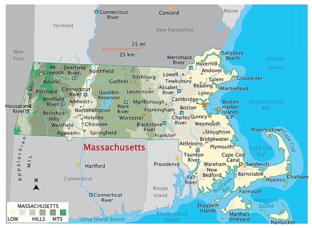
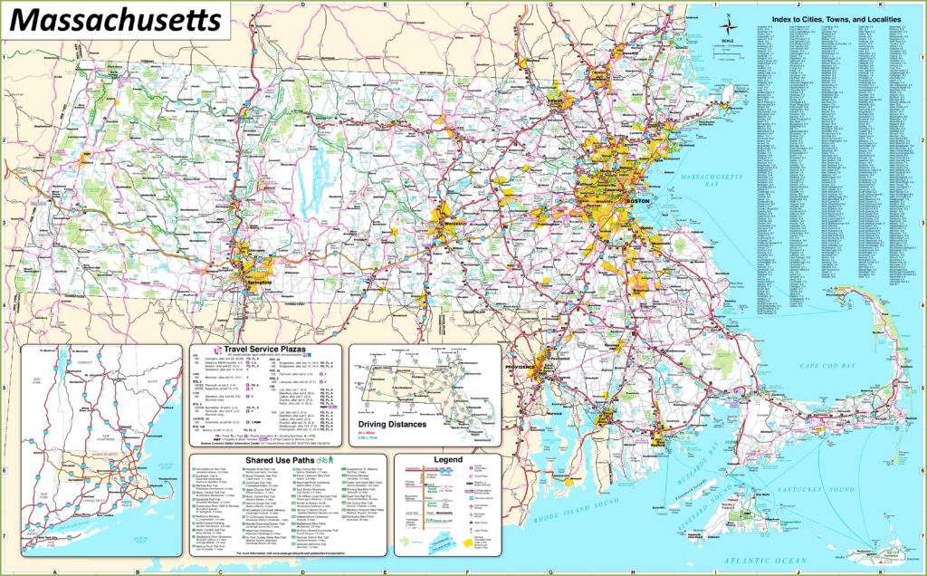
And the fifth map is a map of Massachusetts state. It is a full state map of Massachusetts. So, if you are looking for a state map and cities maps of Massachusetts, you should click this link. The sixth map is a map of Massachusetts with cities that shows all counties, cities, roads, highways, rivers, and lakes. So, these were some high-quality and printable maps that we have added above. These large HD maps are available in PDF and JPG (Image) formats. You can easily download any map by clicking on the buttons under the preview image. All these maps are free to download.