Below is a snapshot of the Web page as it appeared on 5/1/2024 (the last time our crawler visited it). This is the version of the page that was used for ranking your search results. The page may have changed since we last cached it. To see what might have changed (without the highlights), go to the current page.
Bing is not responsible for the content of this page.
Cameron County
Texas State Historical Association (TSHA)
https://www.tshaonline.org
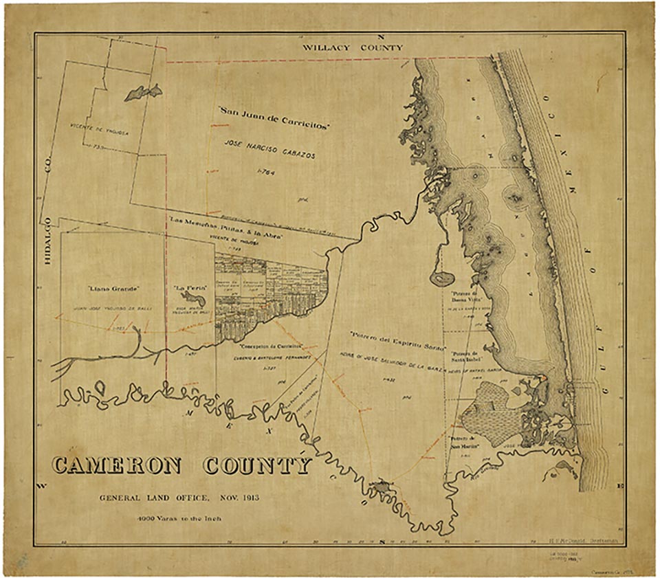
Cameron County (U-17) is 140 miles south of Corpus Christi in the Rio Grande Plains region of South Texas. The county, named for Mier expedition member Capt. Ewen Cameron, is bordered on the north by Willacy County, on the west by Hidalgo County, on the east by the Gulf of Mexico, and on the south by Mexico. The county's largest town and county seat is Brownsville, which serves as the terminus of U.S. Highways 77, 83, and 281 and the Missouri Pacific and Southern Pacific railroads. The center point of the county is at 26°10' north latitude and 97°30' west longitude. Other large communities include Harlingen, La Feria, Port Isabel, San Benito, and South Padre Island.
Cameron County covers 905 square miles, with an elevation range from sea level to sixty feet. Along the eastern edge of the county the soils are sandy and saline, with some cracking clay. The remainder of the county has brownish to reddish soils, with loamy to clayey surface layers and clayey subsoils. Vegetation along the eastern edge of the county is typical of the Gulf Prairie and Marsh vegetation areas, with marsh grasses, bluestems, and grama grasses predominating. The vegetation of the rest of the county is like that of the South Texas Plains area, with small trees, brush, weeds, and grasses found in abundance. Mesquite, live oak, post oak, and shrubs also grow densely in some areas. Between 41 and 50 percent of the county is considered prime farmland. Natural resources include oil and gas, barite, celestite, chromium, bentonite clay, fluorspar, manganese, and phosphate.
Cameron County's climate is subtropical and subhumid, with hot summers and mild winters. Temperatures range from an average low of 50° F to 69° in January and from an average high of 75° F to 94° in July. Rainfall averages twenty-six inches per year. Snowfall is exceedingly rare. The growing season lasts 320 days, with the first freeze in mid-December and the last in late January.
The area now called Cameron County has long been the site of human habitation. Artifacts dating to the Archaic Period suggest that the first inhabitants arrived more than 10,000 years ago. During historic times as many as seven linguistic groups, including Coahuiltecans and Karankawas, inhabited the lower Rio Grande valley. Seven groups of Coahuiltecans lived there. The Indians hunted a wide variety of animals, fished, and gathered berries, fruits, and roots, as well as mountain laurel and peyote for their narcotic effects. After the arrival of the Spanish in the seventeenth century, much of the native population succumbed to disease; those who survived eventually moved away or intermarried with the Europeans, and by the late eighteenth century they had been largely supplanted by the Lipan Apaches. During the nineteenth century the Comanches occasionally made forays into the area, but by the end of the early twentieth century virtually all trace of the Indians had disappeared.
The first Spanish explorers arrived in the seventeenth century. In August 1638 the governor of León sent a group under Jacinto García de Sepulveda to explore the area; they crossed the Rio Grande near Mier and marched down the north bank of the river as far as the site of present Brownsville. In 1687 Alonso De León, on his second journey to find the location of Fort St. Louis, crossed the Rio Grande and proceeded north, probably to Baffin Bay. Beginning in January 1747, Miguel de la Garza Falcón reconnoitered the north bank of the Rio Grande from the site of modern Eagle Pass to the mouth of the river, which he reached on March 3. He listed the numerous Indian groups in the area and described the land as unfit for settlement because of the inadequate fresh water supply. On February 27, 1747, José de Escandón built a raft to sound the Rio Grande north of present-day Matamoros, Tamaulipas, and crossed into what is now Cameron County. A royal inspection made in 1757 by José Tienda de Cuervo recommended that titles to the land in the area be given to the colonists. In 1765 the community of San Juan de los Esteros (present-day Matamoros) was established south of the Rio Grande. In 1781 Spanish authorities granted fifty-nine leagues of land lying on the north bank of the river (including all of the site of Brownsville) to José Salvador de la Garza, who established a ranch about sixteen miles northwest of the site. A number of other grants were made in the area before April 18, 1789, when Juan José Ballí was granted the San Salvador del Tule area.
Additional grants were made in Mexican period, but the region was still only sparsely populated at the time of the Texas Revolution. Before 1836 the area was part of the state of Tamaulipas, but after the signing of the treaties of Velasco it was claimed as part of Texas and included in San Patricio County. Mexico, however, also claimed the territory, and through the late 1830s and early 1840s Mexican rancheros ranged their herds across the much of the area. By 1840 there were isolated settlements throughout the region, especially along the Rio Grande. The area on the north bank of the river immediately across from Matamoros-the future site of Brownsville-was used by the city as a common pasture, or ejido.
In early 1846 United States troops under the command of Gen. Zachary Taylor marched into the disputed territory between the Nueces River and the Rio Grande and constructed a defensive position across from Matamoros. The temporary fort was originally called Fort Texas but was renamed Fort Brown a short time later, in honor of Maj. Jacob Brown, who died during a Mexican attack on the stronghold. On April 25, 1846, a skirmish occurred between United States and Mexican troops at Las Rucias (Las Rusias), in southwest Cameron County, which became known as the spot where "American blood was shed on American soil," the verbal spark that ignited the Mexican War. Two other Mexican War battles were fought in Cameron County, the battle of Palo Alto (May 8, 1846) and the battle of Resaca de la Palma (May 9, 1846).
On February 12, 1848, the Texas legislature decreed the existence of Cameron County, and with the signing of the Treaty of Guadalupe Hidalgo on July 4 the area officially became part of the United States. The new county encompassed 3,308 square miles, including parts of the future Hidalgo, Willacy, Kenedy, and Brooks counties. An election of county officers was held on August 7, but organization was not completed until September 11. Santa Rita, five miles downstream from Fort Brown and believed to be the earliest English-speaking town in the area, was made the county seat. The same year Charles Stillman established Brownsville just west of Fort Brown. In December another election was held, and after intense effort on Stillman's part Brownsville was chosen county seat.
Much of the economy of the county in its earliest years was based on trade. Merchants on both sides of the border quickly recognized the advantage of shipping goods to Brownsville and then smuggling them across the Rio Grande to avoid paying high Mexican duties. During the Mexican War Richard King, Mifflin Kenedy, and Stillman had set up a transport company to haul American troops and supplies up the river. After the war the three men managed to establish a virtual monopoly on river transportation, thus ensuring Anglo dominance of trade in the area and helping to encourage growth. In 1849 and 1850 California-bound gold-seekers came through the area, landing at Port Isabel and taking the military road to the west; some stayed and became settlers. Cholera and yellow fever epidemics struck the area on several occasions, but the population grew rapidly, and by 1850 Cameron County had 8,451 inhabitants.
The early history of the county was marked by a series of ongoing disputes about land titles, especially between the heirs of the original Spanish and Mexican grantees and more recent Anglo-American settlers. In 1852 a board of land commissioners examined the claims to land in the area and confirmed many Spanish and Mexican grants. In 1860 the legislature again authorized Spanish and Mexican grantees to establish their titles by court procedure. But in numerous instances land disputes continued to simmer, and court cases to decide who had legal title dragged on well into the second half of the nineteenth century. The activities of Juan N. Cortina were partly an expression of this rivalry.
By 1860 Brownsville was a thriving city; the Civil War made it the principal port for shipment of cotton and supplies to elude the Union blockade, and cotton caravans traversed the county from north to south on their way to Matamoros and Bagdad, Tamaulipas. Other caravans bore salt from El Sal del Rey in nearby Hidalgo County. Federal forces occupied the county in 1864, but it was later recaptured by the Confederates. The last land battle of the Civil War, the battle of Palmito Ranch, was fought near Brazos Santiago in May 1865.
After the war Fort Brown was rebuilt with brick buildings, and federal troops were once again stationed there. But the lack of a railroad and deepwater port hindered the county's economic recovery. Efforts had been made before the war to build a rail link between Brownsville and the coast. In 1850 and 1853 the Rio Grande Railway and Turn Pike Company and the Brownsville and Rio Grande Railway were planned for the county, but neither was constructed; the first railroad actually built in Cameron County was a military road constructed by Philip H. Sheridan connecting Brazos Santiago to White Ranch. In 1872 Simón Celaya funded and built a narrow-gauge line, the Rio Grande Valley Railway, between Brownsville and Port Isabel. The railroad served to break the Kenedy-King steamboat monopoly, but the lack of a rail connection to the North proved to be a serious impediment to trade. After 1880 the county's economy stagnated. A new railroad linking San Antonio with Laredo diverted much of the trade away, and the Morgan Lines quit making regular stops at Brazos Santiago. The population of Cameron County, which had more than doubled between 1860 and 1880 (growing from 6,028 to 14,959), declined slightly over the next decade, to 14,242.
During the latter half of the nineteenth century Cameron County's economy, as in former times, was based largely on ranching. Almost all the land in the county remained in ranches, mostly owned by a few wealthy landholders. Farming showed a marked increase in the period just after the Civil War but dropped off dramatically after 1880, in large part because of a lack of ready access to outside markets. The number of improved acres in the county grew from 4,354 to 116,989 between 1870 and 1880, but declined over the next decade to just over 31,000. During this period corn was the leading crop, with vegetables and other foods accounting for most of the rest of the harvest. Irrigation was introduced on a small scale during the 1880s, after George Paul Brulay built the first successful irrigation system in South Texas near Brownsville in 1876; but watered land remained a tiny fraction of the land under cultivation.
The population during the early post-Civil War era was nearly equally split between Anglos and Hispanics. Ethnic relations were generally harmonious: as in the rest of the lower Rio Grande valley, Cameron County leaders consisted of both Anglos and Mexicans, linked socially and economically through marriage and the social-religious custom of compadrazgo (compaternity or gossipred, the obligation assumed by godparents). Intermarriage was not practiced exclusively by the elite, but occurred at all levels of society. During the 1880s and 1890s, however, social and ethnic relations in the county began to change. Increasingly, Anglos began taking over the large ranches-usually by purchase or marriage but in some instances also by fraud-and displacing Mexican ranchers. Among the largest landowners were the King and Kenedy families, who owned over 300,000 acres each, and James G. Brown, who held 114,000 acres. By 1890 these large landowners controlled 97 percent of the county.
Political power also came to fall increasingly in the hands of the Anglo elite. James B. Wells, who arrived in the county during the 1870s, soon established a powerful political machine that extended throughout much of South Texas. Using his connections with the big ranchers of the region, who were able to deliver the votes of most of their Mexican-American employees and neighbors, Wells consolidated the Democratic party in the area and built up a secure coalition.
Matters began to change dramatically, however, after 1904, when the St. Louis, Brownsville and Mexico Railway was built through the county. The introduction of the much-awaited rail line to the north opened the area for settlement of Midwestern farmers, who began arriving in the lower Valley in large numbers after the turn of the century. During the late teens and 1920s Cameron County underwent a new period of prosperity as the area experienced a prolonged land boom. Enterprising agents went to the Midwest and North hawking the cheap abundant land in and around Brownsville. Special trains were dispatched to bring prospective buyers to the area, and during the height of the boom in the early 1920s as many as 200 land-seekers a day were being brought into the town and its environs. The new settlers cleared the land of brush, built extensive irrigation systems and roads, and introduced large-scale truck farming. In 1904 H. G. Stillwell, Sr., planted the first commercial citrus orchard in the area, opening the way for what was to become one of the Valley's leading industries (seeCITRUS FRUIT CULTURE).
While the expansion of farming in the area and the railroad connection to the North brought newfound prosperity to the region, it also served to reshape its ethnic and social structure. Before 1900 nearly half of all those born in the area were the products of interracial marriages, and both Anglo and Mexican customs were widely practiced and respected. The county's new residents, however, mostly Protestant and White, were more reluctant to assimilate, and as a result ethnic divisions began to widen. After 1910 social relations came to be increasingly dominated by ethnic separatism. Many of the new arrivals saw their Mexican neighbors as "racial inferiors" ignorant of the American way of life, while Mexican Americans, the majority of whom worked as common laborers, became increasingly resentful of their situation. The animosities grew even worse during the Mexican Revolution, when border raids by Mexican bandits wrought havoc.
The decades after the turn of the century also saw a profound shift in the political structure of the county. Although Wells continued to maintain control during the first two decades of the twentieth century, he came under increasing pressure from the new Yankee residents, who resented his power and sought to clean up the political arena. Because of the changing demographics of the county and the rising tide of racial animosity between Anglos and Hispanics, Wells could no longer maintain his position, and his machine collapsed in 1920. In its place a new Anglo elite, made up mostly of recent arrivals, emerged, and a new social order, based on de facto segregation, became the rule. Segregated facilities-including churches, schools, and restaurants-were established for Hispanics and Anglos, and many of the former felt the sharp sting of discrimination. Their leaders, alarmed by the situation, met at the Harlingen Convention in August 1927 and eventually organized the Latin American Citizens League, a precursor to the League of United Latin American Citizens. But little changed until the 1960s.
The years from 1910 to 1930 also saw a rapid rise in population. Residents numbered just over 16,000 in 1900, 27,158 in 1910, and 77,540 in 1930. The growth was due not only to the influx of farmers from the Midwest, but also to a growing surge of immigrants from Mexico, who moved to the area in search of jobs and better lives. By 1930 the population was almost equally divided between Anglos and Hispanics; African Americans composed less than 2 percent of the population.
During the prohibition years Brownsville became a popular port of entry into Mexico for numerous tourists who wanted to have a few drinks in Matamoros. Smuggling, always an important underground industry, enjoyed a brief heyday as Brownsville became an important port of entry for illegal liquor. The area also saw a steady growth in the volume of legal trade, and after completion of the port of Brownsville in 1936, Brownsville emerged as one of the leading shipping points along the Texas coast.
The farming economy also saw marked growth. Between 1920 and 1930 the number of farms in Cameron County grew from 1,507 to 2,936, and by 1940 the farms numbered 3,243. Similarly, the total number of acres under cultivation rose, from 83,121 in 1920 to 101,376 in 1930 and 120,064 in 1940. The Great Depression of the 1930s briefly slowed the growth, but the region's economy was much less affected than that of many other areas of the state. The rise of agriculture in the county was fueled in large measure by the introduction of commercial-scale truck farming and the growth of cotton as a cash crop. Farmers discovered that the land and climate were ideally suited to growing vegetables and small fruits, and during the 1920s many abandoned such traditional crops as corn and sorghum to raise carrots, lettuce, onions, strawberries, melons and other such produce. The production of cotton, first grown in the area as early as the Civil War, also increased steadily after 1910, and by the 1920s it was among the area's leading cash crops (see AGRICULTURE and articles cross-referenced there).
During World War II Cameron County served as an important food production and shipping center, and in the 1940s the population increased rapidly, rising to 129,170 by 1950. The farming economy also expanded quickly in the early postwar years. Although the number of farms in the county began to decline after 1950 as the result of consolidations, farm output grew tremendously. In 1949 Cameron County farmers grew 214,536 bales of cotton, making the area one of the leading cotton-producing regions in the state. Production of other crops such as grapefruit, oranges, and sugarcane also increased impressively, and by the early 1960s Cameron County had established itself as one of the state's most productive agricultural areas.
In the early 1990s, more than 80 percent of county land was in farms and ranches, with 50 percent of the farmland under cultivation and 90 percent-more than 200,000 acres-irrigated. The county was among the state's largest producers of cotton and sorghum. Other leading crops included corn, sugarcane, hay, soybeans, onions, cabbage, cantaloupes, bell peppers, watermelons, cucumbers, carrots, honeydew melons, tomatoes, grapefruit, oranges, and pecans. Cattle and hogs were also raised in significant numbers.
Much of the county's nonfarm income came from processing fruits and vegetables, fishing, seafood processing, and light manufacturing. The county is also a producer of oil and natural gas. Gas-well gas production in 1982 totaled 2,424,550 thousand cubic feet; in addition, 4,670 thousand cubic feet of casinghead gas and a small amount of crude oil were also produced. Between 1944, when oil was first discovered in the county, and 1990, oil production totaled 434,000 barrels.
The earliest schools in Cameron County were private institutions founded before the Civil War. Among the first of these was the Rio Grande Female Institute, established by Melinda Rankin in 1852. Other early schools included Villa María, a girls' school founded on March 7, 1853, by the Sisters of the Incarnate Word and Blessed Sacrament, and St. Joseph's Academy, a boys' school, established by brothers of the Oblates of Mary Immaculate on November 10, 1862. The first public school system was established in the mid-1850s, and by 1860 Cameron County had six public schools in operation. With the growth of population after the turn of the century the number of schools grew, increasing to fifty-nine by 1904. During the next two decades, however, many of the schools became segregated. Little money was spent on "Mexican schools," and as a result the quality of education offered to Hispanic children was generally inferior. As late as 1960 only 7 percent of the county's population had graduated from high school. The situation subsequently improved, and in the early 1990s the county had eleven school districts with sixty elementary schools, thirteen middle schools, eleven high schools, and three special-education schools. Private schools-predominantly Catholic-enrolled nearly 4,000 students in eleven elementary and five high schools. Texas Southmost College, the University of Texas-Pan American at Brownsville, and Texas State Technical Institute at Harlingen, as well as five vocational schools, offer postsecondary education. Nevertheless, despite efforts to improve the educational system, in the 1990s education levels in Cameron County remained fairly low, and many better-educated young people continued to leave the area.
Before the first American settlers arrived, the populace of the future Cameron County was almost exclusively Catholic. With the arrival of large numbers of English speakers from the Southern states after the Mexican War, several Protestant churches were founded, and by the eve of the Civil War most of the major Protestant denominations were represented. In 1990 Cameron County had 160 churches with an estimated combined membership of more than 150,000. The largest communions were Catholic, Baptist, and Methodist.
Cameron County has generally been staunchly Democratic. Democratic presidential candidates won virtually every race during the nineteenth and twentieth centuries, except for the elections of 1848, 1896, 1952, 1956, 1972, and 1988. Democrats have also dominated local elections, and despite the collapse of the Wells machine in 1920 have continued to maintain a virtual stranglehold on local politics. Republicans, however, made strong gains after the 1970s, particularly in presidential and statewide races. Among the principal reasons for this trend is the influx of retirees from the Midwest.
Between 1960 and 1970 the population of Cameron County fell from 151,089 to 140,368, but it subsequently grew rapidly. In 1980 the residents numbered 209,727, and in 1990, 260,120. In 1990 the largest towns were Brownsville, Harlingen, San Benito, Port Isabel, and La Feria. The growth rate of 22.7 percent during the 1980s was partially attributed to retirees. The county ranked seventh in a 1987 list of the most desirable retirement areas in the United States. Winter Texans, or "snowbirds," often come for a few seasons and then stay permanently. As of 2014, the population was 420,392.
Cameron County ranks high among United States counties in the size of its Hispanic population. In 2014, 88.5 percent (372,047 of the total population) of residents were of Hispanic decent; the actual percentage is probably higher than this census figure, since the census often misses migrant farmworkers, undocumented workers, and refugees. The civil-rights movement of the 1960s helped to desegregate most of the county, and a growing number of Mexican Americans subsequently attained positions of power. The last vestiges of segregation were removed with the closing of separate schools for migrant farmworkers' children in the 1970s. However, the later influx of refugees from Central and South America again increased tensions in the area. The refugee problem was especially acute in Harlingen, where in 1988 and early 1989 several hundred refugees were living in a condemned hotel building and on the streets. Many poor Hispanics, particularly new arrivals from Mexico and Central America, live in the county's numerous colonias, or shantytowns, a sizable number of them without electricity or running water.
Despite such problems, Cameron County remains a favored tourist destination. Each winter thousands of visitors arrive from the North, attracted by the mild climate and low cost of living, and during the spring and summer many more come to visit the beaches on Padre Island, which has seen intense development during the past two decades. Brownsville also serves as a major gateway to and from Mexico for tourists and shoppers. Major attractions in Cameron County include Palo Alto Battlefield National Historic Site, Resaca de la Palma Site State Park, Port Isabel Lighthouse State Historic Structure, Brazos Island State Scenic Park, Immaculate Conception Cathedral, the Old Brulay Plantation, and the García Pasture. The county also offers hunting and fishing opportunities throughout the year. Special events include the Tourist Festival and Shuffleboard Tourney, the Winter Olympics, the Cameron County Livestock Show, Golden Gloves Boxing, Charro Days, the Winter Texan Fishing Tourney, the Valley Music Festival, the Tip O'Texas Wildcat Show, Little Bit of Mexico, the All-Valley Winter Texans Golden Tourney, Riofest, the Blessing of the Shrimp Fleet, the Texas International Fishing Tournament, Seafest, Fiesta Internacional, and the Welcome Home Winter Texans Party.
Is history important to you?
We need your support because we are a non-profit that relies upon contributions from our community in order to record and preserve the history of our state. Every dollar helps.
Evan Anders, Boss Rule in South Texas: The Progressive Era (Austin: University of Texas Press, 1982). Polly Pearl Crawford, The Beginnings of Spanish Settlement in the Lower Rio Grande Valley (M.A. thesis, University of Texas, 1925). Walter Wilson Hildebrand, History of Cameron County, Texas (M.A. thesis, North Texas State College, 1950). Frank Cushman Pierce, Texas' Last Frontier: A Brief History of the Lower Rio Grande Valley (Menasha, Wisconsin: Banta, 1917; rpt., Brownsville: Rio Grande Valley Historical Society, 1962). Maurice S. Pipkin, An Early History of Cameron County (M.A. thesis, Texas College of Arts and Industries, 1940). Florence Johnson Scott, Spanish Land Grants in the Lower Rio Grande Valley (M.A. thesis, University of Texas, 1939). J. Lee and Lillian J. Stambaugh, The Lower Rio Grande Valley of Texas (San Antonio: Naylor, 1954). James Heaven Thompson, A Nineteenth Century History of Cameron County (M.A. thesis, University of Texas, 1965). Virginia Lovelace Thompson, The History of Education in Cameron County (M.A. thesis, University of Texas, 1930). David Martell Vigness, The Lower Rio Grande Valley: 1836–1846 (M.A. thesis, University of Texas, 1948).
The following, adapted from the Chicago Manual of Style, 15th edition, is the preferred citation for this entry.
Alicia A. Garza and Christopher Long,
“Cameron County,”
Handbook of Texas Online,
accessed May 01, 2024,
https://www.tshaonline.org/handbook/entries/cameron-county.
Published by the Texas State Historical Association.
TID:
HCC04
All copyrighted materials included within the Handbook of Texas Online are in accordance with Title 17 U.S.C. Section 107 related to Copyright and “Fair Use” for Non-Profit educational institutions, which permits the Texas State Historical Association (TSHA), to utilize copyrighted materials to further scholarship, education, and inform the public. The TSHA makes every effort to conform to the principles of fair use and to comply with copyright law.
If you wish to use copyrighted material from this site for purposes of your own that go beyond fair use, you must obtain permission from the copyright owner.