World Map With Continents – Continents World Map [PDF]
You can download here a world map with continents for free in PDF and print it out as many times as you need. We offer several versions of a map of the world with continents. Pick the one(s) you like best and click on the download link below the relevant image.
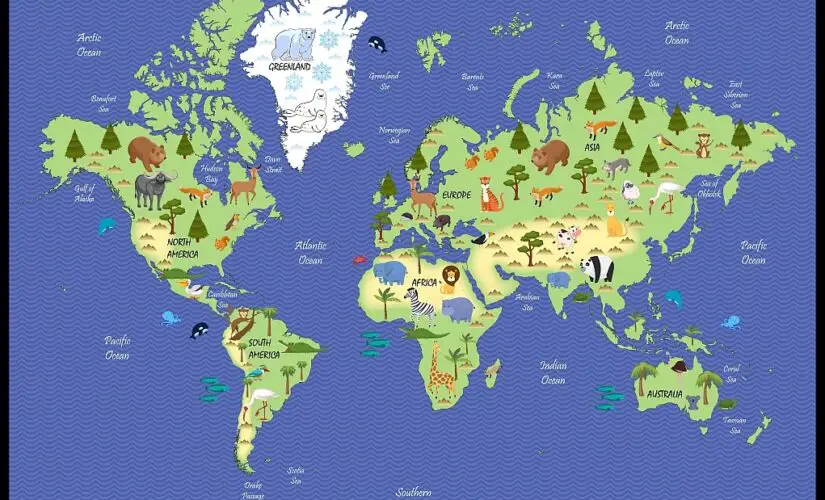
We also offer several other world maps focusing on different topics, such as a blank world map or a world map with oceans and seas, a world map for kids, and a political world map.
If you want to teach your students or kids about the world’s geography, check out our ready-made and fully customizable world map worksheets!
How Many Continents Are There?
The answer to the question “How many continents are there in the world?” depends on who you ask. There is not one correct solution, but there is some room for interpretation.
In the Anglo-Saxon view of the world, there are 7 continents: North America, South America, Europe, Africa, Asia, Australia, and Antarctica.
In countries like Russia and Japan and some Eastern European countries, there are just 6 continents: Africa, Asia, Europe, America, Australia, and Antarctica. This approach argues that North and South America are the same land area and, thus, just one single continent.
That being said, the flag of the Olympic Games suggests that there are only 5 continents: Africa, Eurasia, America, Antarctica, and Australia. The reason is that Europe and Asia geographically belong to the same landmass – just like North and South America.
In conclusion, the answer to the question of how many continents there are depends on the criteria for defining a continent. There is no strict right or wrong number of continents.
In this article, we focus on the model of the English-speaking world. So, our first continents on the world map shows 7 continents.

Map of the World Continents
Following the 7 continents of the world approach, here are some details about the continents of our planet:
North America
North America is a continent located entirely in the northern hemisphere and mostly in the western hemisphere. The Arctic Ocean borders it to the north, the Atlantic Ocean to the east, the Caribbean Sea and South America to the south, and the Pacific Ocean to the west. It covers an area of about 9,540,000 square miles (24,709,000 square kilometers), or approx. 4.8% of the Earth’s total surface area. This corresponds to roughly 16.% of the planet’s land area. As of 2021, the population of North America was estimated at 592 million people.
South America
South America lies in the western and (mostly) southern hemisphere. The Pacific Ocean bounds the continent to the west and the Atlantic Ocean to the east. It encompasses around 12% of the world’s landmass, making it the fourth largest continent after Asia, Africa, and North America. South America has more than 434 million people, making it the fifth most populous continent after Asia, Africa, Europe, and North America.
Europe
Europe is located in the northern hemisphere and forms part of the supercontinent of Eurasia. The Arctic Ocean bounds it to the north, the Atlantic Ocean to the west, and the Mediterranean Sea to the south. The eastern boundary of Europe is defined by various mountain ranges, including the Ural Mountains, which extend from north to south across western Russia. With an area of 3,930,000 square miles (10,180,000 square kilometers), Europe is the second smallest continent after Australia. As of 2021, the European continent has a population of roughly 745 million people.

Africa
Africa is the world’s second-largest continent, both by land area and population. It is located to the south of Europe and the southwest of Asia and is bounded by the Mediterranean Sea, the Red Sea, the Atlantic Ocean, and the Indian Ocean. With over 1.4 billion people (2021), Africa is home to about 18% of the world’s population. The landmass of the African continent is approximately 11.7 million square miles (30.3 million square kilometers). This means that it comprises 20% of the Earth’s land area or 6% of the planet’s total surface.
Asia
Asia is the world’s largest continent, located entirely in the northern and mainly in the eastern hemisphere. The Arctic Ocean borders it to the north, the Pacific Ocean to the east, the Indian Ocean to the south, and Europe and Africa to the west. Asia covers an area of 17,212,000 square miles (44,579,000 square kilometers). 30% of Earth’s total land area or 8.7% of the planet’s total surface area. With over 4.7 billion people, it is home to 60% of the world’s population.
Australia
Australia is the smallest continent in the world. It is also the second-driest, flattest, lowest, and most sparsely populated continent. The Australian continent is in the southern hemisphere and surrounded by the Indian, Pacific, and Southern Oceans. Its total land area is 3,310,000 square miles (8,560,000 square kilometers), corresponding to approx. 5.6% of the Earth’s land area. The continent of Australia has a population of roughly 40 million people.
Antarctica
Antarctica is the world’s fifth-largest continent, almost entirely covered by ice. It has a land mass of about 5,500,000 square miles (14,200,000 square kilometers) and is home to the geographic south pole of the planet. As the driest, coldest, and windiest of all the continents, Antarctica also holds the record for the lowest-ever recorded temperature on Earth of -128.6 °F (-89 °C).
Map of the World With Continents and Countries
The following map shows not only the continents and oceans of the world but also includes countries and borders. Clocks indicate the different time zones of the world.

During the entire history of our planet, the continents have always been in motion. Hundreds of millions of years ago, the continents we know today still formed the supercontinent Pangaea. This huge landmass comprised the subcontinents of Laurussia (Euramerica) and Gondwana and started to break up about 200 million years ago. Hundreds of millions of years from now, the continents of the Earth will look completely different from today as well.
World Map With Continents Labeled
Here is another world map with the names of continents for you to download and print for free in PDF.

World Map With Continents Labeled
Our last map of the Earth’s continents shows the average heat distribution on the seven continents.

More Maps of the World and Its Continents
Below you will find some links to more interesting maps of the world and its continents, as well as single countries. Like all of this website’s maps, the linked maps are free to download and print as PDF files.
Continent Maps
- Map of North America with Labels
- Political Map of Europe
- Blank Map of Europe
- Physical Map of Europe
- Labeled Map of Europe
- Blank Map of Asia
- Labeled Map of Asia
- Labeled Map of Africa
- Africa Political Map
- Map of Antarctica with Labels
- North America Political Map
- Political Map of South America
- Blank Map of South America
- Map of South America with Countries
- Political Map of Australia
- Labeled Map of Australia
World Maps
- Blank World Map
- Oceans Map of the World
- Political World Map
- World Map with Latitude and Longitude
- Physical World Map
- Printable World Map for Kids
- World Map Poster
Country Maps
- Blank Map of France
- Map of France with Regions and Cities
- Germany Map with States
- Blank Map of Germany
- Blank Map of the United States
- Labeled Map of China
- Blank Map of China
- Blank Map of the UK and Ireland
- Canada Blank Map
- Blank Map of South Africa
- Ukraine Blank Map
- Blank Map of Brazil
- New Zealand Blank Map
- Italy Blank Map
- Blank Map of Switzerland
Related Posts