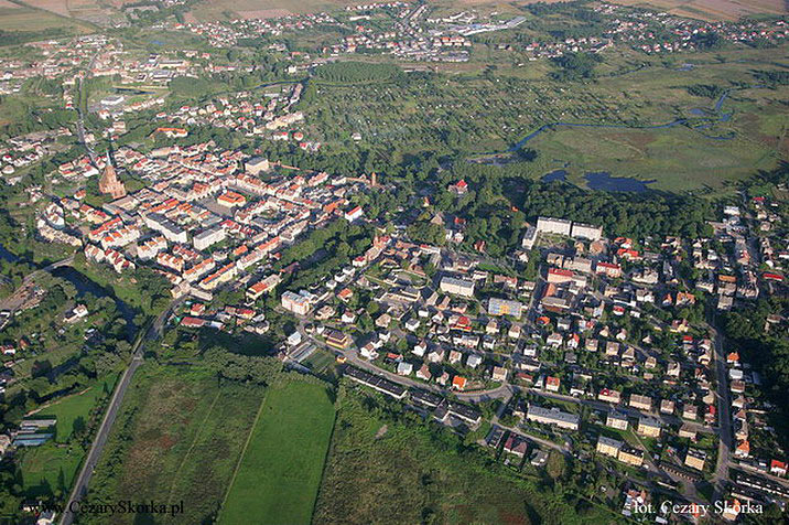
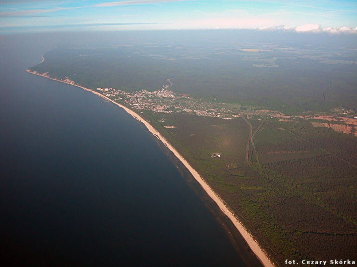
[Poland]-Two photos per post | Page 44 | SkyscraperCity Forum
SkyscraperCity Forum banner
861 - 880 of 5,059 Posts
Świnoujście


Świnoujście (German: Swinemünde) is a city and seaport on the Baltic Sea and Szczecin Lagoon, located in the extreme north-west of Poland. It is situated mainly on the islands of Usedom and Wolin, but also occupies smaller islands, of which the largest is Karsibór island, once part of Usedom, now separated by a Piast canal dug in the late 19th century to facilitate ship access to Stettin (Szczecin).

The city lies in the geographic region of Pomerania and had a population of 41,100 in 2006.

The first human settlements, in areas where it is now Swinoujscie appeared already before 5 thousand years ago, as confirmed by archaeological findings. A thousand years Swiny estuary area were part of the tribal state Wolinian that Polish prince Mieszko I turned to his country. In later centuries ruled there Pomeranian princes, who are on both sides of the river they built fortified castles, destroyed several times by the Danish invasions in the twelfth century in 1170 and 1173 on both sides assumed Swiny Gródki guard destroyed the Danish invasion in 1177 and rebuilt in the years 1181-1182. During the entire 1185-1227 Swinoujscie Western Pomerania has become a fief of Denmark. The river Świna (German: Swine) was formerly flanked by the fishing villages of Westswine and Ostswine. Towards the beginning of the 17th century it was made navigable for large ships, and Swinemünde, which was founded on the site of Westswine in 1748, was fortified and received town privileges from King Frederick II of Prussia in 1765. It served as the outer port of Stettin (Szczecin) and was administered within the Province of Pomerania. Swinemünde became part of the German Empire after the Kingdom of Prussia completed the unification of Germany in 1871.

The town had broad unpaved streets and one-story houses built in the Dutch style, which gave it an almost rustic appearance, although its industries, beyond some fishing, were entirely connected with its shipping. The river mouth, which was the entrance to the harbor, and which was regarded as the best on the Prussian Baltic coast, was then protected by two curving long breakwaters, and was strongly fortified. On the island of Wollin, on the other side of the narrow Swine, a great lighthouse was erected. In 1897 the canal of the Kaiserfahrt was opened to navigation, and this waterway between the Stettin harbour and the Baltic Sea was deepened between 1900–01. From then on Stettin could be reached directly by ships, and Swinemünde's importance diminished somewhat.

On 12 March 1945 during World War II, refugee-crowded Swinemünde suffered heavy destruction by USAAF, an estimated 23,000 to 25,000 were killed, most of whom are buried on the Golm hill west of the town. The uncomplete German aircraft carrier Graf Zeppelin was scuttled in the harbor to save it from the advancing Soviet Army. The city was placed under Polish administration in 1945 and since then remains as part of Poland. After the war ended it was officially renamed Świnoujście. Its German population was expelled and replaced with Poles, themselves refugees from Polish areas annexed by the Soviet Union. The Red Army occupied part of the city until 1957 and the navy harbour until c. 1990.

The town is located on both banks of the river Świna, and since there is no road connection across it, transport is provided by regular ferries. Under current plans, a tunnel will be built under the river some time before 2013.

Świnoujście has one of the largest and most modern ferry terminal in Poland, with regular connections to Denmark and Sweden.

Land border controls were abolished 21 December 2007, and free automobile traffic to and from Germany was allowed for the first time since 1945, (when it was part of German territory), as Poland implemented the Schengen Agreement. From 20 September 2008 the city has a railway connection to its western portion as well, when the railway line to Ahlbeck was extended eastward to Świnoujście, ("Świnoujście Centrum") giving it a direct link to the German railway network.

The city is a very popular summer resort.


Wolin island


Wolin (Pomeranian Wòlin, German: Wollin) is the name shared by an island located in the Baltic Sea located just off the Polish coast, and a town located on the island. It is separated from the island of Usedom by the Świna river, and from mainland Pomerania by the Dziwna river. Origins of the name are unknown, probably it is of Slavic origin, in the old Slavic language the word "wolyn" meant a wetland, and in the course of the time, it was Germanised.

Water from the river Oder (Polish: Odra) flows into the Szczecin Lagoon. From there it flows through the Peene (to the west of Usedom), Świna and Dziwna into the Bay of Pomerania, which is part of the Baltic Sea.

* Area: 265 km²
* Highest point: Mount Grzywacz, 116 m above sea level

Most of the island consists of forests and postglacial hills. Located in the middle is the Wolin National Park. The island is a main tourist attraction of northwestern Poland, and it is crossed by several specially marked tourist trails, such as 73-kilometer long trail from Miedzyzdroje to Dziwnowek. There is a main, electrified rail line, which connects Szczecin and Swinoujscie, also across the island goes an international road E65, which crosses Europe from north to south.

An mediæval document of ca. 850, called Bavarian Geographer after its anonymous creator, mentions the Slavic tribe of Volinians who then had 70 strongholds (Uelunzani civitates LXX). The town of Wolin was first mentioned in the tenth century. Archaeologists believe that in the Early Middle Ages there was a great trade emporium, spreading along the shore for four kilometers and rivaling in importance Birka and Hedeby.

Archaeological finds on the island are not very rich but they dot an area of 20 hectares, making it the second largest Baltic marketplace of the Viking Age after Hedeby. Some scholars speculated that Wolin may have been the basis for the semi-legendary settlements Jomsborg and Vineta. This is dubious, as "no trace has been found there of its artificial harbour for 360 warships, or of a citadel, unless the nearby hill of Silberberg is accepted as the site of such; but there were Norsemen there around the year 1000, and the archaeological finds reveal a mixed population of Vikings and Slavs".

Around 972 the island became controlled by Poland, under prince Mieszko I, however, it has not been established if Wolin became part of Poland, or if it was a fief. Polish influences were not firm and they ended around 1007. In the following years Wolyn became famous for its pirates, who would plunder ships cruising the Baltic. As a reprisal, in 1043 it was attacked by the Danish king Magnus the Good.

In early XII century the island as part of the Pomeranian duchy was captured by the Polish king Boleslaw III Wrymouth, also at that time the inhabitants of Wolyn accepted Christianity, and in 1140 pope Innocent II created a diocese there, with capital in the town of Wolyn. In 1181 the dukes of Pomerania decided to accepted the German emperor as their liege lord instead of the Polish king. Since then Pomerania was part of the so called Holy Roman Empire and the Pomeranians were Germanized. In 1535 Wolyn accepted Protestantism Lutheranism. In 1630 the island was captured by Sweden. In the meantime Pomerania became part of the Prussian (at that time Brandenburgian) kingdom. Wolyn followed in 1679. Since the German political unification in 1870 it was part of Germany. After the annexation of Pomerania by Poland in 1945 the (German) population was expelled and replaced with Poles who were expelled from territories in eastern Poland ceded to the Soviet Union. Then the German place names were translated or reconstructed after their original Slavic connotation in a modern Polish version. This is the reason that all of the places on this island as in Pomerania also have former German names.


Międzyzdroje


Międzyzdroje (German: Misdroy) is a town and a seaside resort in northwestern Poland on the island of Wolin on the Baltic coast. Międzyzdroje has a population of 6000 (2004).

It is called The Pearl of the Baltic. It is situated between wide sandy beaches with high cliffs and the forests of the Woliński National Park (which includes a bison reserve). Międzyzdroje has a spa climate and is rich in tourist services.


Wolin island - wild life


Wolin's island most scenic part constitutes the Wolin National Park with four post-glacial lakes and characteristic sandy cliff nearly 100 m high in places. The flora of the park includes such rare plant species as orchids, sea-holly and common honeysuckle.

The park’s rich bird life (200 species) is represented by bald eagle, ruff and mute swan.

There is a small bison reserve inside the park. Otter and ermine can also be encountered.

The White-tailed Eagle


The European bison

 
Wolin - the town


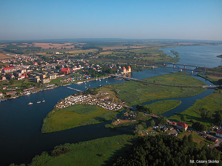
Wolin (German: Wollin) is a town situated on the southern tip of the Wolin island off the Baltic coast of Poland. The island lies at the edge of the strait of Dziwna in Kamień Pomorski County in the West Pomeranian Voivodeship.

The town, now a fishing port and gateway to the island's bathing resorts, has a population of approximately 4,900. Dating from the 9th century, it has been associated with the semi-legendary settlements of Jomsburg, Jumne, Julin and Vineta. It played an important role in the conversion of Pomerania and in 1140 became the first see of the Pomeranian diocese.

Several ruins from the Slavic period occupy the area.

The history of the town starts with the West Slavic settlement of the island in the 8th century. The local tribe was recorded as "Velunzani" (Volinians) in the 9th century by the Bavarian Geographer, and is considered a sub-tribe of both the Slavic Pomeranians and the Veleti (later Lutizians). Compared to other tribes of these groups, the Volinian tribal territory was relatively small, but densely settled: In the 11th century, there was one settlement per four square kilometers. The Volinians are described by Jan Maria Piskorski as the most powerful Pomeranian tribe. This position resulted from the multi-ethnic emporium at the site of the present-day town. Similar emporia were also set up elsewhere along the southern coastline of the Baltic Sea since the 8th century.

This emporium, by contemporary chronicles referred to as Jumne or Julin, began to prosper in the 9th century. Archaeological research revealed seaside foritifications that have been dated back to the beginning 10th century, and also remnants of older fortifications, probably pointing to an earlier burgh with an adjacent open settlement. In the 960s, the Jewish merchant Ibrahim ibn Jakub described the settlement as a town with several thousand inhabitants and twelve gates. Besides the Volinians, there were Scandinavian, Saxons and Russians. Later, the town was mentioned in the chronicles of Adam of Bremen. Adam mentioned a lighthouse, which he described as "the lamp of Vulcan". All these descriptions contributed to the Vineta legend. Though other towns are also considered possible locations of Vineta, it is believed today to be identical with Wollin. The same is true for Jomsborg, a stronghold set up by Danish king Harald Bluetooth and Swedish prince Styrbjörn in the course of Harald's internal struggles with his son, Sweyn Forkbeard, in the 970s or 980s, which housed a garrison of soldiers known as Jomsvikings.

In the late 10th century, the Polish dukes Mieszko I and Bolesław I Chrobry subdued parts of Pomerania and also fought the Volinians. Despite a victory of Mieszko in a 967 battle, the Polish dukes did not succeed to subdue the area.

In 1121/22, the Polish duke Bolesław III Wrymouth conquered the area along with the Duchy of Pomerania under Wartislaw I. Boleslaw aimed at Christianizing the area and in 1122 sent the Spanish eremite Bernard on a mission to Wollin. The inhabitants, reluctant to convert to a religion of a man who did not even wear shoes, beat him up badly and expelled him. With the approval of both Lothair III, Holy Roman Emperor, and Pope Callixtus II, Boleslaw initiated another mission of Saint Otto of Bamberg in 1124. When Otto, a respected and wealthy man acompagnied by German and Polish clergymen and military units, arrived in Wollin, he had already successfully converted the Pyritz and Cammin areas. Yet, he was met with distrust, and the town's inhabitants finally gave in to convert to Christianity only if Otto managed to convert Stettin, which the Volinians assumed was unachievable. Yet, when Otto after two month work and threatening with another military intervention managed to convert Stettin, he returned to Wollin and the Volinians accepted conversion.

Otto's second mission in 1128 was initiated by Holy Roman Emperor Lothair in 1128 after a pagan reaction. While this second mission was oriented more towards Western Pomerania, Otto also visited Wollin again. Wartislaw I, Duke of Pomerania supported and aided both missions. In 1140, Wollin was made the first episcopal see in Pomerania: Pope Innocent II founded the diocese by a papal bull of 14 October, and made Wollin's church of St. Adalbert its see. However, the see was moved to Grobe Abbey on the island of Usedom after 1150.

At the same time Wollin economically decayed and was devastated by Danish expeditions, which contributed to the move of the episkopal see to Grobe. The Danish campaigns completely wiped out the town in the late 12th century.

On the ruins of the early medieval town, a new town was founded and granted Lübeck Law during the Ostsiedlung in 1260. The town remained in the Duchy of Pomerania (which was within the Holy Roman Empire since 1164/1181), passing with the Duchy of Pomerania-Stettin to the Swedish Crown following the Treaty of Stettin (1630), the Peace of Westphalia (1648) and the Treaty of Stettin (1653). Since the Treaty of Stockholm (Great Northern War) of 1720, it was incorporated into the Prussian Province of Pomerania. In 1945, with the conclusion of the Second World War, Wollin was conquered by the Red Army and handed over to Poland and the German population was expelled The town was renamed Wolin and resettled by Poles.
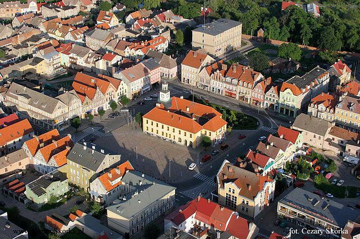
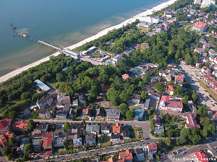
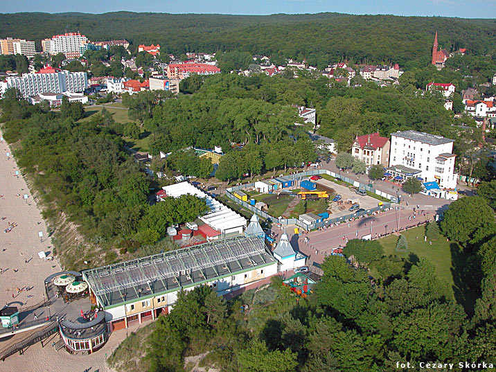


Chojna


Chojna is a small town in western Poland in the West Pomeranian Voivodeship. It lies approximately 60 km south of Szczecin.

Chojna is located near two border crossings (Bad Freienwalde and Schwedt) on the Oder River with Germany.

From the 10th-12th centuries an early Pomeranian fortification, probably with a market, developed at the location of present-day Chojna. Because of its favorable location on trading routes leading to the principalities of Great Poland and the duchies of Pomerania, the settlement developed quickly. Duke Boguslaw I of Pomerania was entombed in the settlement's church after his death in 1187. After 1200 the settlement received Magdeburg rights from Duke Barnim I the Good. It was referred to as "Konigesberge" for the first time in 1244 and passed to the Bishopric of Brandenburg after its acquisition of part of the Neumark in 1252. Populated with German knights and colonists, the town's name "Konigesberge" evolved into the later German name "Königsberg" ("King's Mountain").

After the cession of the "terra Konigesberge" from the Bishops of Brandenburg to the Ascanian Margraves of Brandenburg, the town was granted the right to hold a market as well as regional legal jurisdiction, causing it to become the main town of the Neumark at that time.
[edit] Late Middle Ages

A parish church by existed by 1282, while an Augustian monastery was founded in 1290. From 1310-1329 Königsberg experienced an economic boom through the trade of corn, allowing the town to receive further market privileges. The town hall was built in 1320. Trade goods were shipped over the Oder and Röhricke rivers. During the 13th and 14th centuries a defensive wall was built around the town with numerous towers and three city gates (Schwedter Tor, Bernikower Tor, and Vierradener Tor, the latter demolished in the 19th century). From 1402-1454 Königsberg was under the control of the Teutonic Knights after the pawning of the Neumark by Brandenburg. The Church of St. Mary and the reconstructed town hall (1410) built during this time were some of the most aesthetic Gothic buildings in the Neumark.

The strong town withstood an attack by the Hussites in 1433 during the Hussite Wars. The town flourished economically during the German Renaissance beginning in the 15th century, but the majority of its population died from three plagues during the 16th and 17th centuries. Königsberg had several churches: the Augustinian monastery church, the Augustinian hospital church of the Holy Spirit, and the Churches of Saints Mary, Nicholas, George, and Gertrude. The town gradually converted to Lutheranism from 1539-1553 during the Protestant Reformation, resulting in the dissolution of the monastery in 1536. Its buildings were instead used as a hospital and school, while its church was used as a storehouse. During the Thirty Years' War, Königsberg was occupied at different times by the Imperial troops of Albrecht von Wallenstein and the Swedish troops of King Gustavus Adolphus, in the course of which the town was 52% destroyed. After the destruction of the Church of St. Mary's tower by a lightning bolt in 1682, reconstruction commenced until 1692.

A new Baroque pulpit was built in 1714, as well as an organ built by Joachim Wagner in 1734. Königsberg began to revive economically after the foundation of the Kingdom of Prussia, becoming the seat of the government of the Neumark in 1759 during the Seven Years' War. In 1767 the Schwedter and Bernikower Gates were partially dismantled to provide stone for the construction of a barracks at the former monastery. The town's inhabitants initially specialized in agriculture and forestry and later in the weaving of fine textiles. That industry declined, however, around 1840 with the onset of industrialization. Königsberg became the seat of the district Landkreis Königsberg Nm. in 1809 and part of the Province of Brandenburg in 1816. The former monastery buildings began to deteriorate in 1820. Königsberg became part of the German Empire in 1871 and flourished after being connected to a railway network in 1877. The town also served as an education and administrative seat for the surrounding region.

In 1939 the Luftwaffe constructed an airfield near the gates of Königsberg. In January 1945 battles on the Eastern Front of World War II occurred near the town. Because he had fled the town without issuing a general evacuation order, the burgomaster of Königsberg was condemned to death by hanging on February 4, 1945 by an SS court martial chaired by Otto Skorzeny. On the same day the Soviet Red Army occupied the town. The entire center with the Church of St. Mary and the town hall were burnt on February 16, 1945; Königsberg was 80% destroyed during the war. Upon war's end Königsberg was placed under Polish administration, had its German population expelled, and was renamed Chojna.

Vestiges of the war are still visible in some of Chojna's buildings. The foundation wall of the destroyed town hall was rebuilt for use as a cultural center, town library, and public house. The monastery was also reconstructed, while the marketplace was newly built. Reconstruction of the destroyed Marienkirche began in 1994 as a joint German-Polish cooperation. In 1997 the roof of the church's nave was covered, while the pyramidal tower roof of the tower was reconditioned in a 19th century Neo-gothic style. Chojna's two main landmarks are thus the town hall and the Church of St. Mary, both historical buildings by the Gothic architect Hinrich Brunsberg.

Chojna is on The European Route of Brick Gothic.

* Cathedral
* The Augustinian monastery and the remains of the city wall with the Schwedter and Bernikower Gates.
* Enormous platanus.


Strzekęcino palace


Hotel Bursztynowy Palac [Amber Palace Hotel] in Strzekecino is located 10 km south of Koszalin. The palace was built in the 18th century for the von Kamecke family.

Surrounded by a French garden, the palace is located only 18 km from the Baltic Sea.


Trzebiatów


Trzebiatów (German: Treptow an der Rega) is a town in the West Pomeranian Voivodeship, Poland. As of June 2007, it has 10,196 inhabitants.

The city was member of the Hanseatic League. This very old Slav settlement in Pomerania used to be cult center where oblations were made to pagan gods.

The town received its urban rights in 1277 according to the so-called Lubeck law, and the right of navigation along the Reda river was granted to Trzebiatow in 1287. At that time the town had its own trade fleet and the big port of Regoujscie at the mouth of River Rega could receive numerous merchant`s ships. As a Hansa member, the town had the right to mint its own coins and it boasted of powerful fortifications much respected in the central Baltic Sea area.

The medieval urban layout of the town has been preserved until today. Trzebiatow has a number of historical monuments.

The most famous monuments of Trzebiatów are:

The St. Mary's Church - built in 1305 - 1370. At two-three high, there is a viewng platform, from where you can admire the panorama of the region. There are three bells at the entrance to the tower, the oldest one called the "Mary" is dated on 1515. inside the church, there are tombstones. On of the graves, belonging to the family of Arnold Crample, from 1382, is exhibited right next to the entrance to the church.

The Defense Walls - built in 1300-1370 had 2500 m in perimeter. The Walls had 4 gateways, 40 towers and lookouts. Up to this day, only one tower left - Kaszana.

The Kaszana Tower - called the Prochowa Tower, was built in the very act of building of the Defense Walls. There is a legend related to the Tower, which describes how it saved the city against attack of citizens of Gryfice city.

St. Spirit Chapel - nowadays the Eastern Orthodox Church. Build at the beginning of the 16th Century. The Regional Council of Pomeranian States took place there on December 13th, 1534, when the Reformation was resolved as major religion. Until 1903 there was a fire station and then the auditorium of the Female College.

Segraffito - there is an elephant image on the wall of the corner building, at Zajazdowska street, made with use of segraffito technique. Probably, in fall 1939, a parade with an elephant passed through Trzebiatów city. This fact was registered in the parish register. Segraffito became a symbol of the present Trzebiatów city.


Ruins of the church in Trzęsacz


The Church in Trzęsacz was built in the late 14th or early 15th century.

At that time, it was located almost two kilometers from the sea. Furthermore, north of Trzęsacz there was another village, which had completely been taken over by water. Originally, the church was Roman Catholic, but in the early 16th century, after the Reformation, it became Protestant.


Over time, the process of abrasion (more generally known as erosion) caused the land surrounding the church to recede at the expense of the Baltic Sea. Year by year, water would come closer; in 1750 the sea was as close as 58 meters, in 1771 parts of the cemetery were swallowed, and 1820 the distance shrank to 13 meters. Finally, on August 2, 1874, the last service took place in the temple. Afterwards, all furnishings were transported to the cathedral in Kamień Pomorski, with the exception of the triptych, which is now kept in a church in Rewal. By 1885 the temple stood over a chasm and, with permission of the Prussian government, it was deprived of the roof and left abandoned.

On the night of April 8-9, 1901 the most vulnerable, northern wall of the church collapsed. During the following years, part by part, most of the construction was swallowed by the sea, which mercilessly moves south, taking away the land. The last drop took place on February 1, 1994, when part of the southern wall collapsed.

According to scientists, since the turn of the 19th century the sea has taken around 40 centimeters of land a year. Over time, local governments – both Prussian and (after 1945) Polish – tried to save the temple with fascine and concrete blocks, but all attempts were unsuccessful. Currently, intensive works are taking place to save the ruin, as this is the only one of its kind in Europe. One of the projects stated that the last remains of the wall should be moved southwards, further away from the sea, but the risk of complete collapse of the ruin was too high.


Szczecinek


Szczecinek (German: Neustettin; Kashubian: Nowé Sztetëno; Swedish: Nien Stettin; Latin: Nova Stetin;) is the one of biggest towns of West Pomeranian Voivodeship (northwestern Poland). In 2007 the urban area had a population of 39,777.

In 1310, the castle and town was founded under Lübeck law by Duke Wartislaw IV of Pomerania-Wolgast and modelled after the city of Stettin (now Szczecin) situated about 150 km to the west. The initial name was "Neustettin" ("New Stettin"). It was also known as "Klein Stettin" ("Little Stettin"). In 1707, Polish exonyms were Nowoszczecin and Mały Szczecin, which gradually developed into the modern name Szczecinek which replaced the "Neustettin" as the city's official name after the town became Polish in 1945.

The town was fortified to face the Brandenburgers, with a wall and palisades. In 1356 Neustettin was hit by the plague. Thankful for their survival, the Dukes Bogislaw V, Barnim IV and Wartislaw V founded the Augustine monastery called Marienthron, on the Mönchsberg on the southern bank of lake Streizigsee (nowadays Trzesicko Lake). Under Duke Wartislaw VII Neustettin was from 1376 to 1395 seat of his Duchy. Afterwards, it was ruled by Pommeranian Duchy Rügenwalde (until 1418), Wolgast ( until 1474) and Stettin (until 1618).

On 15 September 1423, the "great day of Neustettin", the Pomeranian dukes, the Hochmeister of the Teutonic Order and Nordic king Eric VII of Denmark met to discuss defense against the treaty of Brandenburg and Poland. In 1461 Neustettin was sacked, looted and burned by Polish troops and Tatars because King Casimir IV wanted to take revenge on Eric II of Pomerania-Wolgast who supported the Teutonic Knights.

In1648 at the end of the Thirty Years War Neustettin became a part of Brandenburg- Prussia, and in 1701 under the crown of the Kingdom of Prussia.

In 1945, the Red Army occupied the town and placed it under Polish, Soviet controlled communist administration. The German population fled or was expelled and the town was resettled with Poles many of whom were expelled from Eastern Poland annexed in 1945 by the Soviet Union.


Pęzino castle


The castle was built in the 12th century as a residence of the Pomeranian family of Pansin. The castle form was changed within the space of the history. As a Gothic building, consisting of a castle and approaches of the castle, used to be surrounded by a wall and a moat, the outline of which can be still visible today.

In time, the castle was converted in Dutch renaissance style, and then in neo-Gothic style in the 19th century. For some time, the Borek family ruled in the castle; Łobez and Węgorzyno owe their development to this great knight’s family. Later, the Knights of St John of Jerusalem had their command here. Between 1680 and 1945, the Puttkamers were legitimate of the castle in Pęzino.


861 - 880 of 5,059 Posts
Top