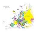
Category:Maps of Europe
Jump to navigation
Jump to search
Temperate regions: North America · South America · Africa · Europe · Asia · Oceania – Polar regions: Antarctica · Arctic – Other regions: Afro-Eurasia · Eurasia
Wikimedia category | |||||
| Upload media | |||||
| Instance of | |||||
|---|---|---|---|---|---|
| Category combines topics | |||||
 | |||||
Both JPEG and PNG formats can be loaded together. See: Discussion about JPEG and PNG format files in Russian.
Discussion about JPEG and PNG format files in English.
- Maps are also available as part of the
 Wikimedia Atlas of the World project in the Atlas of Europe.

Subcategories
This category has the following 78 subcategories, out of 78 total.
!
*
- Maps of the European Neolithic (86 F)
+
?
A
- Atlas of Europe (130 P, 63 F)
C
- Global maps centered 20W (4 F)
- Global maps centered Greenwich (172 F)
E
- Energy maps of Europe (30 F)
- Europawege Denkmal (9 F)
- Eurovision Choir maps (8 F)
F
G
- Geomorphological maps of Europe (28 F)
- Maps of European glaciations (19 F)
H
L
M
N
O
R
- Renewable energy maps of Europe (20 F)
S
- Sea level maps of Europe (12 F)
T
W
Media in category "Maps of Europe"
The following 200 files are in this category, out of 997 total.
(previous page) (next page)-
De-Europakarte.ogg 2.2 s; 22 KB
-
 - 01 europe museo torino.jpg 4,000 × 3,000; 2.17 MB
-
 100329 Zielgebietskarte S2010.png 2,335 × 1,208; 216 KB
-
 150121Europa-mapa polityczna.jpg 2,238 × 1,974; 1.21 MB
-
 190730-143108-00009-Bearbeitet-full BY MATTHIAS RHOMBERG.tif 2,048 × 1,365; 2.18 MB
-
 20070717klphisuni 110.Ees.SCO.png 555 × 371; 54 KB
-
 2014 iPhone 369.JPG 1,936 × 2,592; 2.12 MB
-
 2014 iPhone 374.JPG 1,936 × 2,592; 2.56 MB
-
 20160706a-tortenelem-legpusztitobb-betegsegei-a1.jpg 644 × 682; 98 KB
-
 2017 EURO U-19 Qualifiers Map.png 1,200 × 1,000; 42 KB
-
 2018 EURO U-17 Qualifiers Map.png 1,200 × 1,000; 42 KB
-
 2018 EURO U-19 Qualifiers Map.png 1,200 × 1,000; 51 KB
-
 2019 EURO U-19 Qualifiers Map.png 1,200 × 1,000; 41 KB
-
 2020 August CPC Europe percent of normal precipitation.png 2,700 × 2,700; 436 KB
-
 2020 August CPC Europe total precipitation.png 2,700 × 2,700; 354 KB
-
 2021 Belarus-EU border crisis - general map (version in Belarusian).png 3,200 × 2,403; 398 KB
-
 2021 Belarus-EU border crisis - general map.png 6,400 × 4,804; 1.14 MB
-
 2021-05-05 Donau.jpg 8,510 × 4,740; 6.24 MB
-
 2023 Map With Flags and Physical Land Background.png 2,024 × 1,597; 4.09 MB
-
 231882747 2e763ec5eea89f086b5f8997386c6d60 800.png 800 × 640; 233 KB
-
 28June2012Lightning.png 690 × 728; 81 KB
-
 2rp3bkn.jpg 1,024 × 763; 100 KB
-
 3007 Balti szláv országok.png 930 × 749; 169 KB
-
 501st Europe 2015.PNG 1,532 × 1,024; 268 KB
-
 A Blank Map of Europe in 1914.png 6,432 × 4,639; 368 KB
-
 A Tapestry of Chaos - Europe in 1919.pdf 2,550 × 1,650; 1.3 MB
-
 A Tapestry of Chaos - Post WWI Europe.jpg 2,000 × 1,294; 727 KB
-
 A-Swedish-View-Continental-Europe.png 415 × 422; 14 KB
-
 Abkhazia map-fr Inkscape.png 945 × 737; 898 KB
-
 Abkhazia map-fr librsvg.png 945 × 737; 785 KB
-
 Abkhazia map-fr rendersvg.png 945 × 737; 993 KB
-
 Accordo di Monaco.png 2,253 × 1,961; 73 KB
-
 Acer campestre range.png 4,250 × 2,362; 300 KB
-
 Adaptation of Red France in Europe map without borders.png 640 × 547; 120 KB
-
 Adaptationconvention in Europe.png 3,882 × 3,191; 1.13 MB
-
 AECR map 2015-12-17.png 1,532 × 1,162; 255 KB
-
 AECR map 2018-09-11.png 1,532 × 1,162; 178 KB
-
 Affected People by Floods 2005 2015 Europe.png 1,754 × 1,240; 627 KB
-
 Agglueu.png 1,484 × 1,214; 310 KB
-
 Air Union Orient Poster (19290403780).jpg 721 × 1,100; 755 KB
-
 Aiwropa.jpg 2,000 × 1,268; 323 KB
-
 Alitalia European Network at S13.png 720 × 360; 114 KB
-
 Alkoholersterwerbsalter in Europa.png 1,198 × 1,024; 502 KB
-
 Alleanze prima guerramondiale.png 998 × 593; 179 KB
-
 AlternativníBudoucnost Countryball.png 684 × 684; 141 KB
-
 Amphibian CWE in Europe.png 817 × 585; 375 KB
-
 Ancestral background of US presidents (updated version).png 1,920 × 1,861; 426 KB
-
 Anima International map.png 518 × 540; 116 KB
-
 Annual average concentration of PM2.5 in 2010 in Europe.gif 2,422 × 1,866; 2.97 MB
-
 Archipelagi.PNG 472 × 352; 31 KB
-
 Asia minor Mithridates.jpg 1,043 × 577; 457 KB
-
-
 Atlantic Revolutions.png 2,000 × 2,027; 472 KB
-
 Aurignacian culture map-es.png 767 × 575; 243 KB
-
 Austria Denmark Locator.png 1,200 × 1,000; 49 KB
-
 Automobile assembly plants of GM Europe in 2009.png 400 × 420; 16 KB
-
 Avrupa ülkelerinin siyasi pozisyonları 2022.png 4,592 × 3,196; 994 KB
-
 Azertelecom international network.jpg 368 × 284; 81 KB
-
 Balkan Games Participants.png 1,134 × 783; 210 KB
-
 Balkans 1915 18.gif 1,400 × 900; 61 KB
-
 Balkans-political-map-small1.png 507 × 488; 13 KB
-
 Baltic Air Policing map (LT).png 492 × 691; 107 KB
-
 Baltic countries.png 932 × 566; 37 KB
-
 Baltic Sea.png 742 × 649; 50 KB
-
 Baltic-BlackSeaAxisfromNiklas en.png 4,592 × 3,196; 1.36 MB
-
 Baltic-Europe-map.png 415 × 422; 14 KB
-
 Baltic-Europe-map2.png 415 × 422; 14 KB
-
 Baltikum domborzata.png 1,227 × 869; 1.67 MB
-
 Baltikum würm morénavonulatok.png 1,227 × 868; 1.69 MB
-
 Balto Slavic countries.png 450 × 422; 14 KB
-
 Bank Norwegian in Europe.png 1,200 × 1,001; 52 KB
-
 Bank Norwegian Map Europe.jpg 989 × 790; 216 KB
-
 BasarabiaBugeac.jpg 691 × 599; 273 KB
-
 BEL-GER-FRA-NED.png 467 × 466; 14 KB
-
 Beneluxa-members-observers.png 1,141 × 780; 258 KB
-
 BernConvention.png 3,873 × 3,192; 995 KB
-
 Biomes of europe.jpg 242 × 181; 51 KB
-
 Bismarck Taisei.png 600 × 480; 115 KB
-
 Blank map Eastern Europe with borders1 (fixed).png 1,200 × 1,001; 61 KB
-
 Blank map Eastern Europe with borders1.png 1,200 × 1,001; 61 KB
-
 Blank map europe123.png 680 × 520; 75 KB
-
 Blank Map of Europe.png 2,370 × 1,740; 149 KB
-
 Blank Template for Greater Europe.PNG 1,270 × 1,161; 21 KB
-
 Blattschnitt Nordsee.jpg 770 × 577; 58 KB
-
 Blautopfhoehle schautafel arge.jpg 1,427 × 1,028; 158 KB
-
 Bogenjagd in Europa.png 536 × 338; 62 KB
-
 Bolonga zone.png 479 × 456; 97 KB
-
 Borders Europe Map HD.png 2,802 × 2,396; 138 KB
-
 Boundary between Europe and Asia (green shade).png 735 × 1,134; 163 KB
-
 Bricorstore location.png 1,600 × 1,200; 428 KB
-
 Bristol trade routes1492.png 1,735 × 1,761; 330 KB
-
 Bucovethn.png 350 × 563; 17 KB
-
 Cabot fugitive.png 1,268 × 1,275; 232 KB
-
 Caminho de Edith.PNG 450 × 422; 16 KB
-
 Canis aureus moreoticus range.png 809 × 599; 135 KB
-
 Capital regions in Europe by GDP(nominal) in 2017.jpg 2,360 × 2,140; 202 KB
-
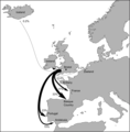
 Cargo flights.png 1,000 × 855; 248 KB
-
 Carta energia elettrica da fonti alternative nell'Unione europea (2007).png 1,037 × 606; 69 KB
-
 Carta ocean e mars europa oc.pdf 1,752 × 1,239; 987 KB
-
 CartaEuropa.png 250 × 235; 42 KB
-
 Carte Arkena.jpg 539 × 454; 94 KB
-
 Carte Carie-he-2.jpg 483 × 444; 48 KB
-
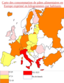 Carte de consommation de pates en Europe.png 605 × 785; 291 KB
-
 Carte des villes d'édition.png 3,698 × 3,337; 681 KB
-
 Carte du taux de chômage en Europe (Fe, 2012).png 519 × 415; 74 KB
-
 Carte Europe rhénane 5 nomenclature.PNG 2,550 × 3,504; 751 KB
-
 Carteeuropa.jpg 500 × 552; 582 KB
-
 Carthage 323 BC.png 1,167 × 667; 100 KB
-
 Cartina La tregua - Primo Levi.gif 1,066 × 707; 296 KB
-
 Cecam Nodes.jpg 1,485 × 1,191; 486 KB
-
 Celebration of International Women's Day in Europe.png 3,277 × 2,624; 654 KB
-
 Cell Broadcast map.svg 680 × 520; 799 KB
-
 Center Europe.png 336 × 378; 24 KB
-
 Center of Population of European Countries.png 1,771 × 2,362; 117 KB
-
 Central Europe (Geographie universelle, 1927).PNG 833 × 565; 33 KB
-
 Central Europe (Geographie universelle, 1927).svg 450 × 456; 495 KB
-
 Central Europe Kundera.png 944 × 899; 224 KB
-
 Central London districts map.png 3,052 × 1,807; 1.02 MB
-
 Central London tube map.png 3,199 × 2,141; 1.36 MB
-
 CEPA Ratification.png 1,024 × 861; 236 KB
-
 Championnats d'europe carte.jpg 789 × 610; 113 KB
-
 Chart Wikimania 2019.jpg 4,032 × 3,024; 1.27 MB
-
 Child Helpline International (Europe).png 3,199 × 2,638; 1.34 MB
-
 CHLmap.png 840 × 600; 156 KB
-
 Churches Orthodox Communion Europe.png 2,100 × 1,525; 69 KB
-
 Claranet map.png 2,000 × 1,440; 620 KB
-
 Climates (Köppen) of Europe.gif 1,885 × 1,200; 148 KB
-
 CLJroutes.png 1,075 × 760; 63 KB
-
 Clubs in upl.png 1,200 × 799; 78 KB
-
 ClunyDensite.png 2,585 × 1,825; 120 KB
-
 CO-RE Members Map 2.png 1,819 × 1,210; 764 KB
-
 CO-RE Members Map 3.png 1,818 × 990; 641 KB
-
 CO-RE Members Map.png 2,736 × 1,824; 1.25 MB
-
 COMEARTH en Russie.JPG 326 × 245; 21 KB
-
 Confini Europa-Asia.png 735 × 1,134; 212 KB
-
 Conflictos congelados en el entorno de Rusia, 2018.svg 1,003 × 744; 386 KB
-
 Conscription map of Europe.png 4,592 × 3,196; 813 KB
-
 Container deposit legislation in Europe.png 1,200 × 1,000; 50 KB
-
 Contiguous United States overlayed over Europe.png 1,953 × 1,479; 1.67 MB
-
 Cornwall map.png 1,041 × 1,001; 24 KB
-
 Corona de Aragón en la UE.png 2,000 × 1,970; 837 KB
-
 Corsican Republic Map (1755-1769).png 2,571 × 2,186; 189 KB
-
 Countries known to have been affected by the warning bug on Nov 7 2013.png 1,000 × 765; 147 KB
-
 Countries of Europe last subordination png.png 1,280 × 979; 366 KB
-
 Country Calling Codes of Europe.png 1,602 × 1,100; 923 KB
-
 Croquis Northern Range, 1.png 3,500 × 1,762; 117 KB
-
 Croquis Northern Range, 2.png 3,500 × 1,762; 134 KB
-
 Croquis Northern Range, 3.png 3,500 × 1,762; 160 KB
-
 Croquis Northern Range, 4.png 3,500 × 1,762; 173 KB
-
 Croquis Northern Range, 5.png 3,500 × 1,762; 192 KB
-
 Croquis Northern Range, 6.png 3,500 × 1,762; 221 KB
-
 Ctpe.pdf 1,754 × 1,239; 162 KB
-
 Cultura de la terralha cardiala.png 932 × 498; 80 KB
-
 D206- Planche VI - partie gauche - liv3-ch09.png 2,362 × 3,390; 3.85 MB
-
 DAB coverage map.jpg 3,812 × 3,436; 3.95 MB
-
 Daenische-EM-Platzierungen.PNG 1,200 × 1,000; 59 KB
-
 Davidovic map 1846.jpg 2,135 × 1,400; 1.21 MB
-
 Deaths per million residents as of December 5, 2020.png 4,592 × 3,196; 925 KB
-
 Deltagande länder i Europamästerskapen i Splatoon 3 2023.png 2,007 × 2,868; 385 KB
-
 Denmark.map.2016.png 4,170 × 3,210; 1.22 MB
-
 Depense-publique-sur-PIB.png 450 × 422; 13 KB
-
 Det baltiska hertigdömet.png 382 × 309; 16 KB
-
 Dette Europe 2012png.png 1,244 × 1,244; 157 KB
-
 Deutsche Frauen EM-Platzierungen.PNG 1,200 × 1,000; 54 KB
-
 Devon map.png 1,203 × 1,096; 27 KB
-
 Dibujo67.PNG 416 × 330; 36 KB
-
 Did Archaic Hominins and Modern Humans Diverge in Circadian Biology?.jpg 3,500 × 2,766; 653 KB
-
 Die Deutschen und ihre Nachbarn.png 900 × 596; 39 KB
-
 Die Pteropoden der Plankton-Expedition (1906) (20915732656).jpg 2,644 × 3,436; 2.31 MB
-
 Different versions of the Europe-Asia border.png 309 × 562; 75 KB
-
 Diplomacylogo.png 256 × 256; 2 KB
-
 Disparité socio-économiques dans l'Union européenne.png 1,900 × 1,391; 43 KB
-
 Distribution F.magna EuropeII.png 1,093 × 795; 350 KB
-

-
 Distribution of Bolbelasmus unicornis.jpg 1,512 × 1,128; 1.82 MB
-
 Do you feel European - 2020.jpg 1,280 × 720; 74 KB
-
 Do you feel European - 2022.jpg 1,280 × 720; 86 KB
-
 Don-Caucasian Union on the map 1918.png 266 × 214; 18 KB
-
 Dorestad and trade routes.jpg 415 × 299; 74 KB
-
 Doublage en Europe.png 1,105 × 975; 37 KB
-
 Države Južne Europe.png 4,592 × 3,196; 1.44 MB
-
 Dymaxion Projection Europe.png 2,560 × 2,560; 935 KB
-
 E11 Overview map.jpg 1,182 × 1,182; 527 KB
-
 EAN Standorte EU.png 1,270 × 1,161; 47 KB
-
 East Central Europe.PNG 1,218 × 1,245; 91 KB
-
 Eastern Europe.png 4,480 × 3,196; 1.28 MB
-
 Eastern Federation map.png 2,048 × 1,426; 945 KB
-
 Ebédlőház - Rodostó, 2014.10.25 (60).JPG 4,320 × 3,240; 5.57 MB
-
 ECDM 20221107 TS Tsunami Early Warning.pdf 1,625 × 1,125; 535 KB
-
 ECR Party map.png 3,785 × 3,189; 1.43 MB
-
 EDC participating countries.png 680 × 520; 82 KB
-
 EDC winning coutries.png 680 × 520; 82 KB
-
 Eden Springs Europe Map.jpg 505 × 484; 15 KB
-
 Eden Springs Europe Sources Map.jpg 518 × 506; 31 KB
-
 EEA identity card requirements.png 2,853 × 3,037; 1.45 MB
-
 EFDD countries.png 3,575 × 3,136; 901 KB
-
 Effortel Europe map.jpg 217 × 219; 52 KB
-
 EHEA mk.PNG 785 × 201; 14 KB
-
 Elder futhark inscriptions.png 731 × 648; 32 KB
-
 ELF member countries.svg 512 × 392; 321 KB


.png)


.jpg)


.png)


.It_includes_all_destinations_(Charter,_Cargo,_Terminated,_All_Year).png)


.png)


.png)


_in_2017.jpg)

.png)


.png)


.PNG)
.svg)


.png)


_of_Europe.gif)


.png)


_(20915732656).jpg)


.JPG)


.png)