One of the things you have to accept as a tech writer is being on the receiving end of a never-ending stream of PR pitches. Generally, they're ill-targeted or irrelevant to the topics I actually write about—for instance, anything with "blockchain" gets deleted immediately. Sometimes, though, a pitch email will be intriguing enough to warrant a reply other than "sorry, this isn't for Ars."
Those replies usually lead to an interesting conversation with an expert in a particular field, which is useful for informing our reporting. But the email that sparked this article was about a new navigation app, called Live Roads, that promises to be the first to feature an HD map and much greater accuracy than we're accustomed to in our cellphones.
Smartphone GPS is usually only accurate to about 4m (13 feet), so the idea of a smartphone navigation app capable of much more accurate spatial resolution piqued my interest enough to try it out. Then it got me wondering how the whole thing works.
What’s an HD map?
I've written about HD maps a few times now but always in the context of autonomous vehicles. In the same way that an HD television screen has a higher resolution than a standard definition screen, an HD map is much more detailed than your road atlas. HD maps are accurate to within a centimeter or two and are usually made by a combination of traditional surveying and lidar scanning. A self-driving car will download the relevant section of a map from the cloud and use that together with its own sensors to locate itself in the world. And if it sees any differences between the reference map and its own perception of the environment—say, a lane closure or roadworks—it will upload those changes (called a "delta") to update the map.
As I've always had it explained to me, these maps are not human-readable, and they require more accuracy than the GPS function in your current phone or car will allow. Perhaps erroneously, I assumed this meant we'd soon need more expensive, more accurate GPS receivers built into our vehicles to access the HD maps. But Live Roads challenged these assumptions and claimed better accuracy was possible with a current smartphone.
A few weeks after talking with the company, I was delivered a Samsung S7 loaded with Live Roads. I'll be honest: I'm not that familiar with Android, and this isn't really a review of the app. I used it enough to check that it does what it claims, but I didn't use it as my sole method of navigation. However, this brief bit of user-testing did let me check out the claims in that email. I don't think I'd equate the app with the HD maps that autonomous vehicles will need. For one thing it's readable by a human being; for another it's not quite that accurate.
-
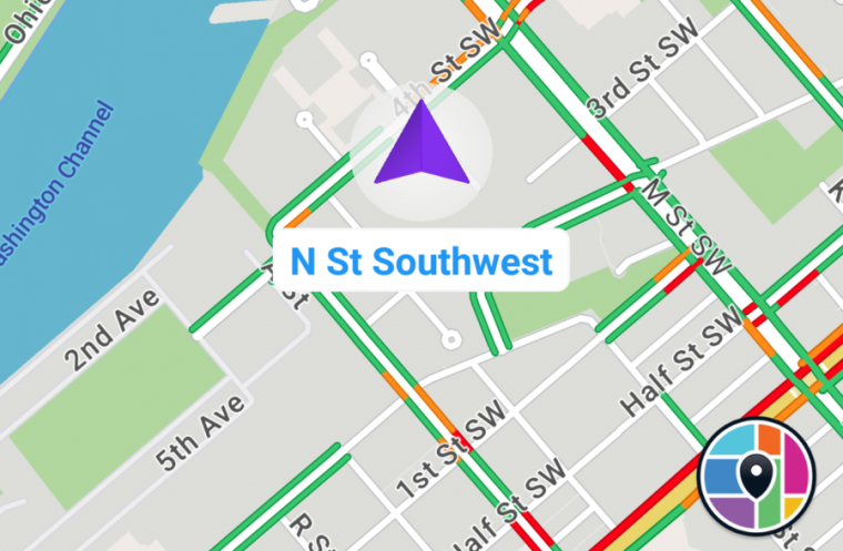
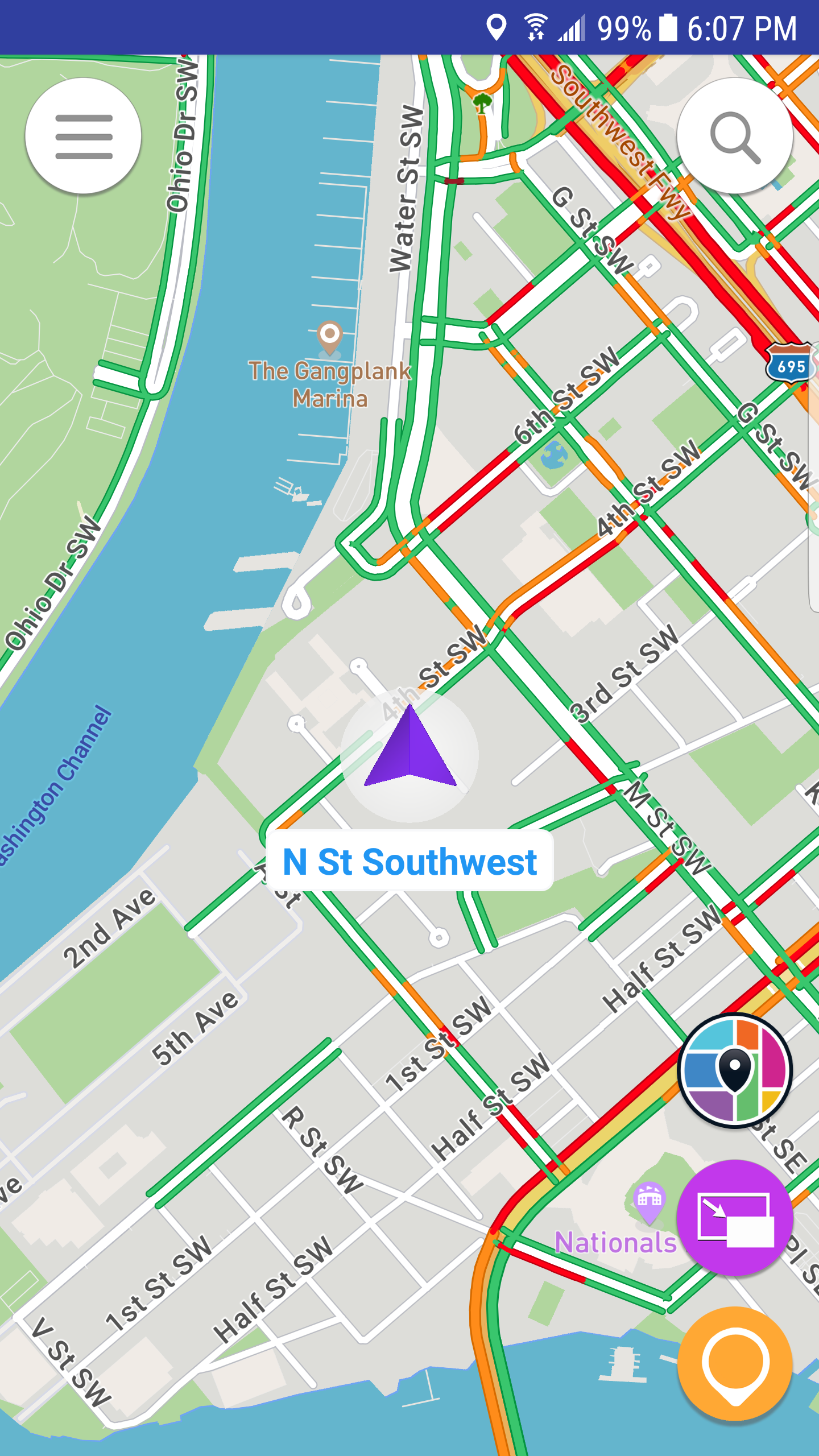
This is Live Roads' default view. Due to my unfamiliarity with Android, obtaining screenshots while I was driving was out of the question, so these were all done at my desk.
-
As you zoom in, more details resolve. The app did place me accurately in the right spot in the house.
-
The picture-in-picture function looks flashy, but I don't know how useful it is on the move.
-
The route guidance is indeed lane-specific.
But the spatial resolution was indeed better than it should be on a consumer phone, and Live Roads was able to locate me down to a specific lane on a multi-lane road. Various navigation apps give you lane-specific instructions—for instance, telling you to stay in the middle two lanes if you're approaching a complicated intersection. Where Live Roads differs is that it can also tell which lane you're actually in. Whether this is enough of a feature to build a business model around is an open question; I'm quite happy using Google Maps on iOS, with occasional forays into Waze (running in the background to warn of speed traps) and Apple Maps (if I'm driving something with CarPlay and the infotainment's built-in navigation sucks).
But it left me wondering: how does it work?
Paul Konieczny, CEO of Live Roads, gave me an explanation—up to a point. "Primarily it is based around sensor fusion and certain probabilistic models—we call it the Black Box," he said. "The current release of the app that is available in the Play Store has an earlier revision of our Black Box. This initial version is missing some of the functionality of the full-fledged system and thus has a spatial resolution of ~2.5m. This compares favorably to standard GPS that has a resolution of 4.0 m+."
By summer, Konieczny hopes that the system will be fully operational and that accuracy will be down to under 1.5m. Assuming a large enough user base, that should let it offer lane-specific traffic data, "as well as introducing an entire ecosystem of 3D objects that users will be able to interact with," he told me.
Making GPS more accurate
There are actually a few different ways to make your GPS system more accurate. The simplest is called Real Time Kinematics (RTK). This system involves comparing the signal from the constellation (or constellations, if you pull in signals from GLONASS, Galileo, and BeiDou as well as GPS) of orbiting satellites to a second signal from a base station at a known position. For things like field surveys, this works very well, but RTK base stations have a limited range—under 20 miles—so you need a network of them if you want widespread coverage.
Precise Point Positioning (PPP) is another alternative; it does away with the base station and instead sends the end user's GPS a correction signal calculated by knowing any corrections made to either the clocks or orbits of the satellites. Increasingly, that correction signal is delivered via the cloud.
"RTK is expensive; between $5,000 and $10,000 per station, and it doesn't scale," explained Fergus Noble, CTO at Swift Navigation. "PPP has global coverage but lower accuracy, and up to 30 min of waiting during initialization." Noble's company has developed a hybrid approach for getting centimeter-accurate localization at relatively low cost, called Skylark. "We model error profiles as GPS signals travel through the different regions of the atmosphere and the environment to correct the clock error," Noble said.
I'm pretty sure GM is using a similar approach for the Cadillac Super Cruise system I raved about recently. The company lidar-mapped more than 160,000 miles of highways in the US and Canada, but the cars equipped with Super Cruise have to be able to place themselves on that map. So GM went with RTX, a system from a company called Trimble. This system also uses a series of reference stations around the world, which compare their known locations with the signal they're getting from the GPS system. That data is then used to send the cars a correction signal via OnStar and 4G LTE.
I asked if this was the approach Live Roads was also using. Unfortunately, I was unable to get further specifics—perhaps the name should have been a clue. "You are correct—'Black Box' was an intentionally obfuscated name," Konieczny told me. "I can disclose that we approached this problem with a fresh set of eyes compared to what has typically been attempted in this space. We looked into the ionospheric clock corrections but came to a conclusion that there was little improvements to be had as such algorithms are already built into modern smartphone GPS receiver chips. Also, for various other reasons, this was not the right approach for us. Unfortunately, that is as deep as I can go at this time."
For now, then, the "how" remains a mystery.
reader comments
136