
Amelia Island at sunset. Photo by J. Kennaw. Flickr
(Click on the following link to listen to an audio version of this blog … Florida 1 beaches and dunes
(I want to thank Randy and Charlene Rezabek for inviting Deborah and I to visit their rental house on Amelia Island in February! They showed us such a wonderful time! I hope that we get to do more ocean adventures together!)
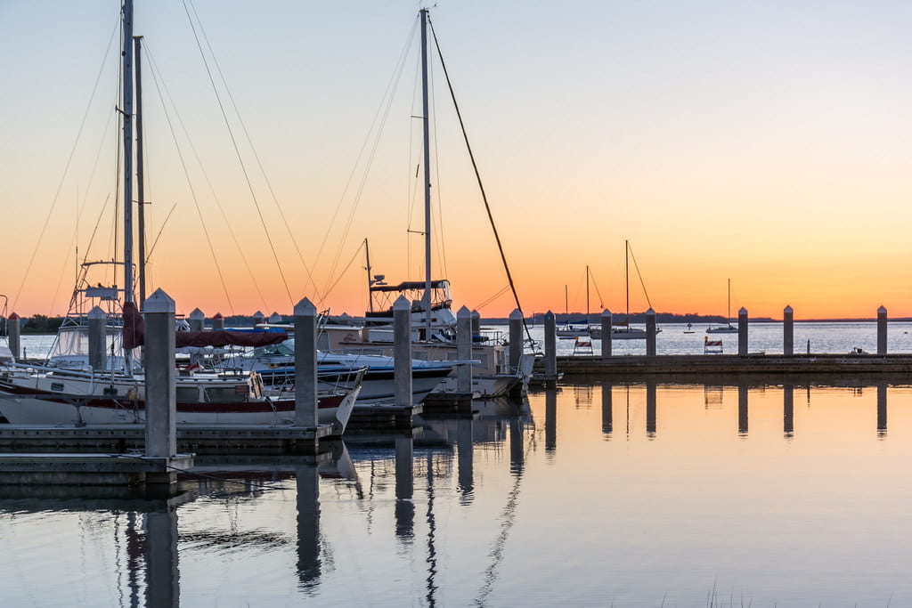
Back in mid-February, I was standing at low tide on the wide beach of Amelia Island and thinking about all of the other beaches I have had the pleasure to visit over the decades of my life. My first surf dunking was in 1959 at Virginia Beach (I was seven years old and the waves looked huge!). After we moved to Houston in 1966, I had ten years of almost constant residence on the beaches up and down the Texas coast. During my 34 years at Penn State, we took frequent family vacations to the shore, and I also taught a yearly field biology course on Chincoteague and Assateague Islands in Virginia. More recently, we visited the Florida Keys in December, 2022, and, this winter, came back once again to Florida.

Amelia Island beach. Photo by D. Sillman
Standing on these beaches and coastlines, tossed and blown by the wind, listening to the sea gulls screaming and the waves crashing, smelling the salt air and the rich, fish-scent of the ocean, the overriding sensation that puts everything else in context is the sight, the feel and even the taste of sand!
Sand is a system of particles primarily made up of quartz (silica dioxide). Sands are classified by their particular size range (0.074 to 4.75 mm in diameter). A sand particle is smaller than a piece of gravel but larger than a silt particle. Most of these pieces of sand-quartz come from the weathering and erosion of the massive rocks that once made up the surfaces and cores of faraway mountains.
Sand particles are so irregularly shaped that when they are piled together the spaces in between them are relatively large. In fact, these spaces are large enough to allow water to flow through them under the pull of gravity. When a system of sand is saturated with water these channels fill up and the cohesiveness of the water molecules weakly holds the sand particles together. This is why you can use wet sand to build sand castles on the beach! The wet sand, though, quickly loses its water (via gravitational drainage and also evaporation) and then the sand castle crumbles apart.
If a sand system has a water-impermeable layer beneath it, it can hold water for a long period of time. This sand, when saturated with water, will behave like a thick liquid and compress and flow like any fluid system. Offshore sand is saturated with water and flows in a very fluid manner. So, sand can blow about when it is dry, and ooze and flow when it is wet. Sand is capable of many types of movements!

Beach sand dune. USFWS. Public Domain
Beaches are strips of sand (or sometimes strips of gravel, shells or pebbles) located between oceans or lakes and the land that abuts them. Dunes are structures on the landward side of a beach. Dunes form from beach sands that are pushed away from the ocean or lake by on-shore winds. Dunes also typically require plants or some other vertical impediments to slow down the passing air-borne sand so that it will accumulate in a slowly building mound. Plant roots also help to hold the very shiftable, dry sand together!
Beaches and dunes are dynamic, constantly changing systems. They are shaped by the daily actions of winds, waves and tides and also by the very occasional but extremely spectacular events of high energy, catastrophic storms.
Beaches act as energy buffers against the destructive action of coastal storms. In general, the wider the beach the greater the potential degree of protection. Dunes also protect the land from storms especially with regard to storm surge. Again, the wider, and taller, the dune system is, the greater the degree of storm surge protection.
The exchange of sand from beach to dune slowly builds the dune. Dunes may also, under certain circumstances, “give back” sand to the beaches especially after a particularly severe storm-induced beach erosion event.

South tip of Amelia Island. State of Florida. PUblic Domain
There is, though, a third reservoir of sand connected to the beach/dune system. This third, sand reservoir is actually much larger than the beach and dune reservoirs combined. This third sand reservoir, though, is usually hidden from view just off-shore from the beach! This is, of course, the immense sand reservoir of the ocean floor and its often barely submerged accumulation of sand in off-shore sand bars. This off-shore sand can move up and down a beach building zone. It is the ultimate, natural source of the sand for all of our coastal beaches and dunes.
Storms may return the beach and dune sands to these off-shore sand reserves and, thus, re-start the whole process of beach and dune building. The steady pulse of waves and tides with their relatively rapid landward flowing velocities and slower seaward flowing velocities inevitably push and carry the off-shore sand to the beach. As long as there are no hard barriers in the way (like sea walls, jetties and groins) the sand will return and the beaches and dunes will re-form even after cataclysmic destruction.
The forces acting on the sand generates a distinctive, “rolling” profile to the sand bar/beach/dune system. This undulating landscape stretches from the submerged, off-shore sand bars all the way inland as far as the dunes are allowed grow.
Here on Amelia Island, the off-shore sand bar is not visible even at low tide. It is possible that dredging has reduce its volume so much that there is not a hint of its presence under the rolling surf. Up at Assateague Island in Virginia and at Surfside Beach in Texas I remember seeing a distinct “browning” of the ocean water over the off-shore bars. In Texas, at low tides, the off-shore sandbar actually emerged from under the water and served as a resting place for sea gulls and pelicans.

National Park Service. Public Domain
In between the sandbar and the emergent (“intertidal” or “face”) beach is a deep “trough” and then a long, submerged, concave dish of sand called, very logically, the “submerged beach” or “terrace”). When this submerged beach reaches up sufficiently high to be exposed at low tides, it then forms start of the “intertidal beach” which extends all the way up to the maximum high tide line. This intertidal beach maintains the distinctive undulating topography with rolling crests and depressions that run all the way up to the dry line of the “upper beach” (or”berm”). The upper beach, then, makes contact with the start of sand dune system.
We often went down to beaches here on Amelia Island at low tide. That gave us more beach to explore and also a greater opportunity to find interesting shells and sharks’ teeth! Even at extreme low tide, though, there was a substantial water flow from the upper part of the intertidal beach back to the ocean water line. In places this water flow had dug gullies in the intertidal sand that were a foot or two deep. These gullies carried a significant water volume down the beach profile and made walking along the beach difficult.
Where did this water come from? Exploring the upper edges of the intertidal beach I noticed a long, broad concavity that very likely filled with sea water at high tide. The sand of this concavity was fluid underfoot and was obviously saturated with water. There must have been a rock pan under this area of the beach that kept the water in the spaces of the sand system from draining downward via a gravitational pull. This water, though, did flow out laterally toward the low tide line. Small seeps and trickles from the sand gathered together into an Artesian spring-like flow that then cut through low spots in the beach and dug the water-filled gullies down to the ocean.
At high tide, the water flow in these gullies would reverse sending the incoming tidal water up into the upper tidal beach concavity. As long as the gullies maintained their structural integrity, this in and out flow of water would continue!
(Next week: Dunes!)