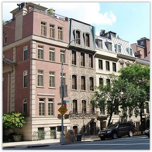
 York Avenue and Sutton Place are the names of a relatively short north-south thoroughfare in the Yorkville, Lenox Hill, and Sutton Place neighborhoods of the East Side of Manhattan, in New York City. York Avenue runs from 59th to 91st Streets through eastern Lenox Hill and Yorkville on the Upper East Side. Sutton Place and its southern extension runs through their namesake neighborhood along the East River and south of the Queensboro Bridge, with Sutton Place South running from 53rd to 57th Streets and Sutton Place from 57th to 59th Streets. The street is considered among the city’s most affluent, and both portions are known for upscale apartments, much like the rest of the Upper East Side.
Addresses on York Avenue are continuous with that of Avenue A in Alphabet City, starting in the 1100 series and rising to the 1700 series. Addresses on Sutton Place vary.
The greater Sutton Place neighborhood, which sits north of the neighborhood of Turtle Bay, runs from 53rd Street to 59th Street and is bounded on the east by the East River and on the west by either First Avenue or Second Avenue.Sutton Square is the cul-de-sac at the end of East 58th Street, just east of Sutton Place; Riverview Terrace is a row of townhouses on a short private driveway that runs north from Sutton Square.
HISTORY
Early years
The street that became York Avenue and Sutton Place (and further north, Pleasant Avenue) was proposed as an addition to theCommissioners’ Plan of 1811 for Manhattan, which designated 12 broad north-south avenues running the length of the island. The geography of Manhattan left a large area on the Upper East Side east of First Avenue without a major north-south thoroughfare, so Avenue A was added to compensate. Sutton Place, the name that applied to the whole street at the time, was originally one of several disconnected stretches of Avenue A built where space allowed, east of First Avenue.
In 1875, Effingham B. Sutton constructed a group of brownstones between 57th and 58th Streets, and is said[by whom?] to have lent the street his name, though the earliest source found by The New York Times dates back only to 1883. At that time, the New York City Board of Aldermen approved a petition to change the name from “Avenue A” to “Sutton Place”, covering the blocks between 57th and 60th Streets. The block between 59th and 60th Streets is now considered a part of York Avenue.
Sutton Place first became fashionable around 1920, when several wealthy socialites, including Anne Harriman Vanderbilt and Anne Morgan, built townhouses on the eastern side of the street, overlooking the East River. Both townhouses were designed by Mott B. Schmidt, launching a career that included many houses for the wealthy.) Very shortly thereafter, developers started to build grand co-operative apartment houses on Sutton Place and Sutton Place South, including several designed by Rosario Candela. Development came to an abrupt halt with the Great Depression, and the luxury apartment buildings on the lower part of Sutton Place South (below 57th Street) and the northernmost part of Sutton Place (adjacent to the Queensboro Bridge) were not developed until the 1940s and 1950s.
In 1928, a one-block section of Sutton Place north of 59th Street, and all of Avenue A north of that point, was renamed York Avenue to honor U.S. Army Sergeant Alvin York, who received the Medal of Honor for attacking a German machine gun nest during World War I’s Meuse-Argonne Offensive.
Park controversy
Sutton Place encompasses two public parks overlooking the East River, one at the end of 57th Street and another at the end of 53rd Street. The 57th Street park is separated by an iron fence from the landscaped grounds behind One Sutton Place South, a neo-Georgian apartment building designed by Rosario Candela. The property behind One Sutton Place South was the subject of a dispute between the building’s owners and the New York City Department of Parks and Recreation. Like the adjacent park, the rear garden at One Sutton Place South is, in fact, cantilevered over the FDR Drive, a busy parkway at Manhattan’s eastern edge that is not visible from most of Sutton Place.
In 1939, city authorities took ownership of the property behind One Sutton Place South by condemnation in connection with the construction of the FDR Drive, then leased it back to the building. The building’s lease for its backyard expired in 1990. The co-op tried unsuccessfully to extend the lease, and later made prospective apartment-buyers review the legal status of the backyard and sign a confidentiality agreement. In June 2007, the co-op sued the city in an attempt the keep the land, and on November 1, 2011, the co-op and the city reached an agreement in which the co-op ended its ownership claim and each side would contribute $1 million toward the creation of a public park on the land.