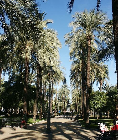
Juan Carlos I Park
Juan Carlos I Park is a park in Córdoba, Córdoba, Andalusia. Juan Carlos I Park is situated nearby to the neighborhoods San Basilio and Fray Albino.Notable Places in the Area
Mercado Victoria
Marketplace

Photo: Mercado Victoria, CC BY-SA 4.0.
Mercado Victoria is a marketplace.
Roman mausoleum of Córdoba
Archaeological site

Photo: Hameryko, CC BY-SA 3.0.
The Roman mausoleum of Córdoba is an ancient structure in the Jardines de la Victoria, Córdoba, Andalusia, southern Spain.
Localities in the Area
San Basilio
Neighborhood

Photo: Wikimedia, CC BY-SA 2.0.
San Basilio is one of the neighbourhoods in the Centro district of Córdoba, Spain.

Juan Carlos I Park
Latitude
37.88337° or 37° 53' 0" northLongitude
-4.78874° or 4° 47' 20" westElevation
118 metres (387 feet)Open Location Code
8C9QV6M6+8GGeoNames ID
10942126Juan Carlos I Park Satellite Map
© OpenStreetMap, Mapbox and Maxar
Other Places Named Juan Carlos I Park
In the Area
Juan Carlos I Park is situated close to the localities Vista Hermosa and Alameda del Obispo.
Localities
- Las ErmitasLocality, 5 km northwest
- El HiguerónVillage, 6 km west
- Las QuemadasLocality, 7 km east
- ValchillónLocality, 7 km southwest
- VillarrubiaLocality, 10 km west
- Santa María de TrassierraHamlet, 11 km northwest
Landmarks
- Hospederia Luis de GongoraHotel
- Plaza de Toros de los CalifasStadium
- Jardines de la AgriculturaPark
- Córdoba Central Railway StationRailway station
- Gran Teatro de CórdobaTheater building
- Royal Collegiate Church of Saint HippolytusChurch
Popular Destinations in Córdoba
Escape to a Random Place
Discover the parks Parque Nacional Itza-Popo in Mexico State, Mexico and Ausspannplatz Windhoek in Khomas, Namibia.
About Mapcarta. Thanks to Mapbox for providing amazing maps. Text is available under the CC BY-SA 4.0 license, excluding photos, directions and the map. Photo: São Paulo, CC BY-SA 3.0.