Below is a snapshot of the Web page as it appeared on 5/4/2024 (the last time our crawler visited it). This is the version of the page that was used for ranking your search results. The page may have changed since we last cached it. To see what might have changed (without the highlights), go to the current page.
Bing is not responsible for the content of this page.
A Magyarország független állam Közép-Európában. Magyarország a Kárpát-medence közepén fekszik, területét a Duna osztja ketté. A Magyar Köztársaság fővárosa, politikai, gazdasági és kulturális központja Budapest, ahol az ország lakosságának mintegy 20%-a él.
This section holds a short summary of the history of the area of present-day Hungary, illustrated with maps, including historical maps of former countries and empires that included present-day Hungary.
Historical maps of Hungary
Approximate extent of Pannonian Sea during the Miocene Epoch
Approximate extent of Pannonian Sea during the Miocene Epoch
approximate extent of Pannonian Sea during the Miocene Epoch
The celts BC800-BC400
Territorial development of the Roman Empire 264 BC-192, including the conquest of present
Roman Empire divided 395, showing the dioceses and praetorian prefectures of Gaul, Italy, Illyricum and Oriens (east), roughly analogous to the four Tetrarch zones of influence after Diocletian's reforms.
The division of the Empire after the death of Theodosius I, ca.395 AD superimposed on modern borders.
Baranya / Baranja region, divided between Hungary and Croatia
Bačka / Bácska region, divided between Serbia and Hungary
Banat region, divided between Romania, Serbia and Hungary
Satellite maps
Satellite map
Satellite map
Notes and references
General remarks:
The WIKIMEDIA COMMONS Atlas of the World is an organized and commented collection of geographical, political and historical maps available at Wikimedia Commons. The main page is therefore the portal to maps and cartography on Wikimedia. That page contains links to entries by country, continent and by topic as well as general notes and references.
Every entry has an introduction section in English. If other languages are native and/or official in an entity, introductions in other languages are added in separate sections. The text of the introduction(s) is based on the content of the Wikipedia encyclopedia. For sources of the introduction see therefore the Wikipedia entries linked to. The same goes for the texts in the history sections.
Historical maps are included in the continent, country and dependency entries.
The status of various entities is disputed. See the content for the entities concerned.
The maps of former countries that are more or less continued by a present-day country or had a territory included in only one or two countries are included in the atlas of the present-day country. For example the Ottoman Empire can be found in the Atlas of Turkey.


.PNG)


.jpg)


_in_Hungary,_census_1890.jpg)
.png)
.JPG)


.png)


_in_Hungary_(census_2001).png)

.png)


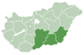 Dél-Alföld region
 Dél-Dunántúl region
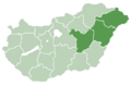 Észak-Alföld region
 Észak-Magyarország region
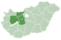 Közép-Dunántúl region
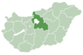 Közép-Magyarország region
 Nyugat-Dunántúl region


 Magyar: Budapest
 English: Baranya countyMagyar: Baranya megye
 English: Bács-Kiskun countyMagyar: Bács-Kiskun megye
 English: Békés countyMagyar: Békés megye
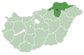 English: Borsod-Abaúj-Zemplén countyMagyar: Borsod-Abaúj-Zemplén megye
 English: Csongrád countyMagyar: Csongrád megye
 English: Fejér countyMagyar: Fejér megye
 English: Győr-Moson-Sopron countyMagyar: Győr-Moson-Sopron megye
 English: Hajdú-Bihar countyMagyar: Hajdú-Bihar megye
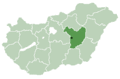 Jász-Nagykun-Szolnok county
 Komárom-Esztergom county
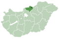 Nógrád county
 Somogy county
 Szabolcs-Szatmár-Bereg county
 Tolna county
 Vas county
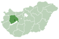 Veszprém county
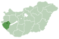 Zala county


