Category:1690s maps of Scotland
Jump to navigation
Jump to search
Media in category "1690s maps of Scotland"
The following 6 files are in this category, out of 6 total.
-

-
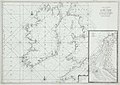 A Chart of Northern Ireland and Scotland.jpg 2,000 × 1,413; 428 KB
-
 Atlante Veneto Volume 2 010.jpg 10,346 × 7,428; 7.53 MB
-
 Atlante Veneto Volume 2 011.jpg 10,346 × 7,422; 8.07 MB
-

-
 Tron Kirk surroundings.JPG 1,371 × 1,292; 614 KB
_-_Geographicus_-_ScotiaParteMeridionale-coronelli-1690.jpg)


