Category:Baghdati
Jump to navigation
Jump to search
| Object location | | View all coordinates using: OpenStreetMap |
|---|
town in Georgia  церква у Багдаті | |||||
| Upload media | |||||
| Instance of |
| ||||
|---|---|---|---|---|---|
| Location | |||||
| Located in or next to body of water | |||||
| Official language | |||||
| Population |
| ||||
| Elevation above sea level |
| ||||
 | |||||
Subcategories
This category has the following 2 subcategories, out of 2 total.
C
- Baghdati Cathedral (5 F)
M
- Mayakovsky House Museum (3 F)
Media in category "Baghdati"
The following 12 files are in this category, out of 12 total.
-
 Baghdati Park.jpg 5,472 × 3,648; 14.92 MB
-
 Baghdati school -2 (1).jpg 5,184 × 3,456; 8.07 MB
-
 Baghdati school -2 (2).jpg 5,184 × 3,456; 8.1 MB
-
 Baghdati school -2 (3).jpg 3,456 × 5,184; 7.82 MB
-
 Baghdati school -2 (4).jpg 3,456 × 5,184; 7.78 MB
-
 Baghdati school -2 (5).jpg 3,456 × 5,184; 7.15 MB
-
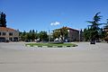 Baghdati Town Center.jpg 5,146 × 3,431; 9.24 MB
-
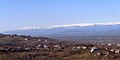
 Baghdati, Georgia - panoramio (1).jpg 2,001 × 1,110; 1.08 MB
-
 Baghdati, Georgia - panoramio (2).jpg 2,304 × 887; 891 KB
-
 Baghdati, Georgia - panoramio.jpg 2,304 × 1,153; 1.28 MB
-
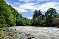 Khanistskali in Baghdati 1.jpg 5,472 × 3,648; 14.56 MB
-
 Khanistskali in Baghdati 2.jpg 5,472 × 3,648; 13.2 MB

.jpg)
.jpg)
.jpg)
.jpg)
.jpg)

.jpg)


.jpg)