
 Yahoo News
 Every area of England to be hit by thunderstorms and downpours on Sunday
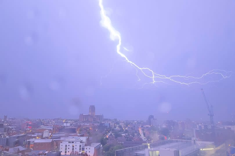
Large swathes of the UK are set to be hit by thunderstorms and downpours today as Yellow weather warnings were issued by the Met Office. Central and westerns parts of the UK are set to be worst affected by the adverse weather.
The yellow weather warnings stretch from the south coast of England, right up to the West Midlands and Wales and into the North West. There are also yellow weather warnings for Scotland and Northern Ireland.
The Met Office website reads: "Heavy showers and thunderstorms are likely to break out late Sunday morning and early Sunday afternoon, moving steadily north whilst growing into larger areas of rain before clearing the area. Some intense downpours are possible in a few places, giving up to 30 mm in less than hour and perhaps 40-50 mm over two to three hours leading to surface water flooding. Hail, frequent lightning strikes and strong wind gusts will be additional localised hazards."
READ MORE: Storm warning as thunder and rain to engulf most of UK with hardly anywhere spared
Get breaking news on BirminghamLive WhatsApp, click the link to join
Here's the areas of UK that are set to be hit by thunderstorms:
West Midlands
Herefordshire
Shropshire
Staffordshire
Stoke-on-Trent
Telford and Wrekin
Warwickshire
West Midlands Conurbation
Worcestershire
East Midlands
Derby
Derbyshire
Leicester
Leicestershire
Northamptonshire
Nottingham
Nottinghamshire
London & South East England
Buckinghamshire
Hampshire
Oxfordshire
Reading
Southampton
West Berkshire
Windsor and Maidenhead
Wokingham
North West England
Blackburn with Darwen
Blackpool
Cheshire East
Cheshire West and Chester
Cumbria
Greater Manchester
Halton
Lancashire
Merseyside
Warrington
South West England
Bath and North East Somerset
Bournemouth Christchurch and Poole
Bristol
Devon
Dorset
Gloucestershire
North Somerset
Somerset
South Gloucestershire
Swindon
Torbay
Wiltshire
Wales
Blaenau Gwent
Bridgend
Caerphilly
Cardiff
Carmarthenshire
Ceredigion
Conwy
Denbighshire
Flintshire
Gwynedd
Isle of Anglesey
Merthyr Tydfil
Monmouthshire
Neath Port Talbot
Newport
Powys
Rhondda Cynon Taf
Swansea
Torfaen
Vale of Glamorgan
Wrexham
Yorkshire & Humber
North Yorkshire
South Yorkshire
West Yorkshire
Central, Tayside & Fife
Clackmannanshire
Falkirk
Fife
Perth and Kinross
Stirling
Highlands & Eilean Siar
Eilean Siar
Highland
North West England
Cumbria
SW Scotland, Lothian Borders
Dumfries and Galloway
West Lothian
Strathclyde
Argyll and Bute
East Ayrshire
East Dunbartonshire
East Renfrewshire
Glasgow
Inverclyde
North Ayrshire
North Lanarkshire
Renfrewshire
South Ayrshire
South Lanarkshire
West Dunbartonshire
Northern Ireland
County Armagh
County Fermanagh
County Londonderry
County Tyrone
Here's what to expect:
Spray and sudden flooding could lead to difficult driving conditions and some road closures
Where flooding or lightning strikes occur, there is a chance of delays and some cancellations to train and bus services
There is a slight chance that power cuts could occur and other services to some homes and businesses could be lost
There is a small chance of fast flowing or deep floodwater causing danger to life, particularly in places such as road and railway underpasses.
There is a small chance that homes and businesses could be flooded quickly, with damage to some buildings from floodwater, lightning strikes, hail or strong winds

