Tides Today & Tomorrow in Annapolis, MD
Printing our tide charts?
Help us keep our doors open and lights on by registering as a member of US Harbors.
It's simple and free!
Annapolis, MD Tides - Jun 2024
| Date | High Tide | Low Tide | Sun | Moon | ||||||||
|---|---|---|---|---|---|---|---|---|---|---|---|---|
| AM | ft | PM | ft | AM | ft | PM | ft | Rise | Set | |||
| 6 | Thu | 5:54 | 1.8 | 5:38 | 1.0 | 12:47 PM | 0.6 | 11:34 | 0.2 | 5:38 | 8:30 |  |
| 7 | Fri | 6:41 | 1.8 | 6:31 | 1.0 | 1:34 | 0.6 | 5:38 | 8:31 | | ||
| 8 | Sat | 7:26 | 1.7 | 7:25 | 1.1 | 12:25 | 0.2 | 2:17 | 0.6 | 5:38 | 8:31 | |
| 9 | Sun | 8:09 | 1.6 | 8:20 | 1.1 | 1:16 | 0.3 | 2:57 | 0.6 | 5:38 | 8:32 | |
| 10 | Mon | 8:52 | 1.6 | 9:14 | 1.1 | 2:07 | 0.4 | 3:37 | 0.5 | 5:38 | 8:32 |  |
| 11 | Tue | 9:33 | 1.5 | 10:10 | 1.2 | 2:59 | 0.5 | 4:17 | 0.5 | 5:38 | 8:33 | |
| 12 | Wed | 10:15 | 1.4 | 11:05 | 1.2 | 3:53 | 0.6 | 4:56 | 0.5 | 5:38 | 8:33 | |
| 13 | Thu | 10:57 | 1.3 | 4:49 | 0.7 | 5:35 | 0.5 | 5:38 | 8:34 | | ||
| 14 | Fri | 12:00 | 1.3 | 11:39 AM | 1.3 | 5:50 | 0.7 | 6:14 | 0.4 | 5:38 | 8:34 |  |
| 15 | Sat | 12:55 | 1.3 | 12:23 | 1.2 | 6:54 | 0.8 | 6:52 | 0.4 | 5:38 | 8:34 | |
| 16 | Sun | 1:47 | 1.4 | 1:08 | 1.1 | 8:01 | 0.8 | 7:32 | 0.4 | 5:38 | 8:35 | |
| 17 | Mon | 2:36 | 1.5 | 1:55 | 1.1 | 9:07 | 0.8 | 8:12 | 0.3 | 5:38 | 8:35 | |
| 18 | Tue | 3:23 | 1.6 | 2:44 | 1.0 | 10:09 | 0.8 | 8:54 | 0.3 | 5:38 | 8:35 |  |
| 19 | Wed | 4:08 | 1.7 | 3:35 | 1.0 | 11:04 | 0.7 | 9:38 | 0.3 | 5:38 | 8:36 | |
| 20 | Thu | 4:52 | 1.7 | 4:27 | 1.0 | 11:53 | 0.7 | 10:24 | 0.3 | 5:38 | 8:36 | |
| 21 | Fri | 5:36 | 1.8 | 5:19 | 1.0 | 12:36 PM | 0.7 | 11:12 | 0.3 | 5:39 | 8:36 |  |
| 22 | Sat | 6:20 | 1.8 | 6:12 | 1.0 | 1:18 | 0.6 | 5:39 | 8:36 | | ||
| 23 | Sun | 7:05 | 1.8 | 7:05 | 1.0 | 12:03 | 0.3 | 1:59 | 0.6 | 5:39 | 8:36 | |
| 24 | Mon | 7:51 | 1.8 | 8:00 | 1.1 | 12:56 | 0.3 | 2:39 | 0.6 | 5:40 | 8:37 | |
| 25 | Tue | 8:37 | 1.7 | 8:57 | 1.2 | 1:51 | 0.3 | 3:20 | 0.5 | 5:40 | 8:37 |  |
| 26 | Wed | 9:24 | 1.6 | 9:57 | 1.3 | 2:49 | 0.4 | 4:02 | 0.5 | 5:40 | 8:37 | |
| 27 | Thu | 10:11 | 1.5 | 10:59 | 1.4 | 3:51 | 0.5 | 4:44 | 0.4 | 5:41 | 8:37 | |
| 28 | Fri | 10:58 | 1.4 | 4:58 | 0.6 | 5:27 | 0.3 | 5:41 | 8:37 | | ||
| 29 | Sat | 12:03 | 1.5 | 11:47 AM | 1.3 | 6:09 | 0.6 | 6:12 | 0.3 | 5:41 | 8:37 |  |
| 30 | Sun | 1:06 | 1.6 | 12:37 | 1.2 | 7:25 | 0.7 | 6:58 | 0.2 | 5:42 | 8:37 | |
| Date | High Tide | Low Tide | Sun | Moon | ||||||||
| AM | ft | PM | ft | AM | ft | PM | ft | Rise | Set | |||

www.USHarbors.com
SPONSORED CONTENT

10 Legal Essentials Every Recreational Boater Should Know
By Lipcon, Margulies & Winkleman, P.A. Embarking on a boating adventure is thrilling, but ensuring safety and legal compliance is crucial for an enjoyable experience. Here are some essential rules to remember to help you stay safe and within the law while on the water. When navigating the waters as… Learn More
Coastal News Updates See All
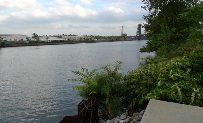
Restoration for Fish, Wildlife, and Communities Coming to Seven Polluted Waterways
By oceanservice.noaa.gov. Good news for a new year! In 2023, NOAA and partners helped to… More
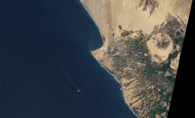
World’s Longest Wave?
By bluemarble.nasa.gov. The waters off the Pacific coast of northern Peru routinely build what has… More
Sailing in Alaska? Watch Out for Tsunamis
By Christian Elliott. Tour boat operators and cruise ship captains face a growing hazard: tsunamis… More
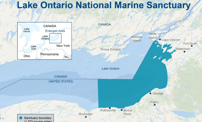
Lake Ontario Designated as New Marine Sanctuary
By noaa.gov. Designated in 2024, Lake Ontario National Marine Sanctuary is a historically rich area… More
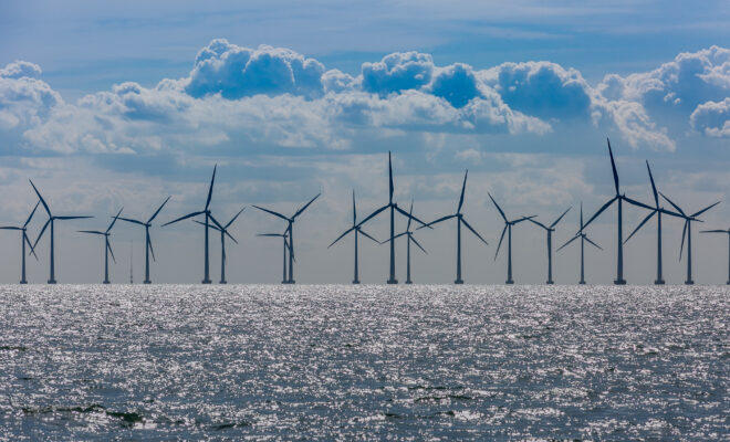
New York Finalizes Contracts for Two Massive Offshore Wind Projects
By Mike Schuler. New York Governor Kathy Hochul announced the finalization of contracts for two… More
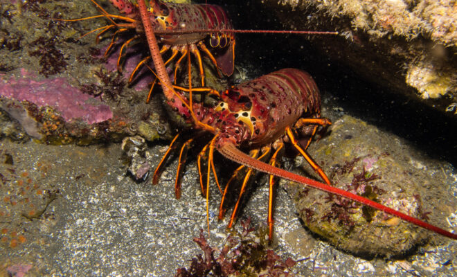
‘Knight in Spiny Armor’: Could Cobsters Help Save Florida’s Dying Corals?
By Richard Luscombe. A three-year study found that the spiny lobsters’ urine scared off predatory… More
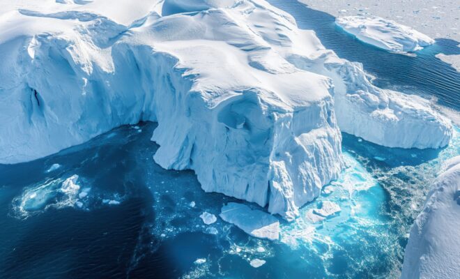
The Doomsday Glacier is melting − fast. How Sea Level Rise Could Drench The World Map.
By Doyle Rice. More unsettling news from the bottom of the world. Scientists have uncovered… More
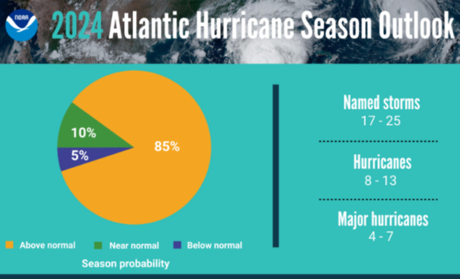
NOAA Predicts Above-Normal 2024 Atlantic Hurricane Season
By NOAA. La Nina and warmer-than-average ocean temperatures are major drivers of tropical activity. NOAA… More
U.S. Climate Outlook for June 2024
By Mike Halpert at NOAA. May was again a warmer-than-normal month for large parts of… More