Bennington College
Bennington College is an university in Bennington, Southern Vermont, Vermont. Bennington College is situated nearby to the peak Bingham Hill and Hinsdellville Cemetery.Notable Places in the Area
Paper Mill Village Bridge
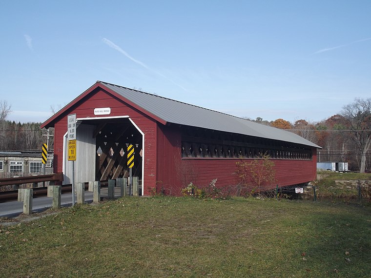
Photo: Doug Kerr, CC BY-SA 2.0.
The Paper Mill Village Bridge, also called the Paper Mill Bridge or Bennington Falls Covered Bridge, is a wooden covered bridge that carries Murphy Road across the Walloomsac River northwest of Bennington, Vermont. Paper Mill Village Bridge is situated 3,200 feet southeast of Bennington College.
Park–McCullough Historic House
Heritage site

Photo: Wikimedia, CC BY-SA 2.0.
The Park–McCullough Historic Governor's Mansion is one of the best-preserved Victorian mansions in New England. Park–McCullough Historic House is situated 3,600 feet northwest of Bennington College.
North Bennington Historic District
Park
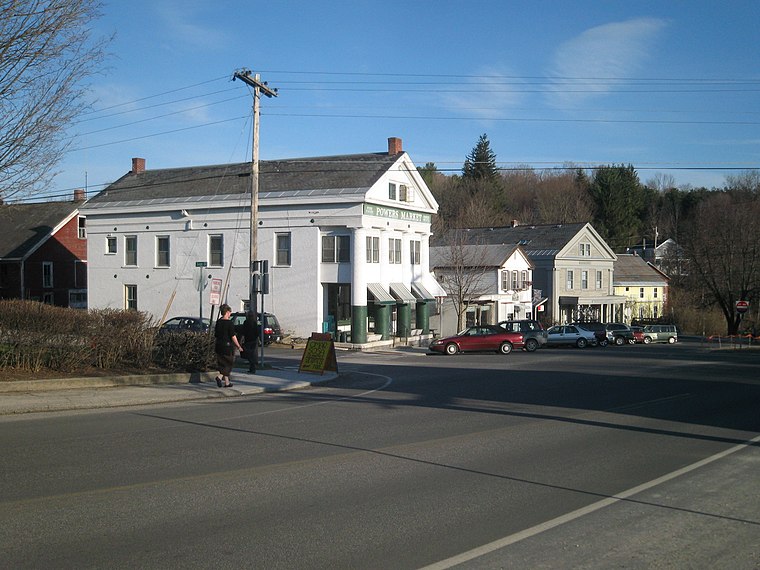
Photo: Mark Barry, CC BY 2.0.
North Bennington Historic District is a park.
Localities in the Area
North Bennington
Village
Photo: Mark Barry, CC BY 2.0.
North Bennington is an incorporated village in the town of Bennington in Bennington County, Vermont, United States.
South Shaftsbury
Hamlet
South Shaftsbury is a census-designated place in the town of Shaftsbury in Bennington County, Vermont, United States. South Shaftsbury is situated 2½ miles northeast of Bennington College.
Old Bennington
Village

Photo: Nheyob, CC BY-SA 3.0.
Old Bennington is a village in Bennington County, Vermont, United States. Old Bennington is situated 3 miles southeast of Bennington College.
Bennington College
- Type: University
- Category: education
- Location: Bennington, Bennington, Southern Vermont, Vermont, New England, United States, North America
- View on OpenStreetMap
Latitude
42.92065° or 42° 55' 14" northLongitude
-73.23856° or 73° 14' 19" westOpen Location Code
87J8WQC6+7HOpenStreetMap ID
way 326096298OpenStreetMap Feature
amenity=universityBennington College Satellite Map
© OpenStreetMap, Mapbox and Maxar
In the Area
Bennington College is situated close to Rice-A Winslow Farm Cemetery and the fire station North Bennington Fire Department.
Landmarks
- Bennington CollegeCollege, 610 feet south
- Bennington College FieldPitch, 870 feet north
- Bennington College Common LawnRecreation area, 930 feet south
- Lincoln SquarePark, 3,200 feet north
- Saint John the Baptist CemeteryCemetery, 3,200 feet northeast
- John G. Mccullough FreeLibrary, 3,200 feet north
Other Places
- Tishman Lecture HallBuilding
- The Barn / Administrative OfficesBuilding, 490 feet southeast
- CommonsBuilding, 610 feet south
- Crossett LibraryBuilding, 820 feet south
- DeweyHouse, 870 feet south
- SwanResidential area, 1,000 feet south
Popular Destinations in Southern Vermont
Escape to a Random Place
Discover the universities Universidad Tecnológica ECOTEC (Campus Samborondón) in Ecuador and Université de Moncton in New Brunswick, Canada.
About Mapcarta. Thanks to Mapbox for providing amazing maps. Data © OpenStreetMap contributors and available under the Open Database License. Text is available under the CC BY-SA 4.0 license, excluding photos, directions and the map. Photo: Wikimedia, CC0.