Havre Air Force Station
Last updatedHavre Air Force Station | |
|---|---|
| 26 miles (42 km) northwest of Havre, Montana [1] | |
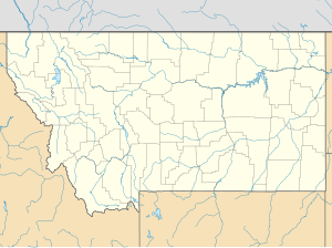 Havre AFS Location of Havre AFS, Montana | |
| Coordinates | 48°52′51″N109°56′42″W / 48.88083°N 109.94500°W Coordinates: 48°52′51″N109°56′42″W / 48.88083°N 109.94500°W [2] |
| Type | Air Force Station |
| Site information | |
| Controlled by | |
| Site history | |
| Built | 1951 |
| In use | 1951–1979 |
| Garrison information | |
| Garrison | 778th Air Defense Group, 778th Aircraft Control and Warning Squadron (later 778th Radar Squadron) |


Havre Air Force Station (site designator P-25, Z-25 after 31 July 1963) is a Formerly Used Defense Site that was used as a Cold War general surveillance radar station. In addition to radar facilities and a NORAD Control Center the site had support services: NCO club, bowling alley, hobby shops, library, movie theater, barber shop, exchange, commissary, grade school, and housing for officers and senior NCOs. [3]
Contents
History
In late 1951 Air Defense Command selected Simpson, Montana as a site for one of twenty-eight radar stations built as part of the second segment of the permanent radar surveillance network.[ citation needed ] Prompted by the start of the Korean War, on July 11, 1950, the Secretary of the Air Force asked the Secretary of Defense for approval to expedite construction of the second segment of the permanent network. Receiving the Defense Secretary's approval on July 21, the Air Force directed the United States Army Corps of Engineers to proceed with construction.
On 1 March 1951 the 778th Aircraft Control and Warning Squadron was activated at Simpson [4] and began operating AN/FPS-3 and AN/FPS-4 radars. Initially, the station functioned as a ground control intercept (GCI) and warning station. As a GCI station, the squadron's role was to guide interceptor aircraft toward unidentified intruders picked up on the unit's radar scopes.
Havre Air Force Station
The site was renamed Havre Air Force Station on 1 December 1953. [4] The Air Force added an AN/GPS-3 radar c. late 1958 that stayed until 1965.
During 1961 Havre AFS joined the Semi Automatic Ground Environment (SAGE) system, when a Burroughs AN/FST-2 Coordinate Data Transmitting Set was installed to transfer radar track data to Air Defense Direction Center DC-20 at Malmstrom Air Force Base, Montana.[ citation needed ] After joining SAGE, the squadron was redesignated as the 778th Radar Squadron (SAGE) on 1 March 1961. [4] The radar squadron provided information 24/7 the SAGE Direction Center where it was analyzed to determine range, direction altitude speed and whether or not aircraft were friendly or hostile. On 31 July 1963, the site was redesignated as NORAD ID Z-25.
In the early 1960s AN/FPS-6 and AN/FPS-6B radars took over height-finder duties. The AN/FPS-6B was upgraded to an AN/FPS-90 in 1964; it was deactivated in 1969. In 1965 an AN/FPS-27 replaced the AN/GPS-3 as the search radar.
In addition to the main facility, Havre operated two AN/FPS-18 Gap Filler sites:
- Galata, Montana (P-25A) 48°46′15″N111°19′44″W / 48.77083°N 111.32889°W
- Hogeland, Montana (P-25B) 48°51′29″N108°34′12″W / 48.85806°N 108.57000°W
Backup Interceptor Control
Over the years, the equipment at the station was upgraded or modified to improve the efficiency and accuracy of the information gathered by the radars. The 778th Radar Sq was inactivated and replaced by the 778th Air Defense Group in March 1970. [4] [5] The upgrade to group status was done because of Havre AFS' status as a Backup Interceptor Control (BUIC) site. BUIC sites were alternate control sites in the event that SAGE Direction Centers became disabled and unable to control interceptor aircraft. The group was inactivated and replaced by the 778th Radar Squadron. [4] [5] as defenses against manned bombers were reduced. Havre AFS was assigned to Malmstrom Air Force Base on 17 June 1974. [1]
Prior to the December 1979 breakup of Aerospace Defense Command, during the Department of Defense announced the proposed closure of "40 obsolete air defense radar stations", 95 military and 25 civilian positions were lost [6] and Havre AFS closed on 1 July 1979. The 778th Radar Squadron did not inactivate until September. [4]
Anchor Academy
The Anchor Academy, a school for troubled teenage boys, operated at the station in 2001, [7] and a few homes in the former military housing area are private residences.
Air Force units and assignments
Units
Squadron
- Constituted as the 778th Aircraft Control and Warning Squadron
- Activated 1 March 1951 at Simpson, Montana
- Redesignated 778th Radar Squadron (SAGE) on 1 March 1961
- Inactivated on 1 March 1970
- Redesignated 778th Radar Squadron on 1 January 1974
- Activated on 17 January 1974
- Inactivated on 29 September 1979 [4]
Group
- Constituted as the 778th Air Defense Group on 13 February 1970
Assignments
- 545th Aircraft Control and Warning Group, 1 March 1951
- 29th Air Division, 6 February 1952
- Great Falls Air Defense Sector, 1 July 1960
- 28th Air Division, 1 April 1966
- 24th Air Division, 19 November 1969 – 29 September 1979 [4] [5]
Commanders
- 778th Radar Squadron
- Maj. Lowell D. Covington, unknown – 1 Mar 1970 [9]
- 778th Air Defense Group
- Maj. Lowell D. Covington, 1 Mar 1970 – unknown [9]
See also
Related Research Articles
Minot Air Force Station [Permanent Installation Number (PIN): 1445; Installation Location Code (ILC): QJVM]) is a closed United States Air Force General Surveillance Radar station. It is located 16.2 miles (26.1 km) south of Minot, North Dakota; on the west side of US Highway 83. It was closed in 1979. A portion of the property was reopened in 1984 as the Minot Communications Site and served until 1997.

Finley Air Force Station is a closed United States Air Force General Surveillance Radar station. It is located 1.5 miles (2.4 km) west-northwest of Finley, North Dakota. It was closed in 1979 by the Air Force, and turned over to the Federal Aviation Administration (FAA).
Dickinson Air Force Station is a closed United States Air Force General Surveillance Radar station. It is located 3.8 miles (6.1 km) northeast of Dickinson, North Dakota. It was closed in 1965.

Lewistown Air Force Station is a closed United States Air Force General Surveillance Radar station. It is located 7.0 miles (11.3 km) east-southeast of Hilger, Montana. It was closed in 1971.

Charleston Air Force Station is a defunct Air Force Station that opened in 1952 and closed in 1980. It was located in Charleston, Maine and is the site of a radar station and other buildings. After closure, it was redeveloped into a juvenile jail for the state of Maine.

Calumet Air Force Station is a closed United States Air Force General Surveillance Radar station. It is located 5.2 miles (8.4 km) east-northeast of Phoenix, Michigan. It was closed in 1988 by the Air Force, and turned over to the Federal Aviation Administration (FAA).
Palermo Air Force Station is a closed United States Air Force (USAF) General Surveillance Radar station. It was located in Palermo, New Jersey, 4.8 miles (7.7 km) north of Sea Isle City, in Cape May County, New Jersey, United States. It was closed in 1970.

Baudette Air Force Station is a closed United States Air Force General Surveillance Radar station. It is located 3.1 miles (5.0 km) south-southwest of Baudette, Minnesota. It was closed in 1979.
Wadena Air Force Station is a closed United States Air Force General Surveillance Radar station. It is located 7 miles (11 km) north-northeast of Wadena, Minnesota. It was closed in 1970.
Chandler Air Force Station is a closed United States Air Force General Surveillance Radar station. It is 2.2 miles (3.5 km) south of Chandler, Minnesota, on the Buffalo Ridge in section 13 of Moulton Township, Murray County. It was closed in 1969.

Opheim Air Force Station is a closed United States Air Force General Surveillance Radar station. It is located 3.3 miles (5.3 km) west of Opheim, Montana. It was closed in 1979.

Mount Laguna Air Force Station is a closed United States Air Force General Surveillance Radar station. It is located 24.3 miles (39.1 km) north-northeast of Tecate, California. It was closed in 1981 by the Air Force, and turned over to the Federal Aviation Administration (FAA).

Madera Air Force Station is a closed United States Air Force General Surveillance Radar station. It is located 5.2 miles (8.4 km) north-northeast of Madera, California. It was closed in 1966.

Condon Air Force Station is a closed United States Air Force General Surveillance Radar station. It is located 5.7 miles (9.2 km) west of Condon, Oregon. It was closed in 1970.

Keno Air Force Station is a closed United States Air Force General Surveillance Radar station. It is located 4.6 miles (7.4 km) south-southwest of Keno, Oregon. It was closed in 1979 by the Air Force, and turned over to the Federal Aviation Administration (FAA).
Othello Air Force Station is a closed United States Air Force General Surveillance Radar station. It is located 7.2 miles (11.6 km) south of Othello, Washington. It was the home station of the 637th Aircraft Control and Warning Squadron and the 637th Air Defense Group, closing in 1975.
Mica Peak Air Force Station is a closed United States Air Force General Surveillance Radar station. It is located atop Mica Peak, 6.3 miles (10.1 km) east-northeast of Mica, Washington. It was closed in 1975 by the Air Force, and turned over to the Federal Aviation Administration (FAA).

Blaine Air Force Station is a closed United States Air Force General Surveillance Radar station. It is located 5.5 miles (8.9 km) south of Blaine, Washington. It was closed in 1979.
Naselle Air Force Station is a closed United States Air Force General Surveillance Radar station. It is located 3.9 miles (6.3 km) north of Naselle, Washington. It was decommissioned by the Air Force in 1966 and later used for commercial and recreational uses.
Houma Air Force Station is a closed United States Air Force General Surveillance Radar station. It is located 3.5 miles (5.6 km) southeast Houma, Louisiana. It was closed in 1970.
References
Notes
- 1 2 Mueller, p. 356
- ↑ "Information for Havre AFS, MT". Radomes.org. Retrieved 2014-07-14.
- ↑ Winkler & Webster[ full citation needed ]
- 1 2 3 4 5 6 7 8 Cornett & Johnson, p. 167
- 1 2 3 4 Cornett & Johnson, p.86
- ↑ "Closure Proposed for Military Bases". Spokane Daily Chronicle. April 26, 1978. Retrieved August 3, 2014.
- ↑ havredailynews.myhometownads.net https://web.archive.org/web/20140808051243/http://havredailynews.myhometownads.net/cms/news/story-89337.html. Archived from the original on August 8, 2014.
{{cite web}}: Missing or empty|title=(help) - ↑ Department of the Air Force/MPM Letter 575q, 27 Sep 1984, Subject: Disbandment of Units
- 1 2 "Abstract, History 778 Air Defense Group Jan–Mar 1970". Air Force History Index. Retrieved January 13, 2012.
Bibliography
![]() This article incorporates public domain material from the Air Force Historical Research Agency.
This article incorporates public domain material from the Air Force Historical Research Agency.
- Cornett, Lloyd H; Johnson, Mildred W (1980). A Handbook of Aerospace Defense Organization, 1946–1980 (PDF). Peterson AFB, CO: Office of History, Aerospace Defense Center. p. 167.
- Mueller, Robert (1989). Air Force Bases, Vol. I, Active Air Force Bases Within the United States of America on 17 September 1982 (PDF). Washington, DC: Office of Air Force History. ISBN 0-912799-53-6.
- Winkler, David F.; Webster, Julie L (1997). Searching the skies: The legacy of the United States Cold War Defense Radar Program. Champaign, IL: US Army Construction Engineering Research Laboratories. LCCN 97020912.[ dead link ]
Further reading
- Grant, C. L. "The Development of Continental Air Defense to 1 September 1954, USAF Historical Study No. 126" (PDF). Research Studies Institute, USAF Historical Division, Air University. Retrieved January 13, 2012.,
- Leonard, Barry (2009). History of Strategic Air and Ballistic Missile Defense (PDF). Vol. I. 1945–1955. Fort McNair, DC: Center for Military History. ISBN 9781437921311.
- Leonard, Barry (2009). History of Strategic Air and Ballistic Missile Defense (PDF). Vol. II, 1955–1972. Fort McNair, DC: Center for Military History. ISBN 9781437921311. Archived from the original (PDF) on 2019-12-16. Retrieved 2012-10-03.
- Information for Havre AFS, MT

Text is available under the CC BY-SA 4.0 license; additional terms may apply.
Images, videos and audio are available under their respective licenses.