California storm brings flooding, mudslides and triggers evacuations | CNN

Live Updates

Massive California storm brings flooding and triggers evacuations

california flood
California has gone from extreme drought to extreme flooding in a matter of days
02:10 - Source: CNN

What we're covering

  • More than 20 million people across California are under flood alerts Tuesday as rain and storms continue to batter the state, and threaten to bring more flooding and mudslides.
  • A parade of storms have forced thousands to evacuate, prompted dozens of water rescues, swept away vehicles and caused widespread damage.
  • California has gone from extreme drought to extreme flooding in a matter of days. Tuesday’s rain is part of a wave of atmospheric rivers – long, narrow regions in the atmosphere that can transport moisture thousands of miles – that have thrashed the West Coast in the last several weeks. 
  • Track the latest severe weather here. And view CNN’s lite site here if you are in an area of low connectivity.
32 Posts

34,000 Californians are under evacuation orders, while 160,000 are without power

Approximately 34,000 people are under evacuation orders across California, Gov. Gavin Newsom said in a news conference Tuesday, adding the number is “dynamic and will change.”

Approximately 160,000 customers across the state are without power, he said.

Montecito evacuation order lifted, effective immediately, and cleanup is underway, sheriff says

Evacuation orders for Montecito and nearby burn scarred areas of Santa Barbara County have been lifted and residents are clear to return to their homes, county Sheriff Bill Brown announced in a countywide news conference Tuesday afternoon. 

Throughout the storm, the county has been deluged with water, the scene of flooding, mudslides, road closures and “countless rescues,” according to Santa Barbara County Fire Chief Anthony Stornetta.

Helicopters have been used in at least six hoist rescues, and 265 firefighters have been out responding to more than 400 storm-related calls scattered throughout the county’s approximately 3,000 square miles, Stornetta said. 

In the city of Santa Barbara proper, there were 110 calls for service ranging from gas leaks to people stuck in cars, homes and elevators, according to Santa Barbara City Fire Chief Chris Mailes. “The city is doing very well, considering,” said Mailes.

Santa Barbara Mayor Randy Rowse said the city lost a fire engine as well as a couple of other trucks due to floodwaters during rescue attempts. Additionally, the airport’s runway is flooded leading to a halt to all incoming and outgoing flights.

The southbound lanes of the 101 Highway have fully reopened and California Highway Patrol Capt. Michael Logie anticipated the northbound lanes will reopen by 5 p.m. local time. Once that thoroughfare is back in action, work will commence on State Route 154, which is blocked by multiple rock slides. 

“This really tested what our capacity was,” Stornetta said of the torrent, noting the county saw 17 inches of rain in some places. Now, Santa Barbara braces for the next storm in the series, expected to hit this weekend.

About burn scars: The National Weather Service explains on its website “steep terrain combined with a severe burn scar and light precipitation can result in flash flooding within minutes of precipitation beginning.”

At least 17 dead from California storms, governor says

As of Tuesday afternoon, at least 17 people have been confirmed dead across California as a result of the winter storms that have battered the state, Gov. Gavin Newsom said at a news conference. 

From north to south in the Golden State this week, flooding, mudslides or threats thereof have led to evacuations, road closures and desperate rescues. On Monday, trees crashed down, homes lost power and major roadways were turned into rivers or otherwise closed as storms unleashed powerful winds and heavy downpours.

NWS: Approximately 150 to 200 reports of flooding and mudslides in southern portions of California

The strong winter storm that continues to batter the state of California has led to a significant amount of flooding and mudslides in the southern portions of the state.

There have been approximately 150 to 200 reports of flooding and mudslides across the region in the last 28 hours, Todd Hall, a National Weather Service (NWS) meteorologist in Los Angeles, told CNN on Tuesday afternoon.  

The region consists of Santa Barbara County, Ventura County, Los Angeles County and San Luis Obispo County, Hall says.  

“We have at least 32 reports of mudslides” that are confirmed in the region in the last 28 hours, according to Hall.

More than 100 cloud-to-ground lightning strikes overnight as PG&E has largest-ever winter storm response

Pacific Gas & Electric (PG&E) has mobilized its largest response effort in company history as a result of a series of major winter storms that continue to affect the company’s service area, Teresa Alvarado, vice president of PG&E’s South Bay & Central Coast Region, said during an update.

“A team of more than 5,000 PG&E crews and coworkers is working to restore power to customers who lost power during the most recent squall in a series of winter storms that has battered Northern and Central California,” the news release from PG&E stated.

Alvarado said they are getting support from fellow power electric companies from Canada, Colorado, Idaho, New Mexico, Oregon, Washington, Utah, Wisconsin, and Wyoming. She said they are expecting additional resources in the coming days to help.

“Overnight, portions of the Central Coast, South Bay and Central Valley were particularly hard hit with wind, rain and more than 100 cloud-to-ground lightning strikes,” PG&E said. 

PG&E has more than 130,000 customers without power currently, according to PowerOutage.US.

California is prepositioning swift water resources in 24 counties, emergency services says

The California Governor’s Office of Emergency Services (Cal OES) is prepositioning swift water resources and workers in certain areas of the state, Cal OES said in a news release Tuesday.  

The National Weather Service is forecasting thunderstorms for large portions of the state with concerns for debris flows from recent burn scars and the potential for renewed flooding, the news release said. 

Residents are being asked to be prepared and have a plan in place in the event they have to quickly evacuate. 

“The public is urged to be on the lookout for potential flooding and mudslides in areas recently burned by wildfires. A debris flow can take homes off their foundations and carry items such as vegetation, large boulders, and cars. If you live near or downslope of burn areas, you should have a plan to quickly evacuate your community if flash flooding or a mudslide were to happen,” Cal OES said.

About burn scars: The National Weather Service explains on its website “steep terrain combined with a severe burn scar and light precipitation can result in flash flooding within minutes of precipitation beginning.”

You can read more about the risks here.

More than 175,000 customers without power across California

The ongoing storm system impacting the state of California has left many customers in the dark.   

Nearly 180,000 customers are currently without power across the state Tuesday afternoon, according to PowerOutage.US.  

The bulk of the outages are Pacific Gas and Electric Company customers, PowerOutage.US says.  

This map shows just how much rain California has received in the last 2 weeks

In the last two weeks, parts of California have received more than 25 inches of rain, with some areas receiving 35 inches or more.

Here’s a look at how much precipitation the state has received in the last 14 days:

What the atmospheric river event affecting California looks like from space

The NOAA Satellite & Information Service released a stunning satellite timelapse of the atmospheric river event affecting California, hitting the state hard with flood, rainfall and mudslide.

Take a look:

Search for missing 5-year-old boy swept away by floodwaters resumes in San Luis Obispo

Officials in San Luis Obispo County resumed their search efforts for a 5-year-old boy who was swept away during Monday’s storm. 

The search for Kyle Doan on Monday was suspended due to unsafe weather conditions for first responders, according to a news release from the San Luis Obispo County Sheriff’s Office.

“A break in the intense storms is allowing today’s search which will involve all available resources of the Sheriff’s Office including the USAR (Underwater Search and Rescue) Team and air operations. The conditions, however, remain extremely dangerous. The water level is high and continues to be fast moving,” the office said, according to the release. 

The office urged the public to leave the search operation to the professionals so resources do not have to be diverted to volunteers if they are swept away. 

2 motorists dead in central California due to downed tree

Two motorists in California’s San Joaquin Valley are dead after a tree fell on State Route 99 in Visalia, according to the California Highway Patrol.

The weather-related death toll in recent storms has now climbed to 16. 

A large eucalyptus tree fell on a Ford pickup truck around 5:50 a.m. PT, killing the driver, according to CHP Officer Steve Beal. The tree, downed by the powerful storm, blocked all northbound lanes of the freeway and several crashes ensued, he said. A motorcyclist crashed into the tree and died. He was a 58-year-old man from the nearby town of Cutler, Beal said.  

He had no further details on the identity of the drivers or the number of crashes related to the downed tree. 

Beal said it is not clear if the tree was struck by lightning before it fell onto the road. 

Gov. Gavin Newsom on Monday evening said winter storms had claimed the lives of 14 Californians.

California’s wild swings in weather, explained

California has always been known for its Mediterranean climate — dry summers and wet winters that prime the landscape for a strong agricultural economy, renowned wineries and perfect weather for tourists from around the country.

But climate scientists say these same factors also make California vulnerable to extreme changes in climate and weather patterns, causing them to swing like a pendulum from drought to floods — a sort of “weather whiplash.”

Human-caused climate change is not just increasing the severity of extreme weather around the country, but it is also interrupting the usual patterns and increasing the potential for this weather whiplash, especially in California, to occur more often.

The parade of atmospheric river storms currently battering California is all happening against the backdrop of a yearslong, climate change-fueled megadrought that has drained the state’s reservoirs and triggered water shortages.

But while these storms usher in much-needed rainfall and snow to the dried-up state, the parched landscape is less able to absorb all the rain, causing widespread flooding due to the storm’s intensity and back-to-back nature.

2018 study in the journal Nature found that these huge swings in weather could occur twice as frequently in the future, with the most frequent swings in Southern California.

Extremely wet years are expected to become 2.5 times more likely by the end of this century, researchers found, while extremely dry years will occur up to 140% more frequently.

Climate scientists told CNN it’s time for California to rethink how it manages the wet times as the multi-year drought continues. How can it harness that water to be used in the dry months? Scientists suggest relying less on levees and letting the land around rives flood safely so the water has a chance to seep into underground aquifers.

Sections of freeway washed over in Ventura County

Parts of Highway 101 were left a muddy mess amid flooding in California’s Ventura County, according to CNN’s Kyung Lah.

The freeway was washed over by water and caked in mud on Tuesday morning, leaving the road completely shut down in the area.

The Ventura River is below the freeway, which rose 17 feet in just 12 hours on Monday, Lah reported.

See it here:

a06b42f7-2028-4d14-a6ca-54e4d0fa7925.mp4
01:28 - Source: cnn

Large sinkhole opens up across a road in Los Angeles County, swallowing at least 2 cars

A large sinkhole opened up in Los Angeles’ Chatsworth neighborhood, cutting across a road, the Los Angeles Fire Department said in a Monday statement. Images from the scene showed at least two cars swallowed in the massive hole.

Four people were trapped in the sinkhole, two of whom freed themselves prior to LAFD’s arrival and were uninjured. The other two people had minor injuries and needed immediate rescue as road conditions continued to deteriorate, according to the release.

The sinkhole is “fully cutting across the southbound lane of Iverson Road,” and the road is now fully closed, it added.

Here’s an aerial view of the scene:

California lieutenant governor tells Golden State residents to prepare for more rain

California Lt. Gov. Eleni Kounalakis is asking residents to stay alert as the Golden State continues to face battering rainstorms.

“We have had five atmospheric rivers come into California over two weeks,” Kounalakis said to CNN’s Kate Bolduan. “Everything is wet. Everything is saturated. Everything is at a breaking point and there is more rain coming.” 

She encouraged everyone to stay vigilant as “every corner of the state is touched by these extreme events.” Kounalakis said people should evacuate when necessary and to be prepared with fresh batteries and flashlights. 

Kounalakis recalled the Montecito mudslides in 2018 and said that is part of the reason for such caution in Santa Barbara County but underscored the wide reach of the storm.

“The threats are across the state right now and we see a lot of internal flooding in neighborhoods. Parts of the Central Valley are very flat so once you’ve had all this water and the drainage systems are full, when you get more water it starts to bring that level up and getting into people’s houses,” she said.  

“It only takes six inches of water to lose control of a car to be knocked over. In 12 inches, cars start floating away and you’ve heard that creeks that have risen 14 feet just in the last day and in certain areas we’ve had over a foot of rain – just in the last 48 hours. So it is unbelievable,” Kounalakis said. 

She said the climate crisis is causing extreme weather events. Gov. Gavin Newsom declared a state of emergency and first responders are working overtime, she said.

“But is just a big task. It’s hard to be prepared for something this extreme, and again, one weather event on top of another the last two weeks and looking at another week or more of rain,” Kounalakis said. 

Heavy rain floods intersection and homeless encampment in Los Angeles

Drivers drove through flooded streets Monday night in Los Angeles, with floodwaters that reached a homeless encampment near the intersection of Willoughby and La Brea Avenues.

“I saw water overflowing onto the curbs,” Los Angeles resident Alan C. said. “The intersections at La Brea had pools of water.” 

Heavy rains and mudslide bring down tree in the Santa Cruz mountains

A video captured by a Pacific Gas and Electric Company lineman shows a mudslide taking down a tree after its roots were loosened by heavy rains, PG&E said in a news release.

The lineman was working along Highway 9 in Santa Cruz, California, was not injured, PG&E said. 

d01327ca-d28b-4069-8b1f-06ffff05a769.mp4
00:11 - Source: cnn

Extreme weather has cost the US more than $1 trillion in past 7 years, feds report

The United States was lashed by 18 catastrophic extreme weather and climate disasters costing at least $1 billion each last year, a new report shows. They came in the form of tornadoes, extreme heat and cold, deadly flooding and hurricanes and a climate change-fueled drought in the West.

When taken together, the country’s so-called billion-dollar disasters inflicted at least $165 billion in damage last year — surpassing 2021 disasters in cost — and caused at least 474 deaths, according to the report from the National Oceanic and Atmospheric Administration.

Over the last seven years, 122 separate billion-dollar disasters have killed at least 5,000 people and cost the US more than $1 trillion in damages, NOAA reports.

Hurricane Ian, the Category 4 storm that left a trail of devastation across the Caribbean and Florida, carried the highest economic toll of nearly $113 billion, along with a death toll of 152, NOAA reports.

The second-costliest disaster was a blistering summer heat wave and the historic drought, which spread from the West to the Mississippi River, totaling about $22.2 billion in damages. 

Five of the last six years, except 2019, have seen disasters exceed the $100-billion mark, a signal that extreme weather events are becoming more costly and destructive as climate change accelerates.

“We’re talking big money here and it’s consistent,” Adam Smith, applied climatologist with NOAA who led the report, told CNN. “This is another trend where the cost and the impacts are quite large and so we need to think about how to better mitigate future damages because we know these extremes will continue to happen.” 

In pictures: California's extreme flooding

California has gone from extreme drought to extreme flooding.

A powerful storm — the latest to thrash the West Coast in recent weeks — continues to batter the state. On Monday, streets again turned into rivers, trees crashed down, homes lost power, rivers swelled and major roadways were shuttered.

Here’s a look at some of the scenes in California:

See more photos here.

How atmospheric rivers could be getting worse 

Atmospheric rivers are storms that draw an incredible amount of moisture from the tropical Pacific to the West Coast. They are essentially a conveyor belt of moisture in the atmosphere emerging from the warm waters of the Pacific Ocean.

They are crucial to the West’s water balance, providing much-needed rain and snow in the winter that replenishes reservoirs and underground aquifers. But they can also be incredibly destructive — they cause extreme flooding and mudslides, both of which can wash out roads and bridges.

An average atmospheric river carries more than 20 times the water the Mississippi River does, but as vapor.

While California is prone to floods from these storms as they come ripping off the Pacific Ocean, and major floods from them have happened before, the climate crisis is making these storms worse.

Scientists have linked the climate crisis to an increase in the amount of moisture the atmosphere holds, meaning storms like this one are able to bring more moisture inland than they would without climate change, which in turn leads to an increase in rainfall rates and flash flooding.

A 2022 study also found climate change has already doubled the chances of a disastrous megaflood happening in California in the next four decades – a storm unlike anything anyone alive today has ever experienced.

That study paints a picture of what California could face as the planet continues to warm. Experts say the chances of sudden transitions from severe drought to atmospheric river events will become more common in California in the coming decades.

Malibu officials caution drivers as large boulder blocks road

Malibu Public Safety warned drivers of potential dangers on the roads, posting a photo of a large boulder that closed Malibu Canyon Road in the California city.

Santa Barbara city officials have also reported dangerous road conditions with numerous roadways impacted by boulders, debris and flooding.

California continues to reel under more than a foot of rainfall in some areas. Here's a look.

Rainfall totals continue to rise as rain moves through California today. Southern California has been hit particularly hard the last 24 to 48 hours with more than a foot of rainfall.

“Nearly all of California has seen much above average rainfall totals over the past several weeks, with totals 400-600% above average values,” the Weather Prediction Center said Tuesday.

Here are the two-day rainfall totals in inches as of 4 a.m. Tuesday morning:

  • Nordhoff Ridge (Ventura County): 16.89 inches
  • Matilija Dam (Ventura County): 16.69 inches
  • San Marcos Pass (Santa Barbara County): 16.57 inches
  • White Ledge Peak (Ventura County): 15.75 inches
  • Rose Valley (Ventura County): 14.13 inches
  • El Deser (Santa Barbara County): 13.70 inches
  • KTYD Tower (Santa Barbara County): 13.55 inches
  • Alisal Reservoir (Santa Barbara County): 13.43 inches
  • Telecolote Canyon (Santa Barbara County): 13.39 inches

Additional rainfall totals from the National Weather Service office in Los Angeles can be found here.

A flood warning remains in place for western Los Angeles, San Luis Obispo, Santa Barbara and Ventura Counties until 8 a.m. PT.

One solution to California's climate woes? Let the rivers flood instead of controlling them, scientist says

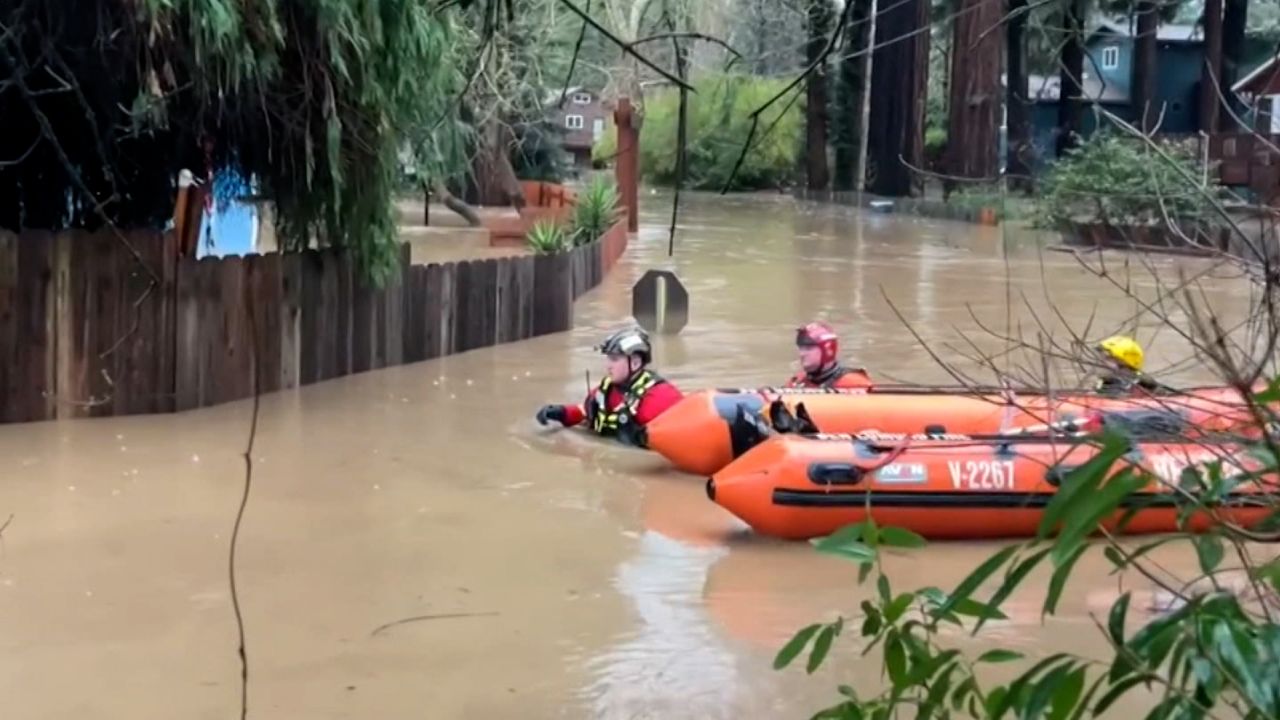
California has gone from extreme drought to extreme flooding in a matter of days, with 90% of the state’s population under a flood watch as another round of storms rolled through. The abrupt shift highlights the dilemma California faces: How do you manage an overwhelming amount of rain in a water-scarce state? And is it possible to harness that water so it’s available in the dry summer months?

Part of the solution, climate scientists told CNN, is drawing levees back to allow rivers more room to flood safely into surrounding land.

“We have to let our rivers flow differently, and let the rivers flood a little more and recharge our groundwater in wet seasons,” Peter Gleick, a climate scientist and co-founder of the Pacific Institute in Oakland, told CNN. “Instead of thinking we can control all floods, we have to learn to live with them.”

Levees have effectively protected communities in the past, Gleick said, but they’re not designed for the climate-change challenges of today.

“We need new thinking, we need to operate that infrastructure differently, we need to change some of the characteristics of that infrastructure,” Gleick said. “That will allow us to capture more of these flood flows, store it underground in these aquifers, and then use those ground water resources when we need them in dry years.”

Many climate experts agree – using levees to prevent floods during the wet season means less water is available to seep into underground aquifers. Those aquifers are a vital source of water for drinking, bathing and agriculture across California’s Central Valley, and they are running dry.

But giving rivers more space to flood has a catch. It means entire communities would need to relocate; the process is known as managed retreat.

Nicholas Pinter, a researcher and professor of applied geosciences at the University of California at Davis, acknowledged managed retreat is a tall task but noted other countries are doing it.

“We are behind the curve on this,” Pinter told CNN. “The Europeans in the 1990s started doing this. They made a multi-billion-euro investment to draw levees back.”

Pinter said the US has always leaned toward building infrastructure to provide protection.

“We have always had an engineering mentality with strong property rights,” Pinter said. “There’s also an intense resistance by property owners when it comes to giving up their property rights.”

There’s also the threat of pushback from political leaders worried about property tax revenue loss and the loss of land for building and development, Pinter said.

A concept like managed retreat requires a mentality shift that will be extremely difficult to achieve, Gleick said. “These changes are absolutely easier said than done but they have to be done.”

Both Pinter and Gleick said managed retreat is just one tool in the box when it comes to adapting to more extreme weather. Gleick noted there are a litany of other policies states should consider.

“We have to redesign insurance policies so that we are not rebuilding houses once they’ve been damaged in the same places where they are going to flood again, Gleick said. “We have to design flood insurance policies to encourage people to move away from flood plains, so we can open up those floodplains, so when we get those floods they will be less damaging.”

Cars and trucks get stuck in 3 feet of mud on California highway

California Highway Patrol in Moorpark released photos of vehicles — including a semi-truck – stuck in 3 feet of mudflow and rocks late Monday into early Tuesday.

The CHP noted that Highway 126 was completely closed.

Moorpark is northwest of Los Angeles.

Why atmospheric rivers can be so devastating

The system wreaking havoc in California is part of an atmospheric river – a long, narrow region in the atmosphere that can transport moisture thousands of miles, like a fire hose in the sky.

While they may not make headlines in the same way hurricanes do, they can have extreme consequences.

“Atmospheric rivers can span the whole Pacific. They are long and narrow, but they’re way larger than hurricanes,” according to Atmospheric River Reconnaissance Coordinator Anna Wilson.

They are crucial to the West Coast. Half the rain and snow the West gets comes from atmospheric rivers, which are plumes of moisture coming in from the Pacific Ocean. And they cross an area with very few observation sites, making them challenging to forecast.

Until the last few years, forecasters had to rely solely on satellites and forecast models for forecasting atmospheric rivers, which can become very muddy without truly knowing what’s happening inside the storms.

But now, the University of California-San Diego, the Scripps Institution of Oceanography, and the Center for Western Weather and Water Extremes have teamed up with the NOAA Hurricane Hunters who are able to drop instruments called “dropsondes” inside an atmospheric river, to relay pinpointed live weather data. The information is immediately put into weather forecast models, which improves the accuracy of the forecast dramatically.

Read more about the hurricane hunters targeting atmospheric rivers here.

A look at the stats and numbers behind the "most impressive storm in nearly 20 years"

The current atmospheric river-fueled storm hammering California is the most impressive storm in nearly 20 years, according to the National Weather Service in Los Angeles.

Many locations saw more than a month’s worth of rain in one day over the past 24 hours. Here’s what else to know:

  • Santa Barbara had the rainiest January day on record with 4.22 inches officially at the airport. This is more than a month’s worth of rain in one day. This was also the fourth rainiest day of all — in nearly 30,000 days of records going back to 1941.
  • San Louis Obispo had its wettest day on record, with 4.10 inches of rain totaled yesterday. 
  • Santa Maria recorded 3.42 inches of rain in one day, more than the January average of 2.74 inches. This is the third rainiest day in more than 100 years of records.
  • Bishop, California, set a daily record and a monthly record with 3.02 inches of rain. This also ranks as the fifth wettest day ever recorded at Bishop.

Some river rises and records:

  • The Ventura River, north of Venturarose 17 feet in 12 hours yesterday, reaching an all-time record crest more than 25 feet for the first time ever last night at 10 p.m. local time. Records on the river go back to at least 1938.
  • The Salinas River, near Salinas, is expected to crest more than 27 feet tomorrow afternoon, this would be the second highest crest in more than 90 years of records, behind only March of 1995. Before the atmospheric river events began in late December, the river was below 5 feet in elevation. 
  • The Santa Ynez River, near Lompoc, has risen 13 feet in less than 24 hours and is still rising. At 16.9 feet, it is at its highest level since 2005.

Storm causes sewer system overflow into the streets in parts of Santa Barbara

The storm system in California has led to the release of sewage in parts of Santa Barbara, according to officials.

“The storm caused flows through the sewer system to exceed capacity resulting in the release of sewage from the system to the street,” Santa Barbara County Supervising Environmental Health Specialist Jason Johnston told CNN Monday evening.

In response to the spill of untreated sewage, the county’s public health department issued a beach closure notice.

“The spill involved a release of at least 5,000 gallons of sewage to a storm drain discharging to Mission Creek, near Vernon Road and Serena Road in Santa Barbara. As a result, West Beach from Santa Barbara Harbor to 2,000 feet east of the eastern Mission Creek outfall has been closed to recreational water contact. The affected area has been posted with signs warning the public to avoid contact with the water until sample results indicate the water is safe for recreational use,” according to a news release from the Santa Barbara County Public Health Department.

The health department also asked residents to not contact the water as it could lead to various illnesses. 

“Storm water is untreated rain water that flows through the drain system into creeks, the ocean, and other waterways. Contact with storm water while swimming or surfing may increase the risk for certain types of illnesses such as rashes, fever, chills, ear infections, vomiting, and diarrhea,” the release said.

Here's what California can expect on Tuesday

As a powerful storm continues to batter California, here’s what the state can expect on Tuesday.

These storms are connected to the atmospheric river that has been pouring heavy rain, high winds and heavy snow across the area.

  • Flood watches remain for over 34 million people. 
  • Another round of moisture will begin to impact the Bay Area and northern California through Tuesday morning and spread to all of California by the afternoon/evening.
  • Expect more flash flood warnings and evacuation orders as saturated ground and heavy rains leads to more widespread problems.
  • There are now over 30 million people under a marginal threat of severe weather (level 1 of 5) across the Southwest on Tuesday. 
  • Cities like Los Angeles, San Diego, San Jose, Long Beach and Las Vegas are all in the threat of severe storms through the day.
  • Level 3 of 4 threat for flooding and excessive rain will be centered over the Los Angeles Basin.
  • Flash flooding is likely in many areas in and around Los Angeles through much of the day, tapering off in the late afternoon and evening.
  • The rest of the state continues to see more scattered showers and also thunderstorms, and the flood threat continues over much of the state along with heavy snow in the mountains.

These storms are connected to the atmospheric river that has been pouring heavy rain, high winds and heavy snow across the area.

One weather-related death confirmed in San Luis Obispo County, officials say

Authorities in San Luis Obispo County confirm there has been a weather-related death that occurred on Monday afternoon.

A motorist died in Avila Beach in San Luis Obispo County in what is being called a weather-related death, the San Luis Obispo County Sheriff’s Office told CNN Monday evening.

Separately, the severe weather has forced authorities to suspend the search for a missing 5-year-old who was reported to have been swept away in floodwaters near the Salinas River in San Miguel, according to the sheriff’s office. 

“At approximately three o’clock this afternoon (3 p.m. PT), the sheriff’s underwater search and rescue team — the dive team — discontinued the search for the 5-year-old missing child, because the weather had become too severe and it was not safe anymore for first responders to be conducting the search,” public information officer Tony Cipolla told CNN by phone.  

Cal Fire and sheriff’s deputies have been searching for the missing 5-year-old since around 8 a.m. PT Monday. 

“They suspended it for the time being and then with the hopes that they will be able to resume it at some point in the future — either tonight or tomorrow, weather permitting,” Cipolla said. 

At least 14 dead from storms that have swept California over past few weeks, governor says

Fourteen people have died in the series of storms causing widespread damage, flooding and evacuations while bringing record rainfalls to California over the past several weeks, according to the governor’s office.

“As of Monday afternoon, winter storms have claimed the lives of 14 Californians – more lives than wildfires in the past two years combined,” Gov. Gavin Newsom’s office said in a news release.

According to the National Weather Service, “the next in the seemingly never ending parade of strong wet Pacific systems pushes more heavy precipitation across all of California on Tuesday.”

Rainfall totals have reached more than a foot in some Southern California locations over the last 2 days

Heavy rainfall across Southern California since Sunday has tallied up over a foot in several locations, particularly along the Ventura and Santa Barbara County mountains.

A flood warning remains in place for western Los Angeles, San Luis Obispo, Santa Barbara and Ventura Counties until 8 a.m. PT, as more rain is expected Tuesday.

“Between 3 and 6 inches of rain have fallen across the coasts and coastal valleys with 6 to 12 inches and locally over 16 inches in the foothills and mountains,” the flood warning stated. “Additional rainfall of up to two inches will be possible, with locally higher amounts in thunderstorms.” 

Here are the highest two-day rainfall totals (in inches) as of midnight local Tuesday morning:

  • Nordhoff Ridge: 16.34
  • San Marcos Pass: 16.05
  • Matilija Dam: 16.01
  • White Ledge Peak: 15.12
  • Rose Valley: 14.13
  • KTYD Tower: 13.31
  • Alisal Reservoir: 13.18
  • El Deseo: 13.17
  • Tecolote Canyon: 12.84
  • Rose Valley RAWS: 12.42

Additional rainfall totals from the National Weather Service office in Los Angeles can be found here.

Over 30 million under flood watches as storm threat continues for Southwest

More than 34 million people were under flood watches early Tuesday after parts of the central California coast received 1 to 1.25 inches of rain per hour Monday, the Weather Prediction Center said.

As of late Monday, 2 to 7 inches of rain had fallen across lower elevations and up to 10 inches in the mountains over a 24-hours period, preliminary rainfall reports showed. Montecito received a whopping 9.89 inches over 24 hours, while Fillmore got 6.24 inches and Santa Barbara got 6.13 inches.

The threat isn’t over yet. The storm is trekking South, shifting the risk of mudslides, flooding and severe storms to the Los Angeles, San Diego, San Jose and Las Vegas areas on Tuesday.

More than 30 million people across the Southwest were under a marginal threat of severe weather Tuesday.

“Isolated strong to severe thunderstorms capable of producing damaging winds and perhaps a brief tornado may occur today across parts of southern/central California,” warns the Storm Prediction Center. “Thunderstorms capable of isolated severe gusts will also be possible across parts of southeast Nevada, northwest Arizona, and southwest Utah.”

In central California, heavy downpours unleashed significant flooding, mudslides and debris flows, prompting calls for residents to flee.

The entire community of Montecito in Santa Barbara County was ordered to evacuate Monday, along with residents in parts of Carpinteria, Summerland and the city of Santa Barbara.