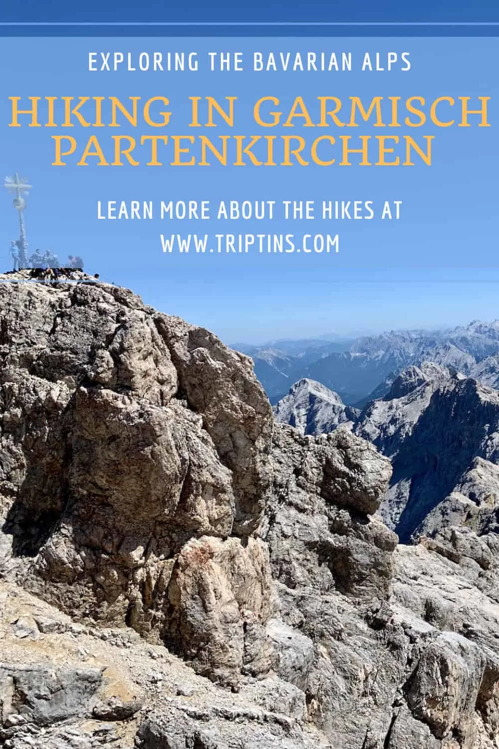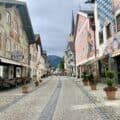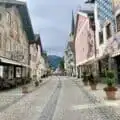

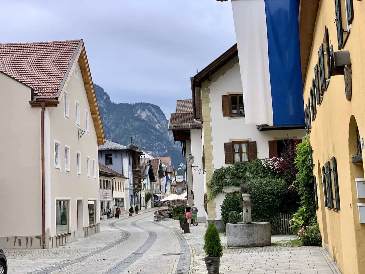
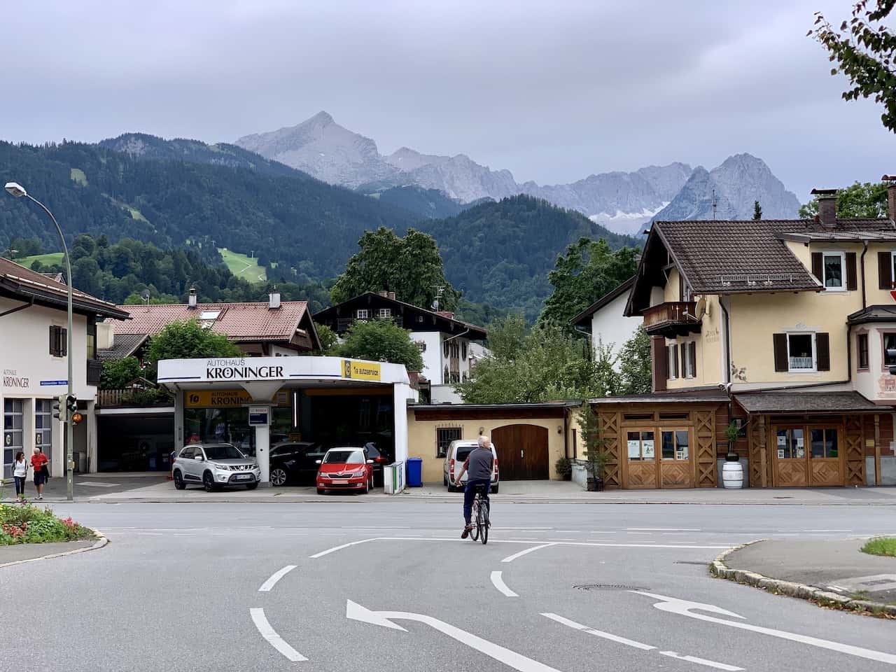
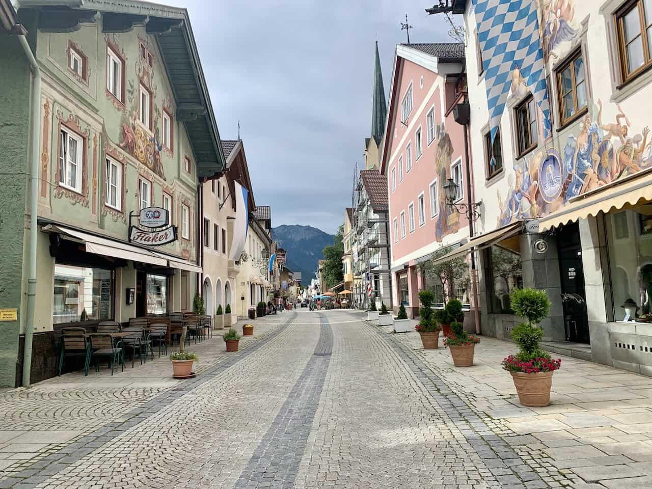
A trip to the Bavarian Alps is not complete without a stop in the town of Garmisch Partenkirchen (GP). Whether it is skiing in the winter or hiking in the summer, Garmisch is one of the best places to visit in the region.
For the purpose of this guide though, I will be talking through some of the top Garmisch Partenkirchen hiking trails to take part in during your time in Bavaria.
Mountains, gorges, lakes, rivers, and more can be enjoyed throughout the trails of GP. Learn more about what hiking options are out there and what to expect out on the trail.
* Affiliate Disclosure: This post may contain affiliate links, which means I may receive a commission if you make a purchase through the links provided, at no additional cost to you. Thanks for supporting the work I put into TripTins!
1) List of Garmisch Partenkirchen Hiking Trails
Throughout this overview, I will be talking through the following Garmisch Partenkirchen hiking trails. These trails offer a little bit of everything, whether that be easy day hikes or more difficult hike options. You should have no trouble finding something that works for you:
Partnach Gorge: this is the most famous of gorges in the area that also offers longer extended hiking options for those that want to make more a day out of it.
Hollental Gorge: another popular gorge that offers more of an overall hike, and the opportunity to head to a mountain hut at the end of the valley.
Osterfelderkopf to Hammersbach: take the cable car up to Alpspitze and then make the scenic descent into the valley, past the Hollental Gorge and to the town of Hammersbach.
Alpspitze Summit Hike Via Ferrata: for those that want a more unique experience, head on up the via ferrata that takes you to the true Alpspitze summit.
Zugspitze Hike: head on up to the highest peak of Germany over the course of 1-2 days and enjoy the some breathtaking views from the summit.
Lake Eibsee: take an easy stroll around the most beautiful lake in Garmsich Partenkirchen, with the mountainous landscape out back.
Hiking Resources & Checklist
Before heading out for the trails, be sure to read up on some of the hiking resources up on the site. These are here to better prepare you for all types of outdoor adventure.
- Gear: Hiking Packing List
- Weather: How to Prepare for Hiking Weather
- Navigation: Hiking GPS & Navigation
- Tips: 20+ Hiking Tips & Tricks for the Trail
- Accommodation: Book Your Hotel Today
- Rental Car: Book Your Car Rental Today
2) Garmisch Partenkirchen Hiking Map
The below map shows the routes in different colors with the starting and ending points pinpointed. Note that the routes are not exact here – they are drawn out to give you a high-level idea of what the route entails.
- Partnach Gorge (Blue)
- Hollental Gorge (Red)
- Osterfelderkopf to Hammersbach (Green)
- Alspitze Summit Hike Via Ferrata (Purple)
- Zugspitze Hike (Black
- Lake Eibsee (Orange)
3) Where to Stay
The town of Garmisch Partenkirchen is full of hotels and guesthouses that are frequented both in the winter months for skiing and the summer months for hiking.
Below are some highly rated options that you can choose from when taking part of hiking trails around the area:
- Luxury: Obermühle 4*S Boutique Resort | Hotel Zugspitze
- Mid Range: Hotel Vier Jahreszeiten | Biohotel Garmischer Hof
- Budget: Hostel der Athleten | moun10 Jugendherberge
Learn More: Take part of some Garmisch Partenkirchen hikes as part of a longer Bavaria Itinerary and be sure to check out some of the other best things to do in Garmisch Partenkirchen

4) Weather Tips
Before diving into the best hikes in Garmisch, I did want to mention a few helpful weather tips to take into consideration.
Conditions: the weather conditions in the alps can really be all over the place. Sometimes there may be bluebird skies while at other moments it can be snowing (yes even in the summer!). Come prepared with the idea that you may need to be flexible with your time in Garmisch based on the weather.
Forecasts: my recommendation would be to look at weather forecasts using mountain-forecast and Meteoblue. These are known to be more accurate forecasting sites when it comes to mountain weather. Also note that the weather up on summits may be different than the weather down below!
Layers: come prepared with the appropriate layers when hiking in the area. These should include a short/long sleeve shirt, sweater, puff jacket, and rain jacket. This hiking packing list can help you out a bit more.
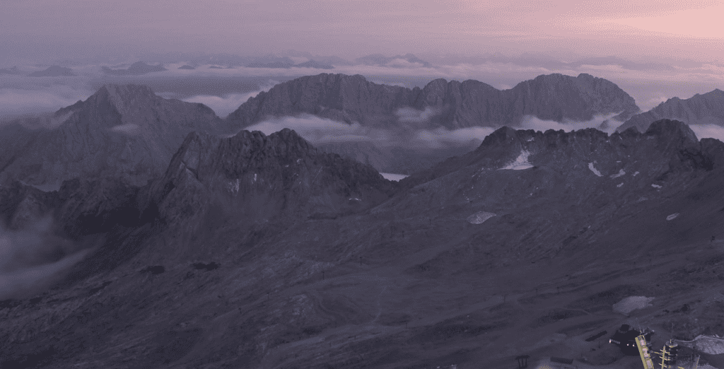
Webcams: utilize the webcams around Garmisch to get a better sense of what the weather is like at higher altitudes. While it may be nice and sunny down in the gorges and by the lakes, the mountains may be covered in clouds.
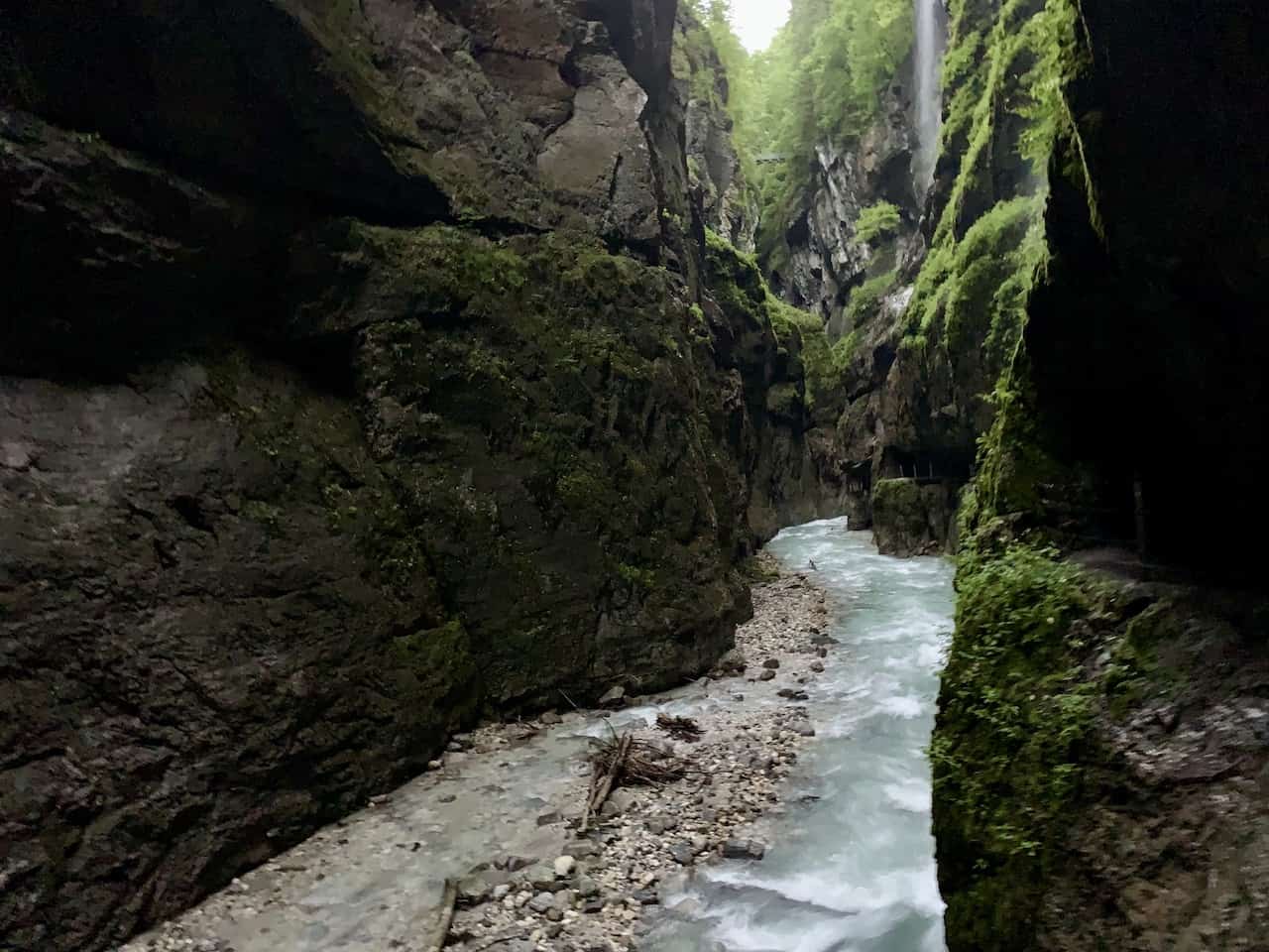
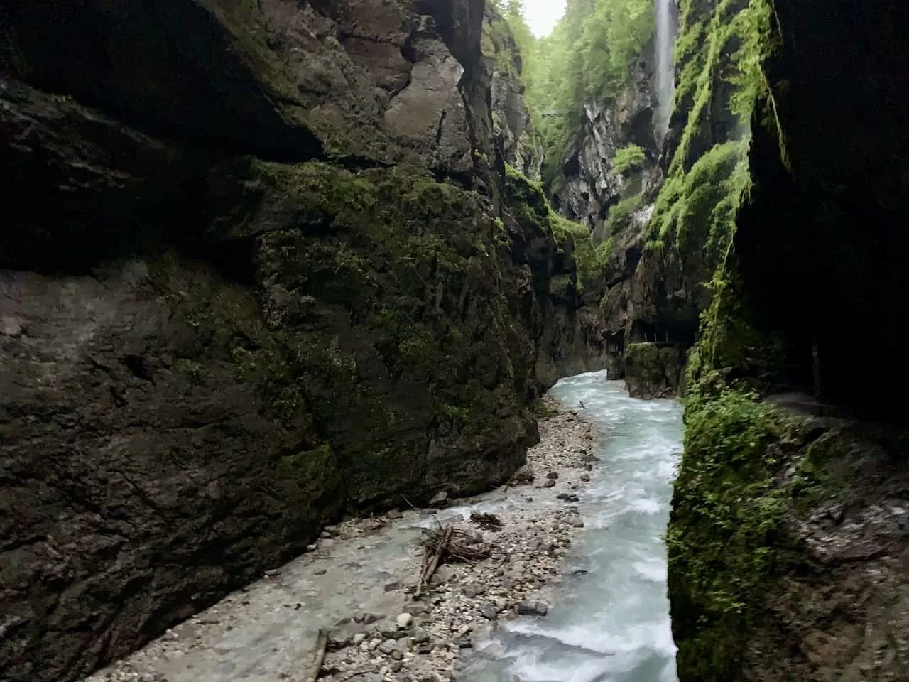
5) Partnach Gorge / Partnachklamm
- Starting & Ending Point: Olympic Ski Jump Parking Lot
- Trail Length: 3 miles / 5 km
- Duration: 1.5 Hours
- Elevation Gain: ~Flat
- Learn More: Partnach Gorge
The Partnach Gorge (also called the Partnachklamm Gorge) is a stunning 700 meter gorge located just outside of GP. Depending on where you are staying in town, you can either walk over to the entrance, drive your car, or take one of the local buses.
The gorge is located around 20 minutes by foot along a paved pathway from the Olympic Stadium Ski Jump parking lot. Once you reach the entrance of the gorge, you will need to pay a small entrance fee to continue into the gorge itself.
It is then around 700 meters of walking between the massive gorge walls with the turquoise waters rushing down below. Within the gorge, there is a walkway that has been built into the walls, allowing visitors to immerse themselves in the Partnach Gorge.
Once you reach the end point of the gorge, you can just turn around the same way you came to experience the gorge once more. Overall, this will be one of the easier hikes in the area, and one that you should be able to fit in at one point or another during your time in GP.
Note: this is the same trail that continues onwards to the Zugspitze summit (more on that soon!)
While the round trip hike from the parking lot to the end of the gorge and back is around 3 miles / 5 km, it is also possible to continue the pathway further up the river and into the mountainside.
If you are interested in making this a longer hike, then these would be your main options:
Hike to Graseck: This is the shortest alternative option. After making it through the gorge, make the walk up to Graseck, which is just about 0.7 miles / 1.1 km away. Once there, you will see the Graseckbahn, a small cable car that quickly takes you back down just past the Partnach entrance. It is then another 15 minutes following the same path back to the parking lot.
Hike to Eckbauer: Another cable car option is the Eckbauerbahn. But to get there, you must make the 2.2 mile / 3.5 km uphill climb from the gorge’s exit, past Graseck, and onto Eckbauer. After getting yourself up, you can enjoy a nice meal or drink at the Berggasthof Eckbauer before taking the cable car straight back down to the Olympic Ski Jump parking lot.
Hike Back via Eckbauer: Now, instead of taking the cable car down from Eckbauer, you can also hike down to the parking lot. Altogether, from the gorge’s exit expect a 4.3 mile / 7.0 km hike that heads up to the high point around Eckbauer, and then back down to the parking lot.
Hike Back via Wamberg: For those looking for an even longer hiking experience, you can also hike back via Wamberg. The trail is essentially an extension of the prior route mentioned. Instead of following the trail down from Eckbauer, you can make a longer loop that includes Wamberg. The hike from the exit of the gorge comes in at 5.5 miles / 8.8 km.
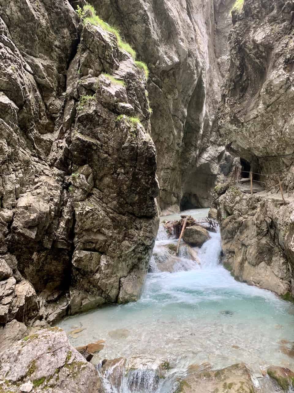
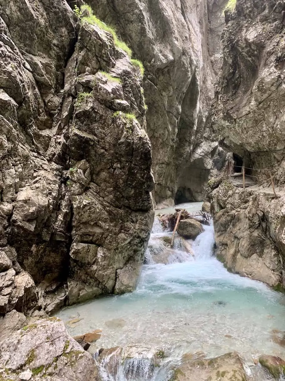
6) Hollental Gorge / Höllentalklamm
- Starting & Ending Point: Hammersbach Village
- Trail Length: 5.1 miles / 8.2 km
- Duration: 3 Hours
- Elevation Gain: +1,667 feet / +508 meters
- Learn More: Hollental Gorge
Once you reach the village of Hammersbach either by car, train, or bus, you will see some of the hiking signs pointing you towards the gorge. Similar to Partnach, the first step is getting to the entrance of the gorge.
This is actually going to be a longer and more strenuous part of the hike, as you gain elevation through the forest. It is around 1.7 miles / 2.8 km to the entrance of the gorge from Hammersbach.
Once you reach the entrance booth, you will pay a small fee and continue alongside the flowing river.
The gorge portion of the trail is around 0.6 miles / 1 km long. Here you will find a boardwalk, small bridges, and a pathway etched into the gorge walls.
It is just a beautiful hike to enjoy as you have the turquoise waters rushing through down below and the narrow gorge walls on either side.
Once you are through the gorge, the trail opens up a bit more and you can follow it for a little while longer. It actually continues towards the Hollentalangerhutte, which is another 30 minutes further up the valley (not included in the totals mentioned above).
Feel free to continue onwards if you would like to reach the hut, before turning back around, walking back through the gorge, and then onto Hammersbach.
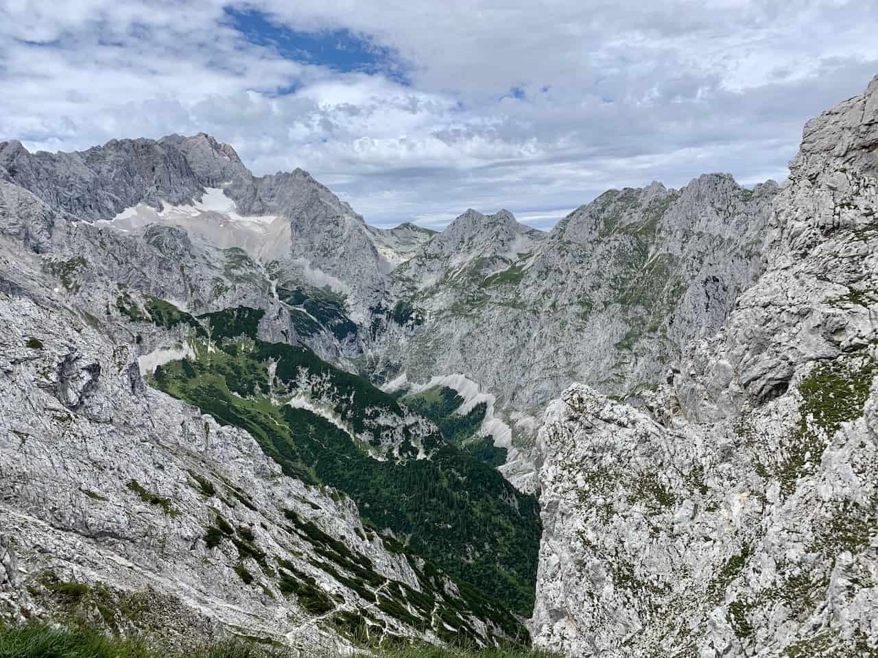
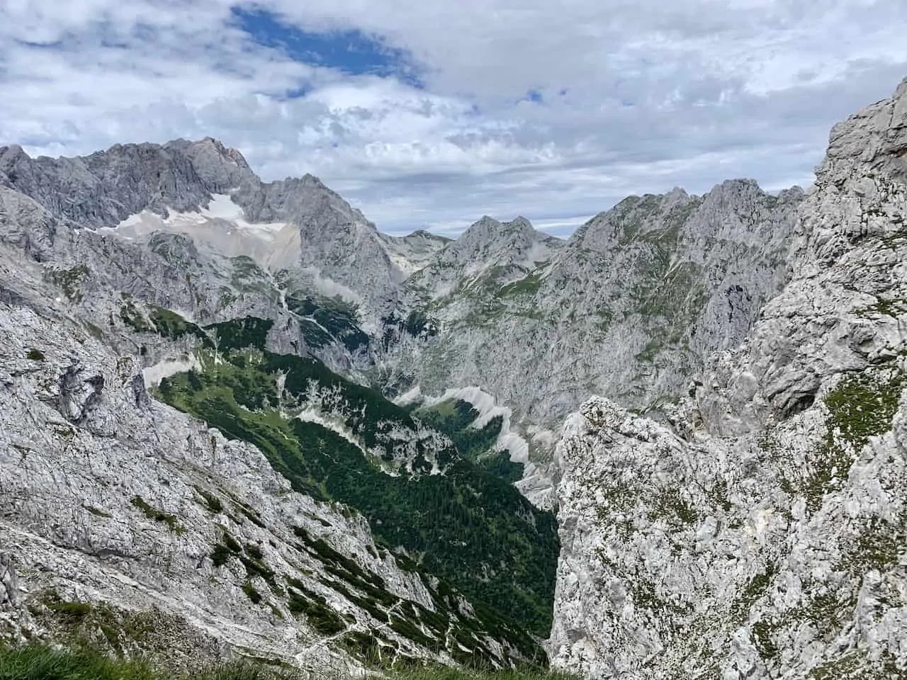
7) Osterfelderkopf to Hammersbach
- Starting Point: Osterfelderkopf
- Ending Point: Hammersbach Village
- Trail Length: 6.0 miles / 9.6 km
- Duration: 4 Hours
- Elevation Gain: +1,247 feet / +380 meters
- Learn More: Alpspitze Hiking
This is one hike that starts and ends in two different locations. You will first need to make your way to the bottom of the Alpspitzbahn cable car station. From there, take the cable car up to the top, where the hike begins.
This route starts at the top of the Alpspitzbahn cable car station at Osterfelderkopf (the name of the peak where the cable car is located). From there, the hike wraps around and heads down to the Hollental Valley.
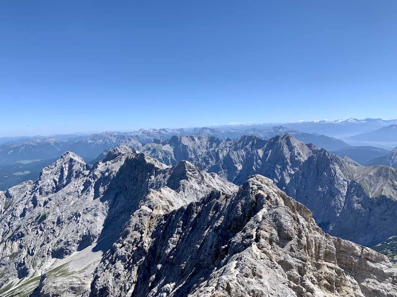
The hike down from Osterfelderkopf is one of the more scenic landscapes to enjoy in the region, as you get views of the surrounding mountains (including Zugspitze), and the valley walls all around.
The trail then reaches the valley floor, where you will be welcomed to the Hollentalangerhutte, where you can enjoy a nice break.
From there the trail follows the Hollental Gorge trail that we just talked through. You will have the chance to walk all along the winding turquoise waters, through the gorge walls, and then down to Hammersbach.
Once in Hammersbach, you can then walk along the road for another 20 minutes or so back to the Alpspitzbahn parking lot.
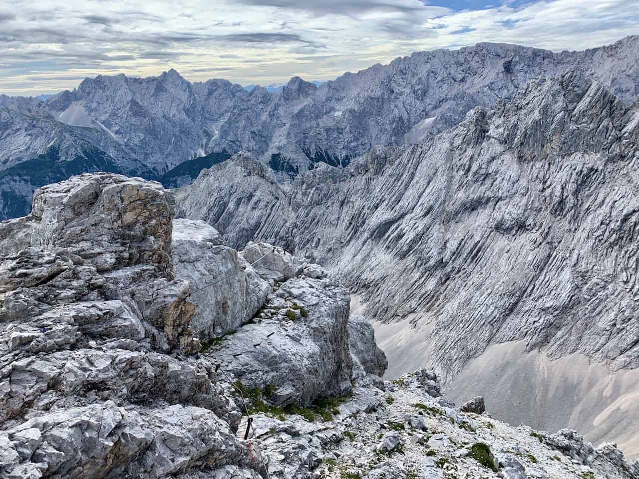
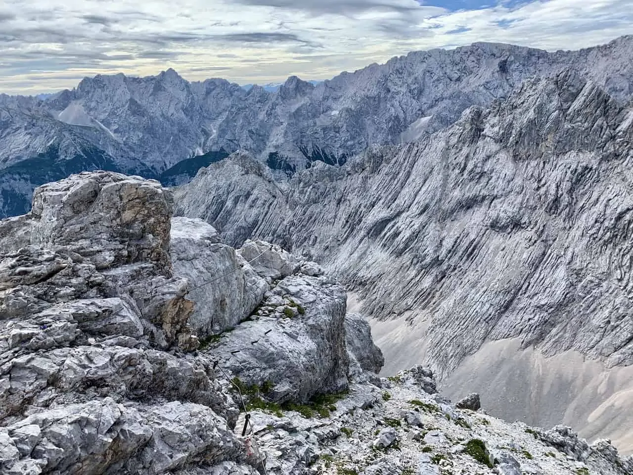
8) Alpspitze Summit Hike Via Ferrata
- Starting & Ending Point: Osterfelderkopf
- Trail Length: Via Ferrata + 1.6 miles / 2.5 km of hiking
- Duration: 4 Hours
- Elevation Gain: Via Ferrata Route
- Learn More: Alpspitze Via Ferrata
The hike to the true summit of Alpspitze is going to be a bit different than the other hikes on this list. That is because to reach the summit, you must climb a Via Ferrata route.
Essentially, a via ferrata is a route with fixed lines built into the mountainside. To safely take part in the climb, you must have via ferrata gear to clip yourself in and out of the fixed lines.
The route begins at the top of the Alpspitzbahn cable car. From there it is a nice easy 20 minute walk to the base of the via ferrata. Once you reach the fixed lines, put on your gear and get ready to climb.
You will see that the overall length of the hike is not that long, but the duration is on the longer side. That is because you will be moving much more slowly on the via ferrata section than on a normal hiking trail.
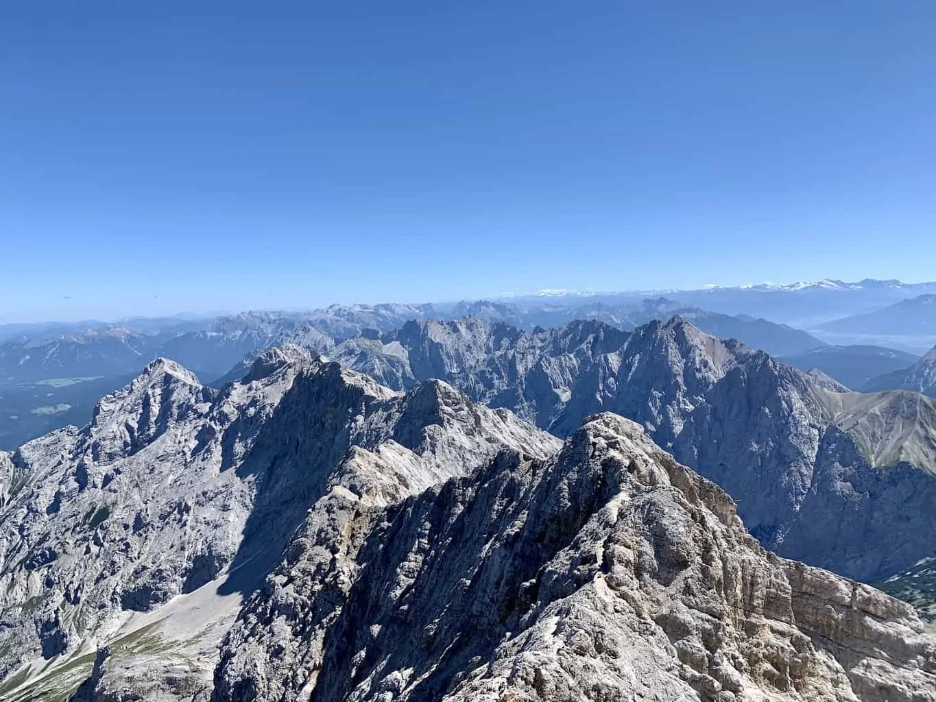
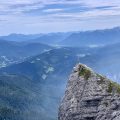
After a couple of hours of climbing the class B ferrata, you will reach the summit of Alpspitze. From here you can enjoy the views of all the surrounding mountains and valleys all around.
It is then following the hiking path on the other side of the peak (Nordwandsteig trail), which wraps its way down and around the mountain back to the top of the cable car station.
So, essentially what you have here is a via ferrata up to the summit + hike back down to the starting point, to complete the route to the Alpspitze summit.
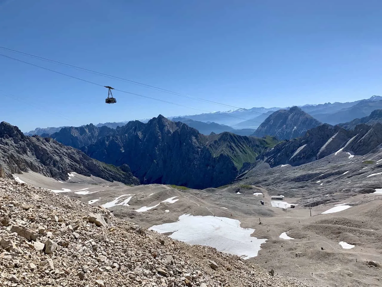
9) Zugspitze Hike
- Starting Point: Olympic Ski Jump Parking Lot
- Ending Point: Zugspitze Summit
- Trail Length: 12.5 miles / 20 km
- Duration: 8-10 Hours
- Elevation Gain: +7,448 Feet / +2,270 Meters
- Learn More: Zugspitze Hike
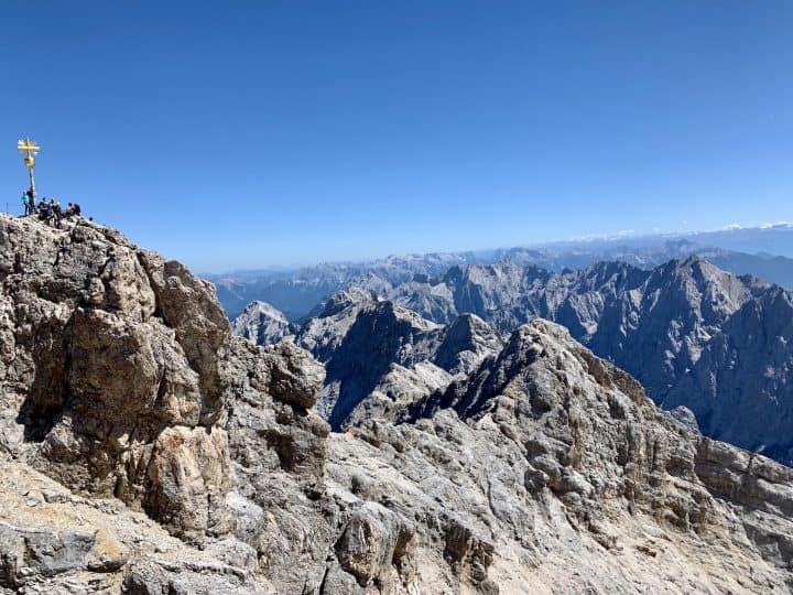
Last but not least, we have the tallest mountain in all of Germany – Zugspitze. This is a hike that should only be attempted by those with the appropriate fitness level. It is a route that can be completed in one day or 2 days if necessary (there are 2 mountain huts on the trail).
While there are a few different routes up to the summit, one of the most common is the route through the Reintal Valley.
The trail actually starts at the Olympic Ski Jump parking lot and makes its way through the Partnach Gorge before continuing on through the valley and to the summit.
If you are thinking about completing the hike in one day, then you must start quite early as it will take around 8 hours to summit.
If you want to split the hike into two days, then you will need to reserve a spot at one of the mountain huts along the way.
While it is one of the tougher hikes out there, it is also one of the most rewarding. There are just stunning views all the way through. From the river and the forest to the mountains and the glaciers, Zugspitze will have it all.
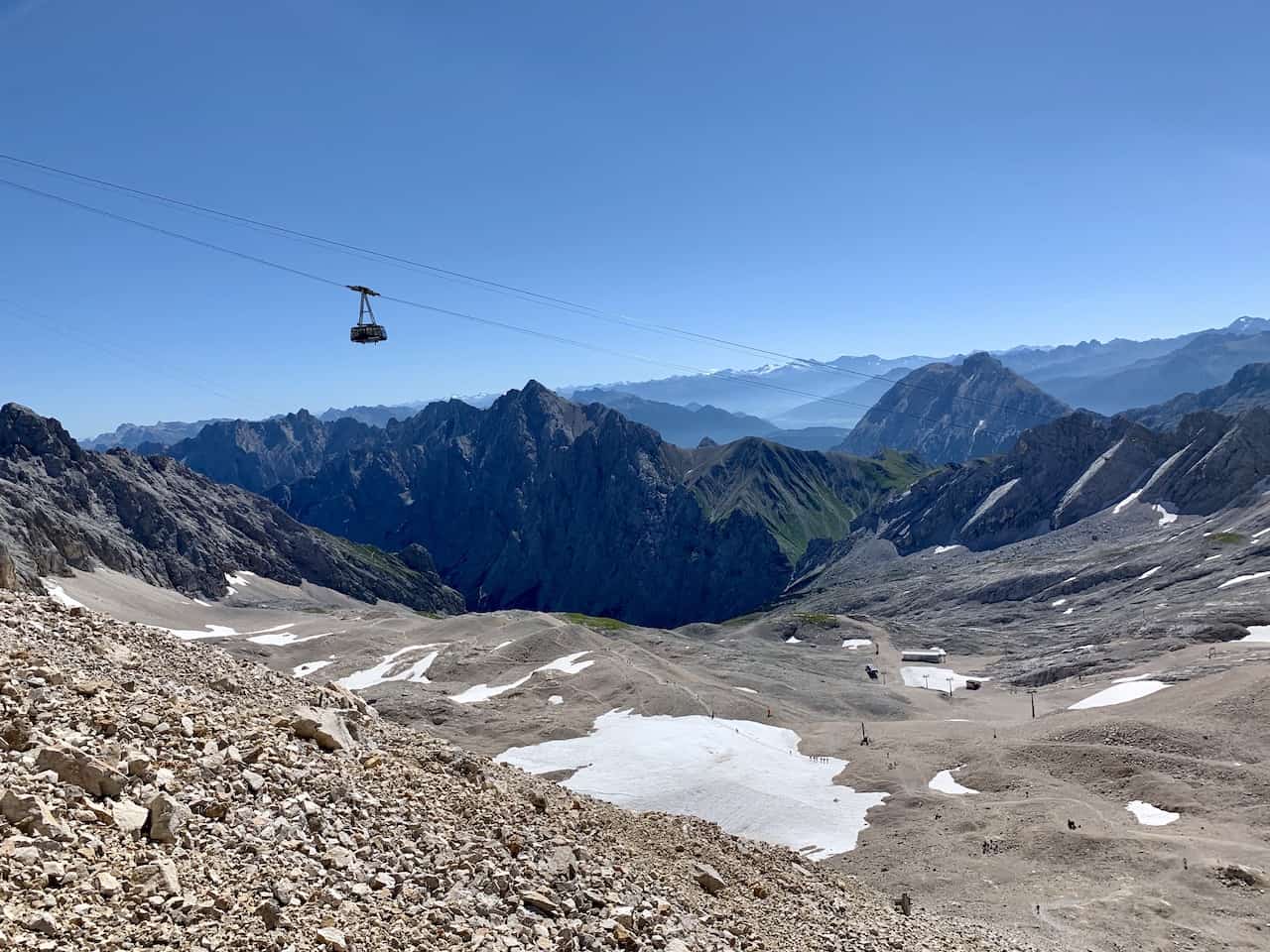
Once you reach the top, you will be welcomed by hundreds of other tourists. Not because they summited the mountain though! It is because there is a cable car that takes people right up top. You must weave your way through the crowd and climb the last few steps to the real summit.
After enjoying some time up top, you can then take the cable car back down to the mountain (10 hours up hiking and just 10 minutes down by cable car!).
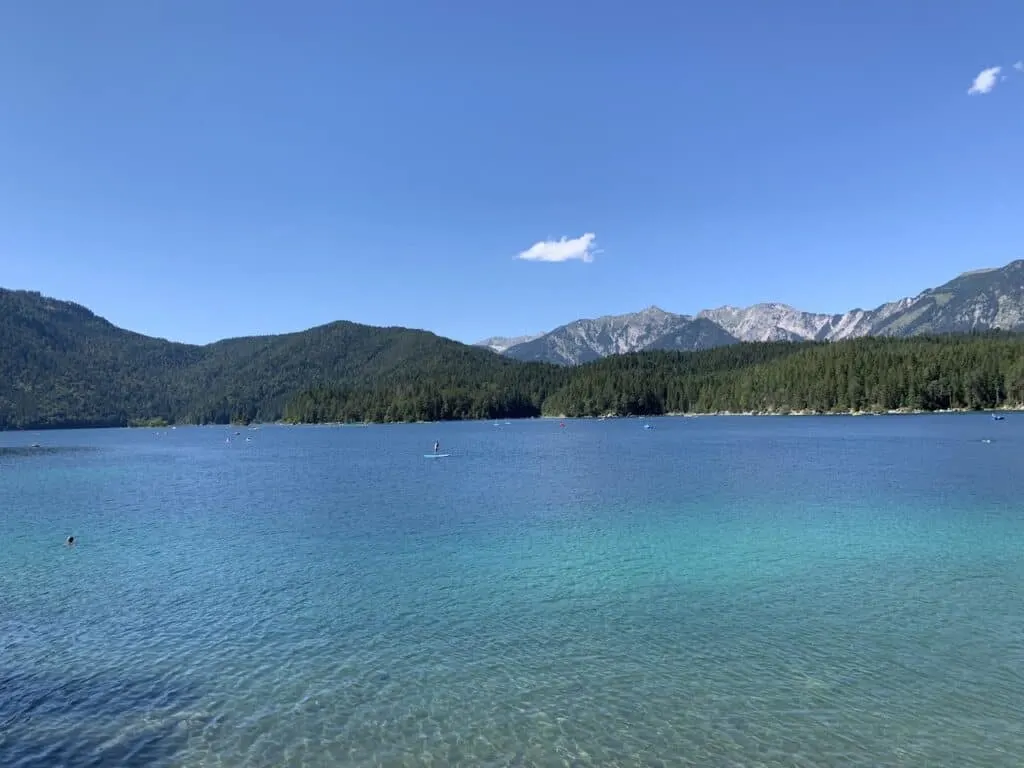
At the bottom, you can head to Eibsee Lake to cool down for a bit, before jumping on the bus or railway back to Garmisch Partenkirchen.

10) Lake Eibsee
- Starting & Ending Point: Eibsee Hotel
- Trail Length: 4.5 miles / 7.2 km
- Duration: 2-3 Hours
- Elevation Gain: +700 Feet / +213 Meters
One of the best easy hikes in Garmisch Partenkirchen that is great for the whole family is the Lake Eibsee loop trail. The trail begins right nearby the Eibsee Hotel, before circumnavigating the lake.
Throughout a hike along the lakeside, you will be able to enjoy Eibsee from all different angles. At some points you will be right next to the lake, where you will have the chance to jump into the water. At other points you may be a bit set back from the lake and take in a wider panorama.
On the north side of the lake, you will have the perfect place to enjoy the mountainous landscapes out back (including Zugspitze) with the lake in the foreground. For those that don’t want to take part of the whole loop, I would definitely recommend at least making it this far just for this beautiful view.
Once wrapped up with the loop, you can spend some time at one of the restaurants by the lakeside, and enjoy a nice meal with a view.

11) How to Get There
Depending on where else you plan to visit during a trip to Bavaria and the surrounding regions, will dictate how you will get to GP. There are a few ways to go about a trip though:
Rental Car
I found it easiest to travel the region by renting a car. During my time in the area I was traveling throughout Austrian Alps and Germany, and having a car gave me the most flexibility. I was able to be on my own schedule, get myself to trailheads with no issues, and not need to worry about public transport.
By doing so, it is also possible to take a day trip to Garmisch depending on where you are coming from.
Book a Car: When it comes to renting a car around Germany, I would recommend checking out Rentalcars.com for potential options.
Train
GP is home to a well-connected train station, so you can make your way there if coming from other places within Germany (i.e. Munich) or Austria (i.e. Innsbruck).
Those two cities mentioned are also home to the closest airports. So, if flying into either, you should be able to grab a train connection into Garmisch.
Bus
Lastly, you can take intercity busses that head in and out of GP. This will depend on season and where you plan to base yourself before/after your time in GP.

12) How to Get Around
Once you are in Garmisch Partenkirchen, you will need to make your way around. While today it is considered one town, it is actually split into two separate areas (Garmisch and Parternkirchen).
So while you can walk between the two, sometimes it may be easier to drive/take local transport.
For the most part though, if looking to head to the hiking trails, you will need to make your way by some sort of transport to get you there.
If you have your own rental car, there shouldn’t be much of a worry here. Simply, head to parking lots and trailheads using your car.
On the other hand, there are two main ways to make your way around GP and the surrounding area:
Local Bus
there are several bus lines that run throughout Garmisch and its surrounding towns.
These buses travel frequently during peak season and make it as far as the Eibsee/Zugspitze area. I found Google Maps to be pretty accurate when I was making my way around, but feel free to take a look at the GP bus map.
Note: most hotels (if not all), should be able to give you a free bus pass that includes many of the routes. Feel free to speak with your hotel directly about this.
Zugspitzbahn Local Railway
Another way to get yourself towards the Zugspitze area is by hopping on the Zugspitzbahn.
The route goes between Garmisch Partenkirchen and up to Zugspitzplatt (just below the Zugspitze mountain summit). But the railway also makes stops along the way at the base of Alpspitze, and Zugspitze/Lake Eibsee.

These unique Garmisch Partenkirchen hiking experiences are sure to be top highlights during your time in the area.
If you want to learn more about each one I would highly recommend you check out the guides that were linked throughout this post.
If you have any additional questions or comments, feel free to add them below. Also, don’t forget to check out the other Germany itineraries and guides on the site for more of the best things to do in the region.
Have fun out there and safe travels!