Hurricane Irma: Visual guide
- Published
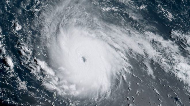
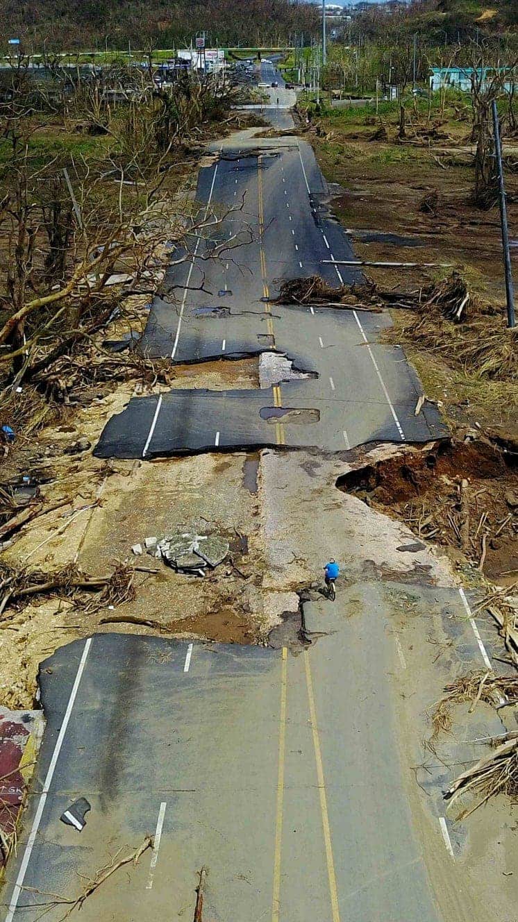
The most powerful Atlantic storm in a decade has caused widespread destruction across the Caribbean and the southern US, leaving 55 people dead. Irma, at times a category five hurricane, packed winds of up to 295km/h (185mph).


The storm cut a devastating trail across Caribbean countries and territories before moving up through the US states of Florida, Georgia and South Carolina, weakening into a tropical depression.
An estimated 1.2 million people have been affected.
Irma broke weather records
At its peak, Irma was a category five storm with winds topping 295km/h (185mph). According to Phil Klotzbach, research scientist at Colorado State University's Department of Atmospheric Science, external, Irma's top wind speeds were tied with the second-strongest maximum winds of all time for an Atlantic hurricane. Irma matches a 1935 storm in the Florida Keys, Hurricane Gilbert in 1988 and Wilma in 2005.
Only one hurricane, Allen in 1980, has recorded stronger winds, at 190 mph, he said.
However, Irma broke Allen's record for sustained winds. It maintained maximum wind speeds of 295km/h for longer than any other Atlantic Hurricane.
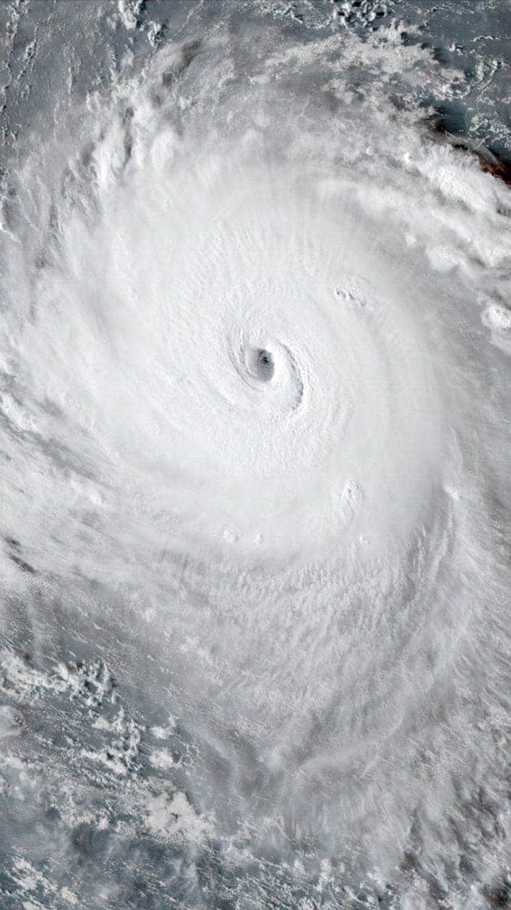
NOAA satellite images of Hurricane Irma
Irma grew in strength over a few days
The remnants of Hurricane Harvey, which hit in late August, could still be seen by satellite when Irma made its way across the Atlantic towards the Caribbean.
Irma and remnants of Hurricane Harvey, 2 September

Irma was just a category two storm on 2 September, but soon became category three.
Irma grew stronger quickly because of a combination of very warm water, high levels of mid-level relative humidity, and vertical wind conditions, meteorologists say.
Between 2 and 5 September, Irma strengthened from a category three to a category five storm, the highest possible level.
By 7 September, Irma was being followed by storm Jose, which was also upgraded to hurricane status.
Also present was Storm Katia in the Gulf of Mexico, which became a hurricane before it hit the Mexican state of Veracruz. Two people died in a mudslide caused by the extreme weather.
Katia, Irma and Jose, 7 September

Irma's clouds were very, very cold
Infrared data from the Nasa-National Oceanic and Atmospheric Administration's Suomi NPP satellite on 7 September, external revealed very cold, very high, powerful thunderstorms stretching around Irma's northern, eastern and southern sides.
Storms with cloud tops reaching very low temperatures have the capability to generate "very heavy rainfall", according to Nasa.
Infrared image of Irma, 7 September

Cloud-top temperatures at the centre of the storm were as cold as 190 Kelvin (minus 83.1C/117.7F), Nasa said.
Irma generated vast amounts of rain
The eye of the storm measured about 35 miles across and generated "extreme rainfall".
Nasa rainfall analysis of Irma's eye, 5 September

.
Nasa's rainfall analysis showed rain falling at a rate of more than 274mm (10.8in) per hour on 5 September in the solid ring of storms within Irma's eye.
The powerful storms rotating around the eye were really tall, reaching altitudes greater than 12.5km (7.75 miles).
But the tallest thunderstorms were found south west of Irma's eye, reaching heights of more than 16.2km (10 miles), Nasa said.
Sea temperatures contributed to Irma's power
Warm oceans, along with wind speed and direction, are the two key ingredients that fuel and sustain hurricanes.
As Irma approached Florida, it passed over waters that are warmer than 30C (86F) - hot enough to sustain a category five storm, according to Nasa scientists. , external
Atlantic Ocean, Caribbean Sea, and Gulf of Mexico temperatures

The green line on the map tracks Irma's path between 3 and 6 September.
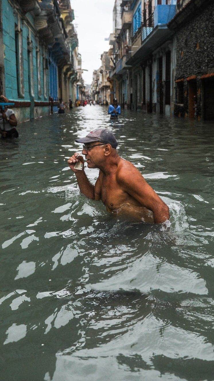
Understanding the impact
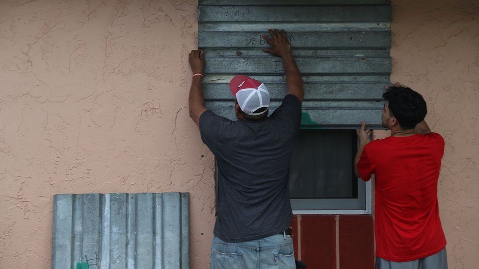
Hurricane Irma has hit many of the Caribbean's islands, and made landfall in Florida on Sunday.
Places hit:
Antigua and Barbuda
St Martin
St Barts (Saint Barthélemy)
Anguilla
British Virgin Islands
Puerto Rico
Dominican Republic
Haiti
Turks and Caicos
Cuba
Bahamas
Florida

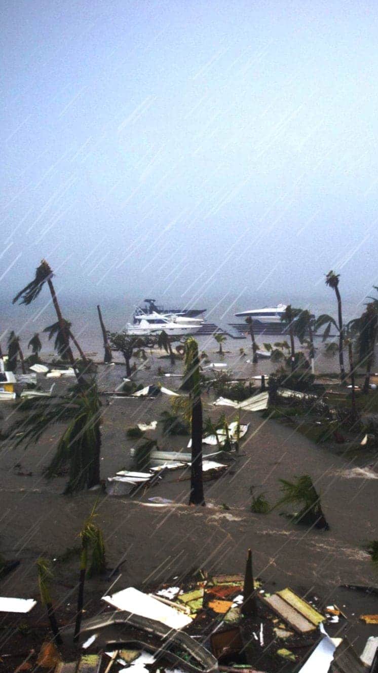
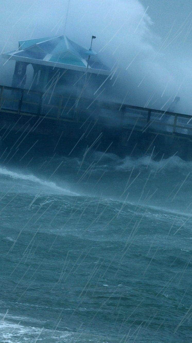
Storm surges
Huge volumes of water are pushed by hurricane-force winds. When they meet land, the water surges inshore at levels far exceeding normal tides.
Storm surges were caused across the south of Florida.

Hurricanes
A guide to the world's deadliest storms
Hurricanes are violent storms that can bring devastation to coastal areas, threatening lives, homes and businesses.

Hurricanes develop from thunderstorms, fuelled by warm, moist air as they cross sub-tropical waters.
Warm air rises into the storm.
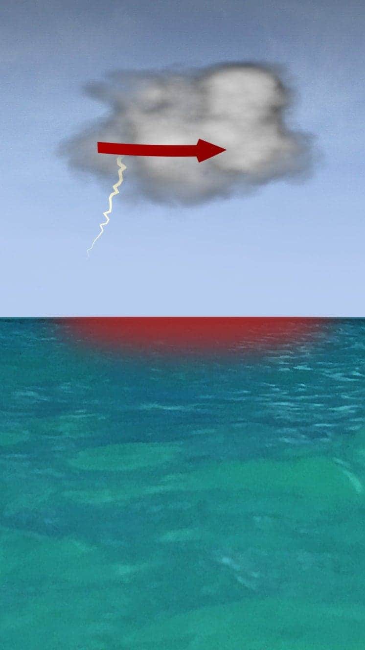
Air swirls in to fill the low pressure in the storm, sucking air in and upwards, reinforcing the low pressure.
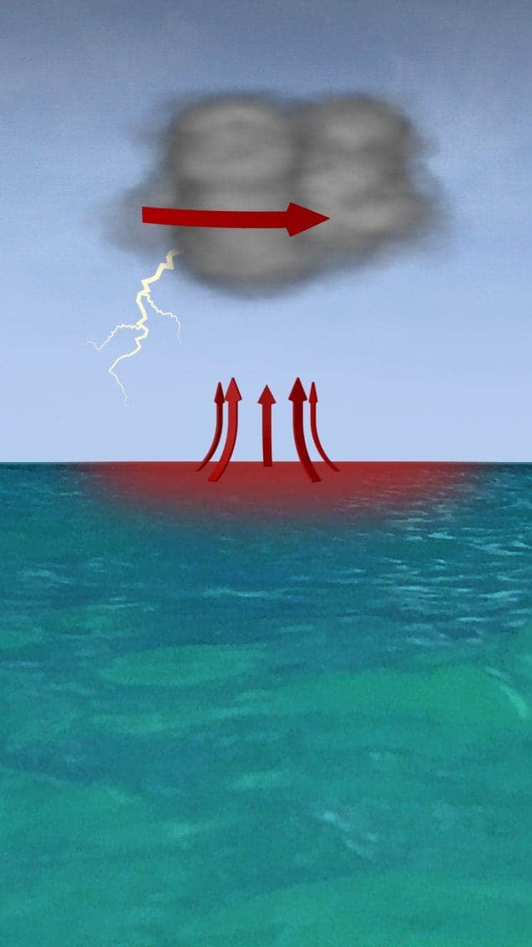
The storm rotates due to the spin of the earth and energy from the warm ocean increases wind speeds as it builds.
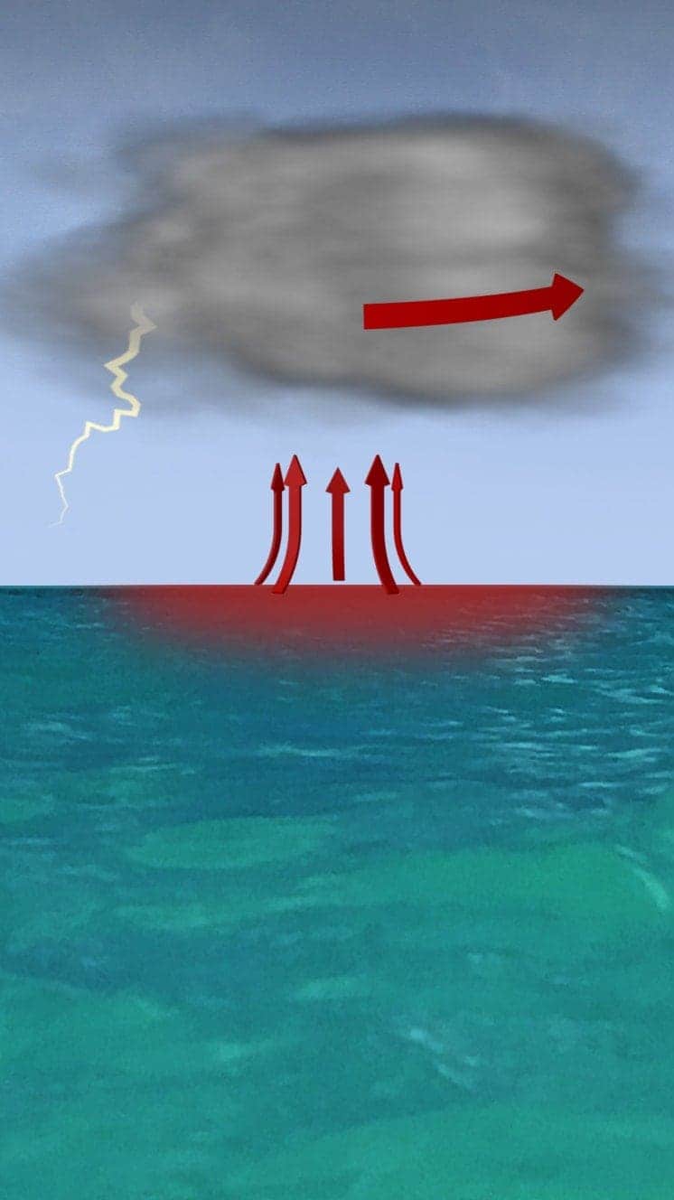
When winds reach 119km/h (74mph), it is known as a hurricane - in the Atlantic and Eastern Pacific - or a typhoon in the Western Pacific.

"Everybody has a plan until they get punched in the face. Well, we're about to get punched in the face."
Florida Mayor Bob Buckhorn, ahead of Hurricane Irma (2017)
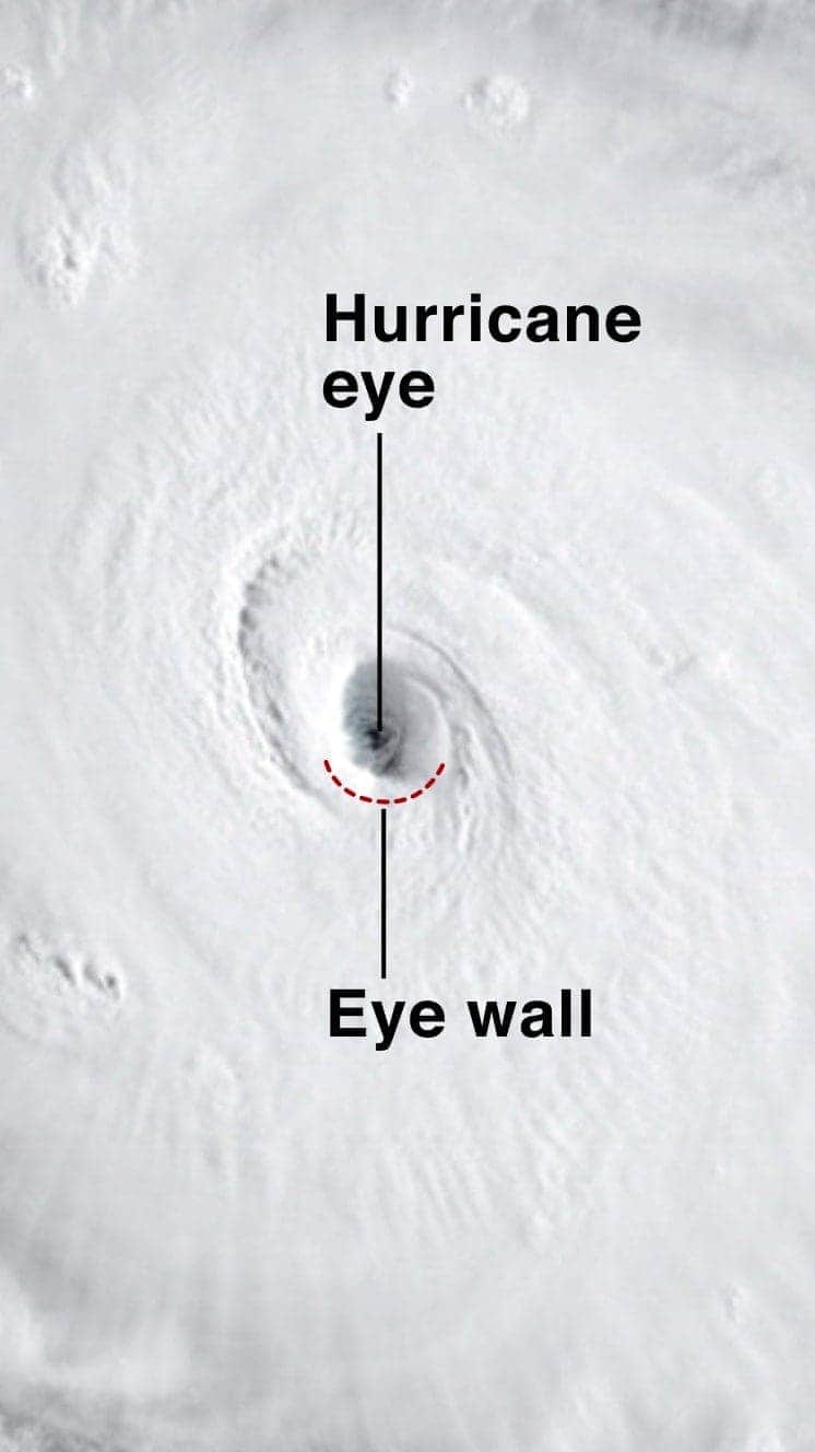
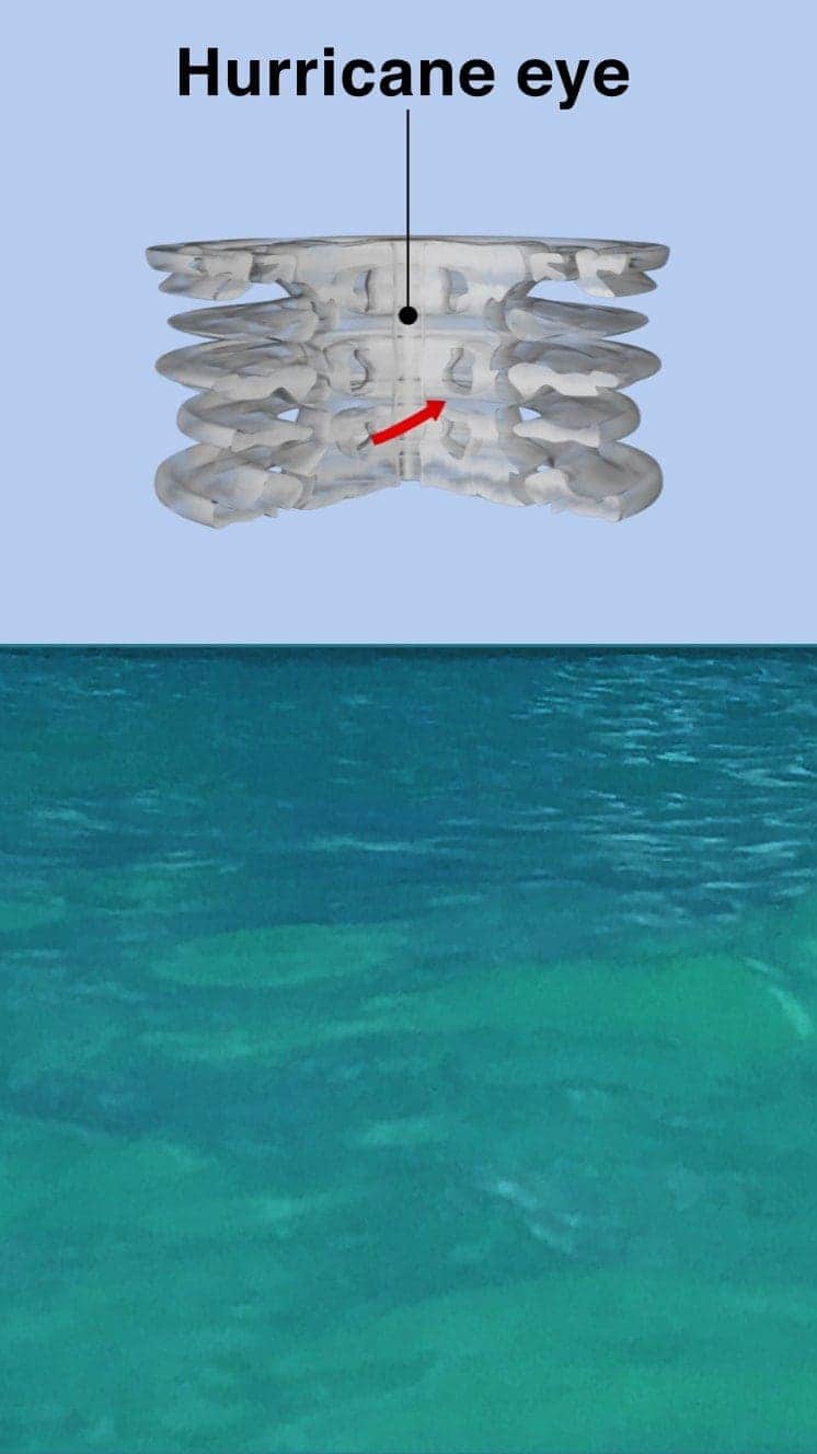
The central eye of calmer weather is surrounded by a wall of rainstorms.
This eyewall has the fastest winds below it and violent currents of air rising through it.
A mound of water piles up below the eye which is unleashed as the storm reaches land.
These storm surges can cause more damage from flooding than the winds.
"Urgent warning about the rapid rise of water on the SW FL coast with the passage of #Irma's eye. MOVE AWAY FROM THE WATER!"
Tweet from the National Hurricane Center
The size of hurricanes is mainly measured by the Saffir-Simpson scale - other scales are used in Asia Pacific and Australia.
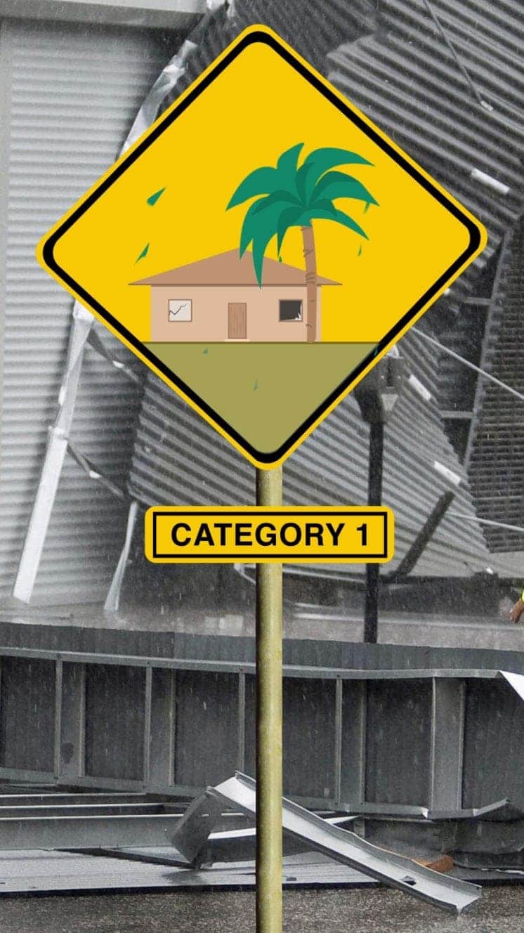
Winds 119-153km/h
Some minor flooding, little structural damage.
Storm surge +1.2m-1.5m
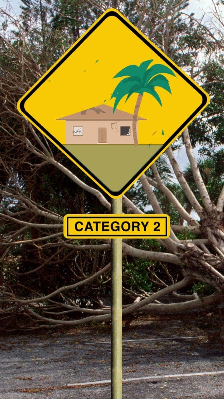
Winds 154-177km/h
Roofs and trees could be damaged.
Storm surge +1.8m-2.4m
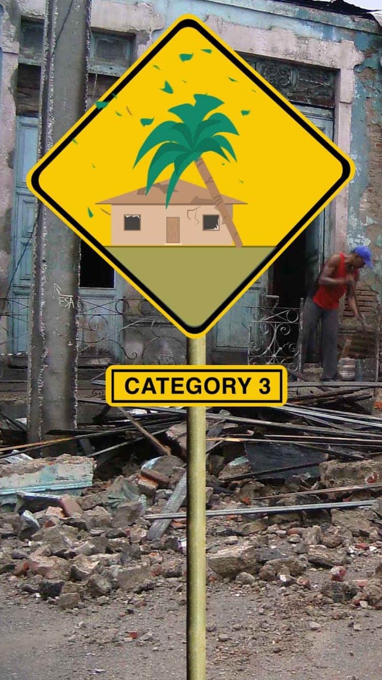
Winds 178-208km/h
Houses suffer damage, severe flooding
Storm surge +2.7m-3.7m
Hurricane Sandy (2012) caused $71bn damage in the Caribbean and New York
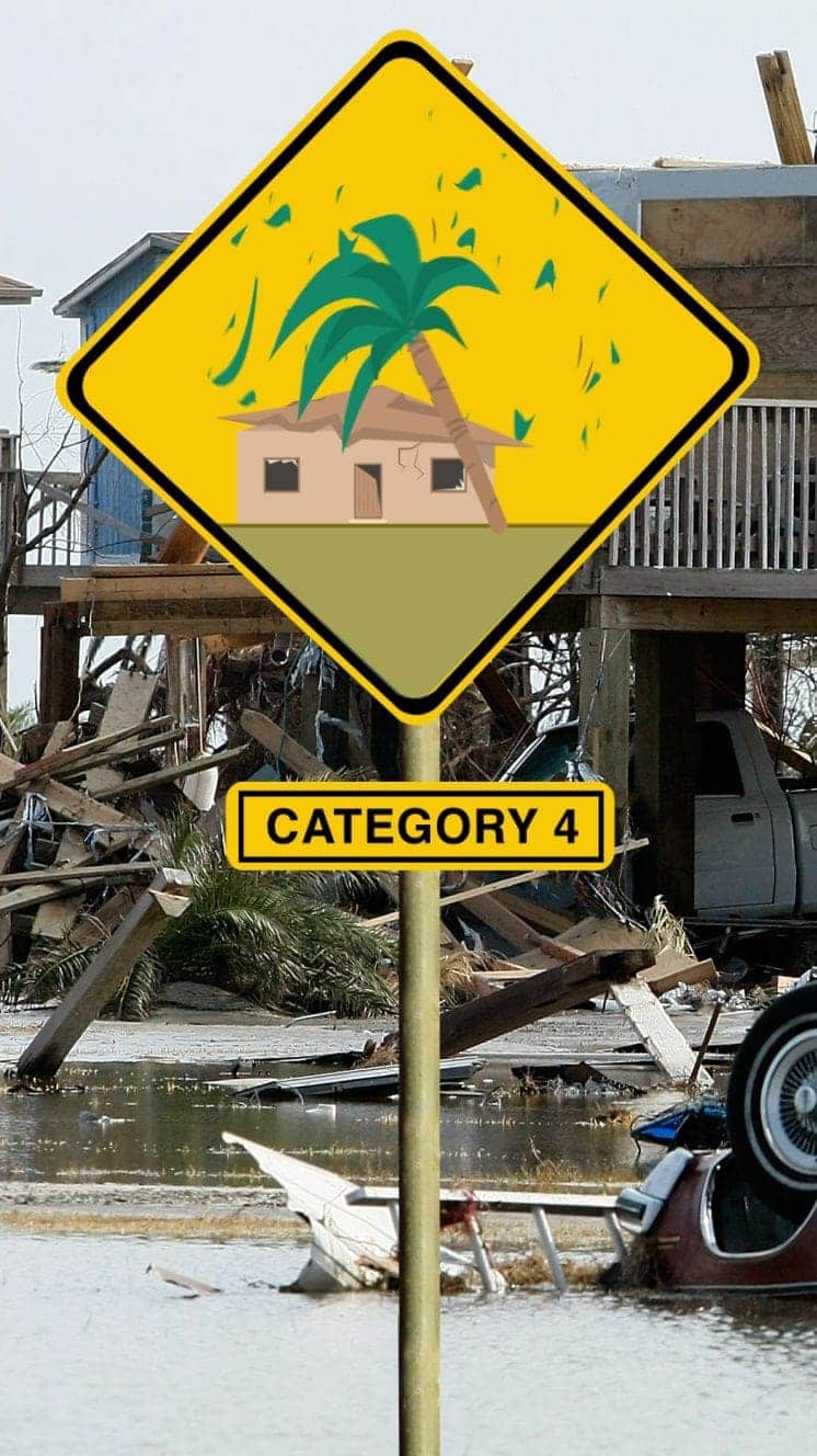
Winds 209-251km/h
Some roofs destroyed and major structural damage to houses.
Storm surge +4m-5.5m
Hurricane Ike (2008) hit Caribbean islands and Louisiana and was blamed for at least 195 deaths
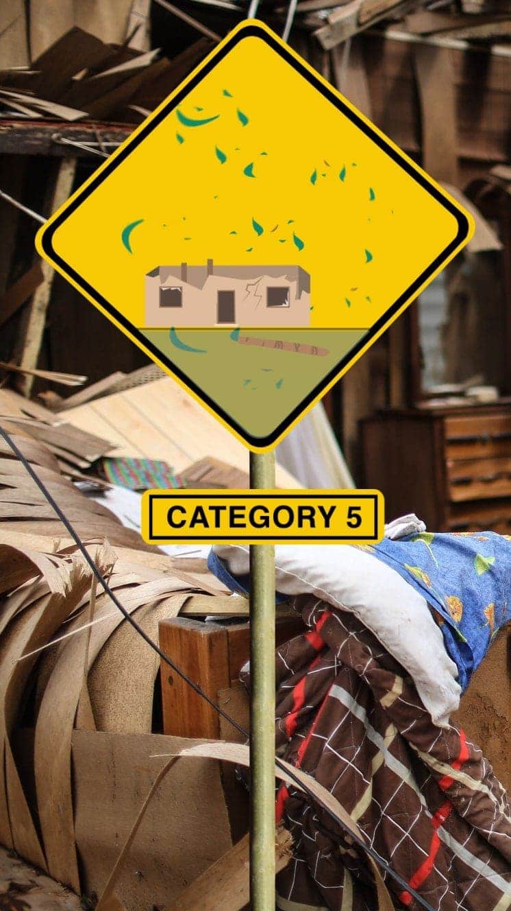
Winds 252km/h+
Serious damage to buildings, severe flooding further inland.
Storm surge +5.5m
Hurricane Irma (2017) caused devastation in Caribbean islands, leaving thousands homeless
"For everyone thinking they can ride this storm out, I have news for you: that will be one of the biggest mistakes you can make in your life."
Mayor of New Orleans Ray Nagin ahead of Hurricane Gustav, 2008
- Published6 September 2017
- Published5 September 2017