Davos
Davos is a winter and summer resort village located in the heart of the Graubünden in the east of Switzerland. In the early 1990s, Davos became famous for hosting the World Economic Forum, an annual winter gathering of international politicians and financiers who represented a transnational elite.Notable Places in the Area
Vaillant Arena
Stadium
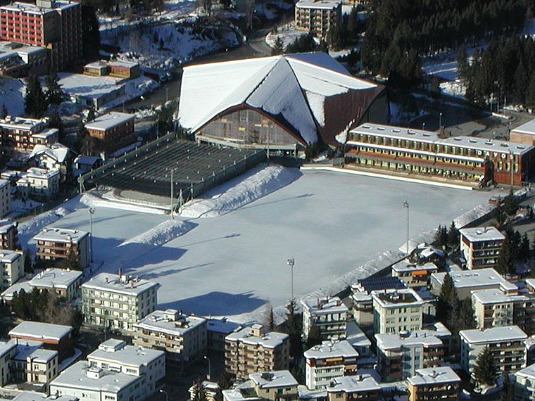
Photo: Wikimedia, CC BY-SA 3.0.
Eisstadion Davos is an indoor arena in Davos, Switzerland.
Lake Davos
Lake
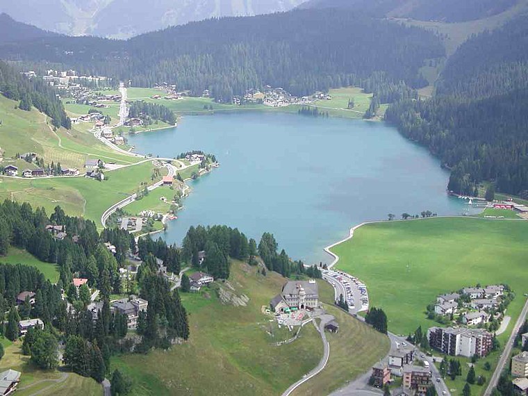
Photo: Flyout, CC BY-SA 3.0.
Lake Davos is a small natural lake at Davos, Switzerland.
Davos Platz Station
Railway station
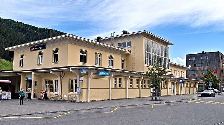
Photo: Kulmalukko, CC BY-SA 3.0.
Davos Platz railway station is a railway station in the municipality of Davos in the district of Prattigau/Davos in the Swiss canton of Graubünden.
Localities in the Area
Davos Platz
Suburb

Photo: MadGeographer, CC BY-SA 3.0.
Davos is an Alpine resort town and a municipality in the Prättigau/Davos Region in the canton of Graubünden, Switzerland.
Davos Frauenkirch
Hamlet
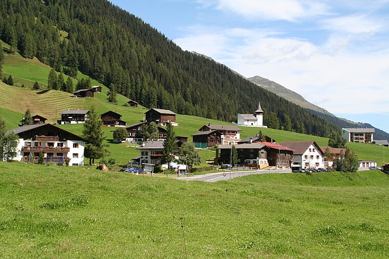
Photo: Parpan05, CC BY-SA 3.0.
Davos Frauenkirch is a hamlet situated 5 km southwest of Davos.
Davos
- Type: Locality with 10,900 residents
- Location: Graubünden, Switzerland, Central Europe, Europe
- View on OpenStreetMap
Latitude
46.8048° or 46° 48' 17" northLongitude
9.8372° or 9° 50' 14" eastPopulation
10,900Elevation
1,563 metres (5,128 feet)Open Location Code
8FRFRR3P+WVGeoNames ID
2661041Davos Satellite Map
© OpenStreetMap, Mapbox and Maxar
Also Known As
- CH3851
Other Places Named Davos
In the Area
Localities
- Davos DorfSuburb
- Davos PlatzLocality
- BolgenLocality
- Wolfgang PassHamlet, 3½ km north
- BedraLocality, 3½ km east
- KriegsmatteLocality, 4 km southeast
Landmarks
- Hotel CasannaHotel
- Hilton Garden Inn DavosHotel
- Davos Dorf Railway StationRailway station
- Golfplatz DavosGolf course
- Turmhotel VictoriaHotel
- Former Grand Hotel Belvédère, DavosHotel
Popular Destinations in Graubünden
Every day is a journey, and the journey itself is home. - Matsuo Bashō
Escape to a Random Place
Discover the localities San Carlo II in Piedmont, Italy and Issarghaouiyene in Morocco.
About Mapcarta. Thanks to Mapbox for providing amazing maps. Text is available under the CC BY-SA 4.0 license, excluding photos, directions and the map. Description text is based on the Wikivoyage page Davos. Photo: Wikimedia, CC BY-SA 3.0.