Radogoszcz
Radogoszcz is a village in the administrative district of Gmina Lubań, within Lubań County, Lower Silesian Voivodeship, in south-western Poland.It lies approximately 3 kilometres north-east of Lubań and 121 km west of the regional capital Wrocław.Photo: PaulT, CC BY-SA 4.0.
Notable Places in the Area
Lubań town hall
Town hall
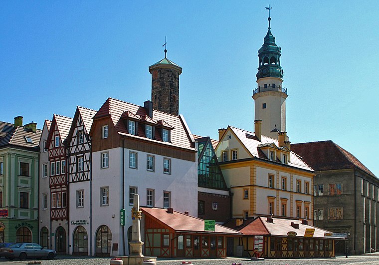
Photo: Hydrus, Public domain.
Lubań town hall is situated 4 km southwest of Radogoszcz.
Polish-Saxon Post Milestone in Lubań
Historic site
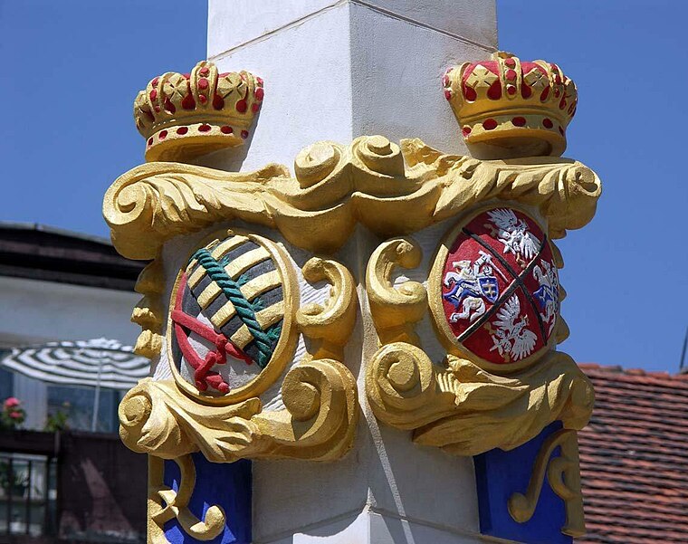
Photo: Wikimedia, CC BY-SA 2.0.
Polish-Saxon Post Milestone in Lubań is a historic site situated 4 km southwest of Radogoszcz.
Holy Trinity church in Lubań
Church

Photo: Bartek444, CC BY-SA 4.0.
Holy Trinity church in Lubań is situated 3½ km southwest of Radogoszcz.
Localities in the Area
Nawojów Łużycki
Village

Photo: Antosh, CC BY-SA 3.0.
Nawojów Łużycki is a village in the administrative district of Gmina Lubań, within Lubań County, Lower Silesian Voivodeship, in south-western Poland.Prior to 1945 it was in Germany. Nawojów Łużycki is situated 2½ km northeast of Radogoszcz.
Henryków Lubański
Village

Photo: Curious, Public domain.
Henryków Lubański is a village in the administrative district of Gmina Lubań, within Lubań County, Lower Silesian Voivodeship, in south-western Poland. Henryków Lubański is situated 5 km northwest of Radogoszcz.
Pisarzowice
Village

Photo: TheGuru, CC BY-SA 4.0.
Pisarzowice is a village in the administrative district of Gmina Lubań, within Lubań County, Lower Silesian Voivodeship, in south-western Poland. Pisarzowice is situated 5 km west of Radogoszcz.
Radogoszcz
- Type: Village with 414 residents
- Description: village in Lower Silesian, Poland
- Categories: village of Poland and locality
- Location: Lower Silesian Voivodeship, Poland, Central Europe, Europe
- View on OpenStreetMap
Latitude
51.15025° or 51° 9' 1" northLongitude
15.31703° or 15° 19' 1" eastPopulation
414Elevation
208 metres (682 feet)Open Location Code
9F3Q5828+4ROpenStreetMap ID
node 692603819OpenStreetMap Feature
place=villageGeoNames ID
3087518Wikidata ID
Q7281505Radogoszcz Satellite Map
© OpenStreetMap, Mapbox and Maxar
Also Known As
- Asturian: Radogoszcz
- Chechen: Радогощ (Нижнесилезин воеводалла)
- Chechen: Радогощ
- Chinese: Radogoszcz
- Czech: Radogoszcz
- English: Radogoszcz, Lower Silesian Voivodeship
- French: Radogoszcz
- German: Radogoszcz
- German: Radogoszcz (Lubań)
- Min Nan Chinese: Radogoszcz (Ē Silesia Séng)
- Polish: Radogoszcz
- Tatar: Радогощ (Түбән Силезия воеводалыгы)
- Tatar: Радогощ
- Ukrainian: Радоґощ
Other Places Named Radogoszcz
In the Area
Radogoszcz is situated close to the villages Nawojów Śląski and Uniegoszcz.
Localities
- Radostów DolnyVillage, 2½ km southeast
- Nowy UniegoszczHamlet, 3½ km south
- RadostówVillage, 4 km southeast
- LubańTown, 4 km southwest
- KoloniaHamlet, 4½ km west
- Radostów ŚredniVillage, 4½ km southeast
Landmarks
- Kościół pw. Matki Bożej Królowej PolskiChurch
- Grodzisko NawojówArchaeological site
- LipieniecPeak
- Manor House in Nawojów ŁużyckiResidential building, 2½ km northeast
- Krzyżowa GóraPeak, 2½ km south
- Kościół pw. Chrystusa KrólaChurch, 2½ km northeast
Escape to a Random Place
Discover the hamlet Elamsville in Virginia, United States and the town Ugledar in Donetsk Oblast, Ukraine.
About Mapcarta. Thanks to Mapbox for providing amazing maps. Data © OpenStreetMap contributors and available under the Open Database License. Text is available under the CC BY-SA 4.0 license, excluding photos, directions and the map. Description text is based on the Wikipdia page Radogoszcz. Photo: PaulT, CC BY-SA 4.0.