Vancouver Island is located in the Pacific Northwest, off the southwest coast of mainland British Columbia. Vancouver Island boasts the warmest climate in BC and Canada, along with the southern Gulf Islands that lie off the southeast coast of the island, the largest of which is Saltspring Island. Off the east coast of Central Vancouver Island are the Discovery Islands, the largest of which are Quadra Island and Cortes Island. The city of Victoria is the capital of British Columbia, located on the southern tip of the island. Vancouver Island is divided into North Island, Central Island, South Island, the Pacific Rim (West Coast), Greater Victoria, and the Gulf & Discovery Islands.
Quick Links: Victoria | Nanaimo | Parksville | Campbell River | Tofino | Desolation Sound
Vancouver Island – North Island
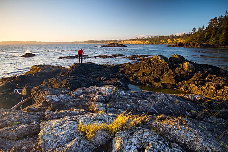
Born from volcanic rock, the rugged North Island region features a largely uninhabited wilderness of forests, lakes and snow-capped peaks – a unique, natural paradise. Most of Vancouver Island once looked as the North Island still does today, with much of the remaining wilderness now preserved.
- Alert Bay
- Blackfish Sound
- Broughton Archipelago
- Coal Harbour
- Discovery Coast
- Discovery Passage
- Echo Bay
- Esperanza Inlet
- Fair Harbour
- Holberg
- Inside Passage
- Island Highway 19
- Johnstone Strait
- Kelsey Bay
- Kingcome Inlet
- Knight Inlet
- Kyuquot Sound
- Loughborough Inlet
- Malcolm Island
- Nimmo Bay
- Nootka Island
Vancouver Island – Central Island
With its warm ocean temperatures, sheltering mountains, tranquil lakes, fabulous fishing and exceptional golf courses, the lush Central Island region is a year-round holiday destination. The Island Highway winds passed well-kept farms in this serenely rural part of Vancouver Island.
Vancouver Island – Pacific Rim (West Coast)
The Pacific Rim is a region of wild landscapes, never-ending beaches and spectacular weather – be it long summer sunsets or fierce winter storms. Prepare yourself for the quintessential wilderness experience in this moss-laden landscape of mist and surf, thunderous ocean and prevalent peace.
Vancouver Island – South Island
A rare combination of rural charm and elegant sophistication, the South Island region is home to Victoria, British Columbia’s capital city. The region presents a remarkable diversity of landscape and recreational opportunities, with beaches and views the likes of which are found nowhere else on the coast.
Vancouver Island – Greater Victoria
The capital region of British Columbia, Greater Victoria encompasses a broad range of communities, from lively downtown streets and bustling harbours to serene parks and coastal farmland. With the mildest climate in Canada, Victoria is perfect for visiting at any time of the year.
Gulf & Discovery Islands
With their ancient forests, rocky shorelines and miles of beaches teeming with marine life, the Northern Gulf Islands are remote, serene places that soothe the soul. Blessed with a balmy climate and an idyllic landscape, the Southern Gulf Islands are each unique in character, but share a gentle, bucolic charm.
Islands in the Strait of Georgia
Situated between Vancouver Island and the mainland of British Columbia, Georgia Strait boasts a number of large islands located between the Gulf Islands and the Discovery Islands. They fall under either the Sunshine Coast or the Gulf and Discovery Islands, but they are grouped together here for ease of navigation, listed in order of south to north.
Coastal Inlets on the Mainland Coast of BC
The remote and rugged coastline of British Columbia is indented with stunning fjord-like inlets that cut deep into the Coast Mountains of the BC mainland north of Vancouver. The inlets fall under various regions of the province, but they are grouped together here for ease of navigation, listed in order of south to north.
Vancouver Island: Greater Victoria
Almost half of Vancouver Island’s population of 750,000 lives in and around the provincial capital of Victoria, at the southern end of Vancouver Island. Victoria has a temperate climate with mild, damp winters and relatively dry and mild summers. It is sometimes classified as a cool-summer Mediterranean climate due to its usually dry summers. There is a rich diversity of landscapes within the region, ranging from the Douglas fir forests along the coast to the drier, exposed conditions of the higher, rockier elevations that support arbutus (madrona) and Garry oak forests. Flowers bloom year-round in Victoria, which makes exploring the outdoors here enjoyable in any season. Thousands of migrating birds, ducks, geese, and swans make the Victoria region a semi-annual stop-over point.
Victorians display their love for the natural world by cultivating flower gardens at every turn. As you’d imagine in a region where a large urban population interacts with such a delightful natural tableau, a vast network of walking, hiking and biking routes leads through the many parks with which the city is blessed.
Although the mountainscape on the southern end of Vancouver Island is not as rugged as the North Shore mountains that rise above Vancouver, this actually mitigates in favour of hiking, as the physical demands for reaching viewpoints is not as great. On the other hand, the views are as panoramic and breathtaking as anywhere in the province. It’s easy to imagine how sweet life was for Native Canadians who once had this all to themselves. Beacon Hill Park in downtown Victoria was the site of a village that had been inhabited for thousands of years prior to the arrival of the colonial settlers in the 1840s. A tangled web of events since then has displaced the original dwellers, but their history is evident in the petroglyphs that adorn the shoreline and in the middens of seashells mounded up beside the beaches on the Strait of Juan de Fuca. Totem poles new and old stand as proud reminders of this heritage.
To gain a fresh appreciation for the talents and skills of First Nations people, combine a visit to the outdoors around Victoria with a stop at the Royal British Columbia Museum, a world-class repository of native artifacts. With the enriched perspective that such a visit will bring, you’ll look at the landscape with new interest and appreciation. The figures on the totems will no longer be static representations from a mythological age. Instead, combined with the presence of killer whales, seals, eagles, ravens, salmon, and other species that are as vibrant in the landscape today as they were in the past, you’ll enter a timeless real and, in the process, discover a new place in nature for yourself.
South Vancouver Island
The exposed waters of Vancouver Island’s southwestern coast quickly dispel any notion that an ocean is an ocean is an ocean. The true personality of the Pacific is revealed as you traverse the slopes of San Juan Ridge as the Strait of Juan de Fuca makes its entrance from the open water of the Pacific. Conditions shift dramatically from the sheltered, rain-shadowed waterways of the Strait of Georgia with its gaggle of tranquil islands. Here you face the open ocean, where nothing breaks the rolling swells or deflects the sting of winter storms. For those who listen for the force of the West Coast, here it begins to speak up, way up.
Many a dark chapter has been written about ships and crews that perished in the violent storms that rake the raw shoreline. This is the Pacific’s Davy Jones’s Locker. Thrown up on the beach, survivors considered themselves blessed if they could reach the West Coast Lifesaving Trail. As harsh today as then, less-endangered people willingly subject themselves to this legendary trail’s test of endurance. Such a reputation adds a wild spice to adventuring here. Venture with care and you’ll come away with wonderful memories of your time spent by the shoreline, where many creatures live in splendid harmony with the ocean’s deep rhythms.
Southern Vancouver Island covers the country between Port Renfrew and Bamfield on the west coast and Malahat and Nanaimo on the east side. Most of the population lives along the east coast, where farming in the lush, rolling Cowichan and Chemainus Valleys has gone hand in hand with logging since Vancouver Island was an independent Crown Colony. The heart of agriculture lies south of Nanaimo, the Hub City, and this pastoral atmosphere persists as you make your way north to Parksville in central island. However, it’s hard to ignore the slopes of the Vancouver Island Mountains that begin to nudge travellers closer to the coastline for wont of wide valley bottoms. Most roads west peter out quickly in the face of this granite tour de force.
The exception is the cross-island melange of paved highway and gravel logging roads that link the sheltered Cowichan Valley with the storm-battered community of Bamfield on the west coast. A greater contrast is hard to find, which is what makes exploring this region so fascinating. There’s plenty of easygoing adventuring to be found by sticking to the main routes, although everyone should treat themselves to a backroad or two where the valleys meet the Strait of Georgia. There are beaches here the likes of which are found nowhere else on the coast, with views that engender intimacy with the landscape, yet emphasize its isolation.
Central Vancouver Island
As you drive the Island Highway, it’s always a treat to look across the Strait of Georgia at landmarks on the mainland as spires of the Coast Mountains rise on the eastern horizon. The farther north you head towards Courtenay and Campbell River, however, the more the peaks and glaciers of Vancouver Island’s ranges, principally the imposing Comox Glacier, Forbidden Plateau, and Mount Washington, rise in the west and vie for equal attention.
As the highway winds past well-kept farms, this is a serenely rural part of the journey. Flowers abound in the gardens that front many of the homes along the way. Small rivers such as the Little Qualicum and the Englishman, as well as the mightier ones such as the Puntledge and the Campbell, empty into the strait. From the highway you catch glimpses of quiet green forest settings on the banks that line each river’s course. Come late summer, these streams teem with spawning salmon.
For much of the way between Courtenay and Campbell River the Island Highway runs beside Qualicum Bay, an area rich in seafood. Pullouts beside the road give easy access to the bay’s sand and pebble beaches. At several places you can buy fresh seafood, brought to the docks daily from local waters.
The mountains and islands of central Vancouver Island have a mysterious sense about them, as if they’re always trying to hide some secret. It’s true: you do have to travel farther afield here in order to penetrate its cloud-laced valleys and coastal rain forest. Take your time as you meander through this laid-back region. Its rhythms are subtle, but with gentle probing they reveal themselves, showing greater complexity than first meets the eye.
Pacific Rim (West Coast Vancouver Island)
In the decades before the Pacific Rim National Park was born in 1970, this moss-laden landscape of mist and surf was a little-known outpost, a world apart. If adventurers managed to coax a vehicle across the tortuous road that led west from Port Alberni to the isolated ports of Tofino and Ucluelet, finding a bed was a simple matter at one of the few local inns. The alternative was constructing a driftwood shelter on one of the fabulous beaches nearby.
One million visitors a year now make this same journey on black-topped Highway 4 (Pacific Rim Highway) to experience the romantic isolation of the region. It’s a tribute to the scale of this environment that so many travellers can be absorbed into it and still leave it so (apparently) empty. The open ocean stretches off unbroken and vacant, while the elemental forces at play here – the winds and the tide, the sun and the rain – excite within visitors a deep-seated resonance, a sense of belonging to this place.
Undoubtedly, the same chaos that reigns in winter during gale-force storms mimics, on a microcosmic scale at least, the fury of the Big Bang. And on eternal summer evenings, when a magenta sunset ignites the ocean’s summer evenings, there’s a peace so prevalent that you could almost bottle it and call it salvation. Take your pick of moods; they’re both soul-satisfying.
North Vancouver Island
Most of Vancouver Island once looked as the north island still does today. Much of the remaining wilderness, such as Brooks Peninsula, a stubby 14-km long projection on the northwest coast of the island, has now been preserved. Other places are sheltered by the elements from the preying eye of industry, like Cape Scott Provincial Park, one of the wildest, windiest, most woebegone locales in the province for human habitation. Journeying to Brooks Peninsula or Cape Scott is only for those whose mettle has been tested by the repeated exposure to the bellows and blast-furnace of nature in the raw.
Some of this landscape’s mysteries lie tucked away inside the vaulted domes of underground caverns. Afloat in a sea kayak on the open Nootka or Quatsino Sounds, or deep inside the Quatsino cave system, be prepared to experience a blend of connectedness and jubilation, isolation and terror, when adventuring here. One thing is guaranteed: at the end of the day, you’ll sleep well.
Gentler conditions prevail in the sheltered waters of Johnstone Strait, where the kwakwaka’wakw First Nations are the traditional gatekeepers. To experience a tranquility that passes all description, paddle these waters where whales rub and salmon run in summer months.
Southern BC Gulf Islands
Snug in the Georgia Strait, between the mainland and the eastern side of Vancouver Island, are the Gulf Islands. Each of these islands seems to be a world unto itself; each has its own history, culture and colourful characters. There are seven major islands in the southern half of the Strait of Georgia. Each island has its distinctive charm, and deserves at least a day or two for exploring. A good way to do so is by bicycle, stopping at campgrounds or bed and breakfasts along the way.
Roadways and trails take you on a tour of natural beauty, leading you to hilltops for fabulous views and down to the beach for an afternoon swim. Around each corner is an artisan’s gallery or a cafe, a row of unique little shops or a quiet marina. There’s also camping, hiking, fishing, boating, all in beautiful surroundings and a friendly, relaxing atmosphere – truly what holiday memories are made of.
Saltspring Island is Canada’s arts and crafts island. Because of its mild climate, mellow pace, beautiful landscapes and island isolation, artists and crafts people are drawn from all over the world. Although Saltspring is well known to boaters and may be reached by three ferries and scheduled air flights, it remains a quiet lesser-known paradise for most travellers. On Saturday mornings in the summer, the spirit of Saltspring can be caught in the local Market in Ganges, the biggest town in the Gulfs.
Rolling orchards and warm rock-strewn beaches abound on Mayne Island, a rustic 13 square-km spot. It’s small enough for a day trip, but pretty enough for a lifetime. Drop by the lighthouse, watch the frantic activity as fishermen wait till the last minute to get out of the ferry’s way in Active Pass, or stroll up the top of Mayne’s mountains for a view of the Strait of Georgia – and you’ll begin to discover what Mayne is all about.
Saturna Island is tucked away at the southern end of the island chain. Rural, sparsely populated, and difficult to reach, Saturna Island is easily the least spoilt of the Gulf islands. The Pender Islands are known as the ‘Friendly Islands’ and the ‘Islands of Hidden Coves’ – with over 20 public ocean access spots to visit along the beaches and coves. The mild climate and pristine wilderness make the Penders perfect for family holidays, romantic retreats, golfing, hiking, biking and nature-watching.
Galiano Island has always enjoyed the reputation of being the most welcoming to visitors. This is due in large part to the limited amount of farmland on Galiano in comparison to other islands. Of necessity, early settlers here opened their homes to tourists as a way of earning a living. Today, Galiano is a hub for sea-kayak trips and the site of the Montague Harbour Provincial Marine park, one of the largest provincial marine parks on any of the islands. This isn’t to say that residents of the other islands won’t be just as pleased to see you disembark at the dock. Indeed, tourism is important to the livelihood and economic well-being of most of the Gulf Islands, although some are better prepared for it than others.
Gabriola Island, the most accessible of the chain, features three provincial parks, quiet beaches and sensational ocean views. Perhaps the most interesting limestone formations on the Gulf Islands are located at Gabriola Sands Provincial Park. Explore the amazing cave-like sandstone formations called the Malaspina Galleries.
Decide in advance which island best suits your purposes, then consult a BC Ferries schedule to see if you can manage the connections in the course of a day’s visit, or whether you’ll have to seek overnight accommodation. Except in summer months, ferry service to many islands is restricted to one or two sailings a day. You may find that in order to catch a ride, you’ll have to start your day well before dawn and return home late in the evening. The trade-off is that you’ll find far fewer visitors sharing the roads, waterways and parks with you as you travel at off-peak times.
Discovery Islands and Northern BC Islands
These islands, part of a chain of 6,000 islands that shelter the British Columbia coastline between Washington and Alaska, lie beyond the quick-access range of Vancouver and Victoria. The wonderful silence that envelops these islands is characteristic of the ambience in remote central coast locales.
It wasn’t always this way. In the heyday of fishing and logging camps, the population on the more isolated islands was surprisingly higher than it is today. Evidence of this can be seen in the abandoned cabins, ancient villages, and overgrown logging roads. Explore by car, kayak, mountain bike or on foot. Find a location that appeals to you, and within this microcosm, experience the wonder and magic that pervades life here.
Quadra Island is a 10-minute ferry ride from Campbell River. Resident artists and craftspeople make the island a fine place to sleuth around for pottery and other wares. The Kwagiulth Museum and Cultural Centre contains an outstanding collection of authentic artifacts. Tranquil and bucolic, Denman Island and Hornby Island sits just off the east coast of Vancouver Island. Denman, the larger of the two is known for its pastoral farmlands and its population of talented artisans.
After going to the effort to reach Cortes Island, with its placid lakes, beaches rich in shellfish, and rugged gorges – your reward is finding a campsite on the southwestern corner at Smelt Bay Provincial Park, a heavenly setting on this picturesque island. Texada Island, originally home to a whaling station, is now the site of a working limestone quarry.
Hop aboard the foot passenger ferry from French Creek and cruise across the Strait of Georgia to Lasqueti Island. Largely undeveloped, Lasqueti is a worthwhile destination for a day trip or longer – not only for its natural beauty, but it is so distant from the mainstream. The fleet of BC Ferries that services the Northern Gulf Islands is not as large nor are the sailings as frequent. Others can only be reached by private transportation such as water taxis, kayaks, canoes, or powerboats and, occasionally, airplanes. Visitors will find that the further north in the Strait of Georgia that they explore, the fewer fellow travellers they’ll encounter.