


Cave Hill is an iconic landmark of Belfast rising to 370m (1,207ft) to reveal stunning scenery.
This famous profile is visible from almost everywhere in Belfast and is ingrained into the social, cultural and political history of the city. Napoleon’s Nose is said to have inspired the giant in Jonathan Swift’s Gulliver’s Travels.
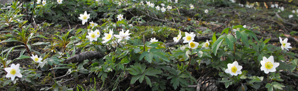
Cave Hill has ancient forts, raths, a limestone quarry and the remains of a beetling mill. The country park encompasses land on top of Cave Hill, the areas of Hazelwood and Ballyaghagan nature reserves, Bellevue, Belfast Castle and Carr’s Glen. Also known as Ben Madigan – the title of a local chieftain who died in 855AD, there is also evidence of Stone Age and Bronze Age settlers with ringforts, the remains of a stone cashel and a crannog. The art deco Floral Hall sits in the grounds of Belfast Zoo.

Cave Hill Country Park is a Green Flag site.

Where to walk
The Castle TrailTake 30 minutes to walk 0.8 miles (1.3km) on the red trail through attractive parkland, including Belfast Castle and gardens containing the famous ‘nine cats’. The route, with views over the city at 120m (400ft) above sea level, includes the Adventurous Playground and picnic areas. Start at any of the car parks or the main entrance to Belfast Castle, walking around the circular route. Here you can take part in the easiest grade of the junior orienteering course. Surfaced paths, slight gradients, some steps.
![]()
![]()
This 2.4 mile (3.9km) route follows the blue waymarked “Estate Trail”. Start at the interpretive vertical sign located just below the castle barrier. Descend and follow the path going left along the outer fence of the castle and gardens.
Turn right and go down past the Adventurous Playground and its car park.
As the main driveway veers to the right, take the small woodland path on the left leading uphill. This path will lead you on to another tarmac driveway. Turn left and follow the access road uphill for a short distance. Where the drive veers left, take the gravel path to your right, and walk up the hill path. You arrive at a well structure on the left. This is often mistaken as the Volunteer’s Well, but this is actually the mountain source stream on your right. Follow the path left and continue uphill taking either of the gravel paths to turn left and begin the descent back towards the castle.
The route can also be accessed from the path that goes above the car park, just below the castle barrier. Turn right at the top of the path and continue up the hill, turning off onto the right at the litter bin and bench and right again to reach the Volunteer’s Well stream.
This path continues along the back of the castle for some distance, before doubling back on itself and descending on to the main driveway. Turn right and follow the footpath until you reach the main gates to the park.
Watch for traffic as you cross the driveway and take the footpath ahead. This leads back up the hill to the car park, past the sculpture of a peregrine on your right
![]()
![]()
This is a challenging 4.5 mile (7.2km) circular route beginning at Belfast Castle and following the green way-marked arrows. It can also start from Belfast Zoo car park, Upper Hightown Road or Upper Cavehill Road. The junior orienteering course also takes in this route.
Begin at the interpretative panel beside the car park just before the entrance barrier to Belfast Castle. Climb the path above the car park until you reach the top, and turn right. Follow this path through the woodland, keeping to the left and up through the trees. Coming out of the wood is a plateau with a set of seats. The caves and McArt’s Fort are in front.
Continue the path and take a left to skirt the narrow trail around a large bowl-like crater called the Devil’s Punchbowl, which passes below the largest cave. Follow this path as it climbs up the hill.
Continue climbing up the steps, at the top veer left to follow the path to the top of the hill and McArt’s Fort. (Veer right to go to Hazelwood and skirt the zoo, which can be done in a circular route.)
From McArt’s Fort join the main path on its gradual descent down the south-facing slopes of Cave Hill. Black Mountain and Divis can be seen as well as the Mourne Mountains in front of you.
Continue downhill on the main path, over a gate and then another gate with a cattle grid, bringing you to the second of two steep downhill paths and veer right. (*alternative route). Continue on before a sharp left at a three-way crossroads.
This path leads down past the top of Carr’s Glen and carries on for some distance before reaching the Upper Cavehill Road. Go down the footpath past some houses and take the path to the left through the side of the gate. Climb up to the top and then descend right into Belfast Castle Estate. Go left at the footpath and return to the starting point up the main driveway.
*An alternative route is to continue along the Limestone Quarry turning left after the second gate and second steep downhill path. The stepped path descends along the top of the quarry and then through the site, continuing across a brook and down to the bottom of the hill. At the end of the steps is a clearing – go left and continue along that path passed a seated area, turning right at a stone marker on the ground, back down to the start at the castle car park. Turning right at the clearing brings you through woodland. Walk along this veering left into Belfast Castle Estate and the driveway. Grade: Moderate-Strenuous
![]()
![]()
![]()
Access via Upper Hightown Road car park. Ignoring the main path and veering left, climb over the metal stile and across the field. Continue along grassy tracks and cattle paths through meadows to a wood stile. Cross the river and walk up turning right when you come to a grass trail. Continue until you see a farm gate across the field on the left. This marks another path at which you turn right and go up the hill bringing you to a Carin (a pile of stones) on the top. This is the highest point of Cave Hill with McArt’s Fort dead ahead and Strangford Lough. Lough Neagh in the opposite direction. Descend to the main path either turning right at McArt’s Fort back to Upper Hightown Road car park (shorter route), or left along the top of the hill, turning right over the cattle grid and along to the Devil’s Punchbowl, and take a right for Belfast Castle. Descend the trail into the trees, keeping to the main path, veering right and along the path going behind the castle. Continue towards a clearing where on the right, the Limestone Quarry bottom steps. Go up the path right until there are no more steps, turn left and continue straight back to Upper Hightown Road car park.
![]()
![]()
![]()
Google Streetview links of Cave Hill Trails
Click on Images and explore!


There is open access to this site all year round however car park opening hours change seasonally so please check signage as you enter the site for the most up to date information.
Further Information
There are numerous pedestrian entrances to the site as listed below, however the three main entrances with Car Parking facilities are Belfast Castle, Belfast Zoo and Upper Hightown Rd (directions provided below).
You can enter the park at:
- Belfast Castle (Innisfayle Park entrance and carpark), Antrim Road BT15 5GR
- Belfast Zoo (Hazelwood entrance, park at zoo carpark), Antrim Road BT36 7PN
- Upper Hightown Road entrance and carpark, BT14 8RR
- Carrs Glen entrance, Ballysillan Road BT14 8LA
- Grays Lane entrance and carpark, Antrim Road BT15 4EP
- Horseshoe Bend entrance, Crumlin Road, BT14 8QU
- Upper Cavehill Road entrance, BT15 5FB
By Car
From the Westlink going north, take Clifton Street exit. At the top of slipway turn left, then at roundabout take the third exit onto the Antrim Road – Belfast Castle and Zoo are signposted
Belfast Castle – Google streetview
Belfast Zoo – Google streetview
Upper Hightown Road – Google streetview
Public transport
Belfast Castle and Belfast Zoo – Translink Metro: Any number 1 bus from Upper Queen Street to Antrim Road. You can alight along this route to two sites on Cave Hill:
Belfast Castle. Walk country-bound from Strathmore bus stop to Innisfayle Park (brown direction sign for Belfast Castle). Follow the sign about 800m into the grounds of the castle. The path to Cave Hill is behind the car park just outside the castle building
Belfast Zoo. Get off the bus at Bellevue where you will see the zoo entrance. Follow the road upwards into the zoo for about 800m. Walk towards the zoo building and then veer right where you will see the path to Hazelwood woodland leading to Cave Hill and an interpretative panel.
Upper Cavehill Road – Metro: 61 Carr’s Glen bus from Queen Street alight Ballysillan Road and walk along Upper Cavehill Road for 320m (400 yards) to access two pedestrian entrances.
Upper Hightown Road – Metro: 11A Silverstream bus. Walk 1 mile heading north on Ballysillan Park turning right onto Crumlin Rd/A52 before car park.
Check timetables before setting out at www.translink.co.uk


AT A GLANCE
-
 Parking
 -
 Toilets
 -
 Cafe
Cafe -
 Dogs
Dogs -
 Picnic Benches
 -
 Play Park / Zoo
 -
 Nappy Changing
 -
 Disabled WC
RECREATION GUIDE

HISTORY OF THE HILLS

ENJOY YOUR VISIT?
 Do you have any pictures or thoughts about your visit?
 Share them with us on FaceBook and Twitter
