Shawnee Mission West High School
Shawnee Mission West High School is a fully accredited public high school located in Overland Park, Kansas, United States, serving students in grades 9-12.Notable Places in the Area
Rio Theatre
Movie theater
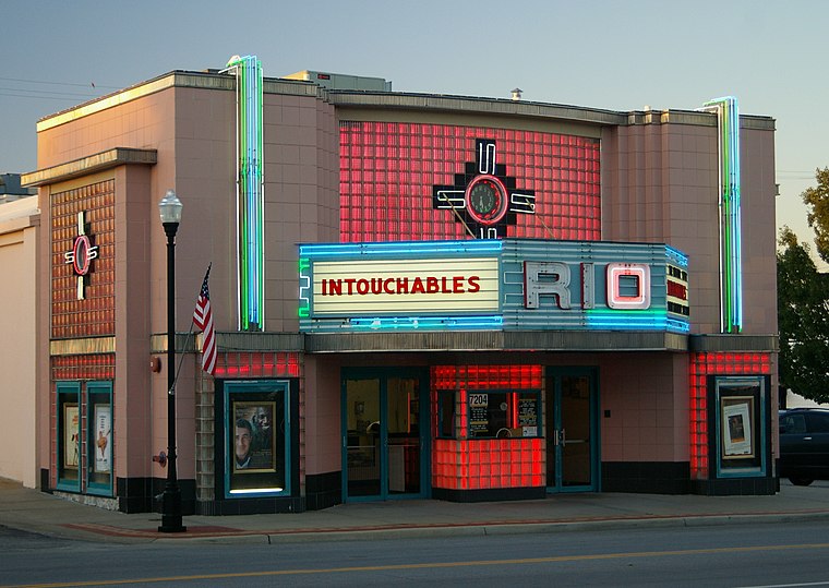
Photo: Dlong417, CC BY-SA 3.0.
The Rio Theatre is a historic single-screen movie theater in Overland Park, Kansas that originally opened on December 25, 1946. Rio Theatre is situated 1¼ miles northeast of Shawnee Mission West High School.
AdventHealth Shawnee Mission
Hospital
AdventHealth Shawnee Mission, is a 504-bed hospital in Merriam in Johnson County, Kansas. AdventHealth Shawnee Mission is situated 1¼ miles north of Shawnee Mission West High School.
Oak Park Mall
Shopping center
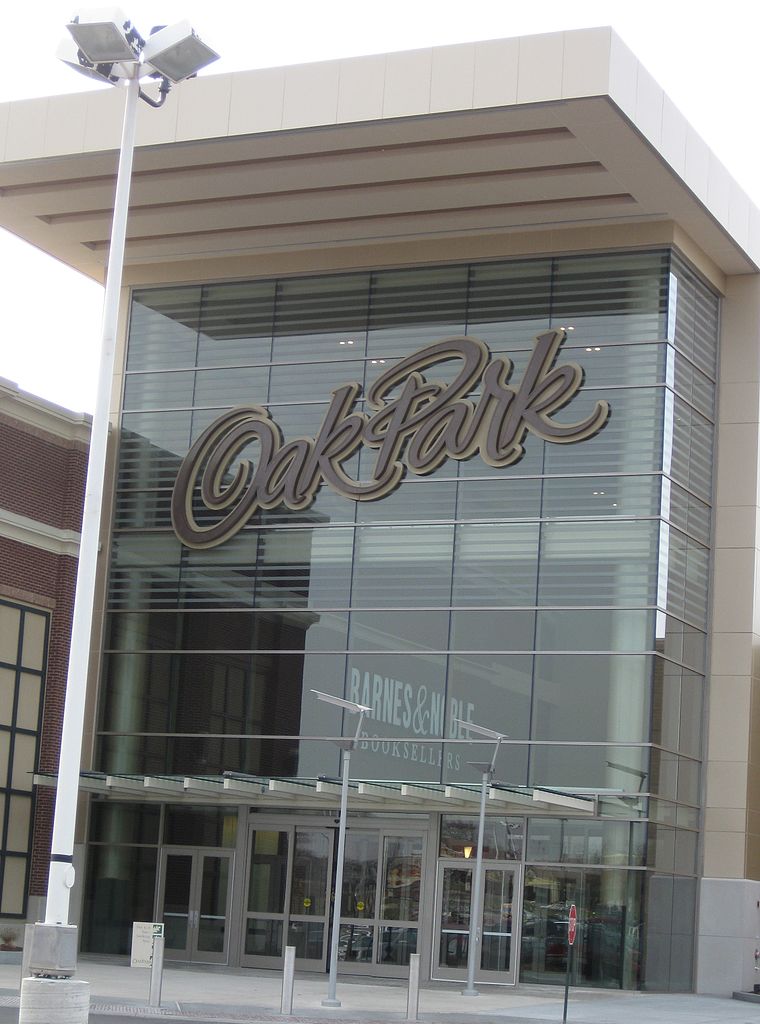
Photo: City of Overland Park, CC BY 2.0.
Oak Park Mall is a super-regional shopping mall located in Overland Park, Kansas, containing over 180 stores in a covered area of 1,607,803 sq ft. Oak Park Mall is situated 2½ miles southwest of Shawnee Mission West High School.
Localities in the Area
Overland Park

Photo: Nightryder84, CC BY-SA 3.0.
Overland Park is a city in northeastern Kansas within the Kansas City metropolitan area.
Merriam
Town
Merriam is a city in Johnson County, Kansas, United States, and part of the Kansas City Metropolitan Area. Merriam is situated 3 miles north of Shawnee Mission West High School.
Prairie Village
Town
Prairie Village is a city in Johnson County, Kansas, United States, and located within the Kansas City Metropolitan Area. Prairie Village is situated 3 miles east of Shawnee Mission West High School.
Shawnee Mission West High School
- Type: School building
- Description: high school in Kansas, United States
- Categories: high school, building and education
- Location: City of Overland Park, Johnson, Kansas, Great Plains, United States, North America
- View on OpenStreetMap
Latitude
38.97607° or 38° 58' 34" northLongitude
-94.68835° or 94° 41' 18" westElevation
1,043 feet (318 metres)Levels
3Open Location Code
86C7X8G6+CMOpenStreetMap ID
way 583747927OpenStreetMap Feature
building=schoolGeoNames ID
6327951Wikidata ID
Q7491549Shawnee Mission West High School Satellite Map
© OpenStreetMap, Mapbox and Maxar
Also Known As
- Catalan: Shawnee Mission West High School
- French: Shawnee Mission West High School
- Hebrew: תיכון שוני מישן וסט
- Swedish: Shawnee Mission West High School
Localities in the Area
- ElmhurstHamlet
- Antioch HillsNeighborhood, 1½ miles north
- Pointe At Prairie HavenNeighborhood, 2 miles northwest
- West Vernon PlanceNeighborhood, 2½ miles north
- Nall HillsNeighborhood, 2½ miles southeast
Places in the Area
- Shawnee Mission West High SchoolSchool
- Myron Scafe BuildingBuilding, 750 feet southeast
- Habitat for Humanity ReStoreCharity shop, 1,000 feet south
- Sunshine FabricareLaundromat, 1,100 feet south
- Sam's ExpressRestaurant, 1,100 feet south
Popular Destinations in Kansas
Discover Topeka, Wichita, Kansas City and Lawrence.
Escape to a Random Place
Discover other schools in the world.
About Mapcarta. Thanks to Mapbox for providing amazing maps. Data © OpenStreetMap contributors and available under the Open Database License. Text is available under the CC BY-SA 4.0 license, excluding photos, directions and the map. Description text is based on the Wikipdia page Shawnee Mission West High School. Photo: Wikimedia, CC BY 2.0.