Minoru Park
Minoru Park is a park located on the site of a former horse-racing track and airstrip in Richmond, British Columbia. Minoru Park's running track, built on its former horse racecourseMinoru Aquatic CentreThe park's running track is often used by School District 38 Richmond for school competitions, such as track and field.Photo: Canuckle, CC BY-SA 3.0.
Notable Places in the Area
Minoru Chapel
Church
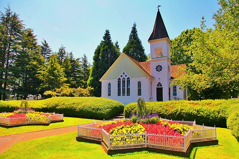
Photo: Grassbag, CC BY-SA 3.0.
Minoru Chapel is a small white wooden chapel that is now located in Richmond, British Columbia's Minoru Park.
Richmond Olympic Oval
Stadium

Photo: Robert Scoble, CC BY 2.0.
The Richmond Olympic Oval is an indoor multi-sports arena in the Canadian city of Richmond, British Columbia.
Richmond Centre
Shopping center

Photo: Wpcpey, CC BY-SA 4.0.
Richmond Centre is a shopping mall in Richmond, British Columbia, Canada.
Localities in the Area
Richmond

Photo: Grotskiii, CC BY-SA 3.0.
Richmond is a riverine city to the south of Vancouver in the Lower Mainland of British Columbia.
Brighouse
Suburb
Brighouse is a neighbourhood that comprises most of the urban core of Richmond in Metro Vancouver.
Burkeville
Suburb
Burkeville, British Columbia is a village located beside Russ Baker Way on Sea Island in Richmond, British Columbia. Burkeville is situated 2½ km north of Minoru Park.
Minoru Park
- Type: Park
- Categories: urban park and recreation area
- Location: Richmond, Metro Vancouver Regional District, British Columbia, Canada, North America
- View on OpenStreetMap
Latitude
49.16629° or 49° 9' 59" northLongitude
-123.14401° or 123° 8' 39" westElevation
2 metres (7 feet)Open Location Code
84XR5V84+G9OpenStreetMap ID
way 584480029OpenStreetMap Feature
leisure=parkGeoNames ID
6943338Wikidata ID
Q6869292Minoru Park Satellite Map
© OpenStreetMap, Mapbox and Maxar
Also Known As
- Cebuano: Minoru Park
- Chinese: 明納努公園
- Japanese: ミノルパーク
- Swedish: Minoru Park
In the Area
Minoru Park is situated close to the suburbs Golden Village and Thompson.
Localities
- BroadmoorSuburb, 3 km south
- SoutharmSuburb, 3½ km southeast
- SeafairSuburb, 4 km southwest
- BridgeportNeighborhood, 4 km northeast
- East CambieSuburb, 4½ km northeast
- StevestonSuburb, 4½ km southwest
Landmarks
- Minoru ArenasSports venue
- Gateway TheatreTheater building
- Minoru OvalStadium
- Richmond Tennis ClubSports venue
- Richmond Public Library (Brighouse)Library
- Minoru Centre for Active LivingSports venue
Popular Destinations in British Columbia
Escape to a Random Place
Discover the parks Fort DeRussy Beach Park in Hawaii and Rock Marsh State Wildlife Management Area in Minnesota, United States.
About Mapcarta. Thanks to Mapbox for providing amazing maps. Data © OpenStreetMap contributors and available under the Open Database License. Text is available under the CC BY-SA 4.0 license, excluding photos, directions and the map. Description text is based on the Wikipdia page Minoru Park. Photo: Canuckle, CC BY-SA 3.0.