Bradford
Bradford is a city and metropolitan borough in West Yorkshire in the north of England. With a population of about 550,000 to the east its built-up area runs into that of Leeds, while to the west are Pennine valleys, the "Bronte Country".Notable Places in the Area
Bingley railway station
Railway station

Photo: Stanley Walker, CC BY-SA 2.0.
Bingley railway station is a grade II listed railway station that serves the market town of Bingley…
Bingley Five Rise Locks
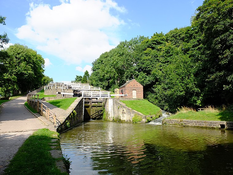
Photo: Sirenuk, CC BY-SA 3.0.
Bingley Five-Rise Locks is a staircase lock on the Leeds and Liverpool Canal at Bingley.
Shipley railway station
Railway station

Photo: Betty Longbottom, CC BY-SA 2.0.
Shipley railway station serves the market town of Shipley in West Yorkshire, England.
Localities in the Area
Saltaire
 Saltaire is a Victorian model village in Shipley, West Yorkshire, England, situated between the River Aire, the railway, and the Leeds and Liverpool Canal.
Bingley

Photo: Wikimedia, CC BY-SA 2.0.
Bingley is a town in the English county of West Yorkshire, located approximately 5 miles north-west of Bradford. it is now part of the Bradford Metropolitan District.
Keighley
 Keighley is a town in the English county of West Yorkshire, north west of Bradford in the Aire Valley.
Bradford
Latitude
53.8333° or 53° 50' northLongitude
-1.8333° or 1° 50' westPopulation
547,000Elevation
459 feet (140 metres)Abbreviation
BRDOpen Location Code
9C5WR5M8+8MGeoNames ID
3333131Bradford Satellite Map
© OpenStreetMap, Mapbox and Maxar
Other Places Named Bradford
Localities in the Area
Landmarks in the Area
- Yorkshire ClinicHospital
- Bingley HospitalHospital
- Chellow HeightsHill
- Saltaire railway stationRailway station
- Crossflatts railway stationRailway station
Popular Destinations in England
Discover London, Manchester, Sheffield and Leeds.
Escape to a Random Place
Discover other destinations in the world.
About Mapcarta. Thanks to Mapbox for providing amazing maps. Text is available under the CC BY-SA 4.0 license, excluding photos, directions and the map. Description text is based on the Wikivoyage page Bradford. Photo: Inkey, CC BY 2.0.