Malvern
Malvern] is a spa town in Worcestershire. It has been famous for its bottled water since 1622. The town was the chosen location for the British government in case of evacuation from London during World War II. Great Malvern Priory…Photo: Bob Embleton, CC BY-SA 2.0.
Notable Places in the Area
Great Malvern railway station
Railway station

Photo: Geof Sheppard, CC BY-SA 4.0.
Great Malvern railway station is one of two stations serving the town of Malvern, Worcestershire, England on the Hereford to Worcester section of the Cotswold Line.
Worcestershire Beacon
Peak

Photo: Bob Embleton, CC BY-SA 2.0.
Worcestershire Beacon, also popularly known as Worcester Beacon, or locally simply as The Beacon, is a hill whose summit at 425 metres is the highest point in Worcestershire.
Malvern Link railway station
Railway station

Photo: Bob Embleton, CC BY-SA 2.0.
Malvern Link railway station serves Malvern Link in Worcestershire, England.
Localities in the Area
Great Malvern
Suburb

Photo: Bob Embleton, CC BY-SA 2.0.
Great Malvern is an area of the civil parish of Malvern, in the Malvern Hills district, in the county of Worcestershire, England.
West Malvern
Village
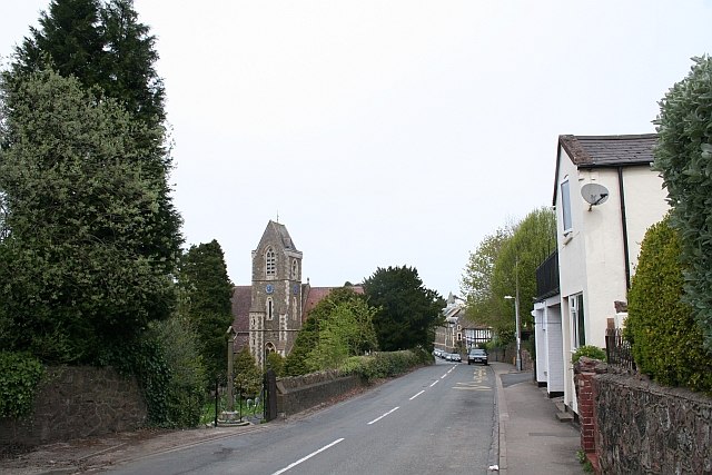
Photo: Bob Embleton, CC BY-SA 2.0.
West Malvern is a village and a civil parish on the west side of the north part of the Malvern Hills, on the western edge of Worcestershire, England.
Madresfield
Village

Photo: Peter Whatley, CC BY-SA 2.0.
Madresfield is a village and civil parish in the administrative district of Malvern Hills in the county of Worcestershire, England.
Malvern
- Type: Town with 32,000 residents
- Description: spa town and civil parish in Worcestershire, England
- Category: locality
- Location: Malvern Hills District, Worcestershire, West Midlands, England, United Kingdom, Britain and Ireland, Europe
- View on OpenStreetMap
Latitude
52.116° or 52° 6' 57" northLongitude
-2.3259° or 2° 19' 33" westPopulation
32,000Elevation
364 feet (111 metres)Open Location Code
9C4V4M8F+9JOpenStreetMap ID
node 11524752OpenStreetMap Feature
place=townGeoNames ID
7290434Wikidata ID
Q623323Malvern Satellite Map
© OpenStreetMap, Mapbox and Maxar
Also Known As
- Arabic: مالفرن (ورشستر)
- Arabic: مالفرن
- Armenian: Մլավերն
- Asturian: Malvern
- Azerbaijani: Malvern
- Bengali: ম্যালভার্ন
- Breton: Malvern
- Bulgarian: Малвърн
- Catalan: Malvern
- Cebuano: Malvern
- Chinese: Malvern
- Chinese: 莫尔文 (伍斯特郡)
- Chinese: 莫尔文
- Chinese: 莫爾文 (伍斯特郡)
- Chinese: 莫爾文
- Chinese: 馬爾文
- Chinese: 馬爾文恩
- Chinese: 马尔文恩
- Czech: Malvern
- Dutch: Malvern
- Egyptian Arabic: مالفرن
- English: Malvern, England
- English: Malvern, Worcestershire
- Finnish: Malvern
- French: Malvern
- German: Malvern
- Gujarati: માલવર્ન
- Hebrew: מלאבן
- Irish: Malvern, Worcestershire
- Irish: Malvern
- Italian: Malvern
- Japanese: マルバーン
- Japanese: マルヴァン (ウスターシャー)
- Japanese: マルヴァン
- Japanese: マルヴァーン
- Japanese: モルバーン
- Kannada: ಮಾಲ್ವೆರ್ನ್
- Korean: 말번
- Ladin: Malvern (Worcestershire)
- Ladin: Malvern
- Latin: Malvernia
- Lithuanian: Malvernas
- Min Nan Chinese: Malvern (Worcestershire)
- Norwegian Bokmål: Malvern
- Norwegian Nynorsk: Malvern i Worcestershire
- Persian: مالورن، ووسترشر
- Polish: Malvern
- Portuguese: Malvern
- Romanian: Malvern, Worcestershire
- Romanian: Malvern
- Russian: Малверн (Вустершир)
- Russian: Малверн
- Slovenian: Malvern
- South Azerbaijani: مالورن، ووسترشر
- Spanish: Malvern
- Spanish: Malvern (Worcestershire)
- Swedish: Malvern, Worcestershire
- Swedish: Malvern
- Tamil: மல்வேர்ன்
- Telugu: మల్వెర్న్
- Turkish: Malvern, Worcestershire
- Ukrainian: Мальверн
- Urdu: مالورن، ورسیسٹر شائر
- Urdu: مالویرن
- Welsh: Malvern, Swydd Gaerwrangon
- Welsh: Malvern
Other Places Named Malvern
Localities in the Area
- Link TopNeighborhood
- North MalvernSuburb
- PickersleighLocality
- NewtownLocality
- CowleighLocality
Popular Destinations in Worcestershire
Discover Worcester, Redditch, Kidderminster and Evesham.
Escape to a Random Place
Explore your world with these selected destinations of excellence.
About Mapcarta. Thanks to Mapbox for providing amazing maps. Data © OpenStreetMap contributors and available under the Open Database License. Text is available under the CC BY-SA 4.0 license, excluding photos, directions and the map. Description text is based on the Wikivoyage page Malvern. Photo: Bob Embleton, CC BY-SA 2.0.