Flatwoods, Kentucky
Last updatedFlatwoods, Kentucky | |
|---|---|
 B.F. Crager Park in Flatwoods | |
| Nickname: Good Neighbor Community | |
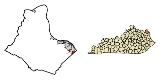
 Location of Flatwoods in Greenup County, Kentucky. | |
| Coordinates: 38°31′23″N82°43′10″W / 38.52306°N 82.71944°W | |
| Country | United States |
| State | Kentucky |
| County | Greenup |
| Government | |
| • Mayor | Buford Hurley II |
| Area | |
| • Total | 3.26 sq mi (8.45 km2) |
| • Land | 3.26 sq mi (8.44 km2) |
| • Water | 0.00 sq mi (0.01 km2) |
| Elevation | 682 ft (208 m) |
| Population (2020) | |
| • Total | 7,325 |
| • Estimate (2022) [2] | 7,243 |
| • Density | 2,246.93/sq mi (867.52/km2) |
| Time zone | UTC-5 (EST) |
| • Summer (DST) | UTC-4 (EDT) |
| ZIP code | 41139 |
| Area code | 606 |
| FIPS code | 21-27802 |
| GNIS feature ID | 0492225 |
| Website | www |
Flatwoods is a home rule-class city in Greenup County, Kentucky, United States. [3] The population was 7,325 at the 2020 census, making it the largest city in Greenup County. Flatwoods is a part of the Huntington–Ashland metropolitan area. Locally, Flatwoods is considered to be a bedroom community, as it has no large employer within the city. Many residents work for CSX Transportation, Marathon Petroleum, or King's Daughters Medical Center.[ citation needed ]
Contents
History
The area now known as Flatwoods was originally named "Advance": [4] Advance Methodist Church formed a Sunday school beginning in 1860. The name was later changed to "Cheap", after John Cheap, a blind clergyman. [5] The original farming community returned to the name of "Advance" when a post office was established in 1918. In 1938, the post office was renamed "Flatwoods", and the town was incorporated the same year under that name. Flatwoods is named for the area's unique topography, a belt of flat wooded land in the ancient Teays River valley on an elevation of approximately 650 feet (200 m) or higher, just south of and 150 feet (46 m) higher than the Ohio River valley. The availability of flat level land and low tax rates made Flatwoods a local hot spot of new construction in the 1950s and 1960s, when many upper-middle-class tract housing developments were built and quickly inhabited. A main contributor to Flatwoods' growth was the fact that nearby Ashland had developed much of its available land prior to 1960, with little new construction possible within its corporation limits. [6]
Geography
Flatwoods is located in eastern Greenup County, between Raceland to the northwest and Russell to the southeast. U.S. Route 23 (Seaton Avenue) forms the northeast border of Flatwoods; the highway leads southeast 6 miles (10 km) to Ashland and northwest 7 miles (11 km) to Greenup. According to the United States Census Bureau, Flatwoods has a total area of 3.2 square miles (8.4 km2), all land. [7]
The topography of Flatwoods is uncharacteristic to eastern Kentucky in that it consists of flat to rolling land on a single elevated hill. In eastern Kentucky, the dissected plateau landscape often referred to as "hill and valley" is standard terrain for the surrounding region. The flat terrain found in Flatwoods was created when it was the river bed of the ancient Teays River, which traveled through the area in prehistoric times, much larger than the Ohio River that now passes through the region.
Climate
| Climate data for Flatwoods, Kentucky | |||||||||||||
|---|---|---|---|---|---|---|---|---|---|---|---|---|---|
| Month | Jan | Feb | Mar | Apr | May | Jun | Jul | Aug | Sep | Oct | Nov | Dec | Year |
| Record high °F (°C) | 81 (27) | 79 (26) | 92 (33) | 96 (36) | 98 (37) | 102 (39) | 107 (42) | 106 (41) | 103 (39) | 94 (34) | 86 (30) | 79 (26) | 107 (42) |
| Mean daily maximum °F (°C) | 42 (6) | 48 (9) | 57 (14) | 68 (20) | 77 (25) | 85 (29) | 88 (31) | 86 (30) | 80 (27) | 69 (21) | 57 (14) | 46 (8) | 66.6 (19.2) |
| Mean daily minimum °F (°C) | 21 (−6) | 24 (−4) | 34 (1) | 42 (6) | 51 (11) | 60 (16) | 64 (18) | 63 (17) | 56 (13) | 44 (7) | 35 (2) | 27 (−3) | 43.4 (6.3) |
| Record low °F (°C) | −15 (−26) | −6 (−21) | −6 (−21) | 12 (−11) | 26 (−3) | 37 (3) | 40 (4) | 41 (5) | 28 (−2) | 17 (−8) | 1 (−17) | −24 (−31) | −24 (−31) |
| Average precipitation inches (mm) | 2.70 (69) | 2.90 (74) | 3.70 (94) | 3.70 (94) | 4.20 (107) | 3.80 (97) | 4.80 (122) | 4.20 (107) | 2.90 (74) | 2.80 (71) | 3.20 (81) | 3.40 (86) | 42.3 (1,070) |
| Source: The Weather Channel. [8] | |||||||||||||
Demographics
| Census | Pop. | Note | %± |
|---|---|---|---|
| 1960 | 3,741 | — | |
| 1970 | 7,380 | 97.3% | |
| 1980 | 8,354 | 13.2% | |
| 1990 | 7,799 | −6.6% | |
| 2000 | 7,605 | −2.5% | |
| 2010 | 7,423 | −2.4% | |
| 2020 | 7,325 | −1.3% | |
| 2022 (est.) | 7,243 | [9] | −1.1% |
| U.S. Decennial Census [10] [7] | |||
As of the census [11] of 2000, there were 7,605 people, 3,114 households, and 2,282 families residing in the city. The population density was 1,691.9 inhabitants per square mile (653.2/km2). There were 3,338 housing units at an average density of 742.6 per square mile (286.7/km2). The racial makeup of the city was 98.19% White, 0.38% African American, 0.20% Native American, 0.36% Asian, 0.30% from other races, and 0.58% from two or more races. Hispanic or Latino of any race were 0.58% of the population.
There were 3,114 households, out of which 31.3% had children under the age of 18 living with them, 58.0% were married couples living together, 12.6% had a female householder with no husband present, and 26.7% were non-families. 24.1% of all households were made up of individuals, and 11.3% had someone living alone who was 65 years of age or older. The average household size was 2.41 and the average family size was 2.85.
In the city the population was spread out, with 23.0% under the age of 18, 7.7% from 18 to 24, 28.0% from 25 to 44, 25.0% from 45 to 64, and 16.3% who were 65 years of age or older. The median age was 40 years. For every 100 females, there were 87.5 males. For every 100 females age 18 and over, there were 82.1 males.
The median income for a household in the city was $31,115, and the median income for a family was $39,023. Males had a median income of $36,184 versus $20,904 for females. The per capita income for the city was $17,633. About 9.7% of families and 11.6% of the population were below the poverty line, including 12.0% of those under age 18 and 10.3% of those age 65 or over.
Education
The majority of the city sits within the Russell Independent School District, which also includes the cities of Russell and Bellefonte. The main campus for the district, which includes Russell High School, Russell Middle School, Russell Primary School and the Russell Area Technology Center, sits on Red Devil Lane on the Russell/Flatwoods city line; the schools' mailing addresses are Russell but they primarily receive police and fire protection from Flatwoods. The city boundary passes through the high school building, as well as the school's athletic facilities. The middle and primary schools are entirely within Flatwoods, and all but a small part of the technology center is also in Flatwoods. In addition, one school, Russell-McDowell Intermediate School, sits on Long Street, firmly within the Flatwoods city limits. The district's central office is on Powell Lane in Flatwoods, near Russell-McDowell Intermediate School.
Some students in a small section of the city near The French Oaks golf course attend the Raceland–Worthington Independent Schools.
There are six institutions of higher education located within an hour's drive of Flatwoods: Ashland Community and Technical College in Ashland, Kentucky Christian University in Grayson, Ohio University Southern Campus in Ironton, Ohio, Shawnee State University in Portsmouth, Ohio as well as Marshall University and Mountwest Community and Technical College, both of which are located in Huntington, West Virginia.
The Greenup County Public Library has a branch library in Flatwoods. [12]
Public safety
Flatwoods is protected by its own police and fire departments. In addition, surrounding fire and police departments are in a mutual aid agreement with the city of Flatwoods. Emergency medical service is provided by the Greenup County Ambulance Authority under an interlocal agreement with the East Greenup County Ambulance Tax District, of which Flatwoods is a member.
- Flatwoods Fire Department (Station 100) is located at 804 Powell Lane. It is home to 2 engines and 1 Ladder Truck.
- Flatwoods Police Department is located in the city's municipal building at 2513 Reed Street.
- The Greenup County Ambulance Authority operates a station at 1104 Powell Lane in Flatwoods.
Television and radio
Radio
- 100.5 WKEE
- 93.7 The Dawg
- 92.7 The Planet
- 101.5 Big Buck Country
- 103.3 WTCR
- Kool Hits 105.7
Television
Notable person
- Billy Ray Cyrus, country singer, actor and father of singer Miley Cyrus [13]
Related Research Articles

Pickaway County is a county in the U.S. state of Ohio. As of the 2020 census, the population was 58,539. Its county seat is Circleville. Its name derives from the Pekowi band of Shawnee Indians, who inhabited the area.

Ashland County is a county located in the northeastern portion of the U.S. state of Ohio. As of the 2020 census, the population was 52,447. Its county seat and largest city is Ashland. The county is named for "Ashland", the home of Senator Henry Clay near Lexington, Kentucky. It was formed in 1846 from parts of Huron, Lorain, Richland and Wayne Counties.

Greenup County is a county located along the Ohio River in the northeastern part of the U.S. state of Kentucky. As of the 2020 census, the population was 35,962. The county was founded in 1803 and named in honor of Christopher Greenup. Its county seat is Greenup. Greenup County is part of the Huntington-Ashland, WV-KY-OH Metropolitan Statistical Area.

Carter County is a county located in the U.S. state of Kentucky. As of the 2020 census, the population was 26,627. Its county seat is Grayson. Carter County is in the Huntington-Ashland, WV-KY-OH Metropolitan Statistical Area. It is home to Carter Caves State Resort Park.

Ashland is a home rule-class city in Boyd County, Kentucky, United States. The largest city in Boyd County, Ashland is located upon a southern bank of the Ohio River at the state border with Ohio and near West Virginia. The population was 21,625 at the 2020 census. Ashland is a principal city of the Huntington–Ashland metropolitan area, referred to locally as the "Tri-State area", home to 376,155 residents as of 2020. Ashland serves as an important economic and medical center for northeastern Kentucky.

Catlettsburg is a home rule-class city in and the county seat of Boyd County, Kentucky, United States. The city population was 1,780 at the 2020 census. It is part of the Huntington–Ashland metropolitan area.
Westwood is a census-designated place in Boyd County, Kentucky, United States. The population was 4,387 at the 2020 census. A suburb of Ashland, the two areas are closely affiliated, sharing a ZIP code and bus system. Westwood is located on a flat to hilly elevation just west of the Ohio River. The flat hilltop is unusual to eastern Kentucky and was created by the preglacial Teays River which existed in ancient times and flowed in the opposite direction of the Ohio River. Westwood is part of the Huntington–Ashland metropolitan area.
Bellefonte is a home rule-class city in Greenup County, Kentucky, United States. The population was 888 at the 2010 census. Bellefonte is a part of the Huntington-Ashland, WV-KY-OH Metropolitan Statistical Area (MSA). In 2013, according to new boundary definitions, the MSA had a population of 361,580.
Greenup is a home rule-class city located at the confluence of the Little Sandy River with the Ohio River in Greenup County, Kentucky, United States. The population was 1,188 at the 2010 census. Greenup is one of three county seats in the Commonwealth of Kentucky to share its name with its county; the other two being Harlan and Henderson.

Raceland is a home rule-class city in Greenup County, Kentucky, United States, in the Ohio River valley. As of the 2010 census, the population was 2,424. It is part of the Huntington–Ashland metropolitan area.

Russell is a home rule-class city on the south bank of the Ohio River in Greenup County, Kentucky, United States. The population was 3,380 as of the 2010 census, down from 3,645 in 2000. Russell is a suburb of Ashland and part of the Huntington-Ashland-Ironton metropolitan area. It has close economic affiliations with its neighbors, Ashland and Flatwoods in Kentucky and Ironton, Ohio.

South Shore is a home rule-class city in Greenup County, Kentucky, United States. The population was 1,122 at the 2010 census, down from 1,226 in 2000. It is located along the Ohio River across from Portsmouth, Ohio, at the mouth of Tygarts Creek. South Shore is a part of the Huntington-Ashland, WV-KY-OH, Metropolitan Statistical Area (MSA).

Worthington is a home rule-class city on the south bank of the Ohio River in Greenup County, Kentucky, in the United States. The population was 1,609 as of the 2010 U.S. census.

Wurtland is a home rule-class city in Greenup County, Kentucky, United States, along the Ohio River. The population was 995 at the 2010 census. Wurtland is a part of the Huntington-Ashland, WV-KY-OH, Metropolitan Statistical Area (MSA). As of the 2010 census, the MSA had a population of 287,702.

Ashland is a city in and the county seat of Ashland County, Ohio, United States, about 66 miles (106 km) southwest of Cleveland and 82 miles (132 km) northeast of Columbus. The population was 19,225 at the 2020 census. It is the center of the Ashland Micropolitan statistical area, which includes all of Ashland County.

Teays Valley is a census-designated place in Putnam County, West Virginia, United States. The population was 14,350 at the 2020 census. Located about 20 miles (32 km) west of Charleston and 30 miles (48 km) east of Huntington, it is part of the Huntington–Ashland metropolitan area.
The Charleston Metropolitan Statistical Area, as defined by the United States Census Bureau, is an area consisting of three counties in West Virginia, anchored by the city of Charleston. It is the largest metropolitan area entirely within the state of West Virginia. While the Huntington Metro Area is more populous, it spans three states, and the core county of the Charleston area, Kanawha County, is more populous than the West Virginia portion of the Huntington area.

U.S. Route 23 (US 23) is a 157.765-mile-long (253.898 km) United States Numbered Highway in the state of Kentucky. It travels from the Virginia state line near Jenkins to the Ohio state line west of South Shore via Jenkins, Pikeville, Coal Run Village, Prestonsburg, Paintsville, Louisa, Catlettsburg, Ashland, Russell, Flatwoods, Raceland, Wurtland, Greenup, and South Shore.
The Huntington–Ashland metropolitan area is a metropolitan area in the Appalachian Plateau region of the United States. Referred to locally as the "Tri-State area," and colloquially as "Kyova", the region spans seven counties in the three states of Kentucky, Ohio, and West Virginia. With a population of 361,580, the Tri-State area is nestled along the banks of the Ohio River. The region offers a diverse range of outdoor activities.

Boyd County is a county located in the U.S. state of Kentucky. As of the 2020 census, its population was 48,261. The county seat is Catlettsburg, and its largest city is Ashland. The county was formed in 1860. The county spans 160 square miles (410 km2), and is found at the northeastern edge of the state, near the Ohio River and Big Sandy River and situated in mountainous Appalachia. Boyd County is in the Huntington-Ashland, WV-KY-OH metropolitan statistical area.
References
- ↑ "2020 U.S. Gazetteer Files". United States Census Bureau. Retrieved March 18, 2022.
- ↑ "Annual Estimates of the Resident Population for Incorporated Places in Kentucky: April 1, 2020 to July 1, 2022". United States Census Bureau. Retrieved May 26, 2023.
- ↑ "Summary and Reference Guide to House Bill 331 City Classification Reform" (PDF). Kentucky League of Cities. Retrieved December 30, 2014.
- ↑ Commonwealth of Kentucky. Office of the Secretary of State. Land Office. "Flatwoods, Kentucky". Accessed 25 July 2013.
- ↑ Rennick, Robert M. (August 28, 2013). Kentucky Place Names. University Press of Kentucky. p. 199. ISBN 0-8131-4401-9.
- ↑ About Flatwoods Retrieved on 2010-05-29
- 1 2 "Geographic Identifiers: 2010 Demographic Profile Data (G001): Flatwoods city, Kentucky". American Factfinder. U.S. Census Bureau. Retrieved December 14, 2016.[ dead link ]
- ↑ "MONTHLY AVERAGES for Flatwoods, KY". The Weather Channel . Retrieved October 22, 2010.
- ↑ "Annual Estimates of the Resident Population for Incorporated Places in Kentucky: April 1, 2020 to July 1, 2022". United States Census Bureau. Retrieved May 26, 2023.
- ↑ "Census of Population and Housing". Census.gov. Retrieved June 4, 2015.
- ↑ "U.S. Census website". United States Census Bureau . Retrieved January 31, 2008.
- ↑ "Kentucky Public Library Directory". Kentucky Department for Libraries and Archives. Archived from the original on January 11, 2019. Retrieved June 5, 2019.
- ↑ Alexander, Lauren (March 19, 2009). More Mad For Miley: An Unauthorized Biography. Penguin Young Readers Group. p. 8. ISBN 978-0-8431-8928-5.
External links
- City of Flatwoods official website
- Ashland Alliance, area chamber of commerce
- Greenup County Tourism Commission
Municipalities and communities of Greenup County, Kentucky, United States | ||
|---|---|---|
| Cities |  | |
| Unincorporated communities | ||
| Principal cities |  | |
|---|---|---|
| Municipalities with population over 5,000 | ||
| Municipalities with population 1,000–5,000 | ||
| Municipalities with population under 1,000 | ||
| West Virginia counties | ||