What is Mapulator?
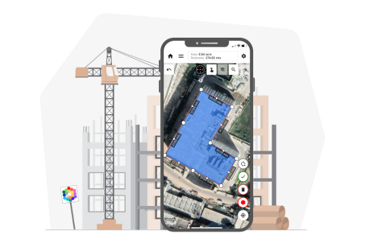
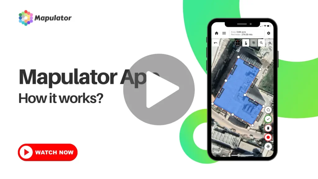
Mapulator is a free online tool that allows users to measure area and distance on a map. It uses Google Maps and Apple Maps as the underlying map provider and provides a variety of measurement tools.
What are the different features of Mapulator?
Mapulator features precise measurements using pin, circle, or drawing options with customizable colors. Enjoy real-time calculations, diverse map views, and easy location search, coupled with undo/redo functionality and seamless measurement sharing.
What are the different users of distance and area measurement?
Area and distance measurement tool that can be used by anyone who needs to measure distances or areas on a map. It is commonly used by individuals or organisations that need to plan routes and calculate distances or estimate the size of a specific area. This could include hikers, bikers or other outdoor enthusiasts who need to plan a route or estimate the distance they will need to travel. Area and distance measurement is useful for real estate agents and surveyors.
What are different units of distance measurement on Mapulator?
Mapulator offers several different units of measurement for distances, including meters, feet, kilometers, miles and nautical miles. Kilometers and miles are often used for measuring longer distances, such as the distance between two cities. Nautical miles are typically used for measuring distances at sea.
What are different units of area measurement on Mapulator?
There are several different units of measurement for area, including square meters, square feet, acres, hectares and square miles the app supports. In addition, we add more local measurement units every now and then to make it more convenient.
What are the different types of maps?
Mapulator offers three map types: Satellite, Roadmap and Terrain.
What mapping tools does Mapulator offer for measurement?
Mapulator provides user-friendly tools for accurate measurements: Draw, Tap, Plot with Scope, GPS Live and Coordinates.
What is the cost for Mapulator?
Mapulator is a free area measurement app for basic distance and area calculations, with all measurement tools available at no extra cost. Additional features, such as collaboration and address search, are offered in Lite or Pro plans. Visit the pricing page for details.
Can you measure distance on Google Maps?
Mapulator uses Google Maps and Apple Maps as the map providers, and hence it supports distance measurement on Google Maps. Please read more on our blog post, ‘Measure Distance Using Google Maps’, which explains map measurement process.
Can I find property lines using the Mapulator app?
Yes, you can find property lines using the Mapulator app. Our app is designed to help you accurately survey and map property lines, making it a valuable tool for landowners and surveyors.
Can I measure roofing with the Mapulator app?
Absolutely! The Mapulator app allows you to measure roofing accurately. You can draw lines on the map to calculate the area of any roof, making it perfect for roofing projects and estimations.
Can I draw Plat Maps and Plot Maps using the Mapulator app?
Yes, you can draw both Plat Maps and Plot Maps using the Mapulator app. Our tool makes it easy to map out detailed and accurate representations of plots and properties, ideal for planning and surveying purposes.
Can I use the Mapulator app for fencing around farmland or building a paddock?
Yes, the Mapulator app is perfect for planning fencing around farmland or building a paddock. You can use the app to measure distances and outline the exact area, ensuring precise and efficient fencing projects.
Need to survey land or calculate area using the Mapulator app?
If you need to survey land or calculate the area of your property Mapulator can be a useful tool. It works as a map calculator and acre calculator, allowing you to quickly determine the size of your land in acres. Additionally, if you need to measure distance then the Mapulator app serves as a map distance calculator, enabling you to measure the distance between two points on a map accurately. The app also provides various modes of map with distance calculator.
Furthermore, the Mapulator app can be used as a map Google distance calculator to obtain more precise results. It also functions as a distance mapper, allowing you to create a visual representation of distances on a map. This app is a valuable tool, particularly for architects, engineers, real estate agents and anyone else who needs to measure distance and area accurately. By using the Mapulator measure distance tool, you can make your work more efficient and effective while ensuring that your calculations are always accurate.