


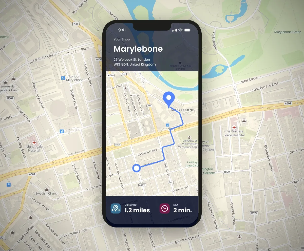
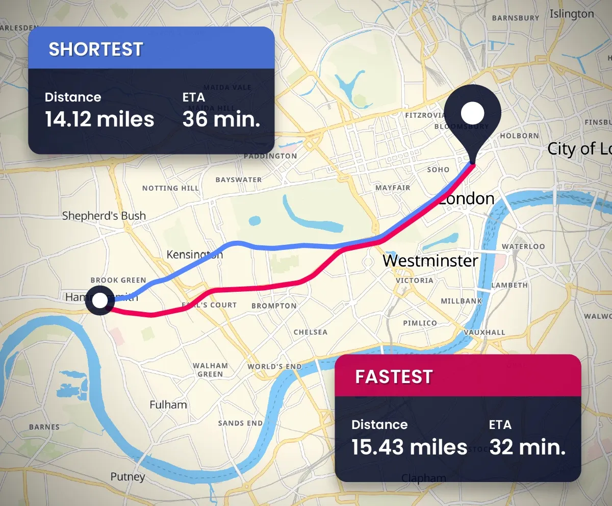
The Woosmap Distance API is a service providing road travel distance and duration calculations. The API takes into account the user’s location (or point of departure) and destination as well as the traffic to give specific distances, a traject / travel route, as well as calculate an estimated time of arrival.
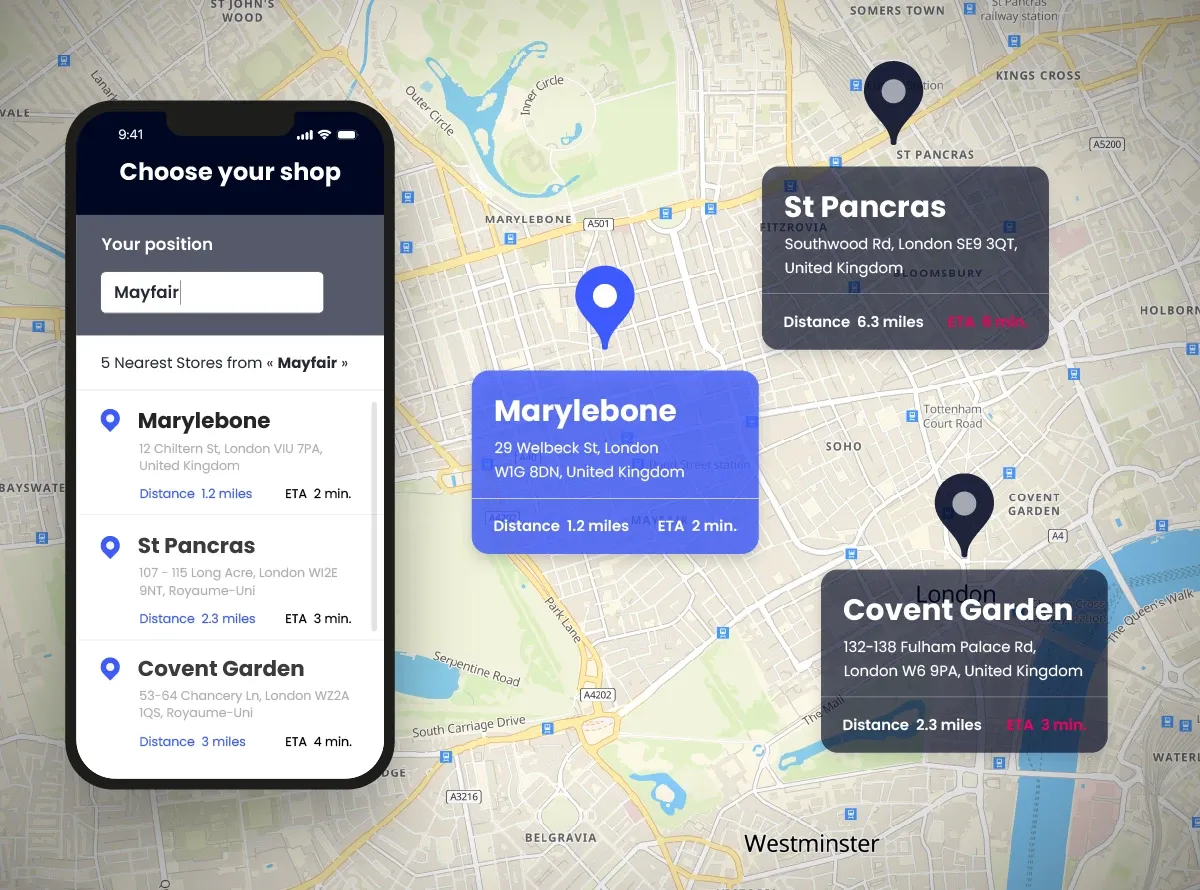
This API can be combined with other Woosmap APIs if needed like the Store Search (examples: search for closest stores or services, ressources / tasks affectation, …).
You might see mentions of Traffic API in our documentation or articles. This API is now directly integrated in Distance API and you can activate the Traffic option when needed.
Yes, Distance API takes into account mobility profiles when calculating a distance between two points (or more). You can either be walking, cycling, using a car and have an appropriate path.
Woosmap has an “open ecosystem” vision when it comes to developing products. We insist on making applications that are compatible with other products. Accordingly, Distance API can be combined with a map from a different provider to build the best solution for your users.
However, the best geometrical map match for Distance API’s calculation is with Woosmap Map because it was developed on the same geographic database.
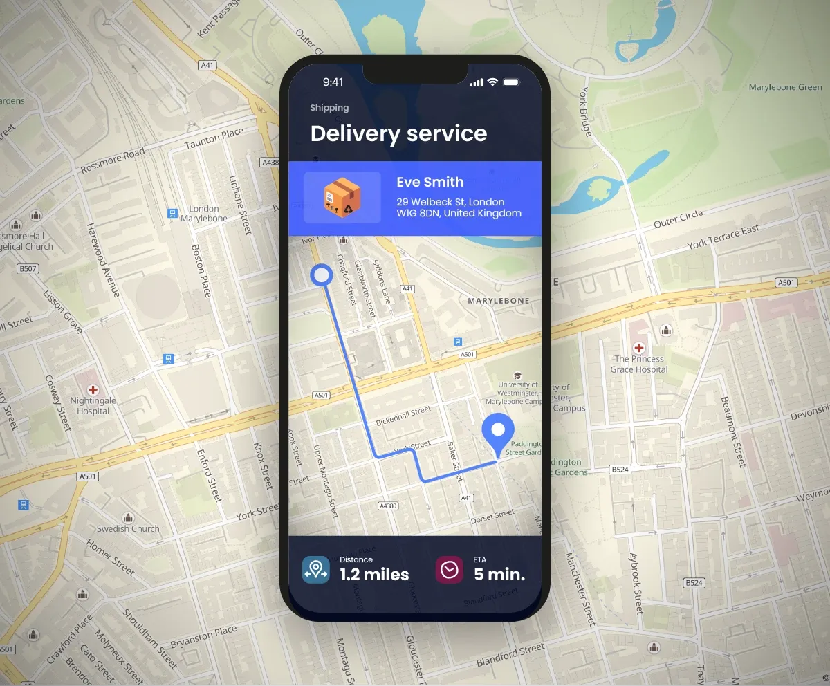
Yes, it’s possible to build a delivery route service with Distance API. By using the distance matrix computing to build your optimisation model, or the reordering of stops in a multistop route thanks to the "waypoints" parameter.
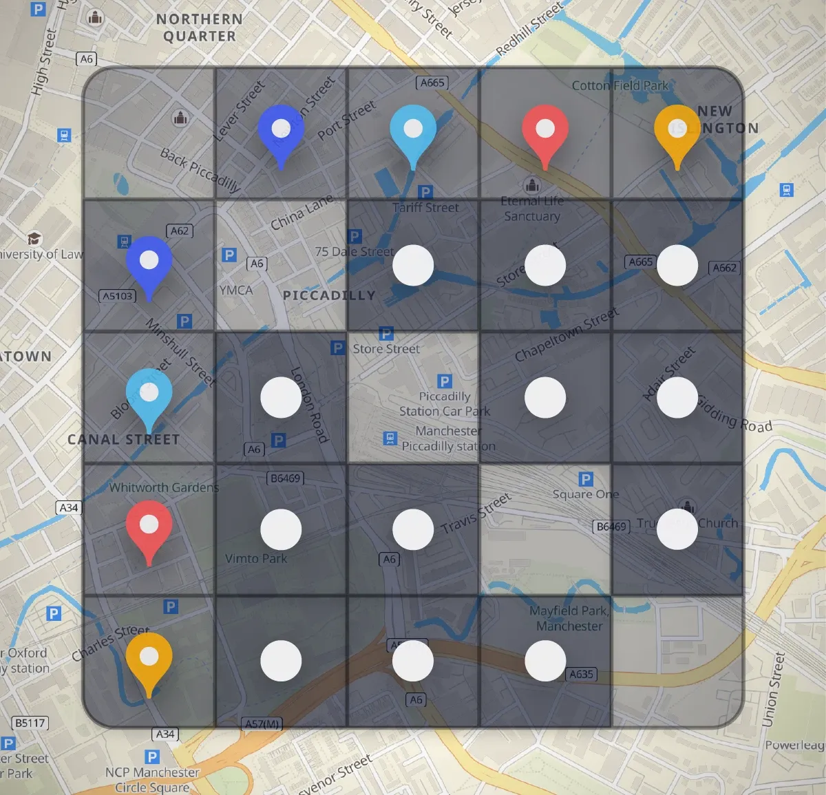
Distance Isochrone is a solution allows you to identify time-based or distance-based areas around a shop, or a location. By creating isochrones within a specific travel time or distance, you can determine reachable destinations for targeted promotions.
This feature enables businesses to strategically plan marketing campaigns, offer location-based discounts, optimise customer outreach based on catchment areas or even plan delivery routes in urban areas for example.