The Best Way to Spend One Day in Black Canyon of the Gunnison This Summer

Looking to make the most of your day trip to Black Canyon of the Gunnison National Park?
Here’s a compact one day in Black Canyon of the Gunnison National Park itinerary, echoing the route I took during my 3 month long road trip journey up the Rockies.
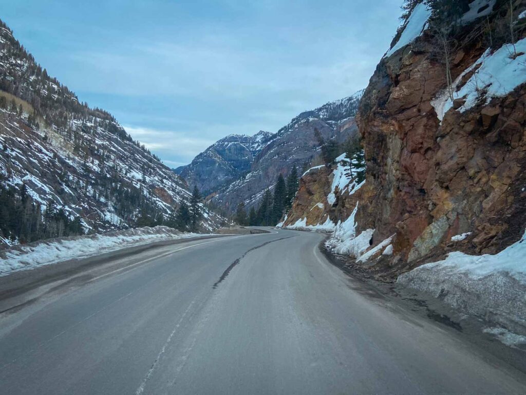
Since I went in March, I was still quite limited because of winter closures. But I must say, even during other seasons, a single day should be enough to see this park. The only thing is this national park is way in the middle of nowhere Colorado, which means it does take some time to reach.
Provided you’re not coming in the dead of winter, we’re going to optimize your time with an action-filled day, focusing on the South Rim and East Portal sections of the park. I’ll also provide recommendations for other must-explore spots and a concise travel guide packed with practical details.
Sample One Day in Black Canyon of the Gunnison National Park Itinerary
I’ve condensed the park overview into one scroll, but keep reading for detailed descriptions of each location and the activities offered.
Travel Tip! There are no bridges or roads within the park that connect the rims. Access to both rim drives is available from the highway, but they dead-end within the park. To travel from one rim to the other, you’ll have to go back out to the public roads, which can take more than 2 hours.
With one day, we’re going to concentrate our time on the South Rim and East Portal, which are connected and have more overlooks and viewpoints.
- Start your day early by entering the South Rim Entrance Station and stopping at Tomichi Point before heading into the visitor center.
- Take a short hike along the Rim Rock Nature Trail to Gunnison Point Overlook for your first up-close canyon views.
- From there, you can continue onto the Oak Flat Loop Trail, which connects to the visitor center.
- Post-lunch, drive along the South Rim Drive, walking at many viewpoints, like Painted Wall View and Chasm View.
- Make a U-turn at the end, and go for a scenic drive down the steep, winding roads of East Portal Road.
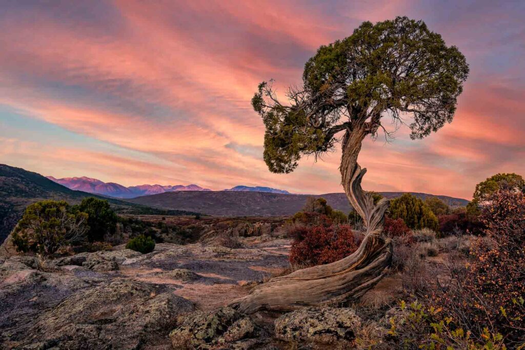
- Drive back up for a peaceful sunset at your favorite overlook.
- Set up camp at the South Rim Campground or return to the nearest city.
Recommended lodging options for the Night Nearby
- Luxury: Double G Ranch & Guestlodge
- Mid-range: Old School Lodge
- Budget: Hampton Inn Montrose
Visiting the Black Canyon of the Gunnison Quick Facts
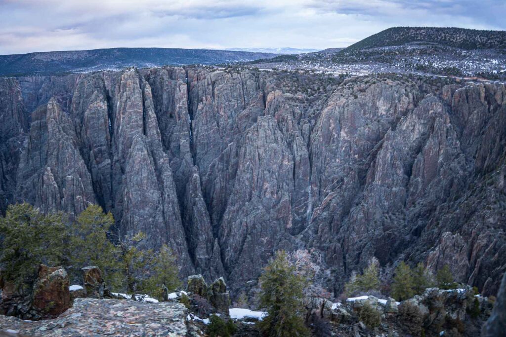
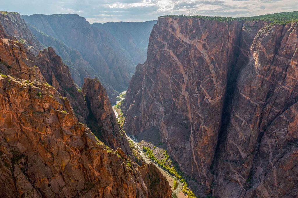
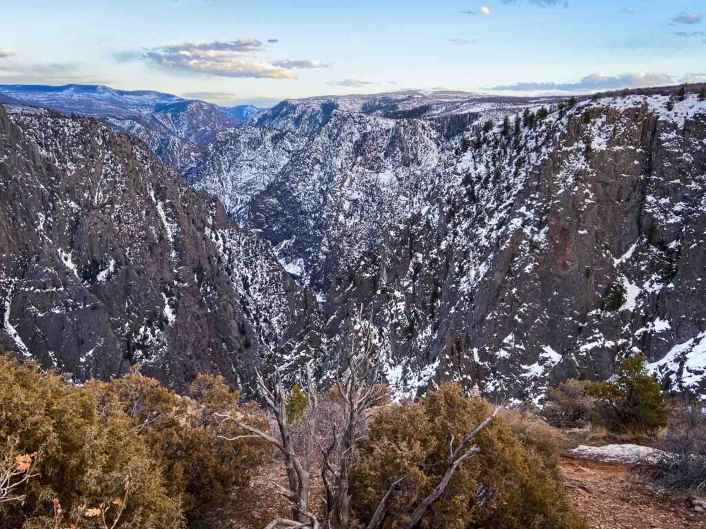
Black Canyon of the Gunnison National Park in western Colorado is where you can see the forces of the Gunnison River and weathering have crafted a vertical wilderness of rock, water, and sky over two million years. This park features dark canyon walls that plunge an astonishing 2,700 feet to the river below, with views that rival even the Grand Canyon.
| Quick Facts | Details |
| Entrance Fee | $25 per vehicle (7-day pass) or $80 for the America the Beautiful Annual National Park Pass |
| Operating Hours | Open 24 hours a day, year-round |
| Visitor Center Names | South Rim Visitor Center, North Rim Ranger Station |
| Park Entrances | South Rim Entrance, North Rim Entrance |
| Main Activities | Hiking, Wildlife Viewing, Camping, Fishing, Rock Climbing, Stargazing |
| Number of Campgrounds | 3 (South Rim, North Rim, and East Portal Campgrounds) |
| Nearby Hotels | Numerous in nearby cities such as Montrose and Gunnison 📍Luxury: Double G Ranch & Guestlodge 📍Mid-range: Old School Lodge 📍Budget: Hampton Inn Montrose |
| Best Time to Visit | Late Spring to Early Fall |
| Nearest Cities & Distances | Montrose – 15 miles, Gunnison – 65 miles Use DiscoverCars to find rental car deals. |
| Nearest Airports & Distances | Montrose Regional Airport – 20 miles, Gunnison-Crested Butte Regional Airport – 65 miles Use Expedia to find the best flight prices. |
Check the official website of the National Park Service for the most up-to-date information.
Morning: South Rim Visitor Center Area
The southern side of the park is where you’ll find the visitor center, as well as access to the majority of overlooks and viewpoints.
If you’re driving in from Montrose, CO take US-50 east 9 miles to CO-347 south. Turn right onto CO-347 for 9 miles until reaching the park’s South Rim Entrance Station.
Tomichi Overlook
The Tomichi Overlook is your first stop after entering the South Rim Entrance Station. With minimal walking required, this overlook previews the staggering depth and dramatic rock formations that Black Canyon of the Gunnison is known for.
Snap a few photos, get a feel of the terrain, and get excited for what’s ahead.
Rim Rock Nature Trail to Gunnison Point Overlook
Starting from the Visitor’s Center, the Rim Rock Nature Trail is a gentle 1-mile trail through scrub oak, serviceberry, and pinyon pine forests before arriving at Gunnison Point Overlook.
This is your first real look at this amazing canyon. Here, the Black Canyon’s sheer walls plunge dramatically into the depths, and you have an unobstructed view of the Gunnison River coursing through the canyon floor. Tall, jagged rocks painted in shades of gray and black rise starkly against the bright blue sky.
Oak Flat Loop Trail
From Gunnison Point Overlook, the Oak Flat Loop Trail provides a moderately challenging 1.5-mile loop that connects back to the visitor center. The trail descends around 400 feet, delving deeper into the canyon’s rugged landscape.
The trail is well-marked and generally takes around 1 to 2 hours to complete. As you wind your way along the trail, you’ll constantly have views of the canyon and the Gunnison River.
I hiked this in early spring, and due to ice, the trail was a bit slippery, so especially if you are coming earlier in the season, be sure to wear sturdy shoes.
South Rim Drive
South Rim Drive
After you’ve explored the trails in the morning, it’s time to hit the road and explore the scenic viewpoints along South Rim Drive. This winding asphalt road is 7 miles long and has plenty of pull-outs.
Note! The South Rim Drive is open to vehicles from early April to mid-November. In the winter, the road is closed to vehicles but remains open for cross-country skiing and snowshoeing.
Here are all the overlooks on the South Rim Drive. They are all easily accessible, with no more than a few minutes walk to most.
Pulpit Rock Overlook
Pulpit Rock Overlook is around 4 miles from the South Rim Visitor Center. The Pulpit Rock is a gigantic rock formation that stands like a sentinel against the backdrop of the canyon walls. This unique structure seemingly juts out of the canyon wall.
Cross Fissures View Overlook
As you continue your journey along the South Rim Drive, the Cross Fissures View Overlook gets its name from the array of vertical rock fractures, or “fissures,” carved into the canyon walls. These fissures, which crisscross the canyon’s steep sides, result from ages of geological forces acting upon the malleable rock.
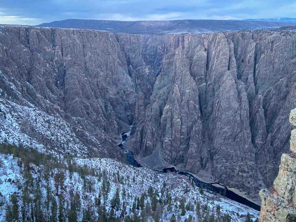
Rock Point Overlook
The Rock Point Overlook provides a panorama of the canyon and the Gunnison River. You can see the winding path the river has carved through the rocky landscape over countless millennia.
Devil’s Lookout Overlook
From Devil’s Lookout, you can see both the sheer cliff faces and the Gunnison River meandering in the depths below. Here, the canyon walls appear to form a natural amphitheater.
Painted Wall View
The Painted Wall views the park’s tallest cliff, known as the Painted Wall. At 2,250 feet, it’s taller than the Empire State Building. The cliff’s unique patterns, caused by lighter pegmatite intrusions against the darker gneiss and schist, gave the place its name.
Chasm View
Chasm View, situated at a bend in the river, is an excellent vantage point to look straight down into the canyon. You’ll stand just 1,800 feet above the river, offering a thrilling perspective.
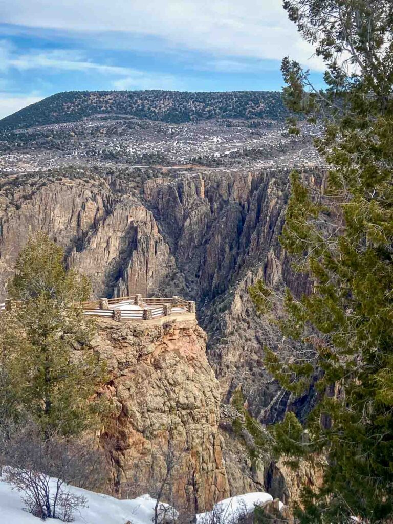
Cedar Point Overlook
From Cedar Point Overlook, you can enjoy sweeping views of the Black Canyon walls and the Gunnison River below. The overlook features two separate viewing platforms.
Dragon Point Overlook
The Dragon Point Overlook has great views of the Black Canyon, the Gunnison River, and the surrounding forest.
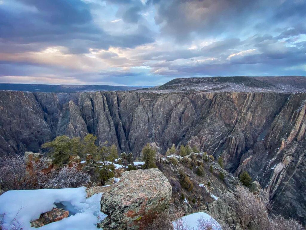
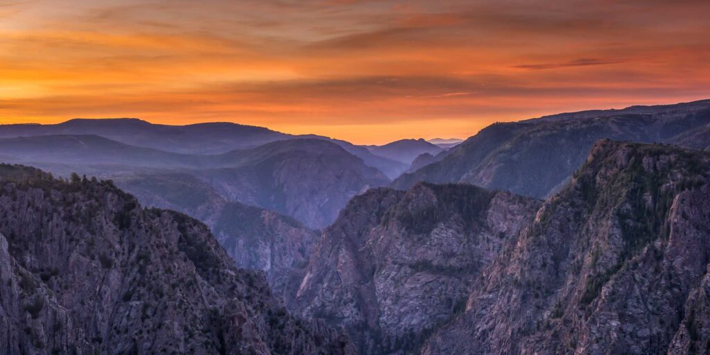
Sunset View Overlook at Black Canyon
The Sunset View Overlook is a perfect spot to cap off your adventure in the Black Canyon of the Gunnison, but we’ve still got more places in the park to go.
This place is known as the sunset spot if you want to drive down the South Rim Road again after the East Portal.
High Point Overlook
The last stop on your journey along the South Rim Drive should be the High Point Overlook. As the name suggests, this spot puts you at an elevation of 8,289 feet. From here, you can see not only the vast expanse of the Black Canyon but also the Uncompahgre Plateau and the San Juan Mountain Range in the distance.
Afternoon: East Portal Road
Now that you’ve finished the South Rim Drive and explored all its overlooks, it’s time to head down the East Portal Road all the way to Crystal Dam.
This winding road leads into the canyon’s depths, which is not allowed for vehicles over 22 feet long or those who are scared of roads steeper than 16%.
The East Portal Road is also closed in winter and early spring.
Places to Visit with More Time
If you have more time to spend in the Black Canyon of the Gunnison National Park, here are some other places I could tack on:
- North Rim Drive: A 9-mile scenic drive along the canyon’s less developed and less visited North Rim.
- Warner Point Trail: A moderate 1.5-mile round-trip trail at the end of the South Rim Road with canyon and San Juan Mountain vistas.
- Curecanti National Recreation Area: Just west of the national park, this area has hiking, fishing, and boating opportunities around three reservoirs.
Note: There used to be Morrow Point Boat Tours, but they stopped operating in 2019.
Where to Stay Near Black Canyon of the Gunnison
Best Hotels in Montrose near Black Canyon of the Gunnison
| Budget | Hotel Name | Benefits |
|---|---|---|
| Luxury | Double G Ranch & Guestlodge | – Close to the Black Canyon of the Gunnison National Park – Clean rooms and food restaurant quality – Great views out every window |
| Mid-range | Old School Lodge | – Affordable option near the park – Extremely well-equipped rooms – Free Wi-Fi and breakfast |
| Budget | Hampton Inn Montrose | – Convenient Location – Complimentary breakfast and free Wi-Fi – Indoor pool and fitness center |
Camping in Black Canyon of the Gunnison
Here’s a table with the three main campgrounds in Black Canyon of the Gunnison National Park:
| Campground Name | Benefits |
|---|---|
| South Rim Campground | – Located on the rim of the canyon at 8,000 feet in elevation. – Most popular campground – Best for RVs |
| North Rim Campground | – Quiet retreat – Less crowded due to its remote location |
| East Portal Campground | – Located at the bottom of the canyon – Best for river access and fishing |
Is One Day Enough?
For most people, sightseeing and taking the short, scenic drives in the South Rim is sufficient, so one day is enough time. You can explore the South Rim Drive, pull-out to every overlook, take the Oak Flat Loop Trail, and finish off with a visit to the East Portal Road, all in a day. With another day, I would add on a trip to the North Canyon as well.
Best Time To Visit
The summer months are the best time to come, with all park facilities and roads open. Summer is the busiest time, but it is generally a pretty underrated National Park. It starts getting cooler in Autumn, and the few crowds there are disperse even more. I went in the winter, and as beautiful as it was with the snow, a lot of the park was closed.
Although the visitor center area is open all year, most roads, including the South Rim Road and East Portal Road, are closed to vehicles during winter and early spring. The winter weather is really harsh and unpredictable.
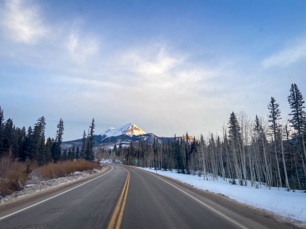
How to Get There
Getting to the Black Canyon of the Gunnison National Park can be an adventure in itself. The park is in Western Colorado, approximately 250 miles southwest of Denver.
If you’re flying, the closest major airport to the park is Denver International Airport (DEN). From here, you can rent a car and drive around 5 hours by road. Alternatively, you could opt for a regional flight to Montrose Regional Airport (MTJ), located just 15 miles from the park entrance.
If you are coming from the south, like Albuquerque or Santa Fe, you can take I-25 N and US-160 W to US-550 N through Durango.
Amtrak offers a rail service, the California Zephyr, which passes through nearby Grand Junction. From the station, it’s approximately a 75-mile drive to the park.
Final Thoughts: Day Trip to Black Canyon of the Gunnison
I hope you’ve enjoyed this itinerary of the south rim of the Black Canyon of the Gunnison National Park. If you’re passing through one of the least visited national parks, then maybe you’re looking for more travel inspiration, don’t forget to check out our other posts on Colorado or other national parks.
Before you Close That Tab…Where to Next in Colorado?
I’ve vanlifed south to the north all of Colorado in the dead of winter to early spring. Let me tell you, it was cold, but turn on that buddy heater, and let’s hit the slopes. If you’re looking for more information on Colorado, check out these other destination itineraries.
- Perfect One Day In Mesa Verde National Park Itinerary
- Perfect One Day In Black Canyon Of The Gunnison Itinerary
- Unbeatable One Day In Rocky Mountain National Park Itinerary
- One Day In Boulder Itinerary: What Not To Miss On A Day Trip
- Perfect One Day In Denver Itinerary For First-Timers
- Perfect One Day In Great Sand Dunes National Park Itinerary
| MY FAVORITE TRAVEL RESOURCES |
✈️ Find amazing guided tours and experiences with Viator to maximize your time! 🏘️ Plan ahead and secure your accommodation with Booking.com in advance. 🧾 Rent a car with Discovercars in advance and get the best prices for your day trip adventures. |