Abingdon
Abingdon-on-Thames is in Oxfordshire on the River Thames about 7 miles south of Oxford. St Helen's Church and the River Thames at Abingdon…Notable Places in the Area
Abingdon County Hall Museum
Museum
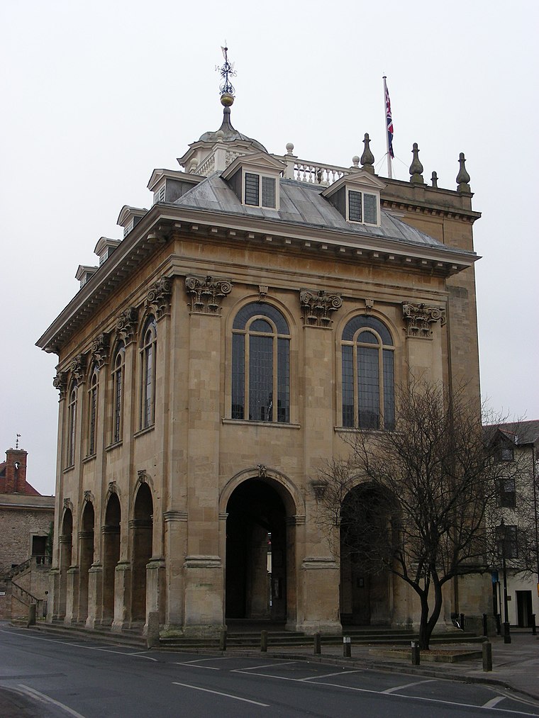
Photo: William M. Connolley, CC BY-SA 3.0.
Abingdon County Hall Museum is a local museum in Abingdon, Oxfordshire, England.
Abingdon Lock
Lock

Photo: Motmit, CC BY-SA 3.0.
Abingdon Lock is a lock on the River Thames in England, less than 1 mile east and upstream of Abingdon, Oxfordshire, on the opposite bank of the river.

Localities in the Area
Sandford-on-Thames

Photo: Simon Burchell, CC BY-SA 4.0.
Sandford-on-Thames is a village in Oxfordshire, just south of Oxford.
Sutton Courtenay
Village

Photo: Motacilla, CC BY-SA 4.0.
Sutton Courtenay is a village and civil parish on the River Thames 2 miles south of Abingdon-on-Thames and 3 miles northwest of Didcot. Sutton Courtenay is situated 2½ miles south of Abingdon.
Abingdon
- Type: Locality
- Location: Vale of White Horse District, Oxfordshire, South East England, England, United Kingdom, Britain and Ireland, Europe
- View on OpenStreetMap
Latitude
51.6721° or 51° 40' 20" northLongitude
-1.2844° or 1° 17' 4" westElevation
187 feet (57 metres)Open Location Code
9C3WMPC8+R6GeoNames ID
7292133Abingdon Satellite Map
© OpenStreetMap, Mapbox and Maxar
Other Places Named Abingdon
In the Area
Localities
- Sutton WickLocality
- SunningwellVillage
- RadleyVillage, 2 miles northeast
- DraytonVillage, 2½ miles southwest
- BayworthHamlet, 2½ miles north
- CothillVillage, 2½ miles northwest
Landmarks
- FitzHarris CastleCastle
- Andersey IslandIsland
- Abingdon Mental Health CentreBuilding
- River OckStream
- Dalton BarracksMilitary installation
- Radley railway stationRailway station, 2 miles northeast
Popular Destinations in Oxfordshire
Escape to a Random Place
Discover the village Dumbrăvița in Romania and the locality Hacienda Piedrahita in Cauca, Colombia.
About Mapcarta. Thanks to Mapbox for providing amazing maps. Text is available under the CC BY-SA 4.0 license, excluding photos, directions and the map. Description text is based on the Wikivoyage page Abingdon. Photo: Andrew Gray, CC BY-SA 3.0.