Castle Bridge, Bristol – Gazetteer – CanalPlanAC
CanalPlanAC

Castle Bridge, Bristol

 
Castle Bridge, Bristol BS1 6WF, United Kingdom
 
Information about the place
Castle Bridge, Bristol is a minor waterways place on the River Avon - Bristol (Main River - Bath to Bristol) between Hanham Lock Weir Entrance (Channel leading to the Weir) (4 miles and 7¼ furlongs and 2 locks to the east) and City Ferry Landing Arm Junction (5¼ furlongs to the southwest).
 
 
The nearest place in the direction of Hanham Lock Weir Entrance is Passage Street Bridge; ¾ furlongs away.
 
The nearest place in the direction of City Ferry Landing Arm Junction is Victoria Street Bridge; 1 furlong away.

There is no access to the towpath here.

Mooring here is impossible (it may be physically impossible, forbidden, or allowed only for specific short-term purposes).

Places of interest within and to which this is the nearest place: Mainline railway stations (7½ furlongs away); B and Q DIY shops (1 mile and 7½ furlongs away); Aliance and Leicester cashpoints (ATM machines) (4, nearest is 1 mile and 5½ furlongs away); Barclays Bank cashpoints (ATM machines) (3, nearest is 1¾ furlongs away); HSBC cashpoints (ATM machines) (3, nearest is 1¾ furlongs away); Lloyds Bank cashpoints (ATM machines) (3, nearest is 1¼ furlongs away); Nationwide Building Society cashpoints (ATM machines) (2½ furlongs away); Natwest Bank cashpoints (ATM machines) (2, nearest is 2¼ furlongs away); Santander Bank cashpoints (ATM machines) (2, nearest is 1½ furlongs away); Sainsbury's supermarkets (1 mile and 5½ furlongs away)

There is a bridge here which takes a track over the canal.


Maps
If you are a user and are logged on, or if you are actively planning a route, a map will be displayed here.
Show on external mapping site: Google | OSM | Bing
 
Additional information

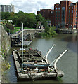
The S-shaped bridge, which Is 91m long and 4m wide, was opened in April 2017 to accommodate both pedestrians and cyclists

 
Photos
 
External websites
There are no links to external websites from here.
Why not log in and add some (select "External websites" from the menu (sometimes this is under "Edit"))?
 
Nearest facilities

Mouseover for more information or show routes to facility

Nearest water point

In the direction of Cumberland Basin Entrance Lock No 2

Arnolfini Moorings5¾ furlongs away
Travel to City Ferry Landing Arm Junction, then on the River Avon - Bristol (City Ferry Landing Arm) to Arnolfini Moorings
Harbour Inlet1 mile away
On this waterway in the direction of Cumberland Basin Entrance Lock No 2

In the direction of Hanham Lock No 1

Hanham Lock No 14 miles, 6½ furlongs and 1 lock away
On this waterway in the direction of Hanham Lock No 1
Wessex Water Services9 miles, 4¾ furlongs and 4 locks away
Travel to Hanham Lock No 1, then on the River Avon (Kennet and Avon Navigation) to Wessex Water Services
Bath Top Lock Visitor Moorings16 miles, 4¾ furlongs and 13 locks away
Travel to Hanham Lock No 1, then on the River Avon (Kennet and Avon Navigation) to River Avon Junction, then on the Kennet and Avon Canal (Main Line) to Bath Top Lock Visitor Moorings
Bathampton Bridge No 18318 miles, 3¾ furlongs and 13 locks away
Travel to Hanham Lock No 1, then on the River Avon (Kennet and Avon Navigation) to River Avon Junction, then on the Kennet and Avon Canal (Main Line) to Bathampton Bridge No 183

Nearest rubbish disposal

In the direction of Hanham Lock No 1

Hanham Lock No 14 miles, 6½ furlongs and 1 lock away
On this waterway in the direction of Hanham Lock No 1
Abbey View Lock No 1116 miles, 3½ furlongs and 10 locks away
Travel to Hanham Lock No 1, then on the River Avon (Kennet and Avon Navigation) to River Avon Junction, then on the Kennet and Avon Canal (Main Line) to Abbey View Lock No 11

Nearest chemical toilet disposal

In the direction of Hanham Lock No 1

Wessex Water Services9 miles, 4¾ furlongs and 4 locks away
Travel to Hanham Lock No 1, then on the River Avon (Kennet and Avon Navigation) to Wessex Water Services

Nearest place to turn

In the direction of Cumberland Basin Entrance Lock No 2

Bathhurst Parade Marina4 furlongs away
On this waterway in the direction of Cumberland Basin Entrance Lock No 2
City Ferry Landing Arm Junction5¼ furlongs away
On this waterway in the direction of Cumberland Basin Entrance Lock No 2
Baltic Wharf1 mile, 3¼ furlongs away
On this waterway in the direction of Cumberland Basin Entrance Lock No 2
Ferry Landings Arm1 mile, 3½ furlongs away
On this waterway in the direction of Cumberland Basin Entrance Lock No 2

In the direction of Hanham Lock No 1

Hanham Lock Weir Exit4 miles, 6¼ furlongs and 1 lock away
On this waterway in the direction of Hanham Lock No 1
Hanham Lock Weir Entrance4 miles, 7¼ furlongs and 2 locks away
Travel to Hanham Lock No 1, then on the River Avon (Kennet and Avon Navigation) to Hanham Lock Weir Entrance
Keynsham Lock Weir Entrance6 miles, 7½ furlongs and 3 locks away
Travel to Hanham Lock No 1, then on the River Avon (Kennet and Avon Navigation) to Keynsham Lock Weir Entrance
Horseshoe Walk Bridge Winding Hole16 miles, 3 furlongs and 10 locks away
Travel to Hanham Lock No 1, then on the River Avon (Kennet and Avon Navigation) to River Avon Junction, then on the Kennet and Avon Canal (Main Line) to Horseshoe Walk Bridge Winding Hole
Pulteney Gardens Winding Hole16 miles, 3¾ furlongs and 11 locks away
Travel to Hanham Lock No 1, then on the River Avon (Kennet and Avon Navigation) to River Avon Junction, then on the Kennet and Avon Canal (Main Line) to Pulteney Gardens Winding Hole
Sydney Wharf Winding Hole16 miles, 6¼ furlongs and 13 locks away
Travel to Hanham Lock No 1, then on the River Avon (Kennet and Avon Navigation) to River Avon Junction, then on the Kennet and Avon Canal (Main Line) to Sydney Wharf Winding Hole
Bathampton Bridge Winding Hole18 miles, 4¼ furlongs and 13 locks away
Travel to Hanham Lock No 1, then on the River Avon (Kennet and Avon Navigation) to River Avon Junction, then on the Kennet and Avon Canal (Main Line) to Bathampton Bridge Winding Hole
Bathampton Winding Hole18 miles, 6¼ furlongs and 13 locks away
Travel to Hanham Lock No 1, then on the River Avon (Kennet and Avon Navigation) to River Avon Junction, then on the Kennet and Avon Canal (Main Line) to Bathampton Winding Hole

Nearest self-operated pump-out

In the direction of Cumberland Basin Entrance Lock No 2

Harbour Inlet1 mile away
On this waterway in the direction of Cumberland Basin Entrance Lock No 2

Nearest boatyard pump-out

In the direction of Cumberland Basin Entrance Lock No 2

Baltic Wharf1 mile, 3¼ furlongs away
On this waterway in the direction of Cumberland Basin Entrance Lock No 2
 
 
Geograph
 
Wikipedia

There is no page on Wikipedia called “Castle Bridge, Bristol”

Wikipedia pages that might relate to Castle Bridge, Bristol
[Bristol Bridge] Bristol Bridge is a bridge over the floating harbour in Bristol, England, the original course of the River Avon. It is a grade II listed building. Bristol's [Bristol Castle] Bristol Castle was a Norman castle built for the defence of Bristol. Remains can be seen today in Castle Park near the Broadmead Shopping Centre, including [Castle Park, Bristol] Castle Park (sometimes referred to as Castle Green) is a public open space in Bristol, England, managed by Bristol City Council. It is bounded by the Floating [Bristol] settlement was known as Brycgstow (Old English "the place at the bridge"). Bristol received a royal charter in 1155 and was historically divided between [Black Castle, Bristol] Black Castle Public House is a Grade I-listed building and public house on Junction Road in the Brislington suburb of the English city of Bristol. It is [River Frome, Bristol] river is known locally in east Bristol as the Danny. The Frome originally joined the Avon downstream of Bristol Bridge, and formed part of the city defences [History of Bristol] included Bristol, from his mother Queen Matilda's estates and granted it to Robert Fitzhamon. Fitzhamon enlarged and strengthened Bristol castle and in [Buildings and architecture of Bristol] periods of the United Kingdom can be seen throughout Bristol. Parts of the fortified city and castle date back to the medieval era, as do some churches [Finzels Reach] central Bristol, England, on a former industrial site, which occupies most of the south bank of Bristol Floating Harbour between Bristol Bridge and St [Castle Ward] have come from the Bristol area, with which the Ward family had associations. It may have been James Bridges who practiced in Bristol between 1757 and 1763
 
Google

Results of Google Search

Finzels Reach - Wikipedia
... of Bristol Floating Harbour between Bristol Bridge and St Philip's Bridge, across the river from Castle Park. A sugar refinery occupied part of the site from 1681, ...
CASTLE BRIDGE, FINZELS REACH, BRISTOL
4613744 51. CASTLE BRIDGE, FINZELS REACH, BRISTOL. Finzels Reach footbridge is a new £2.7m footbridge across Bristol's floating harbour, which allows.
Castle Bridge in central Bristol | Castle Bridge in Bristol … | Flickr
Aug 31, 2018 ... Castle Bridge in Bristol connecting Finzels Reach and Castle Park.
File:Castle Bridge, Bristol, from west.jpg - Wikimedia Commons
Jan 14, 2019 ... File:Castle Bridge, Bristol, from west.jpg. Language; Watch · Edit.
Finzels Reach Bridge - A New Bridge Opens Up Bristol
Twisting its way gracefully across Bristol's historic waterway, Castle Bridge offers a striking connection between Finzels Reach and the city centre. Made from a ...
Bristol's newest bridge is named and opened to the public for the ...
Apr 7, 2017 ... The name, Castle Bridge, was chosen by local musician Barry Walsh, who writes songs about life in Bristol, and says the name "summed up the ...
Castle Bridge Case Study | QED Engineering | Electrical Services ...
Aug 30, 2019 ... QED were commissioned to provide the electrical services design to a new bridge connecting Castle Park with Finzels Reach, Bristol's new city ...
Castle Bridge Bristol - YouTube
Apr 29, 2019 ... As Principal Contractor, we undertook the exciting construction of Castle Bridge in Bristol, a unique 91-metre curved bridge, topped with timber ...
Vibration Simulations and Tuned Mass Damper Design for Castle ...
Castle Bridge is a contemporary and slender S shaped footbridge linking Finzels Reach with Bristol city centre. Full Scale Dynamics were contacted by CTS ...
Bristol, Bristol, England - Castle Bridge, Bristol...
Castle Bridge, Bristol . One from a few months ago on a brief layover in Bristol. Couldn't sleep at all in the hostel so I went for a...