Landsat Next Defined

Landsat Next Defined

Landsat Next is on the horizon—the new mission will not only ensure continuity of the longest space-based record of Earth’s land surface, it will fundamentally transform the breadth and depth of actionable information freely available to end users. Take a look at the new capabilities that will define the next Landsat mission.

Read More »
Landsat Next Defined

Landsat Next Defined

Landsat Next is on the horizon—the new mission will not only ensure continuity of the longest space-based record of Earth’s land surface, it will fundamentally transform the breadth and depth of actionable information freely available to end users. Take a look at the new capabilities that will define the next Landsat mission.

Read More »

“What we’re able to do now is track the flow of the world’s ice from pole to pole and on every continent.”


“When I arrived in Gombe 50-plus years ago, looking up at the stars, it never occurred to me that one day, we’d be relying on remote sensing—satellites circling the globe high above—to help unite communities of people and save Gombe’s chimpanzees. NASA—through its resources and data and funding—is helping us to apply the kinds of innovative solutions needed to address the complex problems people and chimpanzees face today.”


“The water resources communities all through the United States, especially in the irrigated areas, are very appreciative that NASA put the thermal imager on Landsat 8 and that future Landsats are guaranteed to include a thermal imager.”


“We basically built … Tinder for Landsat maps: Swipe right if it’s good, swipe left if it’s bad.”


“Sentinel-2a is essentially Europe’s version of the American Landsat mission.”


“Landsat is the only satellite data archive that allows the quantification of vegetation and flooding dynamics relationships across such a large area. Key features unique to the Landsat archive that are paramount for our work include the archive’s temporal depth and detail provided by over a quarter century of systematically acquired time series of imagery at management-relevant spatial resolution.”


“There are roughly 400 billion land pixels in a single [Landsat] global mosaic.” (With at least one image of every location on Earth per season every year, the entire 43-year Landsat record contains more than 50 trillion pixels.)


“We like to think about Landsat as being, for this particular problem, sort of the sweet spot—the perfect asset. We found Landsat was really good at mapping the bulk of biomass for this particular test area we were looking at.”


“With the Landsat satellite system capable of delivering global coverage every 8 days, we have an unprecedented ability to monitor global forest change. The 2014 tree cover loss data, incorporating hundreds of thousands of Landsat images, confirms that deforestation is not just high in certain countries, it’s speeding up. The next step is to use this information to improve forest protection and more equitably balance economic development with the invaluable ecosystem services forests provid…


“Understanding how this planet works and helping people make better, informed decisions is really what we’re about in Earth Science.”


“New sensors are nice, but can’t let us see back in time. Happy 17th!”


“Landsat data has proved invaluable for much of the work we do to try and comprehend how Earth’s cryosphere is responding to a warming planet and to infer what those results mean for our collective future.”


“The tracking of over-irrigated areas for targeting irrigation advisory texts was completely dependent on Landsat TIR data.”


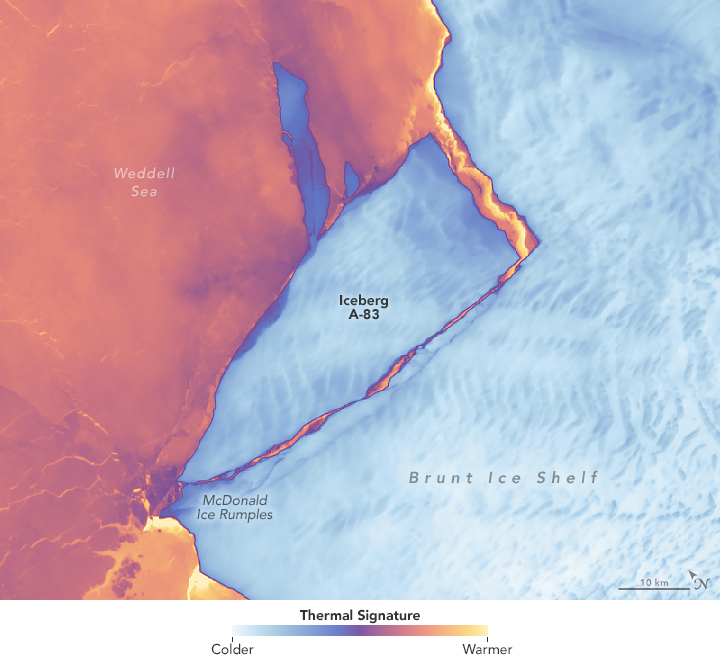
“A growing archive of Landsat images allow us to see how quickly icesheets are changing.”


“Landsat is widely considered to be a crucial national asset, comparable to the satellite-based GPS system and National Weather Service satellites. Ready access to Landsat images supplies a reliable common record of Earth conditions that fosters the mutual understanding of environmental challenges by citizens, researchers, and decision makers worldwide.”


“Until we made the map of coral reefs with Landsat 7, global maps of reefs had not improved a lot since the amazing maps that Darwin drafted.”


“A 35-year dataset in marine biology is really hard to find… But we need long-term data to understand climate change and how it impacts populations. This was an exponential increase in the amount of information available about kelp forests in Oregon.”


“With its superhuman sight, and decades of archived imagery, Landsat provides us with the ability to see through time, to track the vegetal movement which is beyond our normal sight and to see it for what it really is: a titanic unfolding of active and intentional life.”


“Landsat and agriculture go hand in hand because agriculture is a seasonal phenomenon, and you really need to monitor it closely over time.”


“In the world of water resource management, Landsat has played a key role in providing objective and continuous data for the United States, particularly in the arid west. Water-related benefits of Landsat imagery are also reaped far beyond the United States’ borders in countries such as Chile, Australia, Morocco, Sudan, and Venezuela, which are using Landsat data to make informed decisions regarding natural resource allocation and use.”


“Landsat has been producing Big Data since before data was big.”


“I don’t think people appreciate just how revolutionary it was when the Landsat archive became available for free and really empowered researchers and advocates to have access to that data at an affordable price to be able to do the kind of mapping that’s now been done, making visible what was previously invisible…”


Landsat 9 bw
Landsat 9 bw
Landsat 9 bw

The NASA/USGS Landsat Program provides the longest continuous space-based record of Earth’s land in existence. Landsat data give us information essential for making informed decisions about Earth’s resources and environment.