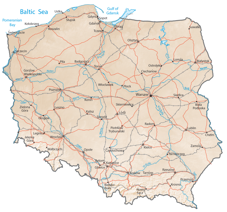
Map of Poland – Cities and Roads
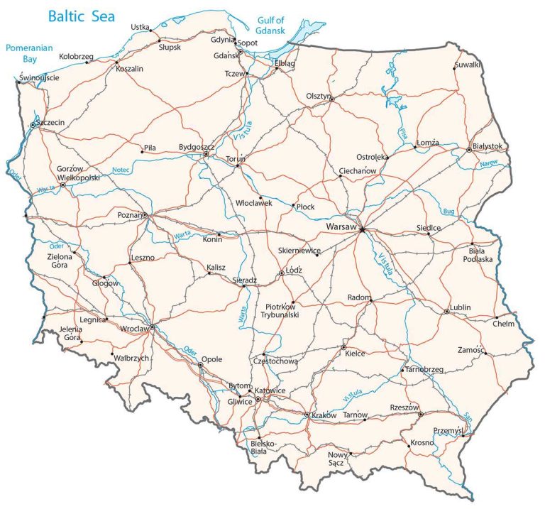
This map of Poland displays major cities, towns, roads, rivers, and lakes. Satellite imagery and an elevation map show everything from the Tatra Mountains to the Masurian Lake District.
Poland map collection

You are free to use our Poland map for educational and commercial uses. Attribution is required. How to attribute?
About the map
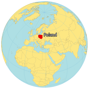
Poland is located in central Europe next to the Baltic Sea. It borders six European countries including Germany to the west, the Czech Republic to the southwest, Slovakia to the south, Ukraine to the southeast, Belarus to the east, and Lithuania to the northeast.
The terrain in Poland is a mostly flat plain, and this lack of natural barriers has contributed to being an area of conflict. Its coastline with the Baltic Sea is estimated at 770 km (478 mi) in length. Warsaw is the capital and largest city of Poland. Other major cities are Krakow, Lodz, and Wroclaw.
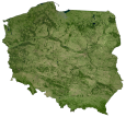
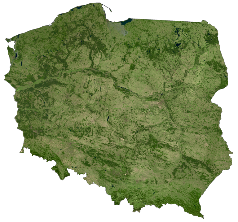
SATELLITE IMAGERY
Poland Satellite Map
Altogether, Poland occupies a total area of 312,696 square kilometers (120,733 sq mi). In comparison, it’s larger than the United Kingdom but smaller than Norway. One of its distinct regions is the Masurian Lake District in northeast Poland. Overall, this area contains more than 2,000 lakes and was a possibility to become one of the new wonders of the world.
However, the Pomerania in the northwest is characterized as a historical region split between Germany and Poland. While its longest river is the Vistula River, Poland’s largest body of water is Lake Śniardwy. Poland has a temperate climate, with cool winters but sometimes hot summers.
PHYSICAL MAP
Poland Elevation Map
The most prominent mountain chain in Poland is the Tatra Mountains, which are part of the Carpathian Mountains. This mountain range straddles Poland’s southern border with Slovakia. At 2,501 meters (8,205 ft) in height, Rysy is the highest peak in Poland. Whereas its lowest point is Raczki Elbląskie at 2 meters (7 ft) below sea level.
From its highest peaks in the south, Poland transitions to the uplands further north. Then, it flattens out with the Polish Plains in the interior of the country. This is the most fertile region in the country with most of its arable land.
Capital City
Warsaw
Major cities
Bialystok
Gdansk
Gliwice
Gorzow Wielkopolski
Kielce
Krakow
Łódź
Lublin
Olsztyn
Opole
Poznan
Szczecin
Wroclaw
Cities, towns and villages
Biala Podlaska
Bielsko-Biala
Bydgoszcz
Bytom
Ciechanow
Częstochowa
Elblag
Gdynia
Glogow
Jelenia Góra
Kalisz
Katowice
Kołobrzeg
Konin
Koszalin
Krosno
Legnica
Leszno
Nowy Sącz
Ostroleka
Piotrkow Trybunalski
Płock
Przemysl
Radom
Rzeszów
Siedlce
Sieradz
Skierniewice
Słupsk
Sopot
Suwalki
Swinoujscie
Tarnobrzeg
Tarnow
Tczew
Torun
Ustka
Walbrzych
Włocławek
Zamosc
Zielona Góra
Rivers, bays, and gulfs
Baltic Sea
Bug River
Gulf of Gdansk
Narew River
Notec River
Oder River
Pisa River
Pomeranian Bay
San River
Vistula River
Warta River