Anchorage Map, Alaska
Anchorage map collection

Anchorage, Alaska is a place for people from all walks of life. Quirky. Friendly. Cold weather. No city in the United States is like Anchorage. It’s for anyone who loves a big city living. But it’s also for those who want a small-town feel.
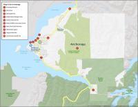
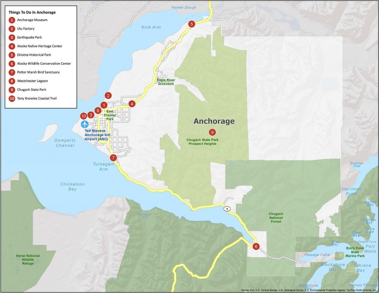
10 Things To Do in Anchorage
Truth be told. When you see the geese flying south in the winter, we can only dream of escaping Anchorage’s horrid weather (like them). Because after experiencing a winter in Anchorage, all that wait… and you get to spend a gorgeous summer surrounded by mountains.
If you’re an outdoorsy person, Anchorage has five state parks not too far away. In the winter, many people head south to escape the cold. But if you are looking for an adventure, Alaska is the place to be. Experience everything from skiing, cruises, and snowshoeing.
- Anchorage Museum
- Ulu Factory
- Earthquake Park
- Alaska Native Heritage Center
- Eklutna Historical Park
- Alaska Wildlife Conservation Center
- Potter Marsh Bird Sanctuary
- Westchester Lagoon
- Chugach State Park
- Tony Knowles Coastal Trail
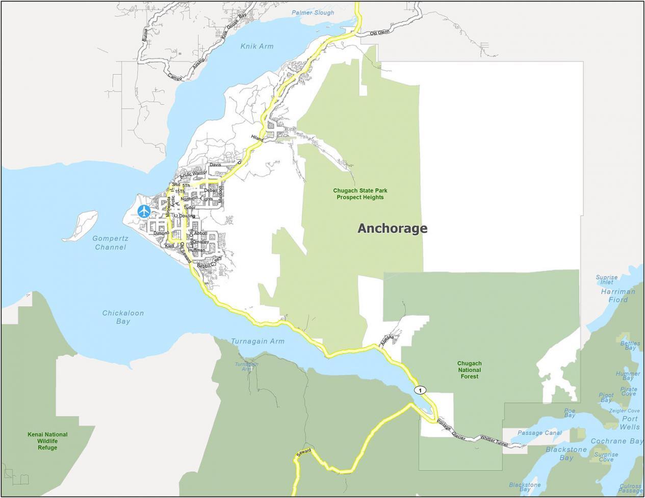
Anchorage Alaska Reference Map
From hiking to fishing, visitors come here to camp, ski, or enjoy a night out. It’s also a great place to retire. It’s home to many historical sites and a large military base. There are enough natural wonders to fill a lifetime of exploration. Its natural resources are forests so you can find abundant wildlife like moose, brown bears, caribou, and black bears.

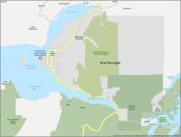
Census Designated Place (CDP): Big Lake, Butte, Hope, Knik River, Knik-Fairview, Point MacKenzie, Point Possession, Sunrise, Susitna
City: Whittier
Municipality: Anchorage
Anchorage Road Map
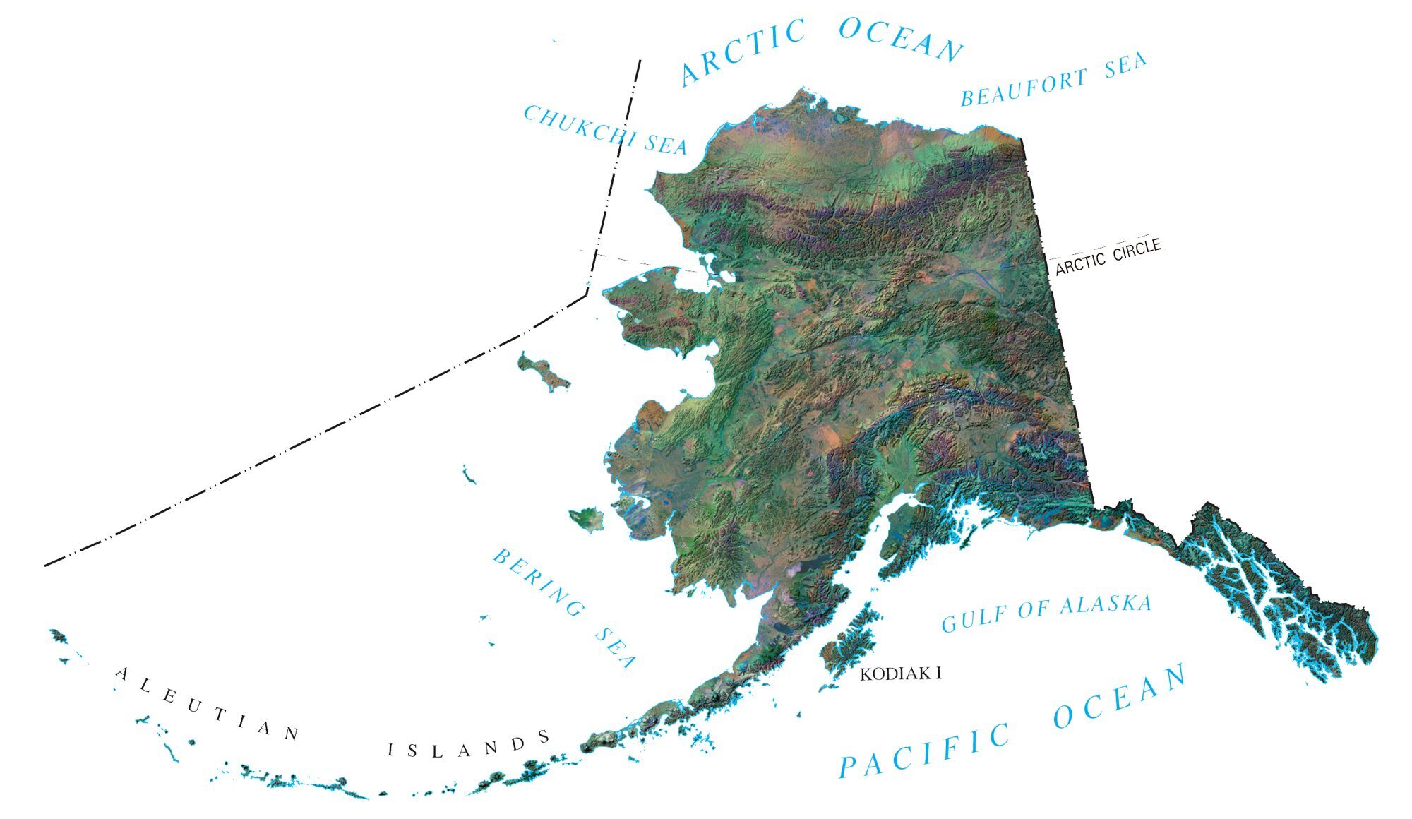
Anchorage is the most populous city in Alaska. It is located near the eastern edge of Knik Arm, with the Chugach Mountains stretching to the east. Anchorage is on a peninsula split along the Cook Inlet.
Anchorage is 370 miles (600 km) south of the Arctic Circle at 61 degrees north latitude. Anchorage is the largest city in Alaska by far. Don’t forget to take a look at our Alaska road map for road and highway information for the state of Alaska.

Major Highways: Highway 1
Highways: Alyeska Hwy, Davis Hwy, Old Glenn Hwy, Old Seward Hwy, Seward Hwy
Parkways: Boniface Pky, Lake Otis Pky, Penland Pky
Major Roads: 36Th Ave, 5Th Ave, 6Th Ave, Brayton Dr, Gambell St, Ingra St, Minnesota Dr, Omalley Rd, Spenard Rd, Walter J. Hickel Pkwy
I’m wondering where the best hospitals in AK are located as I’m a BC survivor and also have cardiac issues.
Thank you for supplying such good maps and so informative as well.