Chicago is one of the most popular U.S. cities to visit. The Windy City is filled with activities for every type of traveler. Foodie travelers would love a Chicago-style hot dog, while outdoor enthusiasts would enjoy getting out on the lake, and sports fans can enjoy a baseball game at Wrigley Field. But getting around any city can be overwhelming – but not in Chicago!
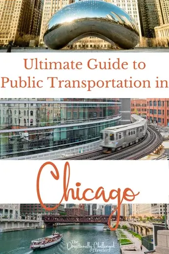
Chicago’s extensive public transportation network is the lifeblood that connects its vibrant neighborhoods and bustling cityscape. Knowing how to traverse the city by transit is essential for experiencing all that Chicago has to offer. This Ultimate Guide is your compass to mastering public transportation in Chicago, from the rhythms of its rail to the dance of its buses. So, buckle up and prepare to become a savvy urban navigator, taking on Chicago’s streets like a seasoned traveler.
I always like to take public transportation when I travel. It’s a great way to be a more sustainable traveler, but it also shows us a side of the city you don’t get to see when taking cabs or ride-shares. Bonus, you also save money on travel.
This post contains affiliate links. This means if you purchase something from a link, I may make a small commission, at no cost to you. This helps me keep the site running and free.
If you like this post, be sure to sign up for my e-mail list for travel inspiration (and get your FREE budget printable), or connect with me on Facebook, Instagram, Twitter, or Pinterest.
Getting Around Chicago: An Overview
Navigating the bustling metropolis of Chicago is an experience made efficient and user-friendly thanks to a robust public transportation network. Operated by the Chicago Transit Authority (CTA), this network gives residents and visitors a variety of convenient options to traverse the cityscape and its suburbs. From the famed elevated trains, affectionately known as ‘The L’, to an extensive bus system, mobility in Chicago is designed to facilitate regular commutes and spur-of-the-moment explorations alike.
The backbone of Chicago’s public transportation is the omnipresent CTA trains and buses. This system is complemented seamlessly by the Ventra payment method – a contactless card solution that lets passengers swipe and travel with ease. No more fumbling for change and tickets; with Ventra, travel across the city becomes a smooth sail. There is also a Ventra app to help plan accordingly!
At the heart of Chicago’s transportation system lies The ‘L’. It’s a network of over 140 stations sprawling across eight train lines that seamlessly integrate above and underground paths to guide travelers to their destinations. Riding The ‘L’ is a quintessential Chicago experience, where catching a glimpse of Lake Michigan, Michigan Avenue, or Navy Pier from an elevated viewpoint can be the highlight of a morning commute – all for the price of a single ride, typically $2.50 or less. We were able to get from Chicago Midway to Staypineapple on the Orange Line for $2.50. It was a budget-friendly way to get to downtown stations.
With a public transit network that includes not just buses and trains, but also bike lanes and the iconic Chicago Water Taxi, the city stands as a testament to urban transportation diversity.

Public Transportation Options in Chicago
Chicago Transit Authority (CTA)
The CTA is the primary provider of public transportation in Chicago and has an expansive network of trains and buses that crisscross the city and some of its suburbs. Known for its reliability and reach, the CTA operates the second-largest public transport system in the United States. Using the Ventra payment system, travelers can enjoy the convenience of contactless fare payments with easily reloadable cards tapped for travel.
They have a single pass, day cards, or multi-day cards. We purchased the 3-day card for our 3 days in Chicago and it was great to have. When our feet hurt after our Gangsters & Ghosts tour, we could take a quick trip to our hotel since there was a bus stop right there!
The CTA’s famous ‘L’ train, with 144 stations serving areas including The Loop, Central Park, and Evanston, forms a vast web of elevated rail lines that give riders a scenic and efficient way to navigate the city. Buses also play a crucial role, filling in the gaps and offering frequent, affordable transit options that keep the city accessible to all.
Commuter Trains
For longer-distance commutes, the Metra’s commuter trains are the answer. Linking the city’s downtown with its surrounding suburbs and even stretching to adjacent states like Indiana and Wisconsin, Metra’s network includes 242 stations. With ticketing options such as one-way passes, a 10-ride pass, day passes, and weekend passes, travelers can select the fare that best fits their needs, with the added convenience of purchasing unlimited travel $6 day passes through the Ventra app.
Designed to accommodate heavy traffic of daily commuters, Metra trains are distinct with their double-decker cars and service routes to remote locations including Fox Lake, Homewood, and University Park. While CTA trains address the needs within the city, Metra helps bridge the gap for suburban commuters, ensuring that even those living outside the immediate urban area can enjoy the benefits of Chicago’s extensive public transportation network.

Chicago Train Stations
Chicago, a bustling metropolis located on the shores of Lake Michigan, is renowned for its extensive and efficient train system. The central area, often referred to as the downtown Loop, offers travelers a variety of train stations, each catering to different routes and services. Among these, three major stations stand out: Union Station, Millennium Station, and LaSalle Street Station. These hubs are strategically situated to serve the expansive needs of suburban, regional, and long-distance passengers. Chicago’s notable ‘L’ train system, with its network of eight color-coded lines including the Orange, Pink, and Red lines, simplify navigation. Notably, the Red and Blue lines offer the convenience of 24/7 operation, ensuring transportation is readily available regardless of the hour.
You can use paper tickets or the very convenient Ventra card. The Metra commuter rail service, extending well beyond the city’s boundaries, offers an impressive weekday schedule with over 700 trains, covering a vast area of 3,700 square miles across northern Illinois.
Union Station
Union Station, situated in the heart of Chicago, is more than a train station—it’s a historic landmark and a central hub for various transit services. With CTA buses 7, 60, 124, 125, 126, 151, 156, and 157 stopping here regularly, and additional buses during peak hours and seasons, accessing Union Station is convenient from numerous parts of the city. For bus transportation within the city, the Union Station Transit Center serves as a key nexus point, and Clinton Street’s different sides offer additional accessibility.
For those traveling further afield or arriving from other parts of the country, Union Station also provides access to the CTA’s Blue Line, which offers direct routes to O’Hare International Airport and Forest Park, cutting right through downtown. This station is just as vital for commuter rail connections, particularly for the Metra service and Pace suburban buses, solidifying Union Station as a pivotal node in Chicago’s intricate transit network.
Millennium Station
Nestled in downtown Chicago, Millennium Station emerges as a vital terminal for the NICTD/South Shore Line transit services. This station is the endpoint of a journey that stretches from the bustling streets of downtown Chicago to the far-reaching South Bend International Airport in Indiana, offering a vital connection between the two regions. Commuters from the outer cities of Northern Indiana find Millennium Station a convenient departure point on their way to Chicago, demonstrating the station’s significant role in the region’s intercity travel.
For those bridging the gap between South Bend and the Windy City, Millennium Station stands as a key hub. Whether embarking or disembarking, passengers rely on the NICTD/South Shore Line, which starts here, ensuring they have a direct and reliable transit service that connects the heart of Chicago with the serenity of South Bend, Indiana.

LaSalle Street Station
A short distance from the financial heart of the city lies LaSalle Street Station, a noteworthy terminal for Chicago’s Metra rail network. This station is exclusive to the Rock Island District line and is one of the four primary stations serving downtown Chicago. It functions as a critical transit point for suburban commuters heading to or from the city, providing efficient and frequent services across numerous suburbs.
Steeped in history, LaSalle Street Station is much more than a modern commuter terminal. It captures a slice of the city’s rich rail transportation legacy, acting not only as a conduit for daily travel but also as a testament to the evolution of Chicago’s robust transit framework. Whether one seeks the practicality of commuter services or wishes to observe a station steeped in historical significance, LaSalle Street Station offers both with an air of distinction and a promise of connectivity.
Chicago Bus Routes
Navigating the city of Chicago is made convenient by the Chicago Transit Authority’s (CTA) vast bus system. The network comprises over 127 routes crisscrossing the Windy City and extending out to serve 35 suburbs. From bustling Michigan Avenue to the historical lanes of Oak Park, CTA bus services connect diverse neighborhoods and major tourist destinations, ensuring visitors and residents alike can effortlessly explore the city’s rich tapestry.
Payment is user-friendly, with options such as cash, the multifaceted Ventra Card, contactless bankcards, and mobile wallet apps facilitating smooth transactions. Fares are affordable, with a single ride costing between $2.25 and $5.00, and further convenience is added with the availability of free transfers and unlimited passes for those using a Ventra Card. Bridging the gap between different modes of transportation, the CTA also accommodates cyclists by equipping each bus with bike racks, reflecting Chicago’s status as a walkable and bike-friendly city.
To enhance the rider experience, the CTA provides the Owl symbol, representing late-night bus services that run approximately every 30 minutes, ensuring the city’s vibrant nightlife is accessible to everyone. Additionally, the innovative CTA bus tracker software empowers passengers to plan their journeys with precision, thus exemplifying the efficiency and accessibility of Chicago’s commendable public transit system.

Overview of Chicago Bus Routes
Chicago’s sprawling metropolis is serviced by a network of bus routes that facilitate smooth travel from the early hours of dawn until late in the evening. CTA buses make frequent stops, generally every two blocks, at posted signs detailing route numbers, names, and descriptions to assist riders in seamlessly reaching their destinations. For visibility and ease, destination signs are clearly displayed above the bus windshield.
Buses are continually in motion from the crack of dawn, serving the city’s need for early commuting, and extend into the sedate hours of late evening, with some routes offering owl services for the nocturnal crowd. Navigating between the avenues near Navy Pier and the hustle of O’Hare International Airport becomes effortless with this extensive service. Attesting to the city’s commitment to inclusivity, each bus is also accessible, ensuring that all passengers, regardless of mobility, can partake in the city’s public transit offerings.
Popular Bus Lines in Chicago
The CTA’s network features numerous bus lines that are essential lifelines of the city, accommodating both the flurry of daily commuters and the inquisitive wanderlust of tourists. Among the vast network, certain bus lines stand out due to their frequent use and strategic routes.
- The #146 Inner Drive/Michigan Express: A popular choice for sightseers, this line wends its way through key destinations including Millennium Station, the Art Institute of Chicago, and Navy Pier.
- The #151 Sheridan: It sails along scenic paths touching the Lake Michigan shoreline and is essential for those who wish to traverse the coastline or visit the renowned Lincoln Park Zoo.
- The #22 Clark: Serving as a crucial north-to-south route, this bus travels through the heart of Chicago’s commercial and residential areas including Andersonville and Rogers Park.
- The #8 Halsted: Perfect for discovering the bustling Greektown and the historic Union Stockyards gate, it is a route deeply embedded in Chicago’s urban fabric.
We found the buses to be very reliable and predictable. Each stop (that we saw) had a sign with an estimated time of arrival
Exploring Chicago by Water
Navigating the bustling city of Chicago doesn’t end with bus routes and trains; the adventure continues on the water with the city’s signature water taxis. These unique vessels provide a picturesque yet pragmatic way to commute and sightsee, whisking passengers among top destinations like the vibrant Chinatown, the educational Museum Campus, the towering Willis Tower, and the festive Navy Pier. They are only available in the warmer months (i.e. not when we visited haha). We did take an Architecture Tour with Shoreline though and their boat was very nice!
Passengers can opt for the services of two primary water taxi providers: the Chicago Water Taxi by Wendella Boats and the Shoreline Water Taxi operated by Shoreline Sightseeing. These operators have carved out direct and scenic pathways along the Chicago River, framing an eclectic mix of Chicago’s urban scenery that complements any tourist’s itinerary or local’s commute.
Traversing these aquatic avenues, water taxis adhere to clearly defined routes with reliable, published schedules. Their docks are strategically located at bustling corridors like Navy Pier, Michigan Avenue, Adams Street, Chicago Avenue, North Avenue, and the serene Ping Tom Park nestled in Chinatown.

Getting to and from Chicago’s Airports
Navigating to and from Chicago’s airports is a breeze with the city’s comprehensive public transportation system. Both O’Hare International Airport and Midway International Airport are connected to downtown Chicago via the Chicago Transit Authority (CTA) train lines.
Chicago O’Hare International Airport
O’Hare International Airport stands about 15 miles to the northwest of the Loop, which is downtown Chicago’s bustling business district. A direct 24/7 link to this major aviation hub is provided by the CTA Blue Line, taking passengers from the heart of the city to the airport in approximately 45 minutes. This is really great since O’Hare Airport is one of the nation’s busiest airports. The fare for this convenient service is set at $5, reflecting the excellent value and ease it offers, especially compared to taxi services that can fluctuate greatly depending on traffic.
Upon arrival at O’Hare airport , travelers have access to a range of services spread across its 5 terminals. Informative booths staffed with multilingual employees are readily available to assist with queries and navigation, for those preferring a more private transfer to downtown or beyond, taxis and GO Airport Express vans are commonly utilized, with travel times contingent on traffic and varying significantly from a swift 30 minutes to potentially 2 hours during congested periods.
Midway International Airport
For travelers focused on domestic flights, Toronto, or select Mexican cities, Midway International Airport is a strategic starting point, particularly for those flying with Southwest Airlines, for which Midway serves as a major focus city. (We flew from Philadelphia to Chicago on Southwest – I was able to find $37 flights – talk about a cheap flight!) The airport is conveniently positioned closer to downtown than O’Hare, and is integrated into the city’s transport network through the CTA Orange Line. This line facilitates passenger movement with schedules that cover early mornings from 3:30 a.m. to late nights at 1:05 a.m. on weekdays, and slightly altered times on Sundays and holidays.
A trip from Midway to downtown Chicago is a relatively short affair, with private car transfers such as Airport Express vans averaging about 20 minutes under clear traffic conditions. Midway may cater to fewer airlines than O’Hare, but it is a prime airport for discount airlines. This makes it advantageous for budget-conscious travelers looking for deals that won’t break the bank. We took the Orange Line from Midway to The Loop to get to our hotel, Staypineapple.

Tips for Using Public Transportation in Chicago
For a safe and efficient journey on Chicago’s buses and trains, here are some practical tips:
- Choose a Strategic Stop: When waiting for the bus, opt for a well-lit stop located close to active establishments like stores or cafes where there’s more public presence.
- Travel Together: If possible, have company while using public transport, especially during late hours, as it can enhance your safety.
- Stay Informed on Schedules: Familiarize yourself with the bus or train schedules in advance to minimize your waiting times, especially during off-peak hours.
- Stay Vigilant: For personal safety, avoid sleeping on public transportation. Staying alert helps you keep track of your stops and ensures you don’t miss your destination.
- Clear the Way: Ensure aisles and exits are kept free of obstacles like luggage or strollers to facilitate smooth movement and rapid boarding or alighting for all passengers.
Implementing these guidelines will contribute to a positive and secure travel experience on Chicago’s public transportation network. I am used to public transportation in New York, so I was pleasantly surprised by the lack of crowds and pushing on the Chicago subway and buses! There were also cameras on most of the vehicles so I felt safe at all times (even when we took the wrong bus – user error!)

Trip Planners and Fare Payment Methods
Planning your trip and understanding fare payment methods can greatly enhance your use of public transportation in Chicago:
- CTA Trip Planner: Leverage the online CTA trip planner to find the most efficient route and precise timings for your journey by entering your start point, destination, and departure time.
- Pace’s Bus Stop Policy: In the suburbs, signal the driver to stop at a safe location, while within the city, drivers adhere to marked bus stops.
- Multiple Payment Options: Chicago allows for varied payment methods including exact cash fare, reloadable Ventra Card, contactless bank cards, and mobile payments like Apple Pay and Android Pay.
- Ventra Card Benefits: The Ventra Card, offering contactless entry, charges an additional $0.25 for up to two transfers within two hours. The Ventra app further simplifies the process, allowing riders to manage their cards through their mobile devices.
Understanding and utilizing these options can make fare payment and travel planning easier, ensuring a smoother transit experience.
Unlimited Ride Passes
Chicago offers convenient unlimited ride passes for CTA trains and buses that are perfect for those who travel frequently:
- Activation and Validity: CTA visitor passes offer unlimited public transportation access and are valid for the consecutive number of days purchased, beginning with the first use.
- Ease of Use: Simply tap your pass at fare terminals on buses or train station turnstiles to enjoy repeated travel.
- Cost Saving: For those planning to navigate Chicago extensively, investing in an unlimited ride pass can be a cost-effective solution.
- Convenience: We probably wouldn’t have jumped on a bus after our Gangsters & Ghosts tour if we didn’t have unlimited rides. The tour ended at 10 pm and the bus stop was right there, but no ticketing location in sight.

Single Ride and Transfer Options
Single ride and transfer options offer flexibility for less frequent travelers:
- Ventra Tickets: Single-ride Ventra tickets are priced at $3, while day passes providing unlimited access are available for just $10.
- Bus Fares and Transfers: Fares start at $2.25 with options available for free transfers using a Ventra Card within a two-hour window.
- Reloadable Ventra Cards: Adding funds to Ventra cards is convenient—online, through the app, over the phone, or at retail locations across the city.
Final Thoughts
Whether you enjoy the water taxi services or the iconic elevated track of the L, public transportation in Chicago is easy to use. Don’t be afraid to use it! It’s a great way to get around the city and see all it has to offer.
Read More about Chicago
An Honest Review of Staypineapple Chicago
Chicago CityPass: Is it Worth the hype?
Save “Public Transportation in Chicago” for Later


I’m a big fan of using public transportation, especially trains and subways wherever we travel to. Looks like this will work out perfectly in Chicago!!