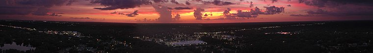
Tampa Bay Area
The Tampa Bay area is a major metropolitan area surrounding Tampa Bay on the Gulf Coast of Florida in the United States. It includes the main cities of Tampa, St. Petersburg, and Clearwater.| Tap on the map to travel |
Photo: Wikimedia, Public domain.
Photo: Richard Mc Neil, CC BY 3.0.
Popular Destinations
Tampa

Photo: Christopher Hollis, Public domain.
The city of Tampa is the county seat of Hillsborough County and the largest city on Florida's West Coast.
Saint Petersburg
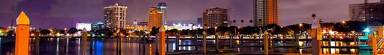
Photo: thesoupboy, CC BY-SA 2.0.
Saint Petersburg sits at the base of the Tampa Bay peninsula in Pinellas County, Florida, and enjoys a more subdued social atmosphere than its larger cousin, Tampa.
Clearwater

Photo: Roman Eugeniusz, CC BY-SA 3.0.
Clearwater is a city in Pinellas County, a region in Florida.
Destinations
Hillsborough County
 Hillsborough County is located in the west-central portion of the U.S. state of Florida.
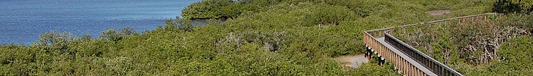
Manatee County

Photo: Wikimedia, CC BY-SA 4.0.
Manatee County is a county in the U.S. state of Florida.
Tampa Bay Area
- Type: metropolitan statistical area with 3,180,000 residents
- Description: metropolitan area on the west coast of Florida, USA
- Location: Florida West Coast, Florida, United States, North America
- View on OpenStreetMap
Latitude of center
28° northLongitude of center
-82.3° or 82° 18' westPopulation
3,180,000Wikidata ID
Q2828677Tampa Bay Area Satellite Map
© OpenStreetMap, Mapbox and Maxar
Also Known As
- Armenian: Տամպա Բեյ շրջան
- Asturian: Área de la Badea de Tampa
- Catalan: Àrea de la badia de Tampa
- Chinese: 坦帕灣區
- Chinese: 坦帕灣地區
- Chinese: 昙帕湾区
- English: Tampa-St. Petersburg-Clearwater MSA
- English: Tampa-St. Petersburg-Clearwater Metropolitan Statistical Area
- English: Tampa Bay
- English: Tampa Bay area
- English: Tampa Bay metro area
- English: Tampa Bay metropolitan area
- English: Tampa area
- English: Tampa metro area
- English: Tampa metropolitan area
- English: Tampa–St. Petersburg–Clearwater MSA
- English: Tampa–St. Petersburg–Clearwater Metropolitan Statistical Area
- French: Agglomération de la baie de Tampa
- French: Aire urbaine de Tampa Bay
- French: Aire urbaine de la baie de Tampa
- French: Tampa Bay Area
- Galician: Área da baía de Tampa
- German: Tampa Bay Area
- Hebrew: אזור מפרץ טמפה
- Hebrew: איזור מפרץ טמפה
- Irish: ceantar Tampa Bay
- Italian: Area della baia di Tampa
- Japanese: タンパ・ベイ・エリア
- Japanese: タンパ・ベイ地区
- Korean: 탬파베이 지역
- Persian: ناحیه خلیج تامپا
- Polish: Tampa Bay Area
- Portuguese: Área da baía de Tampa
- South Azerbaijani: تامپا بای ئیرا
- Spanish: Area de la Bahia de Tampa
- Spanish: Area metropolitana de Tampa-St. Petersburg-Clearwater
- Spanish: Region de la Bahia de Tampa
- Spanish: Región de la Bahía de Tampa
- Spanish: Área de la Bahía de Tampa
- Spanish: Área metropolitana de Tampa-St. Petersburg-Clearwater
- Swedish: Tampa Bay-området
- Urdu: ٹیمپا بے علاقہ
- Vietnamese: Vùng vịnh Tampa
- Vietnamese: Vùng đô thị khu vực vịnh Tampa
- Western Armenian: Թամփա Պէյ շրջան
Popular Destinations in Florida West Coast
Discover Everglades National Park, Sarasota, Cape Coral and Naples.
Escape to a Random Place
Explore your world with these selected destinations of excellence.
About Mapcarta. Thanks to Mapbox for providing amazing maps. Text is available under the CC BY-SA 4.0 license, excluding photos, directions and the map. Description text is based on the Wikipdia page Tampa Bay Area. Photo: Richard Mc Neil, CC BY 3.0.