A continuación aparece una instantánea de la página web tal y como aparecía en 06/06/2024 (la última vez que nuestro rastreador la visitó). Esta es la versión de la página que se usó para la clasificación de los resultados de búsqueda. Puede que la página haya cambiado desde la última vez que la guardamos en caché. Para ver lo que puede haber cambiado (sin la información destacada), ve a la página actual.
Bing no se hace responsable del contenido de esta página.
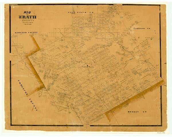
Erath County
Texas State Historical Association (TSHA)
https://www.tshaonline.org
Erath County (EE-rath) was marked off from Bosque and Coryell counties in 1856 and named for George B. Erath, one of the original surveyors of the area. The center of the county is near Stephenville, eighty miles southwest of Dallas (at 32°10' N, 98°15' W). The county comprises 1,983 square miles and is divided into two distinct regions. The Western Cross Timbers, dominated by such hardwoods as post oak and a soil surface of sandy and red clay, crosses the northwestern two-thirds of the county, while the Grand Prairie, with dark limy soils originally covered with little bluestem but now dotted with live oak groves, crosses the southeastern one-third. The northern part of the county, where Cretaceous sediment has eroded, is noted for deposits of bituminous coal, fireclay, oil, and natural gas. The sand of the southern part is of glass-making quality. The animal life of Erath County includes badgers, civet cats, grey foxes, minks, wolves, mockingbirds, woodpeckers, and quail. The county's altitude ranges from 900 to 1,750 feet; the rainfall averages twenty-nine inches a year; the average temperature ranges from a low of 34° F during January to 96° in July, and the growing season lasts 238 days. The two major streams, the Paluxy and Bosque rivers, are tributaries of the Brazos. Transportation in Erath County is provided by Interstate Highway 20, which crosses the northwest corner, and U.S. highways 67, 281 and 377. The Fort Worth and Western Railroad crosses the central and southwestern parts of the county.
The first attempts at settlement were made in 1854 by A. H. Dobkins and Will and Tom Holland near the site of present-day Dublin. In the following year a party of thirty pioneers was brought into the area by surveyors George Erath and Neil McLennan. Included in the group were John M. Stephen, his brother William F., and eighteen slaves. The Stephens moved to the 4,409 acres of the John Blair survey, and the slaves may have been left alone in the post oak grove on the Bosque River, now the site of Stephenville, to establish relations with Caddo and Anadarko Indians, who still visited the area from their new reservation in what is now Young County. In 1856 John M. Stephen offered to donate land for a courthouse and townsite if the town was named Stephenville and made the county seat. The state of Texas agreed and formed Erath County that year.
Most of the early settlers were recent arrivals from southern states. Beginning in 1857, a series of incidents led to their alienation from the Caddos and Anadarkos, whom the newcomers called Comanches; but these Erath County Indians had discouraged raids by the real Comanches and campaigned against them alongside Texas Rangers. On December 26, 1858, a group led by Peter Garland that included Shapley Prince Ross and John M. Stephens participated in a massacre of Comanche Indians that killed seven and wounded six. By 1860 the peaceful Caddo and Anadarko Indians were moved to Oklahoma by Robert S. Neighbors. Comanche raids continued until 1873. The Indian attacks, the Civil War, and raids by outlaw bands caused a decrease in population from 2,425 in 1860 to 1,801 by 1870. With the removal of the Comanches around 1873 the county grew rapidly, increasing to a population of 11,796 by 1880 and 30,000 by 1900. The county population reached a peak of 32,095 in 1910.
During the influx of settlers in the 1870s stock farming gave way to cotton farming, and cotton was the major crop from 1875 through 1915. In 1879 the Texas Central Railroad reached Dublin, and in 1889 the Fort Worth and Rio Grande was completed through Stephenville. This opened eastern markets for the county's cotton crops. The largest cotton production occurred in 1906.
As early as 1890 agricultural agents warned county growers of damage to the soil from lack of diversification. But investments in ginning equipment prevented changes until 1910. Eroding land, the boll weevil, and decreasing profits motivated the farmers to find alternatives. Dairy farms, fruit orchards, nurseries, production of peanuts and feed crops, and an extensive poultry industry that lasted until 1950 were instigated.
Mining and manufacturing have also played a role in the Erath County economy. During the period from 1888 to 1921 the Texas Pacific Coal Company mined coal in the northwest corner of the county near Thurber. In 1918 the Thurber Brick Company was established in the same area to manufacture tile, sewer pipes, paving bricks, and stoneware. Small amounts of oil and natural gas were also mined.
Stephenville College was established in 1893 but faced financial difficulties within two years. John Tarleton, a local rancher, bequeathed funds from the sale of lands for the continuation of the school, and in 1899 the college was renamed for him. In 1916 the school was affiliated with the Agricultural and Mechanical College of Texas (now Texas A&M University), and the following year it was made a state college. Tarleton College began with an enrollment of 100 students and grew to 175 by 1900. In the fall of 1990 Tarleton State University enrolled 6,251 students.
The first newspaper in Erath County was the Texas Pacific, published first in 1871. It later took the name Stephenville Empire and went into competition with the Stephenville Tribune, which was founded in 1890. The two newspapers merged in 1930 to become the Empire-Tribune. Other county papers have been the Dublin Enterprise, begun in 1881, which became the present Dublin Progress in 1888; the Texas Miner in Thurber; and the Duffau Progress.
Two courthouses preceded the present building. The first, a wooden structure, burned in 1866, and with it burned many of the county's important records. The second, a stone building completed in 1877, needed renovation by 1891. The town of Dublin attempted to become county seat by offering to build the new courthouse, but Stephenville won the election, and architects J. Riely Gordon and D. E. Laub were hired to design the present Victorian structure. The building, started in 1891 and completed in 1893, was constructed of local white stone quarried on the Leon River and red granite brought from Pecos County. the building has a wrought-iron stairway, tessellated marble floors, and other elegant details. It was renovated in 1949.
After 1910 the population declined in Erath County, dropping to 28,385 in 1920 and 20,804 in 1930. Loss of cotton production drove farmers away. Railroads converted from coal to oil in 1921 and refused to negotiate with striking workers. The coal mines at Thurber were shut down, and the brick plant followed in 1933. Small farms were consolidated, and Erath County agriculture shifted from crop raising to ranching by 1945. The fruit industry was damaged when overgrazing allowed cedar trees to invade from the hills, bringing San Jose scale to the peach and apple trees.
Most of Erath County’s voters supported the Democratic presidential candidates in almost every election from 1856 through 1948; the only exceptions occurred in 1860, when Constitution Union candidate John Bell carried the county, and in 1928, when Republican Herbert Hoover did. Beginning in 1952, however, when Republican Dwight D. Eisenhower took most of the county’s votes, Republican candidates began to be more competitive in the area. Though the Democratic presidential candidates took the county in 1960, 1964, 1968, 1976 and 1980, the Republicans carried the area in 1956, 1972, and in every election from 1984 through 2004.
Erath County's population rose to 18,434 in 1950 and fell to 16,236 in 1960, then grew to 18,141 by 1970 and 23,500 by 1983. In the 1970s small industries began to move in; however, 80 percent of the annual average county income of $70 million was still from dairy and beef cattle and other livestock. Erath County was the second leading county in Texas in milk production in the 1980s. Peanuts, sorghum, hay, and small grains continued to be important. See alsoCOAL AND LIGNITE MINING.
The U.S. census counted 40,147 people living in Erath County in 2014. About 76 percent were Anglo, 20.2 percent were Hispanic, and 1.6 percent African American. Of residents age twenty-five and older, 77 percent had completed high school, and 25 percent had college degrees. In the early twenty-first century agriculture, various manufacturing operations, and higher education were important elements of the local economy. In 2002 the county had 1,977 farms and ranches covering 580,627 acres, 52 percent of which were devoted to pasture, 38 percent to crops, and 8 percent to woodlands. That year farmers and ranchers in the area earned $207,714,000; livestock sales accounted for $197,746,000 of the total. That year Erath County led the state in milk production; beef cattle, horticulture, and horses were other chief agricultural products.
Stephenville (population, 18,715) is the county seat of government and the home of Tarleton State University. Other communities include Dublin (3,773), Bluff Dale (400), Morgan Mill (206), Lingleville (100), and Thurber (48). County attractions include the university’s fine arts center, Bosque River Park, and the Dairy Fest in June.
Is history important to you?
We need your support because we are a non-profit that relies upon contributions from our community in order to record and preserve the history of our state. Every dollar helps.
George B. Erath, "The Memoirs of George B. Erath, 1813–1891," Southwestern Historical Quarterly 26–27 (January–October 1923; rpts., Austin: Texas State Historical Association, 1923; Waco: Heritage Society of Waco, 1956). Kenneth F. Neighbours, Robert Simpson Neighbors and the Texas Frontier, 1836–1859 (Waco: Texian Press, 1975). H. Grady Perry, Grand Ol' Erath (Stephenville, Texas, 1974).
The following, adapted from the Chicago Manual of Style, 15th edition, is the preferred citation for this entry.
Dan M. Young,
“Erath County,”
Handbook of Texas Online,
accessed June 06, 2024,
https://www.tshaonline.org/handbook/entries/erath-county.
Published by the Texas State Historical Association.
TID:
HCE06
All copyrighted materials included within the Handbook of Texas Online are in accordance with Title 17 U.S.C. Section 107 related to Copyright and “Fair Use” for Non-Profit educational institutions, which permits the Texas State Historical Association (TSHA), to utilize copyrighted materials to further scholarship, education, and inform the public. The TSHA makes every effort to conform to the principles of fair use and to comply with copyright law.
If you wish to use copyrighted material from this site for purposes of your own that go beyond fair use, you must obtain permission from the copyright owner.