Di seguito è disponibile lo snapshot della pagina Web alla data 30/05/2024 (l'ultima volta che è stata visitata dal nostro crawler). Questa è la versione della pagina utilizzata per la classificazione dei risultati della ricerca. La pagina potrebbe essere stata modificata dall'ultima molta che è stata memorizzata nella cache. Per verificare le eventuali modifiche (senza evidenziazioni), go vai alla pagina corrente.
Bing non è responsabile del contenuto di questa pagina.
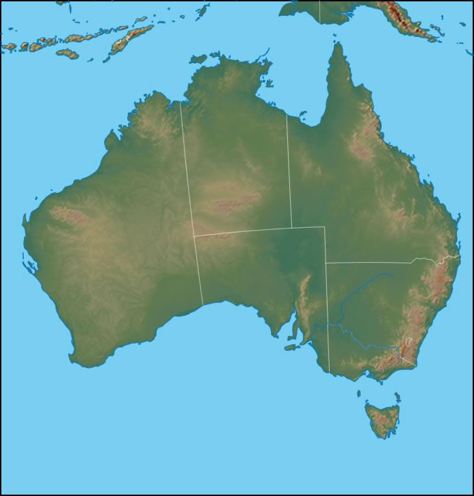
The map above reveals the physical landscape of Australia. In the center of the continent are the Macdonnell Ranges and the Musgrave Ranges along with the Lake Eyre Basin and the Lake Torrens Basin. Mountains on the northwestern coast are the Capricorn Range, the Hamersley Range and the King Leopold Ranges. The Australian Alps and Great Dividing Range are on the southeast coast. The Clarke Range and Calliope Range are on the northeast coast. The island of Tasmania has the Great Western Tiers. Major rivers include the Asburton, Darling and Murray Rivers.
Bodies of water that surround Australia are the Indian Ocean, Timor Sea, Arafura Sea, Gulf of Carpentaria, the Coral Sea, the Tasman Sea and the Great Australian Bight.
Copyright information: The images on this page were composed by Brad Cole and Angela King and are copyright by Geology.com. If you would like to share them with others please link to this page. They are not available for use beyond our websites. The maps were produced using data licensed from and copyright by Map Resources.